List of districts in India
| District | |
|---|---|
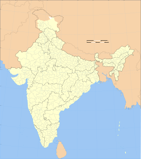 Map | |
| Category | Second-level administrative division |
| Location | States and union territories of India |
| Number | 718 (as of 2018) |
| Populations |
Greatest: Thane, Maharashtra—11,060,148 (2011 census) Least: Dibang Valley, Arunachal Pradesh—8,004 (2011 census) |
| Areas |
Largest: Kachchh, Gujarat—45,652 km2 (17,626 sq mi) Smallest: Mahe, Puducherry—8.69 km2 (3.36 sq mi) |
| Government | District Administration |
| Subdivisions |
Tehsil, Taluka, Mandal Blocks |
A district (zilā) is an administrative division of an Indian state or territory. In some cases districts are further subdivided into sub-divisions, and in others directly into tehsils or talukas. As of 2018 there are a total of 718 districts,[1] up from the 640 in the 2011 Census of India and the 593 recorded in the 2001 Census of India.[2]
District officials include:
- Deputy Commissioner or District Magistrate or District Collector, an officer of the Indian Administrative Service, in charge of administration and revenue collection
- Superintendent of Police or Deputy Commissioner of Police, an officer belonging to the Indian Police Service, responsible for maintaining law and order
- Deputy Conservator of Forests, an officer belonging to the Indian Forest Service, entrusted with the management of the forests, environment and wildlife of the district
Each of these officials is aided by officers from the appropriate branch of the state government.
Most districts have a distinct headquarters; Mumbai City district (MC) in Maharashtra (MH) is an example which, despite forming a district, does not have a clear headquarters, though it does have a District Collector.[3]
Mahe of Puducherry is the smallest (9 km2) district of India by area while Kutch of Gujarat is the largest (45,652 km2) district of India by area.
Overview
|
 States and territories of India, numbered as per the table |
Naming
The majority of districts are named after their administrative centre. Some are referred to by two names, a traditional one and one that uses the name of the town that is the headquarters. Since most of the districts are named after a town, the word "district" is appended to distinguish between the town and the district. Official websites very often use District with a capital D in this context.
Ambiguous names
The names of the 687 districts are mostly unique. There are some exceptions:
- Within India 7 district names are ambiguous, representing 14 districts:
- Aurangabad district, Bihar & Aurangabad district, Maharashtra
- Balrampur district, Chhattisgarh & Balrampur district, Uttar Pradesh.
- Bijapur district, Chhattisgarh & Bijapur district, Karnataka
- Bilaspur district, Chhattisgarh & Bilaspur district, Himachal Pradesh
- Hamirpur district, Himachal Pradesh & Hamirpur district, Uttar Pradesh
- Lakhimpur district, Assam & Lakhimpur Kheri district, Uttar Pradesh
- Pratapgarh district, Rajasthan & Pratapgarh district, Uttar Pradesh
- Outside of India, but within South Asia, there are 7 districts:
- Bhojpur district, Bihar shares a name with Bhojpur District, Nepal
- Daman district, India shares a name with Daman District, Afghanistan
- Ghaziabad District, Uttar Pradesh shares a name with Ghaziabad District, Afghanistan
- Gopalganj district, Bihar shares a name with Gopalganj District, Bangladesh
- Hyderabad district, Telangana shares a name with Hyderabad District, Pakistan
- Lalitpur district, Uttar Pradesh shares a name with Lalitpur District, Nepal
- Poonch district, Jammu and Kashmir, shares a name with Poonch District, Pakistan (the two were, prior to Partition, one district – which got split by the Line of Control, so since then the two parts have been administered separately)
- Outside of South Asia entirely, there are 2 districts:
- Mansa district, Punjab, with Mansa District, Zambia
- Dhar District, Madhya Pradesh, with Dhar District, Yemen.
The following tables list the population details of various states. The columns include the hierarchical administrative subdivision codes,[5] the district name, district headquarters, 2011 census population,[6] area in square kilometres, and the population density per square kilometre.[6]
Andaman and Nicobar (AN)
| Code[5] | District | Headquarters | Population (2011)[6] | Area (km²) | Density (/km²)[6] |
| NI | Nicobar | Car Nicobar | 36,819 | 1,841 | 20 |
| NA | North and Middle Andaman | Mayabunder | 105,539 | 3,227 | 32 |
| SA | South Andaman | Port Blair | 237,586 | 3,181 | 75 |
Andhra Pradesh (AP)
Arunachal Pradesh (AR)
Assam (AS)
Bihar (BR)
Chandigarh (CH)
| Code[5] | District | Headquarters | Population (2011)[6] | Area (km²) | Density (/km²)[6] |
| CH | Chandigarh | Chandigarh | 1,054,686 | 114 | 9,252 |
Chhattisgarh (CG)
Dadra and Nagar Haveli (DN)
| Code[5] | District | Headquarters | Population (2011)[6] | Area (km²) | Density (/km²)[6] |
| DN | Dadra and Nagar Haveli | Silvassa | 342,853 | 704 | 698 |
Daman and Diu (DD)
| Code[5] | District | Headquarters | Population (2011)[6] | Area (km²) | Density (/km²)[6] |
| DA | Daman | Daman | 190,855 | 72 | 2,651 |
| DI | Diu | Diu | 52,056 | 40 | 1,301 |
Delhi (DL)
| Code[5] | District | Headquarters | Population (2011)[6] | Area (km²) | Density (/km²)[6] | Official website |
|---|---|---|---|---|---|---|
| CD | Central Delhi | Daryaganj | 578,671 | 25 | 23,149 | http://dccentral.delhigovt.nic.in/ |
| ED | East Delhi | Preet Vihar | 1,707,725 | 440 | 26,683 | http://dceast.delhigovt.nic.in/ |
| ND | New Delhi | Connaught Place | 133,713 | 22 | 3,820 | http://dcnewdelhi.delhigovt.nic.in/ |
| NO | North Delhi | Sadar Bazaar | 883,418 | 59 | 14,973 | http://dcnorth.delhigovt.nic.in/ |
| NE | North East Delhi | Shahdara | 2,240,749 | 52 | 37,346 | http://dcnortheast.delhigovt.nic.in/ |
| NW | North West Delhi | Kanjhawala | 3,651,261 | 130 | 8,298 | http://dcnorthwest.delhigovt.nic.in/ |
| Shahdara | Shahdara | |||||
| SD | South Delhi | Saket | 2,733,752 | 250 | 10,935 | http://dcsouth.delhigovt.nic.in/ |
| South East Delhi | Defence Colony | |||||
| SW | South West Delhi | Vasant Vihar | 2,292,363 | 395 | 5,445 | http://dcsouthwest.delhigovt.nic.in/ |
| WD | West Delhi | Rajouri Garden | 2,531,583 | 112 | 19,625 | https://web.archive.org/web/20070103184838/http://dcwestrev.delhigovt.nic.in/ |
Goa (GA)
| Code[5] | District | Headquarters | Population (2011)[6] | Area (km²) | Density (/km²)[6] | Official website |
| NG | North Goa | Panaji | 817,761 | 1,736 | 471 | http://northgoa.nic.in/ |
| SG | South Goa | Margao | 639,962 | 1,966 | 326 | http://southgoa.nic.in/ |
Gujarat (GJ)
Haryana (HR)
Himachal Pradesh (HP)
| Code[5] | District | Headquarters | Population (2011)[6] | Area (km²) | Density (/km²)[6] | Official website |
| BI | Bilaspur | Bilaspur | 382,056 | 1,167 | 327 | http://hpbilaspur.gov.in/ |
| CH | Chamba | Chamba | 518,844 | 6,528 | 80 | http://hpchamba.nic.in/ |
| HA | Hamirpur | Hamirpur | 454,293 | 1,118 | 406 | http://hphamirpur.gov.in/ |
| KA | Kangra | Dharamshala | 1,507,223 | 5,739 | 263 | http://hpkangra.nic.in/ |
| KI | Kinnaur | Reckong Peo | 84,298 | 6,401 | 13 | http://hpkinnaur.nic.in/ |
| KU | Kullu | Kullu | 437,474 | 5,503 | 79 | http://hpkullu.gov.in/ |
| LS | Lahaul and Spiti | Keylong | 31,528 | 13,835 | 2 | http://hplahaulspiti.gov.in |
| MA | Mandi | Mandi | 999,518 | 3,950 | 253 | http://hpmandi.nic.in/ |
| SH | Shimla | Shimla | 813,384 | 5,131 | 159 | http://hpshimla.nic.in/ |
| SI | Sirmaur | Nahan | 530,164 | 2,825 | 188 | http://hpsirmaur.gov.in/ |
| SO | Solan | Solan | 576,670 | 1,936 | 298 | http://hpsolan.gov.in/ |
| UNA | Una | Una | 521,057 | 1,540 | 328 | http://hpuna.nic.in/ |
Jammu and Kashmir (JK)
Jharkhand (JH)
Karnataka (KA)
Kerala (KL)
Lakshadweep (LD)
| Code[5] | District | Headquarters | Population (2011)[6] | Area (km²) | Density (/km²)[6] | Official website |
| LD | Lakshadweep | Kavaratti | 64,429 | 32 | 2,013 | http://www.lakshadweep.gov.in/ |
Madhya Pradesh (MP)
Maharashtra (MH)
Manipur (MN)
| Code | District | Headquarters | Population (2011)[10] | Area (km²) | Density (/km²) | Official website |
| BI | Bishnupur | Bishnupur | 240,363 | 496 | 415 | http://bishnupur.nic.in/ |
| TH | Thoubal | Thoubal | 420,517 | 514 | 713 | http://thoubal.nic.in/ |
| EI | Imphal East | Porompat | 452,661 | 710 | 555 | http://imphaleast.nic.in/ |
| WI | Imphal West | Lamphelpat | 514,683 | 519 | 847 | http://imphalwest.nic.in/ |
| SE | Senapati | Senapati | 354,772 | 3,269 | 116 | http://Senapati.nic.in/ |
| UK | Ukhrul | Ukhrul | 183,115 | 4,547 | 31 | http://ukhrul.nic.in/ |
| CD | Chandel | Chandel | 144,028 | 3,317 | 37 | http://chandel.nic.in/ |
| CC | Churachandpur | Churachandpur | 271.274 | 4,574 | 50 | http://churachandpur.nic.in/%5Bpermanent+dead+link%5D |
| TA | Tamenglong | Tamenglong | 140,143 | 4,391 | 25 | http://tamenglong.nic.in/ |
| Not yet assigned | Jiribam | Jiribam | Survey pending | Pending | Pending | Yet to be created. Bifurcated from Imphal East |
| KPI | Kangpokpi (Sadar Hills) | Kangpokpi | Survey pending | Pending | Pending | Yet to be created. Bifurcated from Senapati |
| KAK | Kakching | Kakching | Survey pending | Pending | Pending | http://www.kakching.nic.in/ |
| Not yet assigned | Tengnoupal | Tengnoupal | Survey pending | Pending | Pending | Yet to be created. Bifurcated from Chandel |
| Not yet assigned | Kamjong | Kamjong | Survey pending | Pending | Pending | Yet to be created. Bifurcated from Ukhrul |
| Not yet assigned | Noney | Noney(Longmai) | Survey pending | Pending | Pending | Yet to be created. Bifurcated from Tamenglong |
| PZ | Pherzawl | Pherzawl | Survey pending | Pending | Pending | Yet to be created. Bifurcated from Churachandpur |
Meghalaya (ML)
| Code[5] | District | Headquarters | Population (2011)[6] | Area (km²) | Density (/km²)[6] | Official website |
| EG | East Garo Hills | Williamnagar | 317,618 | 2,603 | 121 | https://web.archive.org/web/20080615020254/http://eastgarohills.nic.in/ |
| EK | East Khasi Hills | Shillong | 824,059 | 2,752 | 292 | http://eastkhasihills.gov.in/ |
| East Jaintia Hills | Khliehriat | 122,436 | 2,115 | http://eastjaintiahills.gov.in/ | ||
| North Garo Hills | Resubelpara | 118,325 | 1,113 | http://northgarohills.gov.in/ | ||
| RB | Ri Bhoi | Nongpoh | 258,380 | 2,378 | 109 | http://ribhoi.gov.in/ |
| SG | South Garo Hills | Baghmara | 142,574 | 1,850 | 77 | http://southgarohills.gov.in/ |
| South West Garo Hills | Ampati | http://southwestgarohills.gov.in/ | ||||
| South West Khasi Hills | Mawkyrwat | 110,152 | 1,341 | http://southwestkhasihills.gov.in/ | ||
| WG | West Jaintia Hills | Jowai | 270,352 | 1,693 | http://westjaintiahills.gov.in/ | |
| WG | West Garo Hills | Tura | 642,923 | 3,714 | 173 | http://westgarohills.gov.in/ |
| WK | West Khasi Hills | Nongstoin | 385,601 | 5,247 | 73 | http://westkhasihills.gov.in/ |
Mizoram (MZ)
| Code[5] | District | Headquarters | Population (2011)[6] | Area (km²) | Density (/km²)[6] | Official website |
| AI | Aizawl | Aizawl | 404,054 | 3,577 | 113 | http://aizawl.nic.in/ |
| CH | Champhai | Champhai | 125,370 | 3,168 | 39 | http://champhai.nic.in/ |
| KO | Kolasib | Kolasib | 83,054 | 1,386 | 60 | http://kolasib.nic.in/%5Bpermanent+dead+link%5D |
| LA | Lawngtlai | Lawngtlai | 117,444 | 2,519 | 46 | http://lawngtlai.nic.in/%5Bpermanent+dead+link%5D |
| LU | Lunglei | Lunglei | 154,094 | 4,572 | 34 | http://lunglei.nic.in/ |
| MA | Mamit | Mamit | 85,757 | 2,967 | 28 | http://mamit.nic.in/ |
| SA | Saiha | Saiha | 56,366 | 1,414 | 40 | http://saiha.nic.in/ |
| SE | Serchhip | Serchhip | 64,875 | 1,424 | 46 | https://web.archive.org/web/20090416165056/http://serchhip.nic.in/ |
Nagaland (NL)
| Code[5] | District | Headquarters | Population (2011)[6] | Area (km²) | Density (/km²)[6] | Official website |
| DI | Dimapur | Dimapur | 379,769 | 926 | 410 | http://dimapur.nic.in/ |
| KI | Kiphire | Kiphire | 74,033 | 1,255 | 66 | http://kiphire.nic.in/ |
| KO | Kohima | Kohima | 270,063 | 1,041 | 213 | http://kohima.nic.in/ |
| LO | Longleng | Longleng | 50,593 | 885 | 89 | http://kohima.nic.in/ |
| MK | Mokokchung | Mokokchung | 193,171 | 1,615 | 120 | http://mokokchung.nic.in/ |
| MN | Mon | Mon | 259,604 | 1,786 | 145 | http://mon.nic.in/ |
| PE | Peren | Peren | 163,294 | 2,300 | 55 | http://peren-district.nic.in/ |
| PH | Phek | Phek | 163,294 | 2,026 | 81 | http://phek.nic.in/ |
| TU | Tuensang | Tuensang | 414,801 | 4,228 | 98 | http://tuensang.nic.in/ |
| WO | Wokha | Wokha | 166,239 | 1,628 | 120 | http://wokha.nic.in/ |
| ZU | Zunheboto | Zunheboto | 141,014 | 1,255 | 112 | http://zunheboto.nic.in/ |
Odisha (OD)
Puducherry (PY)
| Code[5] | District | Headquarters | Population (2011)[6] | Area (km²) | Density (/km²)[6] | Official website |
| KA | Karaikal | Karaikal | 200,314 | 160 | 1,252 | http://Karaikal.gov.in/ |
| MA | Mahe | Mahé | 41,934 | 9 | 4,659 | http://mahe.gov.in/ |
| PO | Pondicherry | Pondicherry | 946,600 | 293 | 3,231 | http://puducherry.nic.in/%5Bpermanent+dead+link%5D |
| YA | Yanam | Yanam | 55,616 | 17 | 3,272 | https://web.archive.org/web/20050130000201/http://yanam.nic.in/ |
Punjab (PB)
Rajasthan (RJ)
Sikkim (SK)
| Code[5] | District | Headquarters | Population (2011)[6] | Area (km²) | Density (/km²)[6] | Official website |
| ES | East Sikkim | Gangtok | 281,293 | 954 | 295 | https://web.archive.org/web/20130815205320/http://esikkim.gov.in/ |
| NS | North Sikkim | Mangan | 43,354 | 4,226 | 10 | https://web.archive.org/web/20130815205319/http://nsikkim.gov.in/ |
| SS | South Sikkim | Namchi | 146,742 | 750 | 196 | https://web.archive.org/web/20130815205319/http://ssikkim.gov.in/ |
| WS | West Sikkim | Geyzing | 136,299 | 1,166 | 117 | https://web.archive.org/web/20130815205319/http://wsikkim.gov.in/ |
Tamil Nadu (TN)
Telangana (TS)
Tripura (TR)
| Code[5] | District | Headquarters | Population (2011)[6] | Area (km²) | Density (/km²)[6] | Official website |
| DH | Dhalai | Ambassa | 377,988 | 2,400 | 157 | http://dhalai.gov.in/ |
| GM | Gomati | Udaipur, Tripura | 4,36,868 | 1522.8 | 287 | http://gomati.nic.in/ |
| KH | Khowai[12] | Khowai | 3,27,391 | 1005.67 | 326 | http://khowai.nic.in/ |
| NT | North Tripura | Dharmanagar | 4,15,946 | 1444.5 | 288 | http://northtripura.gov.in/ |
| SP | Sepahijala[13] | Bishramganj | 4,84,233 | 1044.78 | 463 | http://sepahijala.nic.in/ |
| ST | South Tripura | Belonia | 4,33,737 | 1534.2 | 283 | http://southtripura.nic.in/ |
| UK | Unokoti[14] | Kailashahar | 2,77,335 | 591.93 | 469 | http://unakoti.nic.in/ |
| WT | West Tripura | Agartala | 9,17,534 | 942.55 | 973 | http://westtripura.nic.in/ |
Uttar Pradesh (UP)
Uttarakhand (UK)
| Code[5] | District | Headquarters | Population (2011)[6] | Area (km²) | Density (/km²)[6] | Official website |
| AL | Almora | Almora | 621,927 | 3,090 | 198 | http://almora.nic.in/ |
| BA | Bageshwar | Bageshwar | 259,840 | 2,310 | 116 | http://bageshwar.nic.in/ |
| CL | Chamoli | Gopeshwar | 391,114 | 7,692 | 49 | http://chamoli.nic.in/ |
| CP | Champawat | Champawat | 259,315 | 1,781 | 147 | http://champawat.nic.in/ |
| DD | Dehradun | Dehradun | 1,698,560 | 3,088 | 550 | http://dehradun.nic.in/ |
| HA | Haridwar | Haridwar | 1,927,029 | 2,360 | 817 | http://haridwar.nic.in/ |
| NA | Nainital | Nainital | 955,128 | 3,853 | 225 | http://nainital.nic.in/ |
| PG | Pauri Garhwal | Pauri | 686,527 | 5,438 | 129 | http://pauri.nic.in/ |
| PI | Pithoragarh | Pithoragarh | 485,993 | 7,110 | 69 | http://pithoragarh.nic.in/ |
| RP | Rudraprayag | Rudraprayag | 236,857 | 1,896 | 119 | http://rudraprayag.nic.in/ |
| TG | Tehri Garhwal | New Tehri | 616,409 | 4,085 | 169 | http://tehri.nic.in/ |
| US | Udham Singh Nagar | Rudrapur | 1,648,367 | 2,912 | 648 | http://usnagar.nic.in/ |
| UT | Uttarkashi | Uttarkashi | 329,686 | 7,951 | 41 | http://uttarkashi.nic.in/ |
West Bengal (WB)
See also
References
- ↑ "Districts | Government of India Web Directory". www.goidirectory.gov.in. Retrieved 2018-08-15.
- ↑ "Provisional Population Totals: Nunber of Administrative Units" (PDF). Census of India 2011. Retrieved 13 April 2018.
- ↑ Official site of Mumbai City Collectorate (A district)
- ↑ "List of states with Population, Sex Ratio and Literacy Census 2011". 2011 Census of India. Retrieved 23 January 2013.
- 1 2 3 4 5 6 7 8 9 10 11 12 13 14 15 16 17 18 19 20 21 22 23 24 25 26 27 28 29 30 31 32 33 34 35 36 "NIC Policy on format of e-mail Address: Appendix (2): Districts Abbreviations as per ISO 3166–2" (PDF). Ministry Of Communications and Information Technology, Government of India. 18 August 2004. pp. 5–10. Archived from the original (PDF) on 11 September 2008. Retrieved 24 November 2008.
- 1 2 3 4 5 6 7 8 9 10 11 12 13 14 15 16 17 18 19 20 21 22 23 24 25 26 27 28 29 30 31 32 33 34 35 36 37 38 39 40 41 42 43 44 45 46 47 48 49 50 51 52 53 54 55 56 57 58 59 60 61 62 63 64 65 66 67 68 69 70 71 72 "Indian Districts by Population, Growth Rate, Sex Ratio 2011 Census". 2011 census of India. Retrieved 27 December 2012.
- 1 2 3 4 BTC with 4 districts formed in 2004: Baksa, Chirang, Kokrajhar and Udalguri
- 1 2 3 4 5 On 15 August 2015, five new districts were formed in Assam, taking the total number of districts from 27 to 32. The five new districts are Biswanath (carved out of Sonitpur), Charaideo (of Sivasagar), Hojai (of Nagaon), South Salmara-Mankachar (of Dhubri) and West Karbi Anglong (of Karbi Anglong). Hence these districts did not exist during census 2011.
- ↑ Majuli, District (8 September 2016). "World's largest river island, Majuli, becomes India's first island district". FP India. Retrieved 13 September 2016.
- ↑ "Ranking of Districts by Population Size, 2001 and 2011" (XLS). The Registrar General & Census Commissioner, India, New Delhi-110011. 2010–2011. Retrieved 2011-09-18.
- ↑ Fazilka district was formed in 2011, no data in census 2011 on this district
- ↑ Khowai district of Tripura did not exist during census 2011.
- ↑ Sepahijala district of Tripura did not exist during census 2011.
- ↑ Unakoti district of Tripura did not exist during census 2011.
- ↑ Chhatrapati Shahuji Maharaj Nagar district did not exist during census 2011.
- ↑ Shamli district of Uttar Pradesh was formerly named Prabudh Nagar district, which did not exist during census 2011.
External links
- Districts of India, Indian Ministry of Electronics & Information Technology website
- 2001 maps; provides maps of social, economic and demographic data of India in 2001
- District Books India; Showing List of books for all Indian Districts on socio-economic data