Tikamgarh
| Tikamgarh Tehri | |
|---|---|
| City and district headquarters | |
 Tikamgarh Palace | |
 Tikamgarh Location in Madhya Pradesh, India | |
| Coordinates: 24°44′50″N 78°51′00″E / 24.74722°N 78.85000°ECoordinates: 24°44′50″N 78°51′00″E / 24.74722°N 78.85000°E | |
| Country |
|
| State | Madhya Pradesh |
| Region | Bundelkhand |
| Division | Sagar |
| District | Tikamgarh |
| Named for | Krishna as Teekam |
| Government | |
| • Body | Municipality |
| Area | |
| • Total | 21 km2 (8 sq mi) |
| Elevation | 349.170 m (1,145.571 ft) |
| Population (2011)[1] | |
| • Total | 79,106 |
| • Density | 3,800/km2 (9,800/sq mi) |
| Languages | |
| • Official | Hindi, Bundeli, English |
| Time zone | UTC+5:30 (IST) |
| PIN | 472001 (HPO) |
| Telephone code | 91 7683 |
| Vehicle registration | MP-36 |
| Coastline | 0 kilometres (0 mi) |
| Sex ratio | 911[2] ♂/♀ |
| Literacy | 85.02%[3] |
| Distance from New Delhi | 500 kilometres (310 mi) N (land) |
| Website |
www |
Tikamgarh ( टीकमगढ़ ) is a town and a tehsil in Tikamgarh district in the Indian state of Madhya Pradesh.[4] The city serves as a district headquarters. The earlier name of Tikamgarh was 'Tehri' (i.e., a triangle) consisting of three hamlets, forming a rough triangle. In Tikamgarh town there is locality still known as 'Purani Tehri' (Old Tehri). Until Indian independence in 1947, Tikamgarh, formerly called Tehri, was part of the kingdom of Orchha, which was founded in the 16th century by the Bundeli chief Rudra Pratap Singh, who became the first King of Orchha. In 1783 the capital of the state was moved to Tehri, about 40 miles south of Orchha, which was home to the fort of Tikamgarh, and the town eventually took the name of the fort. The district is famous for the old fort of Kundar known as Garh Kundar, which was built by Khangars and remained the capital of kshatriya Khangar rulers from 1180 to 1347.
Origin of the name
The district is named after its headquarter, Tikamgarh. The original name of the town was Tehri. In 1780, the ruler of Orchha Vikramajit (1776–1817) shifted his capital from Orchha to Tehri and renamed it Tikamgarh (Tikam is one of the names of Krishna).[5]
History
The area covered by this district was part of the Princely State of Orchha till its merger with the Indian Union. The Orchha state was founded by Rudra Pratap in 1501. After merger, it became one of the eight districts of Vindhya Pradesh state in 1948. Following the reorganization of states on 1 November 1956 it became a district of the newly carved Madhya Pradesh
Orchha was founded in the 1501 AD,[6] by the Bundela chief, Rudra Pratap Singh, who became the first King of Orchha, (r. 1501-1531) and also built the Fort of Orchha.[7] He died in an attempt to save a cow from a lion. The Chaturbhuj Temple was built, during the time of Akbar, by the Queen of Orchha,[8] while Raj Mandir was built by 'Madhukar Shah ju Dev' during his reign, 1554 to 1591.[9][10]
During the rule of Mughal Emperor, Jahangir, his ally, Vir Singh Deo (r. 1605-1627) reigned here, and it was during this period that Orchha reaches its height, and many extant palaces are a reminder of its architectural glory, including Jahangir Mahal (b. ca 1605) and Sawan Bhadon.[11]
In the early 17th century, Jhujhar Singh rebelled the Mughal emperor Shah Jahan, whose armies devastated the state and occupied Orchha from 1635 to 1641. Orchha and Datia were the only Bundela states not subjugated by the Marathas in the 18th century. The town of Tehri, now Tikamgarh, about 52 miles (84 km) south of Orchha, became the capital of Orchha state in 1783, and is now the district town; Tehri was the site of the fort of Tikamgarh, and the town eventually took the name of the fort.[12]

Hamir Singh, who ruled from 1848 to 1874, was elevated to the style of Maharaja in 1865. Maharaja Pratap Singh ju Dev (born 1854, died 1930), who succeeded to the throne in 1874, devoted himself entirely to the development of his state, himself designing most of the engineering and irrigation works that were executed during his reign. In 1901, the state had an area of 2,000 sq mi (5,200 km2), and population of 52,634. It was the oldest and highest in rank of all the Bundela states, with a 17-gun salute, and its Maharajas bore the hereditary title of First of the Prince of Bundelkhand. Vir Singh, Pratap Singh's successor, merged his state with the Union of India on January 1, 1950. The district became part of Vindhya Pradesh state, which was merged into Madhya Pradesh state in 1956.
Today Orchha is almost a nondescript town with a small population, and its importance is maintained only due to its rich architectural heritage and tourism. However the name of the Orchha State continued to be in use, as can be seen in the inscriptions of Jain tirth Paporaji, now on the outskirts of Tikamgarh.[13]
General information
As of 2011 India census, Tikamgarh has a population of 79,106. It has an average literacy rate of 85.02%, higher than the state average of 69.32%: male literacy is 89.98%, and female literacy is 79.59%. In Tikamgarh, 11.85% of the population is under six years old.[14]
Hospital facilities
- Dr.Rajendra Prashad Government District Hospital
- Ram Raja Superspecility Hospital
- Rai Surgical Hospital
- Govind Sai Maternity Home
- Matratwya Nursing Home
- Seva Nursing Home
- Shriram Nursing Home
- Life line Nursing Home
- Sudha Sevalaya Nursing Home
- Jawahri Nursing Home
- Shree Radhe Hospital
- Life Care Hospital
Demographies
Tikamgarh is a city in the central Indian state of Madhya Pradesh. It is the administrative headquarters of Tikamgarh District. It is nearby to the border of U.P. Tikamgarh, situated towards the west to the centre of plateau of Bundelkhand is surrounded by district Jhansi of UP in the north and Lalitpur (UP) in the west and south. Towards its east, district Chattarpur is situated.
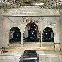
Tikamgarh has a population of 79,106 divided into 27 wards. Schedule Caste (SC) and Schedule Tribe (ST) constitutes 14.89% and 1.80% of the total population. Based on the latest census 2011, 69.95% of the total population are Hindus, 20.87% are Muslims, 8.77% are Jains and the rest is occupied by Christian, Sikh and Buddhist.[15]
Industry
Tikamgarh has emerged as a major center for brass statues.[16][17] While the metalcrafting tradition in small towns has decline with the emergence of major trade centers. the tradition of casting bronze statues was established by Bhainalal Soni in 1950s, who traditionally made silver ornaments in the local style. The President of Indian has awarded Harish Soni and Dhaniran Soni for their crafsmanship.[18]
Transportation
Roads

.jpg)
- About 20,000 of vehicles are running on Tikamgarh city roads including light and heavy vehicles.
- There are daily service of buses for every part of state.
- Highways Passing from Tikamgarh Are, NH-12A, SH-37, SH-10.
- Dr. Syama Prasad Mookerjee Bus Stand Daily service of Buses for New Delhi, Lalitpur, Nagpur, Kanpur, Indore, Bhopal, Jhansi, Gwalior, Jabalpur are also there.
Railways

The construction of railway line to Tikamgarh has been completed in 2012.On 26 April 2013 was connected with railway services. The rail services begun from Lalitpur (Uttar Pradesh) to Tikamgarh and was started under the Lalitpur-Singrauli Rail Project.The first train to travel between the two stations was Tikamgarh-Jhansi (Uttar Pradesh) passenger train. The train was sanctioned between the two stations in the Rail Budget of 2012-13. The railway line between Tikamgarh and Lalitpur rail route is 52 kilometer long. Union Minister Pradeep Jain flagged off the train at Lalitpur station
Airways
Khajuraho is the nearest (125 km) airport from where daily flights operate for Delhi & Agra.
Geography
The city has natural beauty with many parks & lakes which surround the city from every direction.
- Mahendra Sagar (Bada Talab).
- Sail Sagar.
- Vrandavan Talab (Jhir ki Baghiya).
- HanumanSagar Talab.
- Maharajpura Tal.
a Park (Central Park) inaugurated by Dr. Rajendra Prasad First President of India
- Nazarbaugh Garden (Only for ladies)
- UpVan park (Jhirki Baghiya)
- Shaan-E-Park TKG
- Chandra Shekhar Ajad Park
- Children Park Civil Line
- Subhash Chandra Bose Park
- Moniya Party Crossing
Games and sports
The Sports Authority of India (SAI) has its training centre & hostel situated here, facilitating Hockey & Softball.
- All India Veer Singh Ju Dev Hockey Tournament
- Noor Mohammad Memorial Football Tournament(Najarbaugh)
- Night Cricket Tournament (Najarbaugh)
- Night Basketball Tournament (Najarbaugh)
List of clubs
- D.H.A.
- Bright Club
- Sai Center
- Khel Evam Yuva Kalyan Vibhag Tikamgarh
Places of interest

(Within 10 km)
- Kundeshwar
- Nazarbaugh Mandir and Dargah
- Dargah & Maszed Hajart Ilahi Sha Baba Neer New Bus Stand
- Shree Shree 1008 Mandir Janki bag near Chhatarpur road
- Jhir ki Baghiya
- Roraiya Mandir
- Barighat
- Hanuman Chalisa mandir
- Paragarh
- Shani Mandir (Mamaun Pahari)
- Siddh Khaan
- Madkhera For(Surya Mandir)
- Historic Jain Pilgrimage centers of Aharji & Paporaji
- Moniya point
- Bamhori Talab
Notable people
Education
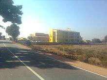
Tikamgarh has many schools & colleges that causes migration of students from different parts of the district.
- Govt. Polytechnic College Dhonga Road.
- Govt. Agriculture College, Kundeshwar road.
- Govt. Veerangna avanti Bai Girls college, Jail Road.[19]
- Govt. P.G. College.
- Basic Training Institute, Kundeshwar.
- School for the cultivation of fine Arts, Music and Dancing.
- Govt. Devendra Sanskrit Vidyalaya, Tikamgarh.
- Govt. Excellence School No.1 & No.2.
- MPITM Computer Center, For DCA & PGDCA
- Jawahar Navodaya Vidyalaya, Kundeshwar.
- Kendriya vidyalaya, Collectorate Tikamgarh
- Pushpa higher sec. school Tikamgarh - Christian school.
- Sardar Singh Smriti Shikha Mahavidhyalay
- Takshshila Computer Academy(MCU Study Center) offers PGDCA & DCA.
- I.C.E. institute of computer education.
- GPITM Computer Institute for PGDCA & DCA.
- Sharp Computer Centre for BCA & PGDCA.
- Unique Computer Centre for BCA, PGDCA & DCA
- Shiva Computer academy for BCA & PGDCA.
- Dream World School
- Daffodil's English medium school.
- Shri Mahavir Bal Sanskar Higher Sec School. Jhansi.
- Maharishi Vidya Mandir Kundeshwar road.
- Angel Abode Public School, Jhansi Road.
- Hope Academy, Jhansi Road
- Saroj Convent Higher Secondary School
Apart from these schools and colleges, there are many B.Ed colleges and coaching institutes running in Tikamgarh.
Radio and television station
Tikamgarh catches radio station of All India Radio (आकाशवाणी) under Prasar Bharati at '675 kHz from Chhatarpur & 92.7 Big FM from Jhansi. Tikamgarh has its own Doordarshan Kendra established in 2008.
Banking
Many Govt. & private banks are working in Tikamgarh.
| Bank | No. of Branches | No.of ATMs |
|---|---|---|
| State Bank of India | 3 | 14 |
| Central Bank of India | 1 | 1 |
| Union Bank of India | 1 | 5 |
| UCO Bank | 1 | 1 |
| Allahabad Bank | 1 | 1 |
| Dena Bank | 1 | 1 |
| ICICI Bank | 1 | 1 |
| HDFC Bank | 1 | 1 |
| Axis Bank | 1 | 2 |
| Punjab National Bank | 1 | 1 |
| Bank of Baroda | 1 | 1 |
| IDBI Bank | 1 | 1 |
| Bank of India | 1 | 1 |
| Vijaya Bank | 1 | 1 |
| Canara Bank | 1 | 1 |
| Co-operative Bank | 1 | 1 |
| Bank of India | 1 | 1 |
| Madhya Bharat Gramin Bank (Regional Office) | 4 | - |
See also
References
- ↑ http://www.censusindia.gov.in/pca/SearchDetails.aspx?Id=481687
- ↑ "Tikamgarh Population Census 2011". Census 2011 - Census of India.
- ↑ "Tikamgarh Population Census 2011". Census 2011 - Census of India.
- ↑ "Tikamgarh Population Census 2011". Census 2011 - Census of India.
- ↑ "Tikamgarh - General Information". Retrieved on May 07 2015.
- ↑ Orchha Tikamgarh district Official website.
- ↑ .co.uk/personalisation/PHO000430S21U00011000 Mausoleum of Raja Rudra Pratap Singh ju Dev British Library.
- ↑ Orchha Archived 7 February 2009 at the Wayback Machine. British Library.
- ↑ Genealogy of Orchha
- ↑ Raj Mandir British Library.
- ↑ Swan Bhadon Palace, Orcha British Library.
- ↑ Orchha state The Imperial Gazetteer of India, 1909, v. 19, p. 241.
- ↑ Papaura Darshan, Pt. Vimal Kumar Shastri, Shri Digambar jain Atishya Kshetra Papaura ji, Tikamgarh, 2014.
- ↑ "Tikamgarh Population Census 2011". Census 2011 - Census of India.
- ↑ "Tikamgarh Population Census 2011". Census 2011 - Census of India.
- ↑ Tikamgarh ki Pital ki Anuthi Shailendra Dvivedi, Bhaskar Sagar, Nov 20, 2017
- ↑ चमकेगी पीतल की अनूठी कारीगरी, Patrika, Jul 5, 2017
- ↑ [https://www.bhaskar.com/news/MP-CHHT-MAT-latest-chhatarpur-news-060502-3150929-NOR.html राष्ट्रीय क्राफ्ट बाजार में होती है टीकमगढ़ में बनी पीतल की मूर्तियाें की डिमांड Bhaskar News Network, Aug 07, 2017]
- ↑ "Govt. Veerangna avanti Bai Girls college". Retrieved 6 February 2014.