Arwal district
| Arwal district | |
|---|---|
| District of Bihar | |
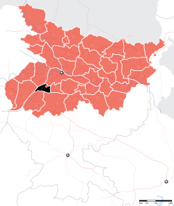 Location of Arwal district in Bihar | |
| Country | India |
| State | Bihar |
| Administrative division | Magadh |
| Headquarters | Arwal |
| Government | |
| • Lok Sabha constituencies | Jahanabad |
| • Assembly seats | Arwal and Kurtha |
| Area | |
| • Total | 638 km2 (246 sq mi) |
| Population (2011) | |
| • Total | 700,843 |
| • Density | 1,100/km2 (2,800/sq mi) |
| • Urban | 51,849 |
| Demographics | |
| • Literacy | 67.44 per cent |
| • Sex ratio | 928 |
| Major highways | NH 98, NH 110 |
| Website | Official website |
Arwal district is one of the thirty-eight districts of Bihar state, India, and Arwal town is the administrative headquarters of this district. It was earlier part of Jehanabad district.
As of 2011 it is the third least populous district of Bihar (out of 39), after Sheikhpura and Sheohar.[1] Arwal District is very small district of Bihar.Most of people are engaged in primary sector.
History
Recent events
There was a massacre of Dalit people, who were considered to be naxal supporters by Ranveer Sena-a private militia of dominant Bhumihar caste, at Laxmanpur Bathe in 1997.This massacre was in response of capturing upper caste people land and killing of Bhumihars by Naxalite-most of them were Dalits. It is a part of the Red Corridor.[2]
Geography
Arwal district occupies an area of 638 square kilometres (246 sq mi),[3] comparatively equivalent to Canada's Foley Island.[4] In Arwal district near Mehandiya MADHUSHARWA MELA, which is famous for ancient SHIV TEMPLE.Its name came in MAHABHARAT.
Population
Arwal District Population.[5]
| Total | Rural | Urban | |
|---|---|---|---|
| Person | 699563 | 699563 | 0 |
| Male | 362945 | 362945 | 0 |
| Female | 336618 | 336618 | 0 |
Language
The language spoken here is Magahi.[6]
Hydrology
Arwal is the unique district of Bihar in the sense of quality of water and its greater availability. As per survey done by the experts underground water of arwal is completely free from the impurities.Water is available at most of the place at much shallower depths this is the reason why most of the households of arwal used to install handpumps instead of motors and storage.Excellent transportation, Son river and huge availability of water in Arwal may provide suitable conditions to establishment of industries.It is the part of plain of Ganga.There are most agricultural field.
Economy
Economy of the district is totally agriculture-based, and this area does not have any presence of any industry. Paddy, wheat and pulse are the main crops. Though most of the area of the district is well irrigated, due to lack of infrastructure and power, farmers are not benefitted. Industries related to agriculture are starting up now a days.
Divisions
Arwal district is a part of Magadh division. It came into existence on 20 August 2001 and was earlier part of Jehanabad district.
The district comprises only one sub-division, Arwal Sadar, which is further divided into five blocks, namely, Arwal, Karpi, Kaler, Kurtha and Suryapur Vanshi.[7]
Transport
Nearest Airport is at Patna and Railway Station is Jehanabad (JHD) and Anugarh Narayan Road (AUBR). By Road, Arwal is linked with Jehanabad, Patna and Aurangabad.
Baba Barmeshwar bridge connects to Arwal with Sahar (Bhojpur) on River Sone. It is having excellent communication facility with other cities of India. NH- 139 (Old NH- 98) which passes through Arwal connects NH- 19 (Old NH- 02).
Demographics
According to the 2011 census Arwal district has a population of 700,843,[1] roughly equal to the nation of Bhutan[8] or the US state of North Dakota.[9] This gives it a ranking of 502nd in India (out of a total of 640).[1] The district has a population density of 1,099 inhabitants per square kilometre (2,850/sq mi) .[1] Its population growth rate over the decade 2001-2011 was 19.01%.[1] Arwal has a sex ratio of 927 females for every 1000 males,[1] and a literacy rate of 69.54%.[1]
See also
References
- 1 2 3 4 5 6 7 "District Census 2011". Census2011.co.in. 2011. Retrieved 2011-09-30.
- ↑ "83 districts under the Security Related Expenditure Scheme". IntelliBriefs. 2009-12-11. Retrieved 2011-09-17.
- ↑ Srivastava, Dayawanti et al. (ed.) (2010). "States and Union Territories: Bihar: Government". India 2010: A Reference Annual (54th ed.). New Delhi, India: Additional Director General, Publications Division, Ministry of Information and Broadcasting (India), Government of India. pp. 1118–1119. ISBN 978-81-230-1617-7.
- ↑ "Island Directory Tables: Islands by Land Area". United Nations Environment Program. 1998-02-18. Retrieved 2011-10-11.
Foley Island 638km2
- ↑ http://arwal.bih.nic.in/dpopulation.htm
- ↑ http://arwal.bih.nic.in/about_district.htm
- ↑ "Bihar districts:Arwal". Official website of Bihar. Archived from the original on 23 September 2008. Retrieved 2008-09-12.
- ↑ US Directorate of Intelligence. "Country Comparison:Population". Retrieved 2011-10-01.
Bhutan 708,427
- ↑ "2010 Resident Population Data". U. S. Census Bureau. Archived from the original on 2013-10-19. Retrieved 2011-09-30.
North Dakota 672,591
External links
Places adjacent to Arwal district | |
|---|---|
| State symbols | |
|---|---|
| History |
|
| Administration | |
| Overviews | |
| Divisions and districts | |
| Cities | |
| Municipal Corporation |
|
| Poltics | |
| Culture | |
Coordinates: 25°14′24″N 84°40′12″E / 25.24000°N 84.67000°E