Champawat
| Champawat | |
|---|---|
| town | |
 Champawat Skyline | |
 Champawat Location in Uttarakhand, India  Champawat Champawat (India) | |
| Coordinates: 29°20′N 80°06′E / 29.33°N 80.10°ECoordinates: 29°20′N 80°06′E / 29.33°N 80.10°E | |
| Country |
|
| State | Uttarakhand |
| District | Champawat |
| Government | |
| • Body | Nagar Palika |
| Area | |
| • Total | 5 km2 (2 sq mi) |
| Elevation | 1,615 m (5,299 ft) |
| Population (2011) | |
| • Total | 4,801 |
| • Density | 960/km2 (2,500/sq mi) |
| Languages | |
| • Official | Hindi, Kumauni |
| Time zone | UTC+5:30 (IST) |
| Vehicle registration | UK-03 |
| Website |
uk |
Champawat is a town and a Nagar Palika Parishad in Champawat district in the state of Uttarakhand, India. It is the administrative headquarters of Champawat district. The city was the former capital of the Kumaon Kingdom.
Mythology
Champawat is believed to be the place where the Kurmavtar (the turtle incarnation of Lord Vishnu) took place.These days there is a temple called Kranteshwar Mandir, which is dedicated to lord Shiva. It is also believed that the head of 'Ghatotkacha (son of Bhima and the Rakshasi Hidimbi ) fell here after he died in battle the of Mahabharata. The Gahtku Mandir is the temple dedicated to Ghatotkacha.
History
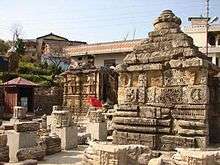
Champawat was formerly the capital of the Chand dynasty rulers of Kumaon. The Baleshwar Temple built by the Chand rulers in the 12th century is an excellent monument with marvelous stone carving works.
Shani Mandir
There is a Famous Temple Shaani Mandir (Manokamna Purn Mandir Kaula) in Maurari Village.
Geography
Champawat lies in the southeast of the North Indian state of Uttarakhand. It is in the eastern part of the Kumaon Himalayas at an average elevation of 1,615 metres (5,299 ft).[1] It is located at 29°20′N 80°06′E / 29.33°N 80.10°E[2] and covers an area of 5 square kilometres (1.9 sq mi). The city of Champawat lies in the Champawat district of Uttarakhand, which was carved out from the Pithoragarh district by the Government of Uttar Pradesh in 1997.[3][4]
Climate
Champawat has a Humid subtropical climate (Köppen climate classification Cfa) with distinct wet and dry seasons.[5] Due to its high elevation, Champawat usually enjoys a more moderate climate throughout the year. The average temperature for the year in Champawat is 24.6 °C (76.3 °F).[5] The warmest month, on average, is June with an average temperature of 32.1 °C (89.8 °F).[5] The coolest month on average is January, with an average temperature of 14.3 °C (57.7 °F).[5] The average amount of precipitation for the year in Champawat is 1,239.5 millimetres (48.80 in).[5] The month with the most precipitation on average is July with 358.1 millimetres (14.10 in) of precipitation.[5] The month with the least precipitation on average is November with an average of 2.5 millimetres (0.098 in).[5] There are an average of 43.8 days of precipitation, with the most precipitation occurring in August with 10.9 days and the least precipitation occurring in November with 0.6 days.[5]
| Climate data for Champawat | |||||||||||||
|---|---|---|---|---|---|---|---|---|---|---|---|---|---|
| Month | Jan | Feb | Mar | Apr | May | Jun | Jul | Aug | Sep | Oct | Nov | Dec | Year |
| Average high °C (°F) | 21.2 (70.2) |
24.1 (75.4) |
30.1 (86.2) |
36.4 (97.5) |
39.4 (102.9) |
38 (100) |
33.7 (92.7) |
33.1 (91.6) |
33.1 (91.6) |
32.1 (89.8) |
28 (82) |
22.9 (73.2) |
31 (88) |
| Daily mean °C (°F) | 14.3 (57.7) |
16.9 (62.4) |
22.2 (72) |
28.4 (83.1) |
31.8 (89.2) |
32.1 (89.8) |
29.5 (85.1) |
29.2 (84.6) |
28.5 (83.3) |
25.4 (77.7) |
20.4 (68.7) |
15.6 (60.1) |
24.5 (76.1) |
| Average low °C (°F) | 7.5 (45.5) |
9.7 (49.5) |
14.4 (57.9) |
20.4 (68.7) |
24.1 (75.4) |
26.2 (79.2) |
25.4 (77.7) |
25.4 (77.7) |
23.9 (75) |
18.9 (66) |
12.8 (55) |
8.5 (47.3) |
18.1 (64.6) |
| Average precipitation mm (inches) | 23.8 (0.937) |
25.3 (0.996) |
19.7 (0.776) |
14.2 (0.559) |
33.2 (1.307) |
165.4 (6.512) |
356.9 (14.051) |
352.5 (13.878) |
193.8 (7.63) |
43.3 (1.705) |
3 (0.12) |
9.5 (0.374) |
1,240.6 (48.843) |
| Average precipitation days | 1.8 | 1.8 | 1.7 | 1.3 | 1.8 | 4.9 | 10.8 | 10.9 | 5.5 | 1.8 | 0.6 | 0.9 | 43.8 |
| Mean daily sunshine hours | 10.9 | 11.6 | 12.4 | 13.3 | 14.1 | 14.4 | 14.2 | 13.6 | 12.7 | 11.8 | 11.1 | 10.7 | 12.6 |
| Source: Weatherbase[6] | |||||||||||||
Tourism
Due to its cooler temperatures Champawat is a popular conduit for tourists visiting Pithoragarh, Dharchula, Almora and other mountain towns. The long winding sealed roads leading up to Champawat through Tanakpur are a popular route for motorcycle enthusiasts. Champawat has multiple hotels and guesthouses for individuals visiting the town. Bal Mithai of Champawat is famous for its unique taste.
Demographics
| Population Growth of Champawat | |||
|---|---|---|---|
| Census | Pop. | %± | |
| 1981 | 1,702 | — | |
| 1991 | 2,525 | 48.4% | |
| 2001 | 3,959 | 56.8% | |
| 2011 | 4,801 | 21.3% | |
| source:[7]:681[8] | |||
Champawat had a population of 4801 in 2011[7] within its administrative limits on a land area of 5 km2 (1.9 sq mi), 21.3% up from 3958 in 2001.[10] Out of the total Population, 2,543 are males while 2,258 are females as per report released by Census India 2011.[11][7][9]
Population of Children with age of 0–6 is 554 which is 11.54% of total population of Champawat.[9][11] In Champawat, Female Sex Ratio is of 888 against state average of 963.[9][11] Moreover Child Sex Ratio in Champawat is around 748 compared to Uttarakhand state average of 890.[9][11] Literacy rate of Champawat city is 91.69% higher than state average of 78.82%.[9][11] The Male literacy is around 95.91% while female literacy rate is 87.04%.[9][11]
Schedule Caste constitutes 18.60% while Schedule Tribe were 0.94% of total population in Champawat.[9][11] Out of total population, 1,356 were engaged in work or business activity.[9] Of this 1,103 were males while 253 were females.[9][11] Of total 1356 working population, 95.28% were engaged in Main Work while 4.72% of total workers were engaged in Marginal Work.[9][11]
See also
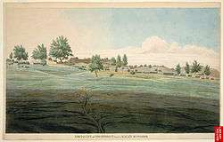
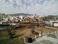
Image Gallery
.jpg)
.jpg)

.jpg)


References
- ↑ Indusnettechnologies, Goutam Pal, Dipak K S, SWD. "Champawat: District of Champawat, Uttarakhand, India". www.champawat.gov.in.
- ↑ Falling Rain Genomics, Inc – Champawat
- ↑ Indusnettechnologies, Goutam Pal, Dipak K S, SWD. "Profile: District of Champawat, Uttarakhand, India". www.champawat.gov.in. Retrieved 23 April 2017.
- ↑ Negi, Sunil (6 February 2017). "उत्तराखंड इलेक्शन: उत्तराखंड में आकार नहीं ले सके नफा-नुकसान के जिले" (in Hindi). Dehradun: jagran. Retrieved 23 April 2017.
- 1 2 3 4 5 6 7 8 "Champawat, India Köppen Climate Classification and Weather Summary". Weatherbase. Retrieved 23 April 2017.
- ↑ "Champawat, India". Weatherbase. Retrieved 22 April 2017.
- 1 2 3 District Census Handbook Champawat Part-A (PDF). Dehradun: Directorate of Census Operations, Uttarakhand. Retrieved 17 October 2016.
- ↑ Pradesh, India Director of Census Operations, Uttar; Sinha, Dharmendra Mohan. District Census Handbook: Series 21, Uttar Pradesh.
- 1 2 3 4 5 6 7 8 9 10 11 District Census Handbook Champawat Part-b (PDF). Dehradun: Directorate of Census Operations, Uttarakhand. Retrieved 17 October 2016.
- ↑ "Census of India 2001: Data from the 2001 Census, including cities, villages and towns (Provisional)". Census Commission of India. Archived from the original on 16 June 2004. Retrieved 2008-11-01.
- 1 2 3 4 5 6 7 8 9 "Champawat City Population Census 2011 – Uttarakhand". www.census2011.co.in. Retrieved 10 May 2017.
External links
| Wikimedia Commons has media related to Champawat. |