Patna district
| Patna district | |
|---|---|
| District of Bihar | |
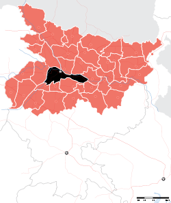 Location of Patna district in Bihar | |
| Country | India |
| State | Bihar |
| Administrative division | Patna division |
| Headquarters | Patna |
| Government | |
| • Lok Sabha constituencies | 1. Patna Sahib, 2. Pataliputra, 3. Munger (shared with Munger district) |
| • Assembly seats | 14 |
| Area | |
| • Total | 3,202 km2 (1,236 sq mi) |
| Population (2011) | |
| • Total | 5,838,465 |
| • Density | 1,800/km2 (4,700/sq mi) |
| • Urban | 2,514,590 (43.7 per cent) (2,011) |
| Demographics | |
| • Literacy | 73.68 per cent[1] |
| • Sex ratio | 897 |
| Major highways | NH 30, NH 83 |
| Website | Official website |
Patna district is one of the thirty-eight districts of Bihar state in eastern India. Patna, the capital of Bihar state is the district headquarters. Patna district is a part of Patna division.
As of 2011, it is the most populous district of Bihar (out of 38)[2] and fifteenth most populous district in India (out of 640).[3][4]
The revenue district of Patna come under the jurisdiction of a District Collector (District Magistrate). The office of the Patna DM is in Patna Collectorate.
History
Patna is one of the oldest continuously inhabited places in the world.[5] Patna was founded in 490 BCE by the king of Magadha. Ancient Patna, known as Pataliputra, was the capital of the Magadha Empire under the Haryanka, Nanda, Mauryan, Shunga, Gupta and Pala empires. Pataliputra was a seat of learning and fine arts. Patliputra was home to many astrologists and scholars including Aryabhata, Panini, Vātsyāyana, Chanakya and Kālidāsa.[6][7] Its population during the Maurya period (around 300 BCE) was about 400,000.[8] Patna served as the seat of power, political and cultural centre of Indian subcontinent during the Maurya and Gupta empires. With the fall of Gupta Empire, Patna lost its glory. It was revived again in the 17th century by the British as a centre of international trade.
Modern history
The modern district of Patna was created in September 1770 as provincial council by the British, to supervise revenue matters of Bihar, along with Murshidabad for Bengal. In 1793, Patna became a separate judicial district. This led the foundation of modern district.[9]
Post-independence
The re-organization of the districts in the State took effect in the year 1972. On November 9, 1972 Nalanda district was constituted by carving out Bihar Sharif sub-division of Patna district.[10]
Geography

The district is bounded by the Son river on the west, on the north by the ganges river, and on the south by Nalanda, Arwal and Jehanabad districts. On the east Begusarai district is bordered and partly by the Lakhisarai to the south east. Boundaries of the district are naturally determined by rivers on north and west.
Patna district occupies an area of 3,202 square kilometres (1,236 sq mi),[11] comparatively equivalent to the Solomon Islands' Makira Island.[12]
Blocks
The district has 23 blocks: Patna Sadar, Phulwari Sharif, Sampatchak, Paliganj, Fatuha, Khusrupur, Daniyawaan, Bakhtiyarpur, Barh, Belchi, Athmalgola, Mokama, Pandarak, Ghoswari, Bihta, Maner, Danapur, Naubatpur, Bikram, , Masaurhi, Dhanarua, Punpun.
Sub-divisions
Patna district comprises six sub-divisions:
- Patna Sadar
- Patna City
- Barh
- Danapur
- Masaurhi
- Paliganj
Assembly constituencies
The district is divided into fourteen assembly constituencies:[13][14][15][16]
- 178 Mokama
- 179 Barh
- 180 Bakhtiarpur
- 181 Digha
- 182 Bankipur
- 183 Kumhrar
- 184 Patna Sahib
- 185 Fatuha
- 186 Danapur
- 187 Maner
- 188 Phulwari (SC)
- 189 Masaurhi (SC)
- 190 Paliganj
- 191 Bikram
Parliamentary constituencies
The district has three parliament constituencies:
- 30 Patna Sahib (Lok Sabha constituency), covers Bakhtiarpur, Digha, Bankipur, Kumhrar, Patna Sahib and Fatuha.
- 31 Pataliputra (Lok Sabha constituency), covers Danapur, Maner, Phulwari, Masaurhi, Paliganj and Bikram.
- 28 Munger/Monghyr (Lok Sabha constituency), covers Barh and Mokama and shared with Munger district.
-Numbers denotes constituency number.
Demographics
According to the 2011 census Patna district has a population of 5,838,465,[2] roughly equal to the nation of Nicaragua[17] or the US state of Maryland.[18] This gives it a ranking of 15th in India (out of a total of 640).[2] The district has a population density of 1,823 inhabitants per square kilometre (4,720/sq mi) .[2] Its population growth rate over the decade 2001-2011 was 22.34%.[2] Patna has a sex ratio of 897 females for every 1,000 males,[2] and a literacy rate of 72.47%.[2]
Climate
| Climate data for Patna | |||||||||||||
|---|---|---|---|---|---|---|---|---|---|---|---|---|---|
| Month | Jan | Feb | Mar | Apr | May | Jun | Jul | Aug | Sep | Oct | Nov | Dec | Year |
| Average high °C (°F) | 23.3 (73.9) |
26.5 (79.7) |
32.6 (90.7) |
37.7 (99.9) |
38.9 (102) |
36.7 (98.1) |
33.0 (91.4) |
32.4 (90.3) |
32.3 (90.1) |
31.5 (88.7) |
28.8 (83.8) |
24.7 (76.5) |
31.53 (88.75) |
| Average low °C (°F) | 9.2 (48.6) |
11.6 (52.9) |
16.4 (61.5) |
22.3 (72.1) |
25.2 (77.4) |
26.7 (80.1) |
26.2 (79.2) |
26.1 (79) |
25.7 (78.3) |
21.8 (71.2) |
14.7 (58.5) |
9.9 (49.8) |
19.65 (67.37) |
| Average precipitation mm (inches) | 19 (0.75) |
11 (0.43) |
11 (0.43) |
8 (0.31) |
33 (1.3) |
134 (5.28) |
306 (12.05) |
274 (10.79) |
227 (8.94) |
94 (3.7) |
9 (0.35) |
4 (0.16) |
1,130 (44.49) |
| Source: worldweather.org[19] | |||||||||||||
Economy
In 2006 the Ministry of Panchayati Raj named Patna one of the country's 250 most backward districts (out of a total of 640).[20] It is one of the 38[21] districts in Bihar currently receiving funds from the Backward Regions Grant Fund Programme (BRGF).[20]
Agricultural products include: paddy, maize, pulses, wheat and oil seeds. Roughly one third of the area sown is under rice (paddy). Cash crops such as vegetables and watermelons are also grown in Diara belt. Major industries include leather, handicrafts, and agro processing.
Education
Schools in Patna are either government run schools or private schools. Schools mainly use Hindi or English as the medium of instruction.[22] The schools are affiliated with the Bihar School Examination Board, the Central Board of Secondary Education (CBSE), the National Institute of Open Schooling (NIOS) or the Indian Certificate of Secondary Education (ICSE).[23] Under the 10+2+3/4 plan, after completing their secondary education, students typically enroll in a school with a higher secondary facility affiliated with the BSEB, the NIOS, Indian School Certificate (ISC) or the CBSE. Students usually choose from one of three streams — liberal arts, commerce, or science, though vocational streams are also available. Upon completing the required coursework, students may enroll in general or professional degree programmed.
See also
References
- ↑ "District-specific Literates and Literacy Rates, 2001". Registrar General, India, Ministry of Home Affairs. Archived from the original on 14 April 2010. Retrieved 5 October 2010.
- 1 2 3 4 5 6 7 "District Census 2011". Census2011.co.in. 2011. Archived from the original on 11 June 2011. Retrieved 30 September 2011.
- ↑ "Patna Pin Code list, Population density ,literacy rate and total Area with census 2011 details". www.indiamapia.com. Archived from the original on 2017-10-17. Retrieved 2017-12-28.
- ↑ "District wise population in India as of 2011 census". updateOX. 2011-05-24. Archived from the original on 2017-12-29. Retrieved 2017-12-28.
- ↑ "Populations of Largest Cities in PMNs from 2000BC to 1988AD". Archived from the original on 29 September 2007.
- ↑ "Patna Tour". cultureholidays.com. Archived from the original on 4 April 2016. Retrieved 28 August 2016.
- ↑ "Ancient Patliputra". go4patna.com. Archived from the original on 18 October 2016. Retrieved 28 August 2016.
- ↑ O'Malley, L. S. S. (2005). James, J. F. W., ed. History of Magadha. Delhi: Veena Publication. p. 23. ISBN 978-81-89224-01-1. Retrieved 24 February 2011.
- ↑ Singh, Vipul (2005). The Artisans in 18th Century Eastern India, a History of Survival. Concept Publishing Company. ISBN 9788180692352. Archived from the original on 2017-12-29. Retrieved 2017-12-28.
- ↑ "Nalanda celebrates foundation day — Times of India". The Times of India. Archived from the original on 2017-12-29. Retrieved 2017-12-28.
- ↑ Srivastava, Dayawanti et al. (ed.) (2010). "States and Union Territories: Bihar: Government". India 2010: A Reference Annual (54th ed.). New Delhi, India: Additional Director General, Publications Division, Ministry of Information and Broadcasting (India), Government of India. pp. 1118–1119. ISBN 978-81-230-1617-7.
- ↑ "Island Directory Tables: Islands by Land Area". United Nations Environment Program. 18 February 1998. Archived from the original on 1 December 2015. Retrieved 11 October 2011.
Makira 3,190km2
- ↑ "14 segments in Patna dist this time". Archived from the original on 2017-12-29.
- ↑ "General Election 2009 Assembly constituencies". Pataliputra. India elections.co.in. Archived from the original on 2009-04-24. Retrieved 2017-12-28.
- ↑ "Monghyr (Munger) loksabha constituency seat election results". IndiaStudyChannel.com. Archived from the original on 2017-12-29. Retrieved 2017-12-28.
- ↑ "Patna Sahib loksabha constituency seat election results". IndiaStudyChannel.com. Archived from the original on 2017-12-29. Retrieved 2017-12-28.
- ↑ US Directorate of Intelligence. "Country Comparison:Population". Archived from the original on 27 September 2011. Retrieved 1 October 2011.
Nicaragua 5,666,301 July 2011 est.
- ↑ "2010 Resident Population Data". U. S. Census Bureau. Archived from the original on 19 October 2013. Retrieved 30 September 2011.
Maryland 5,773,552
- ↑ "Climatological Information for Patna". World Weather. Archived from the original on 8 August 2013. Retrieved 25 February 2011.
- 1 2 Ministry of Panchayati Raj (8 September 2009). "A Note on the Backward Regions Grant Fund Programme" (PDF). National Institute of Rural Development. Archived from the original (PDF) on 5 April 2012. Retrieved 27 September 2011.
- ↑ By: Manav Saurav : Government of Bihar website :gov.bih.nic.in/Profile/Districts.htm
- ↑ Dixon, Pauline (2013). International Aid and Private Schools for the Poor: Smiles, Miracles and Markets. Edward Elgar Publishing, 2013. p. 65. ISBN 9781781953457. Archived from the original on 2015-06-19.
- ↑ "Class XI admission process begins in many schools". The Times of India. 23 May 2015. Archived from the original on 4 March 2016. Retrieved 29 December 2017.
| Wikimedia Commons has media related to Patna district. |
Places adjacent to Patna district | |
|---|---|
Coordinates: 25°25′N 85°10′E / 25.417°N 85.167°E
| State symbols | |
|---|---|
| History |
|
| Administration | |
| Overviews | |
| Divisions and districts | |
| Cities | |
| Municipal Corporation |
|
| Poltics | |
| Culture | |
| Authority control |
|---|