Senapati district
| Senapati district | |
|---|---|
| District of Manipur | |
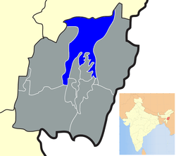 Location of Senapati district in Manipur | |
| Country | India |
| State | Manipur |
| Headquarters | Senapati |
| Tehsils | 1. Purul, 2. Paomata, 3. Mao-Maram,[1] |
| Government | |
| • Lok Sabha constituencies | 1. 47-Karong, 2. 48-Mao, 3. 49-Tadubi [1] |
| • Assembly seats | 6 |
| Area | |
| • Total | 3,271 km2 (1,263 sq mi) |
| Population (2011) | |
| • Total | 479,148[2] |
| • Urban | 3.86%[2] |
| Demographics | |
| • Literacy | 74.13%[2] |
| • Sex ratio | 959[2] |
| Vehicle registration | MN03[3] |
| Major highways | NH-39, AH-2,[4] AH-1[5] |
| Website | Official website |
Senapati (Pron:/ˌseɪnəˈpʌti/) is a district of Manipur state in India.
Geography
Senapati District is located between 93.29° and 94.15° East Longitude and 24.37° and 25.37° North Latitude and is in the northern part of Manipur state. The District is bounded on the south by Kangpokpi District, on the east by Ukhrul District, on the west by Tamenglong District and on the north by Kohima District and Phek district of Nagaland state. The district lies at an altitude between 1061 meter to 1788 meters above sea level.
Hydrology
The district is under humid subtropical climate. The soil is moderately fertile with clay loam soil with little patches of clay and loam. The temperature ranges from a minimum of 3.4 °C (38.1 °F) to a maximum of 34.1 °C (93.4 °F). The annual rainfall ranges from 670 to 1,450 mm (26.4 to 57.1 in). There are about 110 watersheds each of geographical size ranging from 2,000 to 3,000 hectares (4,900 to 7,400 acres), which are drained finally at about 5 major rivers/streams of different aspects and sources as indicated below:
District profile
| Infrastructure facilities | Numbers | |
|---|---|---|
| 1 | Community Development/Tribal Development blocks | 3 |
| 2 | Autonomous Hill District Council | 1 |
| 3 | Police stations | 3 |
| 4 | Fire stations/Sub-stations | 1 |
| 5 | Vidhan Sabha seats | 6 |
| 6 | Lok Sabha seats | Nil |
| 7 | Gram panchayats | Nil |
| 8 | Post offices | |
| 8a | Head offices | Nil |
| 8b | Sub-offices | 11 |
| 8c | Branch offices | 73 |
| 9 | Telecommunications | |
| 9a | Telegraph offices | Nil |
| 9b | Telephone exchanges | 5 |
| 9c | Combined offices | 9 |
| 10 | Employment exchanges | 3 |
| 11 | Public Health Engineering Department | |
| 11a | Villages fully covered | 43 |
| 11b | Villages partially covered | 26 |
| 12 | Power | |
| 12a | Installed capacity of hydro-electric power (State-owned) | 1.30 MW |
| 12b | Electricity generated by hydro-electric power (State-owned) | 0.41 GW·h |
| 12c | 132/33 kV Sub-stations | 2 |
| 12d | No. of villages electrified | 485 |
Administrative divisions
Senapati is the fourth largest district of Manipur within the union of India. Senapati district is under the charge of a Deputy Commissioner cum District Magistrate assisted by a number of other officials including District Supply Officer (FCS), one Assistant Engineer (Dev), one Assistant Election Officer, one Assistant Project Officer and one office Superintendent. The Deputy Commissioner functions as the Additional Development Commissioner, and he is also the ex officio Chairman of the District Rural Development Agency, Senapati.
The district is divided into five subdivisions:[6]
| Subdivision | Headquarters | |
|---|---|---|
| 1 | Mao-Maram | Tadubi |
| 2 | Paomata | Paomata |
| 3 | Purul | Purul |
| 4 | Willong | Willong |
| 5 | Chilivai-Phaibung | Phaibung |
| 6 | Song Song | Song Song |
| 7 | Lairouching | Lairouching |
Economy
Agriculture
66.43% of the land area is covered by forest while the rest 20% are utilized for cultivation. Rice, Maize, Potato, Cabbage and cereals are the major produces of the district. Agriculture is the main occupation of the people and terrace cultivation is generally practice by the people.
Demographics
According to the 2011 census Senapati district has a population of 479148,[7] roughly equal to the nation of Belize.[8] This gives it a ranking of 565th in India (out of a total of 640).[7] The district has a population density of 109 inhabitants per square kilometre (280/sq mi) .[7] Its population growth rate over the decade 2001-2011 was 25.16%.[7] Senapati has a sex ratio of 939 females for every 1000 males,[7] and a literacy rate of 75%.[7]
Mao Naga, Maram, Thangal, Poumai, Thangal, Zemai, Liangmai, Rongmei(Kabui), Tangkhul, Meetei, Thadou, Nepalese, Vaiphei, Chothe, Chiru, Maring are the major inhabitants of this district.
Languages
Languages spoken include the following.
Transport
Roads
92 km of NH 2 passes through the District from the south end to the north end. Imphal-Tamenglong via Kangpokpi road, Maram-Paren road, Tadubi-Tolloi-Ukhrul road, Maram-Ngari-Kachai road, Karong-Purul-Liyai road, Senapati-Khongdei-Phaibung road are other important roads in the district.
Culture
Festivals
District is settled by different communities so there are different varieties of festival are celebrated. some of the important festivals are as follows:
Chaga Ngee
Celebrated by liangmai tribe on 30 Oct. It is a festival of sanctification or purification. the biggest and the most important festival of liangmai
- Thounii
- The new year cultural festival of Poumai Nagas is celebrated on 5 January to mark cultural resurgence, social interaction, family reunion.
- Laonii
- The sacred festival of Poumai Nagas is celebrated on completion of paddy transplantation which usually falls in the last fortnight of July. A festival of male sanctification, this is an occasion to interact and renew ties with brothers and sisters.
- Chiithuni
- The six-day annual festival of Mao Nagas celebrated from 25th day of Chuthunikhro (Dec-Jan), meaning ‘feast of dawn’, is an occasion to rejuvenate the cultural heritage of the Mao Nagas.
- Saleni
- It is a customary festival of Mao Nagas, celebrated in the month of Salekhro (July) on completion of paddy transplantation. The whole menfolk have to purify themselves by taking bath early in the morning in the pond.
- Ponghi
- The seven-day customary festival of Maram Nagas is celebrated on 20th day of Ponghi-kii (July) on completion of paddy transplantation.
- Kanghi
- The seven-day customary festival of Maram Nagas held in the month of Kanghi-kii (December). Wrestling is played during the festival in the Khullakpa’s compound in stark naked to get shy away the devils so as to obviate misfortune and injury.
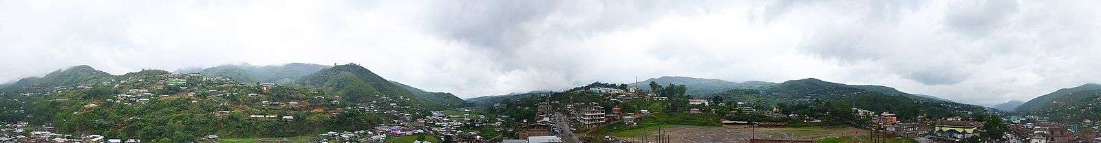
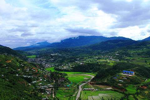
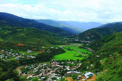
Tourism
Places of interest
- Koubru Mountain
- This mountain is one of the highest peak in Manipur. People climb the mountain in group. It is the sacred place for "meiteis" where they used to climb and pray to God "Koubru". There is a long cave where people passes through.
- Koubru Laikha
- Koubru Laikha is one of the famous Shiv Temples in Manipur. There will be a herd of people during the time of Shivratri and Kanwad. People say that putted milk on the Koubru Mountain comes here. This temple is situated on the bank of Imphal River.
National Highway 39 Passes through here.
- Kangpokpi: second largest town in Senapati district inhibited by mostly Thadou kuki tribe
- Mao Gate: Oldest hill stations of Manipur lying on the border of Nagaland. Dzükou Valley is situated near by this town.
References
- 1 2 http://senapati.nic.in/adminsetup.htm
- 1 2 3 4 http://www.census2011.co.in/census/district/370-senapati.html
- ↑ http://rtoaifmvd.com/Contact_Manipur.aspx
- ↑ AH2
- ↑ AH1
- ↑ Office of the Registrar General of India
- 1 2 3 4 5 6 "District Census 2011". Census2011.co.in. 2011. Retrieved 2011-09-30.
- ↑ US Directorate of Intelligence. "Country Comparison:Population". Retrieved 2011-10-01.
Belize 321,115 July 2011 est.
External links
Places adjacent to Senapati district | |
|---|---|