Muzaffarnagar district
| Muzaffarnagar district | |
|---|---|
| District of Uttar Pradesh | |
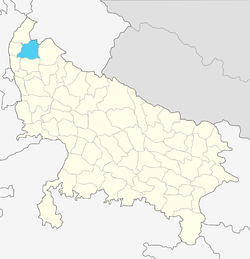 Location of Muzaffarnagar district in Uttar Pradesh | |
| Country | India |
| State | Uttar Pradesh |
| Administrative division | Saharanpur |
| Headquarters | Muzaffarnagar |
| Tehsils | Sadar, Budhana, Jansath, Khatauli |
| Government | |
| • Lok Sabha constituencies | Muzaffarnagar |
| • Assembly seats |
Muzaffarnagar, Budhana, Charthawal, Khatauli, Meerapur, Purqazi |
| Area | |
| • Total | 2,991 km2 (1,155 sq mi) |
| Population (2011) | |
| • Total | 4,143,512 |
| • Density | 1,400/km2 (3,600/sq mi) |
| Demographics | |
| • Literacy | 69.12 per cent[1] |
| • Sex ratio | 889/1000 |
| Major highways | SH59, SH12A |
| Website | Official website |
Muzaffarnagar district is a district of Uttar Pradesh state in northern India. It is part of Saharanpur division. The city of Muzaffarnagar is the district headquarters. This district is the part of National Capital Region.
History
Medieval period
Muzaffarnagar's early medieval history is obscure till the Indo-Mughal period. Timur's army had marched to Delhi through this region in 1399; its people fought it unsuccessfully. In Mughal Emperor Akbar's time, most of the Muzaffarnagar district region, called Sarwat then under the Mahal control of Taga / Tyagi brahmans of Sarvat village, belonged to the sarkar (circle) of Saharanpur. Akbar bestowed pargana of Sarwat on Sayyed Mahmud Khan Barha which remained with his descendants up to the 17th century. After killing Peer Khan Lodi styled as Khan Jahan lodi, Shahjahan bestowed title of deceased Peer Khan Lodhi and Pargana of Sarwat on Sayyed Muzaffar Khan Barha, whose son Munawwar Lashkar Khan Barha established the city and named it Muzaffarnagar in honour of his father, and Sarwat also became Muzaffarnagar.[2]
Modern era
Muzaffarnagar district gained notoriety in the 20th century with frequent incidents of loot, murders, kidnappings and dacoity.[3]
Blocks
The district is divided into 9[4] blocks, these are:
| Sr. No. | Block Name |
|---|---|
| 1 | Muzaffarnagar |
| 2 | Budhana |
| 3 | Baghra |
| 4 | Shahpur |
| 5 | Purquazi |
| 6 | Charthawal |
| 7 | Morna |
| 8 | Jansath |
| 9 | Khatauli |
Demographics
According to the 2011 census Muzaffarnagar district has a population of 4,143,512 [6] roughly equal to the nation of Lebanon[7] or the US state of Oregon.[8] This gives it a ranking of 125th in India (out of a total of 640).[6] The district has a population density of 960 inhabitants per square kilometre (2,500/sq mi) .[6] Its population growth rate over the decade 2001-2011 was 16.8%.[6] Muzaffarnagar has a sex ratio of 886 females for every 1000 males,[6] and a literacy rate of 70.11%.[6]
Minority population is about 40% of the total population of the district[9]
Education
References
- ↑ "District-specific Literates and Literacy Rates, 2011". Registrar General, India, Ministry of Home Affairs. Retrieved 2010-10-10.
- ↑ "Brief District History". Muzaffarnagar district website. Retrieved 2013-09-09.
- ↑ "The streets of fear". India Today. Retrieved 28 January 2017.
- ↑ "Administration". Muzaffarnagar.nic.in. Retrieved 2012-08-08.
- ↑ "Muzaffarnagar Religion Census 2011". Office of the Registrar General and Census Commissioner, India. Retrieved 2018-02-12.
- 1 2 3 4 5 6 "District Census 2011". Census2011.co.in. 2011. Retrieved 2011-09-30.
- ↑ US Directorate of Intelligence. "Country Comparison:Population". Retrieved 2011-10-01.
Albania 2,827,800 July 2011 est.
- ↑ "2010 Resident Population Data". U. S. Census Bureau. Retrieved 2011-09-30.
Oregon 3,831,074
- ↑ "Archived copy". Archived from the original on 17 August 2015. Retrieved 3 February 2011. .
External links
Places adjacent to Muzaffarnagar district | ||||||||||
|---|---|---|---|---|---|---|---|---|---|---|
| ||||||||||