Nirmal
| Nirmal నిర్మల్ | |
|---|---|
| Town | |
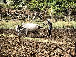 Farming near Nirmal | |
 Nirmal Location in Telangana, India  Nirmal Nirmal (India) | |
| Coordinates: 19°06′N 78°21′E / 19.1°N 78.35°ECoordinates: 19°06′N 78°21′E / 19.1°N 78.35°E | |
| Country | India |
| State | Telangana |
| District | Nirmal |
| Area[1] | |
| • Total | 32.06 km2 (12.38 sq mi) |
| Population (2011)[2][3] | |
| • Total | 88,433 |
| • Density | 2,800/km2 (7,100/sq mi) |
| Language | |
| • Official | Telugu |
| Time zone | UTC+5:30 (IST) |
| PIN | 504106 |
| Telephone code | 08734 |
| Vehicle registration | TS-18 |
| Sex ratio | 50:50 ♂/♀ |
| Lok Sabha constituency | Adilabad |
| Vidhan Sabha constituency | Nirmal |
Nirmal is a town and newly formed district of Telangana.The town is surrounded by various ponds and There are many forts in and around Nirmal. Khilla, Bathees Gargh and Shyam Gardh..etc.
Origin
The name Nirmal is derived from nimma nayudu, the king and founder of nirmal
Geography
Nirmal is located at 19°06′N 78°21′E / 19.10°N 78.35°E.[4] It has an average elevation of 340 metres (1100 feet).on foot hills of nirmal range,in deccan plateau,it is famous for lot of waterfalls like kuntala waterfalls, pochera waterfalls, gayatri waterfalls,kortikal waterfalls, Nirmal Toys(Made of wood powder)etc.
Demographics
In the 2011 Indian census,[5] the total population of Nirmal Town was 88,433. There are 44,053 males (49.82%) and 44,380 females (50.18%). 10,303 children are below 6 years of age. There 5,315 males and 4,988 females. . As per the house hold survey conducted by Telangana govt in August 2014, the population of Nirmal town is 116,800.
Major languages are Telugu, Marathi, Urdu and Gondi. Telugu has been the official language since 1956.
Government and politics
Civic administration
It is one of the oldest municipality in Telangana,Nirmal Municipality was constituted in 1952 and is classified as a second grade municipality with 36 election wards. The jurisdiction of the civic body is spread over an area of 32.06 km2 (12.38 sq mi).[1]
Politics
Nirmal Assembly constituency is a constituency of Telangana Legislative Assembly, India.It comes under Adilabad (Lok Sabha constituency) along with six other Assembly constituencies. In this constituency there are eight mandals,Nirmal, Dilawarpur, Laxmanchanda, Mamda and Sarangapur,soan,narsapur-g,nirmal rural
Transport
Nirmal is well connected by road to state capital, Hyderabad through NH44 and which is 210 km away as well as 270 km away from Nagpur in Maharashtra as well as 658 km away from kalyan Near Mumbai through NH222. TSRTC runs buses from Nirmal to Hyderabad for every 30min and Nizamabad and Adilabad for every 10 minutes. Nirmal bus station is the biggest bus station in the district.basar is a famous pilgrimage center near by this place,
References
- 1 2 "Urban Local Body Information" (PDF). Directorate of Town and Country Planning. Government of Telangana. Archived from the original (PDF) on 15 June 2016. Retrieved 28 June 2016.
- ↑ "District Census Handbook – Adilabad" (PDF). Census of India. The Registrar General & Census Commissioner. pp. 13, 44. Retrieved 13 May 2016.
- ↑ "Census 2011". The Registrar General & Census Commissioner, India. Retrieved 26 July 2014.
- ↑ Falling Rain Genomics, Inc – Nirmal
- ↑ http://www.censusindia.gov.in/pca/SearchDetails.aspx?Id=605818