Shivpuri
| Shivpuri | |
|---|---|
| City | |
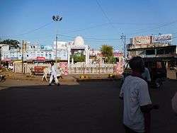 Madhav Chauk, a market in Shivpuri | |
 Shivpuri Location in Madhya Pradesh, India  Shivpuri Shivpuri (India) | |
| Coordinates: 25°26′N 77°39′E / 25.43°N 77.65°ECoordinates: 25°26′N 77°39′E / 25.43°N 77.65°E | |
| Country | India |
| State | Madhya Pradesh |
| District | Shivpuri |
| Named for | Shiva |
| Area | |
| • Total | 10,278 km2 (3,968 sq mi) |
| Elevation | 468 m (1,535 ft) |
| Languages | |
| • Official | Hindi |
| Time zone | UTC+5:30 (IST) |
| PIN | 473551 |
| ISO 3166 code | IN-MP |
| Vehicle registration | MP-33 |
Shivpuri is a city and a municipality in Shivpuri district located in the central Indian state of Madhya Pradesh. It is in the Gwalior Division of northwest Madhya Pradesh and is the administrative headquarters of Shivpuri District. It is situated at an altitude of 1,515 feet (462 m) above sea level. Shivpuri district shares a border with Jhansi in Uttar Pradesh towards the east and Rajasthan towards the west. It has nine tehsils: Badarwas, Karera, Kolaras, Narwar, Pichhore, Pohri, Bairad, Shivpuri and Khaniyadhan.
The city is a popular tourist attraction in the monsoon season as it has a number of minor waterfalls and lakes. The city is known for its lush greenery, thick dense forests and also as being formerly the summer capital of the Scindia family who at one time ruled Gwalior.
Geography
Shivpuri has an average elevation of 468 metres (1,535 ft).