Akola district
| Akola district | |
|---|---|
| District of Maharashtra | |
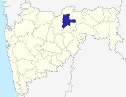 Location of Akola district in Maharashtra | |
| Country | India |
| State | Maharashtra |
| Administrative division | Amravati Division |
| Headquarters | Akola |
| Tehsils | 7 |
| Government | |
| • District collector | Shri. Astik Kumar Pandey |
| • Lok Sabha constituencies | 1 |
| • Assembly seats | 5 |
| Area | |
| • Total | 5,431 km2 (2,097 sq mi) |
| Population | |
| • Total | 1,818,617 |
| • Density | 330/km2 (870/sq mi) |
| • Urban | 44.04% |
| Demographics | |
| • Literacy | 88.5% |
| • Sex ratio | 938 |
| Major highways | AH-46, NH-6, NH-161, NH-161A, NH-161E, NH-361C, NH-548C, MSH-24, SH-197, SH-204, SH-200, SH-194, SH-195, SH-198, SH-199, SH-201, SH-212 |
| Average annual precipitation | 750 mm |
| Website | Official website |
Akola is a district in the Indian state of Maharashtra. The city of Akola is the district headquarters. Akola district forms the central part of Amravati Division, which was the former British Raj Berar Province.
Area of the district is 5,431 km². It is bounded on the north by Amravati District, to the east by Amravati District and by Washim District, to the south by Washim District, and to the west by Buldhana District. Washim was earlier a part of Akola till 1999.
History
The Battle of Argaon, (Adgaon near Akot), took place on 28 November 1803, between the British under the command of Governor Arthur Wellesley and the forces of Maratha under Bhonsle of Nagpur during Second Anglo-Maratha War.
Many old forts are located in Akola District viz.
Geography
The district boundary latitude are : 20.7000° N and longitude are : 77.0142° E
The climate is tropical and people mostly uses cotton clothes.
Rivers and lakes
The Purna River forms the part of north boundary of the district, and the top north portion of the district lies within its watershed along with Aas River and Shahnur River. The Vaan River forms the part of northwest boundary of the district after entering from the Amravati district.
The Mun River drains the southwestern portion of the district, Morna River drains the midsouth portion of the district, while the southeast is drained by the Katepurna River and Uma River.
Here are some of the rivers in Akola, with their tributaries
- Uma River
- Katepurna River
- Shahanur River
- Morna River
- Mun River
- Mas River
- Utawali River
- Vishwamitri River
- Nirguna River
- Gandhari River
- Aas River
- Vaan River
Prominent persons
- Vijay P. Bhatkar, Architect of India's First Super Computer.
Climate
Akola district shows a little variation in its climate along the North-South direction. Akola district mainly features Tropical Savannah Climate. But the Northern parts of the district consisting of hills and mountains that are raised to about 950 to 1000 meters shows a subtropical climate featuring heavily cold winters. The summers are extremely hot while the winters are dry and very cold the temperature may drop to or below 2 °C. The district has recorded a minimum temperature of 2 °C while a maximum of 47.7 °C. Akola has recorded a minimum temperature of 11.9 °C in the month of May which is considered to be the hottest month in the state of Maharashtra.
| Climate data for Akola | |||||||||||||
|---|---|---|---|---|---|---|---|---|---|---|---|---|---|
| Month | Jan | Feb | Mar | Apr | May | Jun | Jul | Aug | Sep | Oct | Nov | Dec | Year |
| Average high °C (°F) | 29.9 (85.8) |
33.2 (91.8) |
37.2 (99) |
40.7 (105.3) |
46.7 (116.1) |
37.4 (99.3) |
32.0 (89.6) |
30.5 (86.9) |
32.1 (89.8) |
38.8 (101.8) |
31.5 (88.7) |
29.4 (84.9) |
34.2 (93.6) |
| Average low °C (°F) | 13.5 (56.3) |
15.7 (60.3) |
20.0 (68) |
24.8 (76.6) |
28.0 (82.4) |
26.1 (79) |
24.1 (75.4) |
23.4 (74.1) |
23.0 (73.4) |
20.1 (68.2) |
15.9 (60.6) |
13.2 (55.8) |
20.7 (69.3) |
| Average precipitation mm (inches) | 7.8 (0.307) |
4.5 (0.177) |
11.0 (0.433) |
5.1 (0.201) |
6.6 (0.26) |
146.3 (5.76) |
210.7 (8.295) |
199.7 (7.862) |
122.0 (4.803) |
45.4 (1.787) |
19.5 (0.768) |
14.2 (0.559) |
792.8 (31.213) |
| Source: IMD | |||||||||||||
Demographics
According to the 2011 census Akola district has a population of 1,818,617,[2] roughly equal to the nation of Kosovo[3] or the US state of Nebraska.[4] This gives it a ranking of 262nd in India (out of a total of 640).[2] The district has a population density of 321 inhabitants per square kilometre (830/sq mi) .[2] Its population growth rate over the decade 2001-2011 was 11.6%.[2] Akola has a sex ratio of 942 females for every 1000 males,[2] and a literacy rate of 87.55%.[2]
Talukwise Religious Population Percentage [1]
| Taluka Name | Hindu | Muslim | Christian | Sikh | Buddhist | Jain | Other | Atheist |
|---|---|---|---|---|---|---|---|---|
| Telhara | 66.14 | 17.72 | 0.17 | 0.03 | 15.60 | 0.10 | 0.008 | 0.20 |
| Akot | 67.27 | 19.18 | 0.14 | 0.02 | 13.00 | 0.15 | 0.03 | 0.17 |
| Balapur | 50.45 | 26.46 | 0.29 | 0.04 | 21.70 | 0.31 | 0.02 | 0.69 |
| Akola | 58.51 | 21.32 | 0.31 | 0.13 | 18.50 | 1.01 | 0.02 | 0.15 |
| Murtijapur | 59.90 | 15.59 | 0.30 | 0.12 | 23.50 | 0.43 | 0.03 | 0.17 |
| Patur | 65.10 | 16.38 | 0.14 | 0.02 | 17.80 | 0.26 | 0.007 | 0.26 |
| Barshitakli | 68.34 | 14.20 | 0.11 | 0.03 | 16.80 | 0.32 | 0.01 | 0.22 |
Languages
Marathi Language is the main language spoken in the district. Varhadi, Hindi and Urdu are also spoken. [5] [6]
Subdivisions
Akola District consists of talukas namely Akot, Telhara, Akola, Balapur, Patur, Barshitakli and Murtajapur.
Transport
Important railway stations with their codes are Paras, Gaigaon, Akola Junction (AK), Murtijapur Junction (MZR) and are under Bhusawal-Badnera Section of Bhusawal Railway Division of Central Railway.
The other stations under meter gauge are Hiwarkhed, Adgaon Buzurg (ABZ), Akot (AKOT), Patsul (PTZ), Ugwe (UGWE), Akola Junction, Shivani Shivpur (SVW), Barshitakli (BSQ), Lohogad (LHD), Amna Vadi (AMW), Jaulka (JUK) are under Purna - Khandwa Section of South Central Railway.
The stations under narrow gauge are Lakhpuri, Murtajapur Junction, Karanja under two Narrow Gauge Branch lines viz Murtajapur-Achalpur and Murtajapur-Yavatmal of Bhusawal Railway Division of Central Railway.
Economy
Cotton and Jawar are the predominant crops grown in the district. Oil and Dal mills are also rampant. The economy is mostly agriculture based. Nowadays, soybean crop is an important crop as major soybean plants have come up in the area.
See also
External links
References
- 1 2 "Population by religion community - 2011". Census of India, 2011. The Registrar General & Census Commissioner, India. Archived from the original on 25 August 2015.
- 1 2 3 4 5 6 "District Census 2011". Census2011.co.in. 2011. Retrieved 2011-09-30.
- ↑ US Directorate of Intelligence. "Country Comparison:Population". Retrieved 2011-10-01.
Kosovo 1,825,632 July 2011 est. I
- ↑ "2010 Resident Population Data". U. S. Census Bureau. Archived from the original on 2010-12-25. Retrieved 2011-09-30.
Nebraska 1,826,341
- ↑ http://www.bharatonline.com/maharashtra/travel-tips/languages.html
- ↑ https://www.maharashtratourism.net/languages.html
Places adjacent to Akola district | ||||||||||
|---|---|---|---|---|---|---|---|---|---|---|
| ||||||||||
Akola district topics | ||
|---|---|---|
| Cities and towns | | |
| Monuments | ||
| Transport | ||
| Lok Sabha constituencies | ||
| Vidhan Sabha constituencies | ||
| Education |
| |
| Industry | ||
| People from Akola |
| |
| Districts of Vidarbha | |
|---|---|
| Cities with municipal corporations | |
Portal: Maharashtra | |
| Topics | |||||||||||||
|---|---|---|---|---|---|---|---|---|---|---|---|---|---|
| Regions | |||||||||||||
| Divisions and Districts |
| ||||||||||||
| Million-plus cities in Maharashtra | |||||||||||||
| Other cities with municipal corporations | |||||||||||||
Portal: Maharashtra | |||||||||||||