Kolhapur district
| Kolhapur district | |
|---|---|
| District of Maharashtra | |
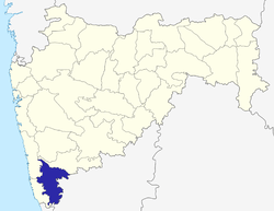 Location of Kolhapur district in Maharashtra | |
| Country | India |
| State | Maharashtra |
| Administrative division | Pune Division |
| Headquarters | Kolhapur |
| Tehsils | 1. Kagal, 2. Karveer, 3. Bhudargad, 4. Panhala, 5. Gadhinglaj, 6. Shirol, 7. Hatkanangale, 8. Ajara, 9. Chandgad, 10. Gaganbawada, 11. Radhanagari, 12. Shahuwadi |
| Government | |
| • Lok Sabha constituencies | 1. Kolhapur, 2. Hatkanangle (shared with Sangli District), based on (Election Commission website) |
| Area | |
| • Total | 7,685 km2 (2,967 sq mi) |
| Population (2011) | |
| • Total | 3,876,001 |
| • Density | 500/km2 (1,300/sq mi) |
| • Urban | 101% |
| Demographics | |
| • Literacy | 89% |
| Major highways | NH-4, NH-204 |
| Average annual precipitation | 1035 mm |
| Website | Official website |
Kolhapur district is in Maharashtra state. The city of Kolhapur is the district headquarters. As of 2011, the district had population of 3,876,001, of which 33% were urban.
Demographics
According to the 2011 census Kolhapur district has a population of 3,874,015,[1] This gives it a ranking of 65th in India (out of a total of 640).[1] The district has a population density of 504 inhabitants per square kilometre (1,310/sq mi).[1] Its population growth rate over the decade 2001-2011 was 9.96%.[1] Kolhapur has a sex ratio of 953 females for every 1000 males.
The district has three centres of tourism, the Mahalaxmi temple and karveer peeth jagadguru shankaracharya math in the city of Kolhapur and Jyotiba temple in Wadi ratnagiri.[2]
Administration and Divisions
| Name of Division (Headquarter) | Sr. No. | Districts | Administration | Sub-Division | Taluka | Source |
|---|---|---|---|---|---|---|
| Pune Division HQ=Pune Districts=5 SubDivisions=31 Talukas=64 |
1. | Kolhapur District | HQ-Kolhapur Sub-Divisions-6 Taluka-12 |
Panhala | District website | |
| Ichalkaranji | ||||||
| Karvir | ||||||
| Radhanagari | ||||||
| Bhudargad | ||||||
| Gadhinglaj | ||||||
See also
- Gandhinagar, Kolhapur
- Mhakave
- Sadoli khalasa
References
- 1 2 3 4 "District Census 2011". Census2011.co.in. 2011. Retrieved 2011-09-30.
- ↑ "AAI proposal to acquire 11ha land for airport soon: MP - Times of India". The Times of India. Retrieved 2017-09-19.
External links
Places adjacent to Kolhapur district | ||||||||||
|---|---|---|---|---|---|---|---|---|---|---|
| ||||||||||
| Topics | |||||||||||||
|---|---|---|---|---|---|---|---|---|---|---|---|---|---|
| Regions | |||||||||||||
| Divisions and Districts |
| ||||||||||||
| Million-plus cities in Maharashtra | |||||||||||||
| Other cities with municipal corporations | |||||||||||||
Portal: Maharashtra | |||||||||||||
Kolhapur district topics | |||||
|---|---|---|---|---|---|
| History | | ||||
| Geography | |||||
| Cities and towns | |||||
| Transport | |||||
| Visitor's attractions | |||||
| Culture | |||||
| Education | |||||
| Lok Sabha Constituencies | |||||
| Vidhan Sabha Constituencies |
| ||||
| Taluka/Tehsil | |||||
| Stadiums | |||||
‡ This constituency also has portions in Sangli district
| |||||
Coordinates: 16°41′52″N 74°13′31″E / 16.697904°N 74.225369°E