Nalanda district
| Nalanda district | |
|---|---|
| District of Bihar | |
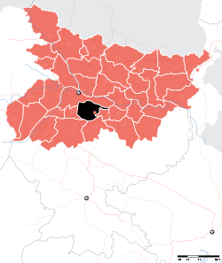 Location of Nalanda district in Bihar | |
| Country | India |
| State | Bihar |
| Administrative division | Patna |
| Headquarters | Bihar Sharif |
| Government | |
| • Lok Sabha constituencies | Nalanda |
| Area | |
| • Total | 2,367 km2 (914 sq mi) |
| Population (2011) | |
| • Total | 2,872,523 |
| • Density | 1,200/km2 (3,100/sq mi) |
| Demographics | |
| • Literacy | 66.41 (M=77.11; F=54.76) |
| • Sex ratio | 921 (2011) |
| Major highways | NH 20, NH 30A, NH 33, NH 120 |
| Website | Official website |
Nalanda district is one of the thirty-eight districts of the state of Bihar in India. Bihar Sharif is the administrative headquarters of this district.
History
Nalanda became a fully-fledged district when it was split from Patna in 1972.[1]
Geography
Nalanda district occupies an area of 2,355 square kilometres (909 sq mi),[2] comparatively equivalent to Canada's Cornwall Island.[3] The Phalgu, Mohane, Jirayan, and Kumbhari rivers flow through it. The district is a part of Patna Division.
Demographics
According to the 2011 census Nalanda district has a population of 2,872,523,[4] roughly equal to the nation of Jamaica[5] or the US state of Kansas.[6] This gives it a ranking of 98th in India (out of a total of 640).[4] The district has a population density of 1,220 inhabitants per square kilometre (3,200/sq mi) .[4] Its population growth rate over the decade 2001-2011 was 21.18%.[4] Nalanda has a sex ratio of 921 females for every 1000 males,[4] and a literacy rate of 66.41%.[4]
Economy
A newly setup Ordnance Factory, one of the 41 Indian Ordnance Factories has been set up by the Ministry of Defence, Government of India to manufacture artillery shells at Nalanda.[7][8] In 2006 the Ministry of Panchayati Raj named Nalanda one of the country's 250 most backward districts (out of a total of 640).[9] It is one of the 36 districts in Bihar currently receiving funds from the Backward Regions Grant Fund Programme (BRGF).[9]
Divisions
Sub Divisions: 3 - Modern District of Nalanda with HQ Biiharsharif was established on Nov 9, 1972. Earlier it was Biharsharif sub-division of Patna district. Bihar Sharif, Rajgir, Hilsa
Blocks: 20 - Giriyak, Rahui, Ajaypur Noorsarai, Harnaut, Chandi (Nalanda), Islampur (Nalanda), Rajgir, Asthawan, Sarmera, Hilsa, Biharsharif, Ekangarsarai, Bena, Nagarnausa, Karai Parsarai, Silao, Parwalpur, Katrisarai, Bind, Tharthari
Flora and fauna
In 1978 Nalanda district became home to the Rajgir Wildlife Sanctuary, which has an area of 35 km2 (13.5 sq mi).[10]
RWLS is also known as Pant Wildlife Sanctuary has numbers of wild animals like 34 Species of Butterflies(sharma & Kumar),Birds, Reptiles etc
Butterflies : Common Mormon,Peacock Pansy,Blue Pansy,Painted Lady,Common commander, Fourring
Herpetofauna : Indian Bullfrog,Common Asian Toad, Skittering Frog,Tree Frog, Garden Lizard,Indian Rock Python ,Common Karait etc.
Birds : Painted Special, Flycatchers,Gray Hornbill,Great Egret,Lesser Whistling Duck,Common Coot,Rose Ringed Parakeet,Bulbul,Munia etc.
Mammals : Golden Jackal,Black Naped Hare,Spotted Deer,Indian Crested Porcupine,Blue Bull etc.
Status
Nalanda district is fast developing and the ruins of the ancient Nalanda University or UNESCO Nalanda Archaeological Site attracts tourists from all over world driving the local economy.
References
- ↑ "Districts of India".
- ↑ Srivastava, Dayawanti et al. (ed.) (2010). "States and Union Territories: Bihar: Government". India 2010: A Reference Annual (54th ed.). New Delhi, India: Additional Director General, Publications Division, Ministry of Information and Broadcasting (India), Government of India. pp. 1118–1119. ISBN 978-81-230-1617-7.
- ↑ "Island Directory Tables: Islands by Land Area". United Nations Environment Program. 1998-02-18. Retrieved 2011-10-11.
Cornwall Island 2,358km2
- 1 2 3 4 5 6 "District Census 2011". Census2011.co.in. 2011. Retrieved 2011-09-30.
- ↑ US Directorate of Intelligence. "Country Comparison:Population". Retrieved 2011-10-01.
Jamaica 2,868,380 July 2011 est
- ↑ "2010 Resident Population Data". U. S. Census Bureau. Retrieved 2011-09-30.
Kansas 2,853,118
- ↑ http://articles.timesofindia.indiatimes.com/2006-01-16/india/27829660_1_ordnance-factory-denel-nitish-kumar
- ↑ http://www.thehindubusinessline.com/government-and-policy/ofb-nalanda-to-develop-indigenous-artillery-shells/article3342557.ece
- 1 2 Ministry of Panchayati Raj (September 8, 2009). "A Note on the Backward Regions Grant Fund Programme" (PDF). National Institute of Rural Development. Archived from the original (PDF) on April 5, 2012. Retrieved September 27, 2011.
- ↑ Indian Ministry of Forests and Environment. "Protected areas: Bihar". Archived from the original on August 23, 2011. Retrieved September 25, 2011.
External links
Places adjacent to Nalanda district | |
|---|---|
| State symbols | |
|---|---|
| History |
|
| Administration | |
| Overviews | |
| Divisions and districts | |
| Cities | |
| Municipal Corporation |
|
| Poltics | |
| Culture | |
Coordinates: 25°12′00″N 85°31′12″E / 25.20000°N 85.52000°E