Nandurbar district
| Nandurbar district | |
|---|---|
| district | |
 Yeshwant | |
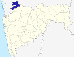 Map of Maharashtra with Nandurbar highlighted in blue | |
| Coordinates: 21°23′N 74°22′E / 21.383°N 74.367°ECoordinates: 21°23′N 74°22′E / 21.383°N 74.367°E | |
| Country |
|
| State | Maharashtra |
| Founded by | Anna saheb pk patil |
| Named for | gujrana |
| Headquarters | Nandurbar |
| Talukas |
1.Shahada |
| Area | |
| • Total | 5,035 km2 (1,944 sq mi) |
| Population (2011) | |
| • Total | 16,46,177 |
| • Density | 260/km2 (700/sq mi) |
| Languages | |
| • Official | Marathi |
| Time zone | UTC+5:30 (IST) |
| Telephone code | 91-2564 |
| ISO 3166 code | IN-MH-NB |
| Vehicle registration | MH-39[1] |
| Sex ratio | 975 ♂/♀ |
| Literacy | 64.38%% |
| Website |
nandurbar |
Nandurbar is an administrative district in the northwest corner (Khandesh Region) of Maharashtra state in India . On 1 July 1998 Dhule was bifurcated as two separate districts now known as Dhule and Nandurbar. The district headquarters are located at Nandurbar city. The district occupies an area of 5035 km² and has a population of 1,311,709 of which 15.45% were urban (as of 2001).[2]
Nandurbar district is bounded to the south and south-east by Dhule district, to the west and north is the state of Gujarat, to the north and north-east is the state of Madhya Pradesh. The northern boundary of the district is defined by the great Narmada river.
Ranjana Sonawane of Tembhli village and rushil in Nandurbar district became first citizen of India to get twelve (12) digit Unique Identification on 29 September 2010. The unique identification or Aadhaar is ambitious project of the central government of India to provide unique identification to its billion plus citizens.[3]
Divisions
The district comprises 6 talukas. These talukas are Akkalkuwa, Akrani Mahal (also called Dhadgaon), Taloda, Shahada, Nandurbar and Navapur.
There is one Lok Sabha constituency in the district which is Nandurbar (ST) reserved for ST. There are four Maharashtra Assembly seats namely Akkalkuwa (ST), Shahada (ST), Nandurbar (ST), Nawapur (ST).
Sakri (ST) and Shirpur (ST) assembly seats from Dhule district are also part of Nandurbar Lok Sabha seat. Nandurbar is primarily a tribal (Adiwasi) district.
Demographics
As of 2001 India census,[4] Nandurbar District had a population of 1,309,135, being 50.62% male and 49.38% female. Nandurbar District has an average literacy rate of 46.63%: male literacy is 55.11%, and female literacy is 37.93%.
Languages
Languages spoken include Ahirani, a Kandeshi tongue with approximately 780,000 speakers, similar to Marathi and Bhili.[5] and Pauri Bareli, a Bhil language with approximately 175 000 speakers, written in the Devanagari script.[6]
Others are: Marathi, Various Bhili languages, Gujarati and Hindi. Ahirani is a sub language of Marathi.
Transport and Communication
- Total railway Lines length :90 km
- No of villages connected by road
- 12 Months :671
- Temporary :262
- Total length of the roads :4338 km
- Total length of National Highway :44 km
- Total length of State
Education
- Nandurbar District has 1354 primary schools with 4497 teachers teaching 1,59,502 students; that comes to 36 students per teacher.
- Around 257 secondary schools with 2765 teachers teaching 1,31,554 students, and no of students per teacher comes to 48.
- Government Polytecnic Nandurbar with four branches Electronics and Telecommunication Engineering, Electrical Engineering, Computer Engineering, & Mechanical Engineering with intake capacity of 60 seats each.Having highly qualified and experienced staff.[7]
- Total colleges for higher studies, including medical and engineering, is 30, and more than 8580 students enroll each year.
- Nandurbar District also has 6 Government ITI (Industrial Training Institutes) and 2 private ITI having 1444 students in total.
- 3 VJNT Pri. School [Mhasawad, Akrale & Nandrakhe] 2 high schools, 1 junior college
- 1 SC Residential School Shahada
Economy
In 2006 the Ministry of Panchayati Raj named Nandurbar one of the country's 250 most backward districts (out of a total of 640).[8] It is one of the twelve districts in Maharashtra currently receiving funds from the Backward Regions Grant Fund Programme (BRGF).[8]
Industries

- Total Registered Factories: 346
- Total Registered & running Factories: 346
- Cooperative Sugar Factories: 3
- Total Spinning Mills: 2
- Total Cooperative Societies 1400
- Primary Agricultural Credit Societies Total: 159
- Members: 47448
- Cooperative Milk Societies: 392
Agriculture
Climate
| Nandurbar | ||||||||||||||||||||||||||||||||||||||||||||||||||||||||||||
|---|---|---|---|---|---|---|---|---|---|---|---|---|---|---|---|---|---|---|---|---|---|---|---|---|---|---|---|---|---|---|---|---|---|---|---|---|---|---|---|---|---|---|---|---|---|---|---|---|---|---|---|---|---|---|---|---|---|---|---|---|
| Climate chart (explanation) | ||||||||||||||||||||||||||||||||||||||||||||||||||||||||||||
| ||||||||||||||||||||||||||||||||||||||||||||||||||||||||||||
| ||||||||||||||||||||||||||||||||||||||||||||||||||||||||||||
The Climate of Nandurbar District is generally Hot and Dry. As the rest of India Nandurbar District has three distinct seasons; Summer, Monsoon/Rainy and the Winter season.
Summer is from March to mid of June. Summers are usually hot and dry. During the month of May the summer is at its peak. Temperatures can be as high as 45° Celsius during the peak of Summer. The Monsoon sets in during the mid or end of June. During this season the weather is usually humid and hot. The northern and western regions receive more rainfall than the rest of the region. The average rainfall is 767 mm through the district.[10] Winter is from the month of November to February. Winters are mildly cold but dry.
| Seasons | Start | End |
|---|---|---|
| Summer | March | Mid June |
| Monsoon | mid June | October |
| Winter | November | February |
| Climate data for Nandurbar | |||||||||||||
|---|---|---|---|---|---|---|---|---|---|---|---|---|---|
| Month | Jan | Feb | Mar | Apr | May | Jun | Jul | Aug | Sep | Oct | Nov | Dec | Year |
| Average high °C (°F) | 25 (77) |
27 (81) |
36 (97) |
42 (108) |
43 (109) |
35 (95) |
28 (82) |
27 (81) |
30 (86) |
31 (88) |
28 (82) |
25 (77) |
31 (89) |
| Average low °C (°F) | 11 (52) |
13 (55) |
18 (64) |
22 (72) |
25 (77) |
25 (77) |
23 (73) |
22 (72) |
21 (70) |
19 (66) |
15 (59) |
12 (54) |
19 (66) |
| Average precipitation mm (inches) | 7.00 (0.2756) |
1.18 (0.0465) |
1.42 (0.0559) |
1.79 (0.0705) |
9.15 (0.3602) |
108.62 (4.2764) |
373.63 (14.7098) |
134.91 (5.3114) |
122.75 (4.8327) |
40.40 (1.5906) |
16.39 (0.6453) |
3.49 (0.1374) |
820.73 (32.3123) |
| Source: [9] | |||||||||||||
Religion
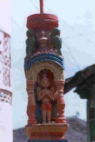
- Prakasha, one of the famous religious places, also known as Dakshin Kashi, is in Shahada Tehsil. The temple of Prakasha is very old.
- One of the famous temples of God Shree Ganesha (Heramb) is at Jainagar, 24 km away from Shahada. Hundreds of thousands of people visit this temple on the occasion of Mangli Chathurthi.
- Shri Datta temple is at Sarangkheda. Every year a big fair is organised on the eve of Datta Jayanti which has main attraction of sale of horses.
- Umaj Mata temple is at Shinda. Every year a big fair is organised on the eve of Ashatami (December).
- Hingani is a small village between Shahada and Shirpur. People there conduct the "Mahavakya" & "Mahakavya" of the Mahanubhav panth.[11]
- Ashwashthama and Shanimandal religious places are also in this district.
- Dandapaneshwar Ganesh Mandir
- Devi Mogra Mata is mother goddess of Adivasis. Malda-Mogra Tal Taloda is famous village related to Devi Mogra mata.
- Saint Gulam Maharaj Ranjanpur Tal Taloda is Saint of adivasi, who took away them from addiction of alcohol.
- Toranmal 1076 m high pick is famous place for Navnath.
Dandapaneshwar tempal is one of the best place in Nandurbar¿
Demographics
According to the 2011 census Nandurbar district has a population of 1,646,177,[12] roughly equal to the nation of Guinea-Bissau[13] or the US state of Idaho.[14] This gives it a ranking of 304th in India (out of a total of 640).[12] The district has a population density of 276 inhabitants per square kilometre (710/sq mi) .[12] Its population growth rate over the decade 2001–2011 was 25.5%.[12] Nandurbar has a sex ratio of 972 females for every 1000 males,[12] and a literacy rate of 64.38%.[12]
References
- ↑ "Vehicle Registration Number – Useful info for car lover". Team-BHP. Retrieved 20 November 2010.
- ↑ "Census GIS India". Censusindiamaps.net. Archived from the original on 11 January 2010. Retrieved 20 November 2010.
- ↑ "Aadhar – How to get your unique ID from the govt of India". The Times of India. 29 September 2010. Retrieved 3 October 2010.
- ↑ "Census of India 2001: Data from the 2001 Census, including cities, villages and towns (Provisional)". Census Commission of India. Archived from the original on 2004-06-16. Retrieved 2008-11-01.
- ↑ M. Paul Lewis, ed. (2009). "Ahirani: A language of India". Ethnologue: Languages of the World (16th ed.). Dallas, Texas: SIL International. Retrieved 28 September 2011.
- ↑ M. Paul Lewis, ed. (2009). "gujar is also indian language Bareli, Pauri: A language of India". Ethnologue: Languages of the World (16th ed.). Dallas, Texas: SIL International. Retrieved 28 September 2011.
- ↑ "G P Nandurbar". Archived from the original on 17 December 2012.
- 1 2 Ministry of Panchayati Raj (8 September 2009). "A Note on the Backward Regions Grant Fund Programme" (PDF). National Institute of Rural Development. Archived from the original (PDF) on 5 April 2012. Retrieved 27 September 2011.
- 1 2 "The Gazetteers Department – DHULIA". Maharashtra.gov.in. Retrieved 20 November 2010.
- ↑ "Special Articles – Government of Maharashtra". Maharashtra.gov.in. Retrieved 20 November 2010.
- ↑ "Hinagani". Hingani.tripod.com. Retrieved 20 November 2010.
- 1 2 3 4 5 6 "District Census 2011". Census2011.co.in. 2011. Retrieved 30 September 2011.
- ↑ US Directorate of Intelligence. "Country Comparison:Population". Retrieved 1 October 2011.
Guinea-Bissau 1,596,677 July 2011 est.
- ↑ "2010 Resident Population Data". U.S. Census Bureau. Retrieved 30 September 2011.
Idaho 1,567,582
- "Nandurbar District". Government of Maharashtra.
- "History of Khandesh". Government of Maharashtra.
External links
| Wikimedia Commons has media related to Nandurbar district. |
Places adjacent to Nandurbar district | ||||||||||
|---|---|---|---|---|---|---|---|---|---|---|
| ||||||||||
| Topics | |||||||||||||
|---|---|---|---|---|---|---|---|---|---|---|---|---|---|
| Regions | |||||||||||||
| Divisions and Districts |
| ||||||||||||
| Million-plus cities in Maharashtra | |||||||||||||
| Other cities with municipal corporations | |||||||||||||
Portal: Maharashtra | |||||||||||||