Dehradun
| Dehradun | |
|---|---|
| Metropolis | |
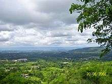
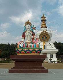
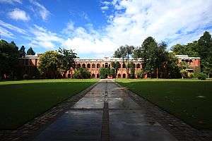  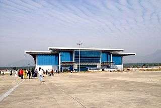    Clockwise from top: The Doon School, Dehradun Airport, Songtsen Library, view of Doon Valley from Landour, Indian Military Academy, Forest Research Institute | |
| Nickname(s): Doon | |
 Dehradun Location in Uttarakhand  Dehradun Dehradun (India) | |
| Coordinates: 30°19′05″N 78°01′44″E / 30.318°N 78.029°ECoordinates: 30°19′05″N 78°01′44″E / 30.318°N 78.029°E | |
| Country |
|
| State | Uttarakhand |
| District | Dehradun |
| Founded | 1676 |
| Founded by | Guru Ram Rai |
| Government | |
| • Type | Municipal Corporation |
| • Body | Dehradun Municipal Corporation |
| • Mayor | Government of Uttarakhand |
| • District Magistrate | S. A. Murugeshan, IAS |
| • Senior Superintendent of Police | Nivedita Kukreti, IPS |
| Area | |
| • Metropolis | 300 km2 (100 sq mi) |
| Elevation | 437 m (1,434 ft) |
| Population (2011)[1] | |
| • Metropolis | 578,420 |
| • Density | 1,900/km2 (5,000/sq mi) |
| • Metro[2] | 714,223 |
| Languages | |
| • Official | Hindi |
| • Other | Garhwali, Hindi,Kumaoni,English |
| Time zone | UTC+5:30 (IST) |
| PIN | 248001 |
| Telephone code | +91–135 |
| Vehicle registration | UK-07 |
| Website |
dehradun |
Dehradun (/ˌdɛərəˈduːn/) or Dehra Dun is the provisional or temporary capital of Uttarakhand, a state in the northern part of India. Located in the Garhwal region, it lies 236 kilometres (147 mi) north of India's capital New Delhi and 168 kilometres (104 mi) from Chandigarh. It is one of the "Counter Magnets" of the National Capital Region (NCR) being developed as an alternative centre of growth to help ease the migration and population explosion in the Delhi metropolitan area and to establish a smart city at Dehradun.[3] During the days of British Raj, the official name of the town was Dehra. [4] At present, Gairsain, a hill-town between Garhwal and Kumaon regions and centrally located in Uttarakhand, is being developed as permanent capital of the state.
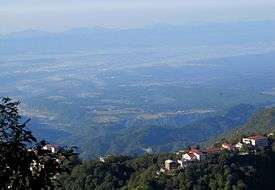
Dehradun is in the Doon Valley on the foothills of the Himalayas nestled between the river Ganges on the east and the river Yamuna on the west.The city is famous for its picturesque landscape and slightly milder climate and provides a gateway to the surrounding region. It is well connected and in proximity to Himalayan tourist destinations such as Mussoorie, and Auli and the Hindu holy cities of Haridwar and Rishikesh along with the Himalayan pilgrimage circuit of Chota Char Dham.
Dehradun Municipal Corporation is locally known as Nagar Nigam Dehradun. Other urban entities involved in civic services and city governance and management include Mussoorie Dehradun Development Authority (MDDA), Special Area Development Authority (SADA), Jal Sansthan, and Jal Nigam among others. Dehradun is also known for its Basmati rice and bakery products.
Etymology
Dehradun is made up of two words: 'Dehra' is derived from the word "dera", meaning camp or temporary settlement. "Dun" or "Doon" in Garhwali language refers to a valley that lies between the middle Himalayas and the "Shivaliks". Other prominent Doon valleys are Kotli Doon, Patli Doon and Pinjore Doon. When Guru Ram Rai, son of Guru Har Rai, came to this region with his followers, he established a camp here for them. Around this time, the modern city of Dehradun started to develop. This is when the word Dehra was linked to Dun, and thus the city was named Dehradun. In Skanda Purana, Dun is mentioned as a part of the region called Kedarkhand, the abode of Shiva. In ancient India during the Mahabharata epic era, Dronacharya the great teacher of Kauravas and Pandavas, lived here hence the name, "Dronanagari" (lit. city of Drona).[5][6] Some historians believe that the word Dehra can be regarded as a term for camping.[7]
History
The history of the city of Uttarakhand, Dehradun (nicknamed "Doon Valley") is linked to the story of Ramayana and Mahabharata. It is believed that after the battle between Ravana and Lord Rama, Lord Rama and his brother Lakshmana visited this site. Dronacharya, the legendary Royal guru to the Kauravas and Pandavas in the epic Mahabharata, is believed to have been born and resided in Dehradun.[8] Evidences such as ancient temples and idols have been found in the areas surrounding Dehradun which have been linked to the mythology of Ramayana and Mahabharata. These relics and ruins are believed to be around 2000 years old. Furthermore, the location, the local traditions and the literature reflect this region's links with the events of Mahabharata and Ramayana. Even after the battle of Mahabharata, the Pandavas had influence on this region as the rulers of Hastinapura with the descendants of Subahu ruled the region as subsidiaries. Likewise, Rishikesh is mentioned in the pages of history when Lord Vishnu answered the prayers of the saints, slaughtered the demons and handed the land to the saints. The adjoining place called Chakrata has its historical impression during the time of Mahabharata.In the seventh century this area was known as Sudhanagara and was described by the Chinese traveller Huen Tsang. Sudhanagara later came to be recognised as the name of Kalsi. Edicts of Ashoka have been found in the region along the banks of river Yamuna in Kalsi indicating the wealth and importance of the region in ancient India. In the neighbouring region of Haripur, ruins were discovered from the time of King Rasala which also reflect the region's prosperity. Before the name of Dehradun was used, the place is shown on old maps as Gurudwara (a map by Webb, 1808) or Gooroodwara (a map by Gerard, 1818). Gerard's map names the place as "Dehra or Gooroodwara". Surrounding this original Sikh temple were many small villages that are now the names of parts of the modern city.
Dehradun itself derives its name from the historical fact that Ram Rai, the eldest son of the Seventh Sikh Guru Har Rai, set up his "dera" (camp) in "dun" (valley) in 1676. This 'Dera Dun' later on became Dehradun.
The Mughal Emperor Aurangzeb was highly impressed by the miraculous powers of charismatic Ram Rai. He asked the contemporary Maharaja of Garhwal, Fateh Shah to extend all possible help to Ram Rai. Initially a Gurudwara (temple) was built in Dhamawala. The construction of the present building of Darbar Shri Guru Ram Rai Ji Maharaj was completed in 1707. There are portraits of gods, goddesses, saints, sages and religious stories on the walls. There are pictures of flowers and leaves, animals and birds, trees, similar faces with pointed noses and big eyes on the arches which are the symbol of the colour scheme of Kangra-Guler art and Mughal art. High minarets and round pinnacles are the models of the Muslim architecture. The huge pond in the front measuring 230 x 80 feet had dried up for want of water over the years. People had been dumping rubbish; it has been renovated and revived.
Dehradun was invaded by Mahmud of Ghazni during his campaigns into India followed by Timur in 1368, Rohilla chief Najib ad-Dawlah in 1757 and Ghulam Qadir in 1785. In 1806 Nepalese King Prithvi Narayan Shah united many of the Indian territories that now fell under places such as Almora, Pathankot, Kumaon, Garhwal, Sirmur, Shimla, Kangra and Dehradun.
On the western front Garhwal and parts of Himachal Pradesh up to Punjab and on the eastern front the state of Sikkim up to Darjeeling became parts of Nepal for a brief period until the British East India Company went on war from 1814 to 1816. The war ended with signing of the Treaty of Sugowli where almost a third was ceded to British East India company. The British got Dehradun in 1816 and colonised Landour and Mussoorie in 1827–1828.
Jawaharlal Nehru, India's first prime minister, was quite fond of the city and often visited. He spent his last few days here before passing away in Delhi in 1964.[9] Another leader from the independence movement, Rash Behari Bose, who was one of the key organisers of the Ghadar conspiracy and, later, the Indian National Army was based in Dehradun in his early days before he was forced to move to Japan in 1915 to continue the freedom struggle.
Post independence Dehradun and other parts of Garhwal and Kumaon were merged with United Provinces which was later renamed the state of Uttar Pradesh. In 2000, Uttarakhand state (earlier called Uttaranchal) was created from the northwestern districts of Uttar Pradesh under the Uttar Pradesh Reorganisation Act 2000. Dehradun was made its interim capital. The city has seen continuous development since the creation of Uttarakhand.[10]
Afghan Connection
Dehradun's Afghan connection dated back to the First Anglo-Afghan War, after which the Afghan Emir Dost Mohammad Khan (Emir of Afghanistan) was exiled by the British to Dehra Dun.[11] He stayed in Mussoorie for over 6 years. The Balahissar ward under the Mussoorie municipality has been named after the palace of Dost Mohammad. The famous Dehradooni Basmati was brought along by him from Kunar Province in Afghanistan and it continues to be counted as a delicacy of the valley.[12] [13] Forty years later, after the Second Anglo-Afghan War, his grandson, Mohammad Yaqub Khan, was sent to exile to India in 1879. Just like his grandfather, he choose Doon valley as his abode. Yakoob became the first Afghan to formally settle in Dehradun. The present Mangla Devi Inter College, was once the Kabul Palace where Yakoob spent a few years of his life. The extended family and servants of the King were also relocated to Dehradun[14]
The Afghan royal family maintained a presence in Dehra Dun. It was the birthplace of the second to last King of Afghanistan, Mohammed Nadir Shah.Two quaint palaces — the Kabul Place in Dehradun and Balahissar Palace in Mussoorie — stand testimony to this connection with Afghanistan. They were built by these Afghan rulers in exile in India in the early part of the 20th Century and are palaces are a miniature replica of the palatial structures owned by the kings in Afghanistan. The Balahissar Palace has now been turned into Mussoorie's Wynberg Allen School. Doon-based heritage enthusiast Ghanshyam told the Times of India, "The police station at Karanpur used to be the royal guard room of Yakoob way back in 1879. The electrical office located at the Survey Chowk was the royal servant quarters."[15]
Today the descendents of the former royalty, Yakub Khan and his grandson Sardar Azim Khan’s family have integrated with the mainstream of Dehra Dun life.[16] The Doon connection was revived when Zahir Shah, the last king of Afghanistan, while undergoing treatment in New Delhi during the last years of his life expressed a desire to meet his Doon cousins but the meeting could not take place as the family members were away.[17]Ashraf Ghani, the current President of Afghanistan has mentioned that his grandmother grew up in Dehra Dun. "I speak of Tagore because I was raised on Tagore by my grandmother who lived in Dehradun...," Dr Ghani said while talking about India's vision and the remarkable transformation.[18] Dehra Dun is also being selected to be the second "home" ground of the Afghan cricket team.[19]
Geography
The city of Dehradun mainly lies in Doon Valley and is at a varying height from 410 m in Clement Town to above 700 m at Malsi which is 15 km from the city. However, the average elevation is 450 m above sea level. Malsi is the starting point of Lesser Himalayan Range that extends to Mussoorie and beyond. Jaunsar-Bawar hills in Dehradun district rises to 3700m above sea level. The hilly region of Mussoorie goes up to a height of 1870–2017 metres above sea level.
The Doon valley contains the settlements including Raiwala, Rishikesh, Doiwala, Harrawala, Dehradun, Herbertpur, Vikasnagar, Sahaspur, Selaqui, Subhash Nagar and Clement Town. The district contains Rajaji National Park which is home to several elephants, Benog Wildlife Sanctuary at Mussoorie & Asan Conservation Reserve (Asan Barrage). The Doon Valley has the Terai and Bhabar forests within it as well as the Shivalik hills and Lesser Himalayan Range containing hill stations such as Mussoorie and Chakrata. The district is bordered by the Himalayas in the north, Rajaji Range of the Sivalik Hills to the south, the river Ganges to the east, and the Yamuna river to the west. Towns in the foothills of the mountain ranges include Sahastradhara, Lakhamandal, Gautam Kund, Chandrabani, Kalsi and Dakpathar.
This district is divided into two major parts: the main city Dehradun surrounded by Shivalik and the Jaunsar-Bawar, which is in the foothills of Himalayas. In the north and northwest it borders on the district of Uttarkashi and Tehri Garhwal, in the east and southeast by Pauri Garhwal and Ganges river, in the west, it is bordered by Shimla and Sirmaur districts of Himachal Pradesh, Yamunanagar district of Haryana and the Tons and Yamuna rivers. To the south are Haridwar and Uttar Pradesh's Saharanpur district.
It is between latitudes 29 °58' N and 31°2'N and longitudes 77° 34' E and 78° 18'E.[20] This district consists of six tehsils — Dehradun, Chakrata, Vikasnagar, Kalsi, Tiuni and Rishikesh — six community development blocks — Vis, Chakrata, Kalsi, Vikasnagar, Sahaspur, Rajpur and Doiwala — 17 towns and 764 villages. Out of these 746 villages are inhabited; 18 are uninhabited.[21]
Climate
The climate of Dehradun is humid subtropical.
Summer temperatures can reach up to 44 °C for a few days and a hot wind called Loo blows over North India. Winter temperatures are usually between 1 and 20 °C and fog is quite common in winters like plains. Although the temperature in Dehradun can reach below freezing during severe cold snaps,[22] this is not common. During the monsoon season, there is often heavy and protracted rainfall. Dehradun and other plains areas of Uttarakhand see almost as much rainfall as coastal Maharashtra and more than Assam. Agriculture benefits from fertile alluvial soil, adequate drainage and plentiful rain.[23]
| Climate data for Dehradun | |||||||||||||
|---|---|---|---|---|---|---|---|---|---|---|---|---|---|
| Month | Jan | Feb | Mar | Apr | May | Jun | Jul | Aug | Sep | Oct | Nov | Dec | Year |
| Record high °C (°F) | 24.6 (76.3) |
31.2 (88.2) |
37.2 (99) |
40.8 (105.4) |
42.8 (109) |
44.6 (112.3) |
40.6 (105.1) |
37.2 (99) |
36.6 (97.9) |
36.1 (97) |
30.6 (87.1) |
27.4 (81.3) |
44.6 (112.3) |
| Average high °C (°F) | 19.3 (66.7) |
21.5 (70.7) |
26.4 (79.5) |
32.1 (89.8) |
35.6 (96.1) |
34.8 (94.6) |
30.5 (86.9) |
29.4 (84.9) |
29.7 (85.5) |
28.5 (83.3) |
25.0 (77) |
21.1 (70) |
27.8 (82) |
| Average low °C (°F) | 6.0 (42.8) |
7.8 (46) |
12.0 (53.6) |
16.7 (62.1) |
20.7 (69.3) |
23.0 (73.4) |
22.8 (73) |
22.4 (72.3) |
20.8 (69.4) |
15.7 (60.3) |
10.4 (50.7) |
6.8 (44.2) |
15.4 (59.7) |
| Record low °C (°F) | −1.1 (30) |
−1.1 (30) |
2.2 (36) |
7.2 (45) |
11.3 (52.3) |
13.1 (55.6) |
13.2 (55.8) |
18.0 (64.4) |
14.3 (57.7) |
8.4 (47.1) |
2.8 (37) |
0.0 (32) |
−1.1 (30) |
| Average precipitation mm (inches) | 55.0 (2.165) |
58.8 (2.315) |
49.0 (1.929) |
22.5 (0.886) |
41.7 (1.642) |
201.8 (7.945) |
672.6 (26.48) |
728.2 (28.669) |
296.5 (11.673) |
49.8 (1.961) |
8.6 (0.339) |
24.4 (0.961) |
2,208.9 (86.965) |
| Average relative humidity (%) | 72 | 66 | 57 | 46 | 48 | 66 | 85 | 86 | 81 | 69 | 68 | 71 | 68 |
| Source #1: IMD[24][25] | |||||||||||||
| Source #2: MyWeather.com[26] | |||||||||||||
Demographics
As per provisional reports of Census India, population of Dehradun in 2011 was 578,420;[1] male and female are 303,411 and 275,009 respectively. The sex ratio of the city is 906 per 1000 males.[1] The number of literates in Dehradun city is 463,791, of which 251,832 are males and 211,959 are females.[1] Average literacy rate of Dehradun city is 89.32 percent, whereas male literacy and female literacy rates are 92.65 and 85.66 percent, respectively.[1] The number of children of age under six in Dehradun city is 59,180 as per figure from Census India report on 2011. There are 31,600 boys and 27,580 are girls.[1] Child sex ratio of girls is 873 per 1000 boys.[1]
Languages
Major languages spoken in Dehradun district according to census 2011 are following => Hindi 87.05 (including Garhwali 16.83%, Jaunsari 7.43%, Kumaoni 1.09%), Punjabi 3.35%, Nepali 3.31%, Urdu 3.82%.[29]
Places of interest
There are a number of small towns and tourist sites in Dehradun District.
Khalanga Memorial
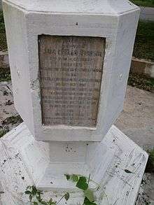
The Battle of Nalapani was the first battle of the Anglo-Nepalese War of 1814–1816, fought between the forces of the British East India Company and Nepal, then ruled by the House of Gorkha. The battle took place around the Nalapani fort, near Dehradun, which was placed under siege by the British between 31 October.
Maa Bala Sundari Mandir
There are various temples of Maa Bala Sundari Devi situated in India and this is one such temple. The main temple is in Trilokpur, Himachal Pradesh. This Mata Temple is situated approximately 3 km South-West Direction of Sudhowala. This great temple is situated inside a forest. Gaur Brahmin of sudhowala are Pandits (Brahman) of this temple.
Dehradun International Cricket Stadium
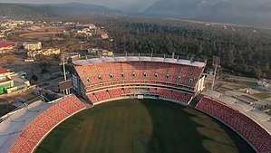
Rajiv Gandhi International Cricket Stadium, Dehradun is a multi-purpose stadium in the Raipur area of Dehradun, Uttarakhand.[30] It is the first international level stadium in the state.
Robbers Cave
Robber's Cave (locally known as Guchhupani), is a river cave formation in Himalaya, located approximately 8 km from the centre of Dehradun City in Uttarakhand state of India. Believed to be the hideout of the famous Sultana Daku and his band of dacoits. The cave formation has thus been named Robber's Cave.
The cave is about 600 metres long, divided into two main parts. The cave has a highest fall of about 10 metres. In the central part there is a fort wall structure which is now broken.[31] It consists of an extremely narrow gorge formed in a conglomerate limestone area on Doon Valley's Dehra plateau.[32]
It is a natural cave formation where rivers flows inside the cave. The place is a tourist site and is maintained by Uttarakhand State. Local bus services are available up to Anarwala village, from where it is a kilometre's trek away.[31][33]
Lacchiwala Picnic Spot
It is a popular tourist destination specially during summers. It is well known for its forest scenic beauty, man-made water pools and bird watching. It is now known as Nature Park.
Tapkeshwar Temple
It is a temple of Lord Shiva. It is situated beside a forest on the bank of the Asan river and the main deity (Shivalinga) is housed in a natural cave. According to the holy epic Mahabharata, Guru Drona is said to have resided in this cave for a period of time. The temple's natural cave is named Drona cave after him.[34] Water trickles down the ceiling of the cave and drops on the Shivalinga creating a magnificent image.
Dehradun Zoo
Formerly known as Malsi Deer Park but now it is known as Dehradun Zoo. Its main objective is conservation of wild animals, to develop an education centre and a rescue centre for wild animals.It is located on the foothills of Shivalik Range(Mussoorie) on the Mussoorie Road.It is about 10km away from Dehradun and 23km from Mussoorie.
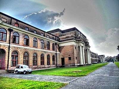
Forest Research Institute
Forest Research Institute or ‘FRI’ is an institution in the field of forest research in India. The institute is one of the oldest and biggest forest-based training institutes in India. The institute is known for its research work and wonderful architecture that dates to British Raj. FRI is affiliated to the Forest Research Institute University and is approved by the University Grants Commission (UGC). The aim of the institution is to accomplish the needs of the Indo-Gangetic plains of Punjab, Haryana, Chandigarh, Delhi and Western Uttar Pradesh, as Well as the U.P. Himalayas.[35]
Education
Schools
Educational institutions include St. Joseph's Academy, Convent of Jesus and Mary, Colonel Brown Cambridge School, Summer Valley School, Scholars Home, Ann Mary School, The Heritage School, Rashtriya Indian Military College, Doon International School, Welham Girls School Welham Boys School, The Doon School, Ecole globale, SelaQui International School, Army Public School, Cambrian Hall, St. Thomas' College, Brightlands School, Marshall School, Hilton's School and kendriya vidhyala IIP Several Indian and international luminaries have attended these schools. In addition to these schools there are many other state board schools located in the city.[36]
Since Dehradun has many central Government offices, there are as many as 12 Kendriya Vidyalayas also in the city.[37]
Higher Education
Premier research institute based in Dehradun are the Forest Research Institute, Indian Institute of Remote Sensing, Indian Institute of Petroleum, Wildlife Institute of India, Instruments Research and Development Establishment and Wadia Institute of Himalayan Geology. Universities located in Dehradun are Doon University, ICFAI University, Dehradun, University of Petroleum and Energy Studies, Graphic Era University, Uttarakhand Technical University Uttaranchal University.
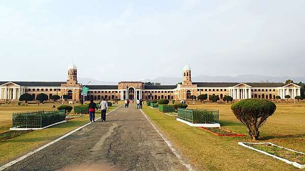
The Forest Research Institute campus hosts the Indira Gandhi National Forest Academy(IGNFA), the staff college that trains officers selected for the Indian Forest Service (IFS). Wildlife Institute of India (WII) is an autonomous institution under the Ministry of Environment Forest and Climate change, Government of India which carries out wildlife research.
National Institute for Visually Handicapped[38] (NIVH) plays a key role in helping the blind people. It is the first such institute in India and the first press for Braille script in the country[39] which provides education and service to the blind children.
Dehradun houses organisations like the Latika Roy Foundation[40] for people with disabilities to access education, employment, and full inclusion in the community. The ASK Foundation, an educational charity, is also located in Dehradun.[41]
Economy
.jpg)
Because of the low population and, on the whole, competent education institutes, Dehradun garners a good per capita income close to $2400 (per 2012 figures: national average $800). It has enjoyed strong economic growth in the last 20 years. Dehradun has experienced a commercial and information technology upswing, amplified by the establishment of software technology parks of India (STPI).[42] and SEZs (Special economic zones) throughout. Regional offices of Genpact, Spice Digital, Serco, Aptara and IndiaMART are present in Dehradun. A number of manufacturing units are present in the Selaqui area.
The largest profession in Dehradun is agriculture. Staple foods are rice and dal with raita, curd and salad. Dehradun is known for its lychees and for growing the world's finest basmati rice.
It hosts training institutions of national importance such as the Indian Military Academy, Indira Gandhi National Forest Academy (IGNFA), Zoological Survey of India (ZSI). It is home to national foundations such as the Ordnance Factory Dehradun, Instruments Research and Development Establishment (IRDE), Defence Electronics Application Laboratory (DEAL) and other defence establishments. Other institutions include the Indian Institute of Petroleum, National Institute for Visually Handicapped, Central Soil and Water Conservation Research & Training Institute, Oil and Natural Gas Corporation (Keshav Dev Malviya Institute of Petroleum Exploration, Institute of Drilling Technology), Uttarakhand Space Applications Centre, Survey of India, Wadia Institute Of Himalayan Geology, Forest Survey of India (FSI), Indian Council of Forestry Research and Education (ICFRE), Indian Institute of Remote Sensing, Wildlife Institute of India, Forest Research Institute (FRI), Army Cadet College and the Rashtriya Indian Military College (RIMC).[43]
Major defence production establishments include the Ordnance Factory Dehradun, the Opto Electronics Factory of the Ordnance Factories Board, Defence Electronics Application Laboratory and Instruments Research and Development Establishment of the Defence Research and Development Organisation which manufactures products for the Indian Armed Forces. Many of these are located in the Raipur area. The Ordnance Factory estate is located in the middle of mountains.
Tourism
Tourist destinations[44] include the Dehradun Zoo, Kalanga Monument, Chandrabani, Himalayan Gallary cum Regional Science Centre Guchhupani, Forest Research Institute, Tapovan, Lakshman Siddha Peeth,[45] Tapkeshwar Temple, Santala Devi Temple, Mindrolling Monastery, Prakasheshwar Mahadev Temple,[46] Sai Mandir,[47] Central Braille Press[48] and Wadia Institute of Himalayan Geology.[49]
The tourist destinations can be divided into four or five areas: nature, sports, sanctuary, museums and institutions. The nearby hill stations are well known for their natural environment,[50] temples for its faith dimensions, sanctuary for animal and bird lovers. Hill stations include Mussoorie, Sahasradhara, Chakrata, and Dakpathar. Famous temples Tapkeshwar, Lakhamandal and Santala Devi are here.
In sports tourism, the Doon Ice Rink at Maharana Pratap Sports Complex, Raipur is the first full-sized ice arena in India.[51][52] It has hosted ice skating competitions and ice hockey tournaments, including the IIHF Challenge Cup of Asia.[53]
Maa Bala Sundari Mandir is a Hindu temple located in Sudhowala near Dehradun. It is dedicated to the Hindu goddess Maa Bala Sundari, also known as Bal Roop of Maa Vaishno Devi, a manifestation of the Hindu Mother Goddess Mahalakshmi.[54] The words "maa" and "mata" are commonly used in India for "mother", and thus are often used in connection with Maa Bala Sundari. The Temple or Bhawan is 3.5 km from Sudhowala and various modes of transportation are available from Sudhowala, including ponies, electric vehicles and palkis operated by 2 or 4 persons. Many pilgrims visit from the northern Indian states to get the blessings of Mahmaya Bala Sundari. A Trust is also run by Mandir Maa Bala Sundari Trust, Sudhowala.
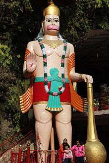 Hanuman Idol at Tapkeshwar Temple
_in_Malsi_Deer_Park_(photo_-_Jim_Ankan_Deka).jpg) An Indian monkey in Malsi Deer Park
An Indian monkey in Malsi Deer Park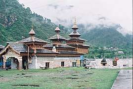 Hanol Temple
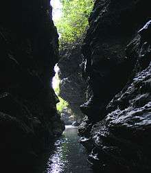 Robbers Cave, Dehradun
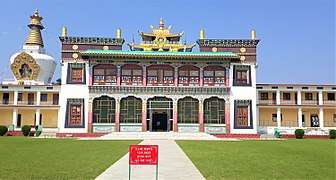 Front view of Buddha Temple Dehradun Uttarakhand
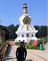 Front view of Buddha Temple Dehradun
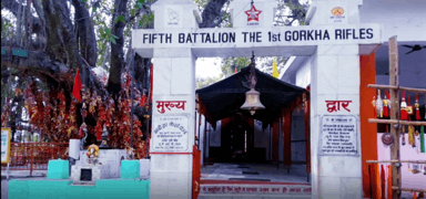 Santala Devi Temple Dehradun
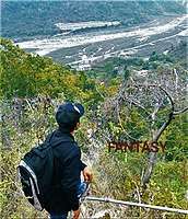 A view from Santala Devi Temple While Trekking down Dehradun
Transport
Transport options include:
- By air: Air India, Indigo, Jet Airways and SpiceJet offer daily flights from Delhi while Jet Airways operates a daily hopping flight (stop at Delhi) from Mumbai and Thiruvananthapuram (via Bangalore and Delhi) Direct flight from Mumbai and Srinagar (Jet Airways). Air India and Indigo has a direct 50 minute flight from Lucknow to Dehradun's Jolly Grant Airport 25 km from the valley of Dehradun.
- Railways: Dehradun railway station has service to major cities including Delhi, Mumbai, Kolkata, Lucknow, Trivandrum, Vadodara and Varanasi. Some fast trains running to and from Dehradun include the Shatabdi Express, Jan Shatabdi Express and Nanda Devi Express. Dehradun will soon get a metro rail in near future, The project in under Designing phase.[55]
- Jolly Grant Airport, Dehradun
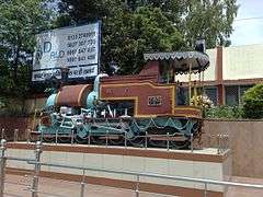 Old steam Loco outside Dehradun railway station
Culture
Hindi is the primary and official language, other languages spoken in the region are English, Bengali, Punjabi, Nepali, Tibetan. After becoming the capital, there has been continuous growth in education, communication and transport. As the state capital, Dehradun is home to many government institutions. Dehradun is renowned all over India for its educational institutions.
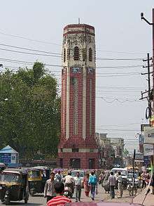
Buses are identified with blue bars. There are autorickshaws which are often used for transportation but blamed for pollution and noise. The evening buzz of Rajpur road is an attraction. After becoming the capital of Uttarakhand, due to the continues migration of people from hill districts of Garhwal the city has become overcrowded and turned into an urban mess with poor infrastructure and unplanned development. The city centre is easily recognised by the Clock Tower (Ghanta Ghar), a structure with six functioning clocks. The statue of San Dijen placed in Shanti Niketan contributes to the beauty of the city. Dehradun has been home to artists and writers including Stephen Alter, Nayantara Sahgal, Allan Sealy, Ruskin Bond and also to country singer Bobby Cash.
Dehradun was home to freedom fighters whose names are engraved in gold on the Clock Tower. It was called "The Gray City" in the initial days because ex-Army officers and VIPs considered this place ideal for residence after retirement.[56]
Woolen blankets are typical of this region and worn by people living at high altitude. Women wear saris with full-sleeve blouses along with angora jackets. Girls wear full skirts with scarfs covering their head and shoulders; more recently, they have adopted modern wear like salwar suits. In villages and to a lesser extent in towns, men wear the traditional dhoti, angarakha and langoti. The way dhotis are worn represents backgrounds and castes: short dhotis represent low status whereas long dhotis represent high. It is more common in urban areas for men to wear shirts and trousers, jeans and kurta-pyjamas. In winter, men usually dress in jackets, hats and overcoats. Hemp is grown in great quantities in this region, so its yarn is frequently used as lining.
There are fairs (melas) throughout the year. Notable fairs include Magh Mela, held on 14 January and Jhanda Mela in March, a fair for the Hindu community, that attracts Hindus from all over India and abroad.
Sport
The first indoor ice rink in India that meets the size requirements for ice hockey, figure skating, short track and rink bandy was built in Dehradun.[51]
Uttarakhand Cricket Association is the governing body of the Cricket activities in the Uttarakhand state of India and the Uttarakhand cricket team. The city has an international cricket stadium called Rajiv Gandhi International Cricket Stadium & a Mega Sports Complex in the Raipur area. It is the first international level stadium in the state.[30]
Since, the formation of the state 2000, the state suffered a blow to its sport facilities as Uttar Pradesh had the entire infrastructure for sports. Uttarakhand had hosted very few matches of Ranji Trophy. Due to lack of infrastructure the player started moving to different states.
In November 2012, Former Chief Minister of Uttarakhand Vijay Bahuguna laid the foundation of the stadium hoped that the stadium would bring Dehradun on the international cricket map and added that the shortage of money would not be a hurdle in the completion of the Rajiv Gandhi International Cricket Stadium and the Mega Sports Complex.[30] The stadium would be constructed as per international standards. The stadium and sports complex would be built in 23 acres.[57]
Some Other Cricket Grounds are:
- Doon School Ground
- RIMC Cricket Ground
- Abhimanyu Cricket Academy Ground
- MPSC Cricket Ground
- Rangers College Cricket Ground
- Survey Of India Cricket Ground
- Doon Cricket Academy Ground
- Tanush Cricket Academy Ground
Architecture
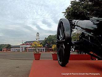
After Dehradun was made the capital of Uttarakhand, there was a construction boom, especially in residential property. Modern buildings have gradually supplanted older architectural styles including those related to the British colonial rule of India. Important older buildings still upstanding include the Clock Tower, Forest Research Institute, CNI College, Morrison Memorial Church, Inamullah Building, Jama Masjid, Osho Meditation Centre, Indian Military Academy and Darbar Sahib.
See also
| Wikimedia Commons has media related to Dehradun. |
| Wikivoyage has a travel guide for Dehradun. |
References
- 1 2 3 4 5 6 7 "Provisional Population Totals, Census of India 2011; Cities having population 1 lakh and above" (pdf). Office of the Registrar General & Census Commissioner, India. Retrieved 26 March 2012.
- ↑ "Provisional Population Totals, Census of India 2011; Urban Agglomerations/Cities having population 1 lakh and above" (pdf). Office of the Registrar General & Census Commissioner, India. Retrieved 26 March 2012.
- ↑ Bhushan, Ranjit. "Counter Magnets of NCR". Mydigitalfc.com. Retrieved 1 September 2010.
- ↑ "Dehra". Encyclopædia Britannica. 7. 1911.
- ↑ History of Dehradun
- ↑ Natural Resource Management By B. W. Pandey (ed. By) Page 226 ISBN 81-7099-986-3 Mittal Publications, India Language English (31 March 2005)
- ↑ The History of Sikh Gurus ISBN 81-8382-075-1 page 112 Chapter 8
- ↑ "A Brief History of Dehradun". District Institute of Education and Training, Dehradun. Archived from the original on 19 May 2007.
- ↑ "How Nehru spent his last four days". Mid-day.com. Retrieved 8 December 2014.
- ↑ "गौरवशाली इतिहास है देहरादून का" [The glorious history of Dehradun] (in Hindi). म्यार पहाड़ [Mount Hill]. 18 May 2008. Retrieved 26 March 2011.
- ↑ https://timesofindia.indiatimes.com/city/dehradun/Tracing-Doons-Afghan-connect/articleshow/47835111.cms
- ↑ https://timesofindia.indiatimes.com/city/dehradun/Tracing-Doons-Afghan-connect/articleshow/47835111.cms
- ↑ Myths and Realities of Security & Public Affairs https://books.google.com/books?id=AJUkBQAAQBAJ&pg=PA195&dq=afghanistan+dehradun&hl=en&sa=X&ved=0ahUKEwjAnsnu0ufZAhWP2VMKHZDeCFgQ6AEISzAG#v=onepage&q=afghanistan%20dehradun&f=false
- ↑ Malalai Joan of Arc of Afghanistan and the Victors of Maiwand: The Second Anglo-Afghan War 1878-1882https://books.google.com/books?id=9ZsuDgAAQBAJ&pg=PT184&dq=afghanistan+dehradun&hl=en&sa=X&ved=0ahUKEwjAnsnu0ufZAhWP2VMKHZDeCFgQ6AEIKTAA#v=onepage&q=afghanistan%20dehradun&f=false
- ↑ https://timesofindia.indiatimes.com/city/dehradun/Tracing-Doons-Afghan-connect/articleshow/47835111.cms
- ↑ http://www.tribuneindia.com/2009/20090821/dplus.htm#1
- ↑ http://www.tribuneindia.com/2009/20090821/dplus.htm#1
- ↑ http://indianexpress.com/article/india/india-others/tagores-kabuliwala-has-given-us-a-brand-afghan-president-ashraf-ghani/
- ↑ https://timesofindia.indiatimes.com/sports/cricket/news/dehradun-likely-to-be-afghanistans-second-home-ground/articleshow/62554424.cms
- ↑ "Altitude". Dehradun. Archived from the original on 2 June 2008. Retrieved 26 March 2011.
- ↑ "Important District Indicators". Dehradun. Archived from the original on 2011-07-21. Retrieved 26 March 2011.
- ↑ "Cold Wave Claims 29 Lives in North India". Outlook india.com. 8 January 2013. Archived from the original on 13 December 2013. Retrieved 8 December 2014.
- ↑ "देहरादून" (एक्सएमएल). उत्तराकृषिप्रभा. Retrieved 26 March 2011.
- ↑ "Dehradun Climatological Table 1901–2000" (PDF). Indian Meteorological Department. Archived from the original (PDF) on 13 April 2015. Retrieved 24 January 2015.
- ↑ "Extremes of India" (PDF). Indian Meteorological Department. Archived from the original (PDF) on 21 May 2013. Retrieved 24 January 2015.
- ↑ "Climate profile for Dehradun". MyWeather.com. Retrieved 24 January 2015.
- ↑ Government of India. "2011 Census". Census of India. Retrieved 26 August 2015.
- ↑ "Census India, 2001, Religious composition by district". Retrieved 12 May 2015.
- ↑ "Census of India Website : Office of the Registrar General & Census Commissioner, India". www.censusindia.gov.in. Retrieved 2018-08-28.
- 1 2 3 "4930-rajiv-gandhi-international-cricket-stadium-dehradun-uttarakhand". Archived from the original on 3 March 2016. Retrieved 9 July 2014.
- 1 2 "Robber's Cave (Guchhupani)". Dehradun. Archived from the original on 2007-12-14.
- ↑ Singh, Surendra (1995). Urbanization in Garhwal Himalaya: a geographical interpretation. M.D. Publications. p. 27. ISBN 81-85880-69-7.
- ↑ "Robbers Cave". MapsofIndia.com.
- ↑ https://www.euttaranchal.com/tourism/tapkeshwar.php
- ↑ Joshi, Bhartendu (15 March 2018). "Forest Research Institute "वन अनुसंधान संस्थान देहरादून"". Bugyal Valley.
- ↑ http://dehradun.nic.in/Institution.htm
- ↑ "Kendriya Vidyalayas in Dehradun - KVs in Dehradun - Kendriya Vidyalaya". www.euttaranchal.com. Retrieved 2018-09-13.
- ↑ "National Institute for the Visually Handicapped" (in German).
- ↑ "Post Graduate Professional Certificate Course in Special Education Distance Education Programme (PGPC-SEDE)". Rehabilitation Council of India. Archived from the original on 23 February 2011. Retrieved 26 March 2011.
- ↑ "Latika Roy Foundation". Latikaroy.org. Retrieved 8 December 2014.
- ↑ "Home Tuition – Home". Askfound.org. Archived from the original on 16 July 2014. Retrieved 8 December 2014.
- ↑ "STPI homepage". Dehradun.stpi.in. Archived from the original on 27 December 2014. Retrieved 8 December 2014.
- ↑ "Dehradun Map". MapsofIndia.com. Retrieved 30 January 2018.
- ↑ "Dehradun Attractions – Things to do in Dehradun". Dehradunlive.in. Archived from the original on 17 February 2015. Retrieved 17 February 2015.
- ↑ "Laxman Siddha Temple Dehradun - How To Reach Laxman Siddh Temple". www.euttaranchal.com. Retrieved 2016-05-04.
- ↑ "Shiv Mandir Kuthal Gate Mussoorie Road Dehradun - Prakasheswar Mahadev Temple Dehradun". www.euttaranchal.com. Retrieved 2016-05-04.
- ↑ "Sai Mandir Rajpur Road Dehradun - How To Reach Sai Darbar Temple". www.euttaranchal.com. Retrieved 2016-05-04.
- ↑ Central Braille Press – the first braille printing press of India Archived 27 September 2013 at the Wayback Machine., Withjim.in
- ↑ "इनका आकर्षण है खास" [They have special charm] (in Hindi). देहरादूनएक्सकर्शन्स [Dehradun Expresscans]. Archived from the original on 2 June 2008. Retrieved 26 March 2011.
- ↑ "Namaste Dehradun-Natural Beauty of Dehradun – Namaste Dehradun". Namastedehradun.com. Retrieved 8 December 2014.
- 1 2 Sandeep Rana. "Nation's biggest ice-skating rink draws players from across country". Archived from the original on 24 May 2013.
- ↑ "First ice arena for India". 19 March 2010. Archived from the original on 17 December 2013.
- ↑ "STATISTICS". IIHF. Retrieved 8 December 2014.
- ↑ "What Is Hinduism? - Maa Bala Sundari". HINDUISM TODAY Magazine.
- ↑ "दिल्ली की तरह ही उत्तराखंड में भी दौड़ेगी आधुनिक मेट्रो रेल" [Like Delhi, modern metro rail will also run in Uttarakhand]. MR. Solved (in Hindi). August 10, 2017. Archived from the original on 2017-08-27. Retrieved 2017-08-26.
- ↑ "देहरादून" [Dehradun] (in Hindi). Archived from the original on 21 September 2008. Retrieved 26 March 2011.
- ↑ "Layout for Rajiv Gandhi cricket stadium finalised". Dailypioneer.com. Retrieved 8 December 2014.
|