Siwan district
| Siwan district | |
|---|---|
| District of Bihar | |
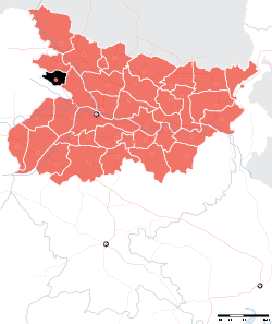 Location of Siwan district in Bihar | |
| Country | India |
| State | Bihar |
| Administrative division | Saran |
| Headquarters | Siwan, Bihar |
| Government | |
| • Lok Sabha constituencies | Siwan |
| • Assembly seats | Siwan, Ziradei, Darauli, Raghunathpur, Daraunda, Barharia, Goriakothi, Maharajganj |
| Area | |
| • Total | 2,219 km2 (857 sq mi) |
| Population (2011) | |
| • Total | 3,318,186 |
| • Density | 1,500/km2 (3,900/sq mi) |
| Demographics | |
| • Literacy | 71.59 per cent |
| • Sex ratio | 984 |
| Major highways | NH 85 |
| Website | Official website |
Siwan district is one of the districts of Bihar state, India. Siwan town is the administrative headquarters of this district. Siwan district is a part of Saran Division since 1972. The town is known for its great past especially for First President of Indian Republic who belonged to Jeeradei.[1] [2] The district was previously also known as Aliganj Siwan after the name of Raja Ali Bux Khan. Siwan has historical and mythological importance attached to it. Member of Parliament from Siwan is Om Prakash Yadav.[3]
The district occupies an area of 2,219 square kilometres (857 sq mi).[4]
History
Siwan district, situated in the western part of the state, was originally a sub-division of Saran district, which in ancient time formed a part of Kosala Kingdom.[5] Siwan became a fully-fledged district when it was split from Saran in 1976.[6]
Siwan derived its name from "Shiva Man", a Bandh Raja whose heirs ruled this area till Babar’s arrival. The meaning of "Siwan" is border, previously it used to be the border district of "Bihar". Maharajganj, which is another subdivision of Siwan district, may have found its name from the seat of the Maharaja there. A recently excavated marvelous statue of Lord Vishnu at Bherbania village from underneath a tree indicates that there were large numbers of followers of Lord Vishnu. It is now dominated by Yadavs and Rajputs.[7]
Siwan was a part of Banaras Kingdom during the 8th century. Muslims came here in the 13th century. Sikandar Lodi brought this area under his kingdom in the 15th century. Babar crossed Ghaghra river near Siswan in his return journey. By the end of the 17th century, the Dutch came first; followed by the English. After the battle of Buxar in 1765, it became a part of Bengal. Siwan played an important role in 1857 independence movement. It is famous for the stalwart and sturdy ‘Bhoj-puries’, who have always been noted for their martial spirit and physical endurance and from whom the army and police personnel were largely drawn. A good number of them rebelled and rendered their services to Babu Kunwar Singh. The last ruler of Siwan was Raja Ismail Ali Khan.The anti pardah movement in Bihar was started by Sri Braj Kishore Prasad who also belonged to Siwan in response to the Non Co-Operative movement in 1920.[5]
Demographics
According to the 2011 census Siwan district has a population of 3,318,176.[8] This gives it a ranking of 101st in India (out of a total of 640).[8] The district has a population density of 1,495 inhabitants per square kilometre (3,870/sq mi) .[8] Its population growth rate over the decade 2001-2011 was 22.25%.[8] Siwan has a sex ratio of 984females for every 1000 males,[8] and a literacy rate of 71.59%.[8]
Administrative Division
Siwan is divided into 2 sub-divisions, 19 Blocks, 3 municipality (city councils) and 293 gram-panchayat (village councils). There are total 1528 villages in Siwan District.[1]
| Subdivision | CD Block | Hindi name | Area (KM2) | Population (2011) |
|---|---|---|---|---|
| 2 | 19 | १९ | 2,219 | 33,30,464 |
| Siwan | Andar | आंदर | 120.41 | 110,027 |
| Siwan | Barharia | बरहरिया | 177.27 | 321,292 |
| Siwan | Darauli | दरौली | 172.80 | 174,357 |
| Siwan | Guthani | गुठनी | 91.70 | 128,155 |
| Siwan | Hasanpura | हसनपुरा | 96.56 | 149,580 |
| Siwan | Hussainganj | हुसैनगंज | 85.37 | 182,794 |
| Siwan | Mairwa | मैरवा | 69.17 | 113,499 |
| Siwan | Nautan | नौतन | 65.39 | 90,714 |
| Siwan | Panchrukhi | पंचरुखी | 124.33 | 201,759 |
| Siwan | Raghunathpur | रघुनाथपुर | 156.03 | 157,694 |
| Siwan | Siswan | सिसवां | 115.78 | 153,953 |
| Siwan | Siwan | सिवान | 137.34 | 340,983 |
| Siwan | Ziradei | जीरादेई | 124.03 | 163,752 |
| Maharajganj | Lakri Nabiganj | लकरी नबीगंज | 95.21 | 1,28,899 |
| Maharajganj | Goriakothi | गोरेयाकोठी | 138 | 223,709 |
| Maharajganj | Basantpur | बसंतपुर | 62.22 | 1,05,229 |
| Maharajganj | Bhagwanpur Hat | भगवानपुर हाट | 149.40 | 2,20,651 |
| Maharajganj | Maharajganj | महाराजगंज | 115.48 | 1,90,217 |
| Maharajganj | Daraundha | दरौंधा | 126.60 | 1,73,200 |
Urban councils
There are 3 urban councils in Siwan district they are categorised as Municipality. Nagar Parishad and Nagar Panchayat are a form of municipality.
| City council | Council's type | Hindi name | part of (Block) | Area (KM²) | Population (2011) |
|---|---|---|---|---|---|
| Siwan | Nagar Parishad | सिवान नगर परिषद | Siwan | 13.05 | 1,35,66 |
| Mairwa | Nagar Panchayat | मैरवा नगर पंचायत | Mairwa | 6.23 | 23,565 |
| Maharajganj | Nagar Panchayat | महाराजगंज नगर पंचायत | Maharajganj | 7.60 | 24,282 |
Village councils
There are 293 Gram panchayats and 1528 villages in Siwan district grouped into 19 blocks. A gram-panchayat may have a large village or more villages.[1]
| Block | Village councils |
|---|---|
| Basantpur | Baiju Barhoga, Basantpur, Basaon, Kanhauli, Kumkumpur, Molanapur, Rajapur, Sareya srikant, Suryapura |
| Bhagwanpur Hat | Balahan arazi, Bansohi, Barka gaon, Bhikhampur, Bilaspur, Bithuna, Brahmasthan, Brahmasthan, Gopalpur, Kauria, Kherwa, Mahamada, Mahamadpur, Mirjumala, Morakhas, Sagar Sultanpur dakshin, Sagar Sultanpur uttar, Sahasaraon, Sankarpur, Saraya parauli, Sondhani |
| Maharajganj | |
| Daraundha | |
| Lakri Nabiganj | |
| Goriakothi | |
| Andar | |
| Barharia | |
| Darauli | |
| Guthani | |
| Hasanpura | |
| Hussainganj | |
| Mairwa | |
| Nautan | |
| Panchrukhi | |
| Raghunathpur | |
| Siswan | |
| Siwan | |
| Ziradei |
References
- 1 2 3 http://siwan.bih.nic.in. "An Official Website of Siwan". Archived from the original on 2009-04-22.
- ↑ https://www.siwanonline.com. "Latest News of Siwan". Archived from the original on 2017-12-22.
- ↑ Mehta, Dr. Arun C. "District-specific Literates and Literacy Rates, 2001". Archived from the original on 2010-04-14.
- ↑ Srivastava, Dayawanti et al. (ed.) (2010). "States and Union Territories: Bihar: Government". India 2010: A Reference Annual (54th ed.). New Delhi, India: Additional Director General, Publications Division, Ministry of Information and Broadcasting (India), Government of India. pp. 1118–1119. ISBN 978-81-230-1617-7.
- 1 2 "Archived copy". Archived from the original on 2015-07-17. Retrieved 2015-09-24.
- ↑ Law, Gwillim (2011-09-25). "Districts of India". Statoids. Archived from the original on 2011-10-17. Retrieved 2011-10-11.
- ↑ "This week: Bihar - Indian Express". Archived from the original on 2013-08-13.
- 1 2 3 4 5 6 "District Census 2011". Census2011.co.in. 2011. Archived from the original on 2011-06-11. Retrieved 2011-09-30.
External links
Places adjacent to Siwan district | ||||||||||
|---|---|---|---|---|---|---|---|---|---|---|
| ||||||||||
Headquarter: Siwan | ||
| Siwan Subdivision | | |
| Maharajganj Subdivision | ||
| Municipalities | ||
| State symbols | |
|---|---|
| History |
|
| Administration | |
| Overviews | |
| Divisions and districts | |
| Cities | |
| Municipal Corporation |
|
| Poltics | |
| Culture | |