Bulandshahr district
| Bulandshahr district | |
|---|---|
| District of Uttar Pradesh | |
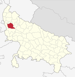 Location of Bulandshahr district in Uttar Pradesh | |
| Country | India |
| State | Uttar Pradesh |
| Administrative division | Meerut |
| Tehsils |
Bulandshahr, Syana, Anoopshahr, Shikarpur, Khurja, dibai, Sikandrabad |
| Government | |
| • Lok Sabha constituencies | Bulandshahr |
| Area | |
| • Total | 4,441 km2 (1,715 sq mi) |
| Demographics | |
| • Literacy | 76.23 per cent[1] |
| • Sex ratio | 892 |
| Major highways | National Highway 91 |
| Website | Official website |
Bulandshahr district (also spelled Bulandshahar) is a district in the Meerut region in the North India state of Uttar Pradesh located between 28.4° and 28.0° north latitudes and between 77.0° and 78.0[2]° east longitudes. Bulandshahr is the district headquarters. It is part of National Capital Region of India.[3] Bulandshahar district is surrounded by Aligarh district, Sambhal district, Gautam buddha nagar district, Hapur district and Amroha district.
Demographics
According to the 2011 census, Bulandshahr district had a population of 3,498,507,[4] roughly equal to the nation of Lithuania[5] or the US state of Connecticut.[6] This makes it the 85th most populous district of the total 640.[4] The district has a population density of 788 inhabitants per square kilometre (2,040/sq mi).[4]
Its population growth rate over the decade 2001-2011 was 20.09%.[4] Bulandshahar has a sex ratio of 892 females for every 1000 males,[4] and a literacy rate of 76.23%.[4]
In 1901, the population stood at 1,138,101.[7]
Agriculture
The district of Bulandshahar is an important grain producing agricultural district. Wheat, potatoes, maize, sugar and many others are cultivated here in large quantities.[8][9]
References
- ↑ "District-specific Literates and Literacy Rates, 2001". Registrar General, India, Ministry of Home Affairs. Retrieved 2010-10-10.
- ↑ "Bulandshahar District Map". www.mapsofindia.com. Retrieved 2017-11-21.
- ↑ "National Capital Region Planning Board". ncrpb.nic.in. Retrieved 2017-11-10.
- 1 2 3 4 5 6 "District Census 2011". Census2011.co.in. 2011. Retrieved 2011-09-30.
- ↑ US Directorate of Intelligence. "Country Comparison:Population". Retrieved 2011-10-01.
Lithuania 3,535,547 July 2011 est.
- ↑ "2010 Resident Population Data". U. S. Census Bureau. Archived from the original on 2011-01-01. Retrieved 2011-09-30.
Connecticut 3,574,097
- ↑

- ↑ "Bulandshahr Agriculture, District Level Information of Bulandshahr | Uttar Pradesh". www.districtsofindia.com. Retrieved 2017-11-21.
- ↑ "Agricultural Efficiency in Uttar Pradesh" (PDF).
External links
Places adjacent to Bulandshahr district | |
|---|---|