Sirohi
| Sirohi Hirohi Devnagri | |
|---|---|
| City | |
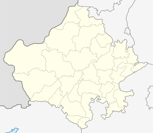
 Sirohi Location in Rajasthan, India  Sirohi Sirohi (India) | |
| Coordinates: 24°53′06″N 72°51′45″E / 24.885°N 72.8625°ECoordinates: 24°53′06″N 72°51′45″E / 24.885°N 72.8625°E | |
| Country |
|
| State | Rajasthan |
| District | Sirohi |
| Founded | aft. 1450 |
| Founded by | Rao sobhaji, sehastramal |
| Government | |
| • Type | Rajasthan Government |
| • Body | Municipal Council / Nagar Parishad ,Sirohi |
| • Collector | Anupama Jorwal, IAS |
| • Superintendent of police | Jai Yadav, IPS |
| • MP | Devji .M Patel |
| • MLA | Otaram Devasi |
| Area | |
| • Total | 5,179 km2 (2,000 sq mi) |
| Elevation | 321 m (1,053 ft) |
| Population (2012) | |
| • Total | 851,107 |
| • Density | 164/km2 (420/sq mi) |
| Demonym(s) | Sirohian |
| Languages | |
| • Official | Hindi |
| • Local | Rajasthani |
| Time zone | UTC+5:30 (IST) |
| PIN | 307001 |
| Telephone code | 02972 |
| Vehicle registration | RJ-24 |
| Nearest city | Ahmedabad, Jalore, Pali, Barmer , Mehsana, Udaipur, Pindwara |
| Avg. summer temperature | 42 °C (108 °F) |
| Avg. winter temperature | 6 °C (43 °F) |
| Website | http://sirohi.rajasthan.gov.in/ |
Sirohi is a city in southern Rajasthan state in western India. It is the administrative headquarters of Sirohi District and was formerly the capital of the princely state of Sirohi ruled by Deora Chauhan Rajput. It has five Tehsils (Administrative Divisions): Abu Road, Sheoganj, Reodar, Pindwara, and Sirohi itself. It is also known as Devnagari. The nearest railway station to Sirohi is Sirohi Road.Sirohi got first rank in 33 districts of Rajasthan for "Swachha bharat Abhiyan " in year 2014.
Transportation
Sirohi is well connected to all the cities of India through National Highways and State Highways . RSRTC has daily services to Jaipur, Udaipur, Ajmer, Kota, Barmer, Delhi, Ahmedabad, Surat, Kalyan from Sirohi Central Busstop . Various private company buses like VRL Travels,MR travels, SRS Travels, Shrinath Travels have daily services from Sirohi to Bangalore and Pune . Nearest Railway Station Sirohi Road (SOH) and Abu road (ABR). Nearest Domestic Airport Udaipur and International Airport Ahmedabad .
Geography
Sirohi is located at 24°53′06″N 72°51′45″E / 24.885°N 72.8625°E.[1] It has an average elevation of 321 metres (1053 ft).
History
The Name Sirohi had been derived by "Siranwa" hills on the Western Slope of which it stands. Colonel Tod in his book "Travels in Western India" has suggested that the names of the territory might have derived from its position at the head (Sir) of the desert (Rohi), Sirohi also named as "Sword" and this had led some people to believe that this State of brave Deora Chauhans received it present name due to its widespread fame of its Swords i.e. Sirohi means " Self Respect is most important even if head may be detached " in other words "A Rajput of Sirohi may die for Self Respect." Sirohi, is said to have taken its name from Sirohi from Siranwa hill, on the western slope at which it stands. In 1405, Rao Sobhaji founded the town of Shivpuri on the eastern slope of Siranwa Hill. Shivpuri today lies in ruins. In 1425, his son and successor, Sehastramal (or Sahastramal, Sehastramal), founded a fortress on the eastern slope of the same hill, which became his capital and grew into the present-day town of Sirohi.
After Independence an agreement was signed between Central Government and minor ruler of Sirohi State, with this the State Administration of the Sirohi State was taken over by Bombay Government from 5 January 1949 to 25 January 1950. The first administrator representing a bombay state was Prema Bhai Patel. After final merger with Rajasthan in 1950, an area of 787 km2 consisting of Aburoad and Delwara tehsils of Sirohi district was renamed with the Bombay State on 1 November 1956, after the recommendation of the State organisation Commission, which forms the present position of the district.
Demographics
As of 2011, Sirohi had a population of 851,107. The urban population is 150,890. Males constitute 53% of the population, and females constitute 47%. Sirohi has an average literacy rate of 66%, higher than the national average of 54.3%; male literacy is 70%, and female literacy is 37%. In Sirohi, 14% of the population is under 6 years of age.
Stated.
Education
Schools in Sirohi are affiliated either by the Central board of secondary education, or Rajasthan board of secondary education. There are 863 schools in the district including both private and government. The higher education institutions in the city included Govt P.G.College affiliated by Mohanlal Sukhadia University , a Govt. GIrls College which is also affiliated to Mohanlal Sukhadia University ,Udaipur and & Private colleges. For technical education Govt. POLYTECHNIC & Govt. Women B.ed college and ITI College as well
Some renowned schools in the city are St. Paul's Senior Secondary School, Ajit Vidhya Mandir, and Emmanuel Mission School.
National and state highways
Sirohi is well connected to highways of India by the NHAI . NH 62 connects sirohi from South starting from Pindwara to the north up to the Pali District of Rajasthan and continues up to Beawar. NH 168 passing through Sirohi intersecting SH 27 which is also known as Delhi - Kandla Highway SH 27 ends at Deesa In Gujarat State. SH 38 passing from NH 62 in the west of the Sirohi connecting NH 112 via Jalore and ends at the Balotra in Barmer District. SH 10 on the east of Sirohi heading towards NH 8 intersect at Udaipur, Rajasthan and SH 10 continues up to Banswara District in Rajasthan.
- Sarneshwar Mahadev, Sirohi
- Shree Pavapuri Jain Tirthdham, Sirohi
- Vastanji Mahadev, Sirohi
- Jirawala Parshwanath Tirth, Sirohi
- Matar Mataji Temple, Sirohi
- Sirohi Fort
- Kesar Vilas "King's Residence" ,Sirohi
- Vijaypataka Jain Tirth, Sirohi
- Sukhdham, Posaliya ( Sirohi)
- Sarvadham, Sirohi
- Varada Hanuman ji Temple, Varada(Sirohi)
- Sun Temple, Sirohi
- Ambeshwar Mahadev, Sirohi
- Khetlaji Temple,Sindrath(Sirohi)
- Varahi Mata Temple, Mandwa (Sirohi)
- Veerji Mandir, Sirohi
- Thakur Bavsi Mandir, Sirohi
- Kolargarh Gaushala, Sirohi
- Sanghvi Bheru tarak Tirth Dham, Sirohi
- Mount Abu wild life sanctuary and fish spa
- Shree Jal Devi Mataji Temple (Udd)
- Shree Sachiyaav Mataji Temple (Jawal)
- Shree Sarneshwar Mahadevji Temple(Sirohi)
- Pavapuri
- Sirohi (Rajasthan Assembly Constituency)
- Jawan Singh (politician)
- Mirpur Jain Temple
- Cultural History of Abu Region by Dr. Sohan Lal Patni
- [[ sri vareshree mataji temple (bawali)
- [[ maa saraswati dham (bawali)
- Shree Bhuvneshwar Mahadev Temple (Dodua)

- Cahoon, Ben (2000), Indian princely states, WorldStatesmen, retrieved April 2013 Check date values in:
|accessdate=(help) — also shows the state's flag - P.R.O. Sirohi (15 April 2013), Sirohi district web site, National Informatics Centre, Government of India, District Unit-Sirohi, archived from the original on 1 April 2013, retrieved April 2013 Check date values in:
|accessdate=(help) - Temples of Sirohi, archived from the original on 18 November 2012
- Indian Princely States- Genealogy of the ruling chiefs of Sirohi, archived from the original on 17 February 2005
