Mirzapur district
| Mirzapur district | |
|---|---|
| District of Uttar Pradesh | |
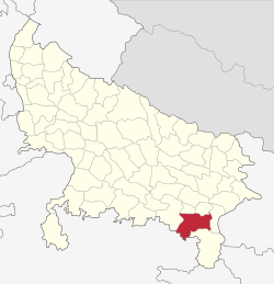 Location of Mirzapur district in Uttar Pradesh | |
| Country | India |
| State | Uttar Pradesh |
| Administrative division | Mirzapur |
| Headquarters | Mirzapur |
| Tehsils | 4 |
| Government | |
| • Lok Sabha constituencies | Mirzapur |
| Area | |
| • Total | 4,521 km2 (1,746 sq mi) |
| Population (2011) | |
| • Total | 2,494,533,[1] |
| Average annual precipitation | 1043 mm |
| Website | Official website |
Mirzapur district is one of the 75 districts of Uttar Pradesh state in northern India. The district is bounded on the north by Sant Ravidas Nagar and Varanasi districts, on the east by Chandauli district, on the south by Sonbhadra district and on the northwest by Allahabad district. The district occupies an area of 4521 km2. Mirzapur town is the district headquarters. Mirzapur district is a part of Mirzapur division. This district is known for the Vindhyavasini temple in Vindhyachal and several tourist attractions like water falls and dams. It consist of several Ghats where historical sculptures are still present. During the Ganges festival these Ghats are decorated with lights and diyas. It is a part of the Red Corridor.[2]
It was once the largest district in Uttar Pradesh until Sonebhadra district was separated from Mirzapur in 1989.
Divisions
The district consists four Tehsils. These are Mirzapur (sadar), Lalganj, Marihan and Chunar. These four tehsils are further divided into twelve blocks.
Economy
In 2006 the Ministry of Panchayati Raj named Mirzapur one of the country's 250 most backward districts (out of a total of 640).[3] It is one of the 34 districts in Uttar Pradesh have received funds from the Backward Regions Grant Fund Programme (BRGF).[3] Once tourism used to contribute in the economy but due to lack of care from government officials and local people the unmatched beauty of the places like Sirshe dam and waterfall, Dadri (Pipari) dam, Vindham waterfall, Lower Khajuri, Upper Khajuri, Lakhaniya waterfall, Siddhnath Waterfall, Kotwan-Patehara forest, Fort of Chunar and Dadri-Haliya forest has become 'the stories of past'. Once there was a time when every Sunday of rainy season used to be a fair like atmosphere for the neighbouring localities of Sirshe waterfall and Vindham waterfall due to their attraction of tourist not only from every part of the U.P. and but neighbourhood states too. The separation of the Sonebhadra largely affected the economical condition and after the closing of mills and depression in the carpet industry Mirzapur has become nearly economically handicapped.
Colleges
- K.B. Postgraduate College, Mirzapur [4]
- G.D.Binani P.G. College Mirzapur
- Dharamjeet Singh Mahavidyalaya, Mirzapur
- Kamala Maheshwari Arya Kanya Snatkottar Mahavidyalaya, Mirzapur
- Banasthali Mahavidyalaya, Ahraura, Mirzapur
- Bal Ganga Mahavidyalaya, Kailhat, Mirzapur
Demographics
According to the 2011 census Mirzapur district has a population of 2,494,533,[1] roughly equal to the nation of Kuwait[6] or the US state of Nevada.[7] This gives it a ranking of 174th in India (out of a total of 640).[1] The district has a population density of 561 inhabitants per square kilometre (1,450/sq mi) .[1] Its population growth rate over the decade 2001-2011 was 17.89%.[1] Mirzapur has a sex ratio of 900 females for every 1000 males,[1] and a literacy rate of 70.38%.[1] Female Literacy rate here is 54%.
Languages
Languages spoken include Agariya, an Austroasiatic tongue with approximately 72 000 speakers;[8] Awadhi, which has a lexical similarity of 72-91% with Hindi[9] (compared to 60% for German and English)[10] and is spoken by about 7 800 000 in Bagelkhand;[9] and Bagheli, a tongue in the Bagheli language group with almost 40 000 000 speakers, written in both the Devanagari and Kaithi scripts.
References
- 1 2 3 4 5 6 7 "District Census 2011". Census2011.co.in. 2011. Retrieved 2011-09-30.
- ↑ "83 districts under the Security Related Expenditure Scheme". IntelliBriefs. 2009-12-11. Retrieved 2011-09-17.
- 1 2 Ministry of Panchayati Raj (8 September 2009). "A Note on the Backward Regions Grant Fund Programme" (PDF). National Institute of Rural Development. Archived from the original (PDF) on 5 April 2012. Retrieved 27 September 2011.
- ↑ http://www.kbpgcollege.org/
- ↑ http://www.census2011.co.in/data/religion/district/570-mirzapur.html
- ↑ US Directorate of Intelligence. "Country Comparison:Population". Retrieved 2011-10-01.
Kuwait 2,595,62
- ↑ "2010 Resident Population Data". U. S. Census Bureau. Archived from the original on 2010-12-25. Retrieved 2011-09-30.
Nevada 2,700,551
- ↑ M. Paul Lewis, ed. (2009). "Agariya: A language of India". Ethnologue: Languages of the World (16th ed.). Dallas, Texas: SIL International. Retrieved 2011-09-28.
- 1 2 M. Paul Lewis, ed. (2009). "Bagheli: A language of India". Ethnologue: Languages of the World (16th ed.). Dallas, Texas: SIL International. Retrieved 2011-09-28.
- ↑ M. Paul Lewis, ed. (2009). "English". Ethnologue: Languages of the World (16th ed.). Dallas, Texas: SIL International. Retrieved 2011-09-28.
External links
| Wikimedia Commons has media related to Mirzapur district. |
Places adjacent to Mirzapur district | |
|---|---|
Coordinates: 25°09′02″N 82°33′53″E / 25.150677°N 82.564807°E