Kathua
| Kathua | |
|---|---|
| City | |
   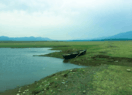  clockwise from top: Kathua Skyline, Atal Setu, Jasrota Fort, Purthu Artificial Beach & Textile Park | |
| Nickname(s): Gateway to Jammu and Kashmir, Dawlat- Auliya, City of Sufis | |
 Kathua Location in Jammu and Kashmir, India  Kathua Kathua (India) | |
| Coordinates: 32°23′06″N 75°31′01″E / 32.385°N 75.517°ECoordinates: 32°23′06″N 75°31′01″E / 32.385°N 75.517°E | |
| Country |
|
| State | Jammu and Kashmir |
| District | Kathua |
| Settled | 1025 BC |
| Government | |
| • Type | Municipal Council |
| • Body | Kathua Municipal Council(defunct) |
| • MLA | Rajeev Jasrotia (Minister of Forest & Ecology-J&K Government/BJP) |
| Area | |
| • Total | 51 km2 (20 sq mi) |
| Elevation | 393 m (1,289 ft) |
| Population (2011) | |
| • Total | 1,91,988 |
| • Density | 3,765/km2 (9,750/sq mi) |
| Languages | |
| • Official | Urdu Dogri Hindi |
| Time zone | UTC+5:30 (IST) |
| PIN | 184101(Down town), 184102(Patel Nagar Suburbs) and 184104 (Upper Shiva Nagar) |
| Telephone code | 01922(xxxxxx) |
| Vehicle registration | JK-08 |
| Literacy | 80.45% |
| Website | http://kathua.nic.in/ |
Kathua (kəˈθʊə), is a city and a Municipal Council in the Indian state of Jammu and Kashmir, near its southern border with Punjab and Himachal Pradesh.Kathua is also called 'the city of Sufis' or ' Dawlat Auliya' owing to the presence of large number of Sufi Shrines of Pirs. The city is also the gateway to the state and a big industrial town with army presence .Kathua along with its satellite township of Lakhanpur in J&K and the nearby city of Pathankot in Punjab constitute the Kathua-Pathankot twin city urban area. Kathua is the second largest city in Jammu division after Jammu city.
History and etymology
The word "Kathua" is derived from the word "Thuan" in Dogri which means "Scorpions". Some believe that its name is derived from the name of Rishi Kashyap who disguised himself as a tortoise (Kachua)for strong meditation.Jodh Singh of the Andotra clan is believed to have migrated from Hastinapur to [Kathua] nearly 2,000 years ago.His three sons established the three Hamlets of Taraf Tajwal, Taraf Manjali and Taraf Bhajwal. These hamlets later evolved into modern day Kathua.
Geography
Kathua is located at 32°22′N 75°31′E / 32.37°N 75.52°E.[1] It has an average elevation of 393 metres (1,289 ft). The city is surrounded by three rivers. Ravi is just 7 km down Kathua while ujjh is about 11 km ahead on Jammu Highway. Kathua itself is situated along the banks of a khad (river) dividing it into two boroughs: Parliwand, meaning the other side; and Orliwand, meaning this side. Both parts are connected by three bridges. Many parts of the district and the city itself lie on plains while the tehsils of Basoli and Billawar are very hilly. The Kandi region - the barren lowlands at shiwalik foothills constitute it. A gateway to the northernmost state of Jammu and Kashmir, Kathua lies just 88 kilometres south of the state's winter capital of Jammu.
Administrative divisions
The district is divided into four Sub-divisions-
- Basohli
- Bani
- Billawar
- Hiranagar
Kathua District comprises these tehsils:
- Barnoti
- Basohli
- Billawar
- Kathua
- Hiranagar
- Bani
- Nagri parole
- Mahanpur
- Marheen
- Lohai Malhar
- Ramkot
Demographics
Kathua is the fourth biggest city in the state after Srinagar (population=11,77,253), Jammu city (population=9,51,373) and Anantnag (population=2,08,312 including agglomerations).As of 2011, Kathua city has a population of 1,91,988.[3] The sex ratio is 853 females per 1,000 males.[4] There has been a sudden increase in the population of the town due to migration from rural areas and hilly areas from Basoli Tehsil due to the construction of Ranjit Sagar Dam.
Kathua city is overwhelmingly Hindu, the religion practised by 82% of its population,Christians are largest minority at 10.57%, another 3.75% is Sikh and the proportion of Muslims being 3.68%. The city's neighbourhoods are divided on ethnic lines. The Christian and Sikh population are almost concentrated in Christian Quarter and Sawan Chak areas respectively. Christian population is in heavy concentration in outskirts, nearby Pathankot and Gurdaspur in Punjab and Kathua border. Even within Hindus, the Schedule Caste population has their own exclusive neighbourhoods. However people have a strong faith in Sufistic culture too as there are large number of Sufi shrines in and around the city. Most of the people are of Dogra race and Dogri is the principal language. Dogras constitute 88% of population, 7% Nepali immigrants, 2% Bengali and rest others. Urdu is the official language.
Transportation
Kathua is just 80 km away from Jammu city and 120 km from Katra. Basoli is just 72 km from it. Buses for longer distances and matadors (small buses) for shorter distances are the main sources of transportation in Kathua.Matadors(small buses) run on major roads of the city. They also connect city with nearby villages. The bus journey from Kathua to Jammu is approximately 1.5 hours. Video Coach buses from Kathua to Jammu is available from morning 5:00 am to evening 9:00 pm. There are also railway links to Jammu and Pathankot from Kathua. Kathua Railway station at Gobindsar is just 4 km from city centre. Kathua has two bus stops. The smaller at Nagri Road for buses to Nagri-Parole town which is 10 km from Kathua. The larger one is for other destinations. The old busstand at Parliwand is no longer in use and is generally used for parking.Kathua is served by nearby Pathankot Airport which is 17 km from the city centre. Vistara Airlines and Alliance Airways have started scheduled flights from 2017.
Industrial estate
On the outskirts of Kathua, there is a well-developed industrial estate, SICOP (State industrial cooperation), including the Nirmal Industries, Chenab Textile Mill (CTM). This venture of Birla Group, established in the 1970s, contributed greatly to the development of today's Kathua. In addition to CTM, there are several other factories, manufacturing cement, iron, and other products. There is a unit Celine Health Care Pvt. Ltd. that is in the manufacturing of cosmetic products. In 2011, a new milestone, JAKSON entered in Jammu & Kashmir with the two units for manufacturing Generating Sets at SICOP, IID Centre, Kathua. With a cumulative manufacturing space of 435000 sq. ft, both units manufacture genset accessories base frames and fuel tanks along with Diesel and Gas based generating sets. In 2012 M/s. J and K Integrated Textile Park Limited (JKITPL) entered in Kathua with the manufacturing HUB of Textiles and Its products / auxiliaries in approx. 10,00,000 Sq. Ft. area and investment of Rs.50 crores in Infrastructure and Rs.150 Crores in Plant & Machinery. JKITPL is a project approved by Ministry of Textiles, Govt. of India and is an only private project categorised as Prestigious project.There are around 13 mini cement plants in industrial estate. A well known brand BLC cement is manufactured and supplied from SICOP, Kathua. Other industries include pipes, tiles, glassware, bridge girders, perfumes manufacture etc. The city also boasts of a well developed Biotechnology Park, the only one in North India. SICOP Industrial estate, IGC Phase 2 and Ghatti Industrial estates are new industrial estates that have come up around Kathua.
Agriculture and land holdings
The district has a reporting area of 2.65 lacs Hectt as per revenue records out of which 0.45 lacs Hectt is agricultural use, 0.36 lacs Hectt constitutes barren and uncultivable land excluding follow land, 0.12 lacs Hectt accounts for culturable waste, 0.13 lacs Hectt is under misc. trees, 0.10 lacs Hectt forms permanent pastures, 0.01 lacs Hectt is fallow land other than current fallows, 0.14 lacs is the area under current fallows and 0.61 Hectt is net area sown. The total cropped area of the district during 1999-2000 was 1.24 lacs Hectt of which 0.63 lacs hectt represents the area sown more than once. According to the agricultural census of 1991-92, the district had 69508 number of land holding of different sizes. Out of these 60.15% were of below one Hectt and only 39.85% were of the sizes of one hectts and above which indicates that large number of land holding are very small. Major crops of the district are Paddy, Maize and Wheat. Wheat and Paddy constitutes the staple food in plain tehsils Viz. Kathua and Hiranagar whereas Maize for Hilly Tehsils Basohli and Billawar. Wheat being main crop in whole of the district had covered 50 thousands hectares of area followed by paddy grown over an area of 36,000 hectares and the remainder 38,000 hectares were covered by maize, millets, oil seeds, pulses and vegetable crop during 1999-2000.
Climate
Talking of Kathua city in particular the climate is sub tropical. Kathua generally experiences extreme rainfall being on windward side of Siwaliks. According to common Hindu belief there are six seasons experienced in the region.Because of its proximity to rivers climate is moderate in summers and harsh in winters. Summers are hot and the mercury may shoot up to 41 degrees while in winters mercury generally dips to 2 degrees or even sometimes to zero. Heavy downpour is also experienced. The annual rainfall is 700 cm mainly in monsoons and winters due to Western Disturbances. Kathua city does not experience snow while there may be snow in upper reaches of district like Bani Tehsil. Heavy hailstorms with piles of hail can be experienced in February and March but are very few. Severe smog due to heavy air pollution is common in winters. 669 millimetres (26.3 in) in the wettest months.
| Climate data for Kathua | |||||||||||||
|---|---|---|---|---|---|---|---|---|---|---|---|---|---|
| Month | Jan | Feb | Mar | Apr | May | Jun | Jul | Aug | Sep | Oct | Nov | Dec | Year |
| Record high °C (°F) | 26 (79) |
31 (88) |
36 (97) |
41 (106) |
43 (109) |
43.2 (109.8) |
42.5 (108.5) |
41 (106) |
37 (99) |
36 (97) |
31 (88) |
26 (79) |
43.2 (109.8) |
| Average high °C (°F) | 18.8 (65.8) |
21.9 (71.4) |
26.6 (79.9) |
32.9 (91.2) |
38.3 (100.9) |
40.6 (105.1) |
35.5 (95.9) |
33.7 (92.7) |
33.6 (92.5) |
31.7 (89.1) |
26.8 (80.2) |
21.1 (70) |
30.1 (86.2) |
| Average low °C (°F) | 1.2 (34.2) |
9.7 (49.5) |
13.6 (56.5) |
19.0 (66.2) |
24.4 (75.9) |
26.8 (80.2) |
24.5 (76.1) |
24.0 (75.2) |
23.0 (73.4) |
18.4 (65.1) |
12.6 (54.7) |
8.5 (47.3) |
17.7 (63.9) |
| Record low °C (°F) | −3.9 (25) |
−2 (28) |
3 (37) |
6 (43) |
7 (45) |
13 (55) |
13 (55) |
8 (46) |
12 (54) |
4 (39) |
2 (36) |
−3 (27) |
−3.9 (25) |
| Average rainfall mm (inches) | 50.0 (1.969) |
46.4 (1.827) |
53.2 (2.094) |
26.3 (1.035) |
16.0 (0.63) |
51.8 (2.039) |
283.4 (11.157) |
344.5 (13.563) |
123.9 (4.878) |
38.1 (1.5) |
11.9 (0.469) |
42.2 (1.661) |
1,087.7 (42.823) |
| Source #1: BBC Weather | |||||||||||||
| Source #2: IMD | |||||||||||||
Languages spoken
Kathua District broadly comprises three distinct zones viz. Border, Kandi and Hilly. Billawar, Bani, Basohli and Lohai–Malhar Blocks of the district comes under HILLY Area. The culture of this area is Pahari which resembles the culture of Himachal Paradesh. The other part of the district has Dogra culture.
Dogri is the main language spoken by the people of the district.
Culture
The district is culturally an integrated part of Jammu region and all important religious fairs like Lohri, Maha Shivratri, Id-ul-Fitr, Holi, Ramnavmi, Baisakhi, Basantpanchami, Martyr's day of Guru Arjun Dev, Raksha Bandhan, Janam Ashtami, Mahanavami, Dussehra, Diwali, id-ul-zuha, Guru Ravi Dass's b’day, Mahatama gandhi's b’day Guru Govind Singh's b’day, Chacha Nehru's birthday. Above all, the Independence Day and Republic Day are celebrated with great enthusiasm. Holy Navratras also provide special occasion for worship and pilgrimage to holy places culminating into small to big fairs. Ram Lilas are organized in every town as well as in every village of the district. A locally popular Ram Lila is performed in Basohli. Among teens Christmas, New year, Valentine's Day are also observed. One of the main temples of Mata Baal-kanya is situated at Changran, a village 2 km from the city centre. Other temples and shrines include Mata Ashapurni Temple in Down Town bazaar, Mata Jasrota, Peer Chattar Shaw on Nagri road, Peer Lakhdata ji in Jawahar nagar and Baba Yogdhhyan Mandir in Ramkot many others.
Recreation
Kathua contains a few cinemas including the Moon light multiplex, a district sports stadium near "police lines", and a few parks including Dream Land (situated on banks of Kashmir Canal), Green city park near Ambedkar Bridge and Bhagat Singh Park. Shopping Malls located in Kathua include the Moonlight Mall, Neeraj Mall,Savitri Mall, Easyday,The Bionik Game Hub, V-Mart, Vishal Mega Mart, V2 Mall and Gravity One Mall.
Higher Education Institutions
1. Government Degree College Kathua College Road
2. Govt women College, Down Town
3. Ashoka Law College, Manke Talab
4. Kathua Campus of Jammu University
5. Surya College of Education, Logate More Kathua
6. Rajeev Gandhi Memorial College of Education, Kalibari Kathua
7. Govt. Medical College, Islamabad, Kathua.
8. TDS College, Parliwand
9. Baba Farid-ud-din Ganjshakar College, Islamabad, Kathua
10. Sidhi vinayak E.T.T and nursing college
11. Govt polytechnic college,NH 1-A, kathua
12. Govt. College of Engineering, Janglot, Kathua
13. Govt. ITI College,Down Town
14. Mehtab College of Education and Business.
15. Kawa Institute of Computer Sciences, Kalibari
See also
References
- ↑ Falling Rain Genomics, Inc - Kathua
- ↑ http://www.census2011.co.in
- ↑
- ↑ "Sub-District Details". Office of the Registrar General & Census Commissioner, India. Retrieved 26 March 2012.
- Bakshi Nagar