Etah
| Etah | |
|---|---|
| city | |
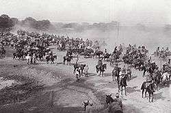 Grand Trunk Road, at Etah, during British Raj | |
 Etah Location in Uttar Pradesh, India | |
| Coordinates: 27°38′N 78°40′E / 27.63°N 78.67°ECoordinates: 27°38′N 78°40′E / 27.63°N 78.67°E | |
| Country |
|
| State | Uttar Pradesh |
| District | Etah |
| Founded by | King Dil Sukh Rai Bahadur |
| Government | |
| • Etah (Lok Sabha constituency )MP | Rajveer Singh (BJP) |
| Population (2011) | |
| • Total | 131,023 |
| • Rank | 272nd in India |
| Languages | |
| • Official | Hindi |
| Time zone | UTC+5:30 (IST) |
| Vehicle registration | UP-82 |
| Website | http://etah.nic.in/ |
Etah is a municipality town which is also the district headquarters of Etah district of Uttar Pradesh state, India. The driving distance from New Delhi to Etah is 207 km and it takes approximately 4 hours by public transport to reach there.[1][2][3] It is 82 kilometers from Agra, which is one hour and 33 minutes by road.[4] Etah District is part of the Aligarh Division.
Geography
Etah is located at 27°38′N 78°40′E / 27.63°N 78.67°E.[5] It has an average elevation of 170 metres (557 feet). Eesan river flows through there (though very polluted now and almost dried up) behind the village Gajipur Pahore.
Agriculture
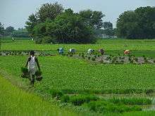
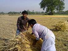
The primary occupation of the people of the district is agriculture. The area is situated between Ganga and Yamuna (Doaab) which is highly fertile (Alluvial soil). The farmers are harvesting three crops in a year. The water for irrigation is available the year round. Major agricultural products are rice, wheat, barley, jowar, bajra, maize; the soil is suitable for the cultivation of tobacco.
Population density
The initial provisional data released by census India 2011, shows that density of Etah district for 2011 is 717 people per km2. In 2001, Etah district density was at 636 people per km2. Etah district administers 2,456 square kilometers of areas.
Cultural
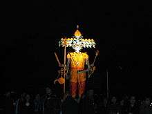
Etah is a developing city. It is the district headquarters since the British times. National Highway 91 (India)(NH 91) GT Road passes through city Etah. The Padav maidan (open field) is the field used for the army during army movements. Every year this field is used for Ram-Lila at Dussehra in month September and October and for exhibitions in month from December to February.
Demographics
As per provisional data of 2011 census, Etah urban agglomeration had a population of 131,023, out of which males were 69,446 and females were 61,577. The literacy rate was 85.62 per cent.[6]
As of 2001 India census,[7] Etah has a population of 107,098. Males constitute 53% of the population and females 47%. Etah has an average literacy rate of 68%, higher than the national average of 59.5%: male literacy is 73%, and female literacy is 63%. In Etah, 14% of the population is under 6 years of age.
Developments
The opening of railway line by the first president Rajendra Prasad. Here is only one small railway line from ETAH to Tundla and further railway connectivity to Kasganj and Aligarh is on high demand by people of Etah.
Railway Ministry has approved the survey for direct trains to New Delhi, Agra and Aligarh.
A thermal power project of 4000 MW has been proposed, will situated at Nandpur Belamai near Sakit and approximately 20 km from Etah, Ministry of Environment has cleared the project. Land acquisition work is over and construction of the same shall start in 2015, will boost up the power supply in UP. A new firing range is built in Etah on Nidhauli road.
Religious places
The Kailash Mandir at Etah was built by King Dil Sukh Rai Bahadur and is 148 years old.
Noah Kera village was known for marriage of Lord Sri Krishna with Rukmini.
Bhooteshwar is a place for Hindu bodies to be cremated.
Food
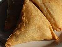
Etah food consists of the food prepared in the state of Uttar Pradesh, India. It consists of the Mughlai near in Agra cuisines and comprises vegetarian and non-vegetarian foods. Dum biryani, kababs, and kormas are some of the dishes made in this region.
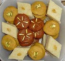 Assorted halva including sooji, chana, and gajar halva
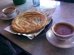 Paratha served with tea
 Puri with accompaniments
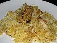 Chicken Dum Biryani
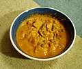 Navratan korma
 Chicken curry with chapati
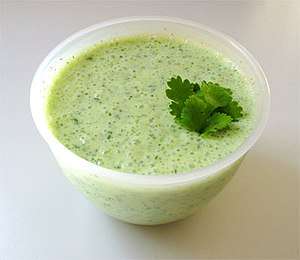
Education

Etah beside of its rich cultural diversity is too famous form its educational institutes .Schools in the town include B.S.D. Public School, Assisi convent school,BPS Public School, SMS Jr. High school-Shikohabad Road, Kendriya Vidyalaya, Jawahar Navodaya Vidyalaya, St. Paul's Sr. Sec. School, Gyan Bharti Inter College, Tulip Public School, Sarswati Vidya Mandir, Sri Ram Bal Bharati Higher Secondary School, Dr. Lokman Das Public School, Apex Public School, S.B Public School, Satyasheel Public School Bhojpur Nagla Jawahari, Christian Agricultural Inter College, G.I.C Inter College, JLN Public school, Bhagipur, Gandhi Smark inter College, Arya Vidyalay, Printis Girls College, G.G.I.C. Inter College and Maharani Lakshmi Bai Inter College are some of the schools in Etah. Ganjdundwara PG College and Dr. Z.H. Degree College and Jawaharlal Nehru Degree College Etah are colleges in the district for science students.
Places to visit
There is a bird sanctuary about 10.0 km from this village called Patna Pakshi Vihar maintained by Govt of Uttar Pradesh.
Public spaces
Mehta Park and Thandi Sadak, Ghanta Ghar and Hathi Gate, Pipal Adda, are "hangout" places for people of the area.
Mehta Park is known for its Indian dish samaosa but more for the cheela and forest area near railway station. This railway station is almost barren so it is also a good place to visit and spend evenings. This is barren in the sense that there are just one train which comes in at 8:30 am & 3:00 pm and leaves after 15 minutes and halts at tundla junction and stays there.
Just behind the gurukul there is very huge ground commonly known as maalgodam where almost all the time cricket is being played
Notable people
References
- ↑ Distance between Etah, Uttar Pradesh and New Delhi, Delhi 128 Miles / 207 km. Distancebetweencities.co.in. Retrieved on 2014-01-02.
- ↑ Fifth phase of UP polls to seal Yadavs' fate. Hindustan Times (2012-02-22). Retrieved on 2014-01-02.
- ↑ https://books.google.co.in/books?id=8V4IAAAAQAAJ&pg=PA237&dq=Jats+Gujars+and+Ahirs&hl=en&sa=X&ei=H0m3VPf_JI2zuASO84LgBw&ved=0CCQQ6AEwAjhk#v=onepage&q=Ahirs&f=false
- ↑ Distancebetween.co. Retrieved on 2018-04-07.
- ↑ Falling Rain Genomics, Inc – Etah. Fallingrain.com. Retrieved on 2014-01-02.
- ↑ "Urban Agglomerations/Cities having population 1 lakh and above" (PDF). Provisional Population Totals, Census of India 2011. Retrieved 2012-07-07.
- ↑ "Census of India 2001: Data from the 2001 Census, including cities, villages and towns (Provisional)". Census Commission of India. Archived from the original on 2004-06-16. Retrieved 2008-11-01.