Kushinagar district
| Kushinagar district | |
|---|---|
| District of Uttar Pradesh | |
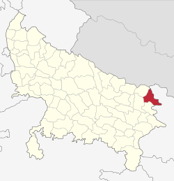 Location of Kushinagar district in Uttar Pradesh | |
| Country | India |
| State | Uttar Pradesh |
| Administrative division | Gorakhpur |
| Headquarters | Padrauna |
| Tehsils | Padrauna, Khadda, Kushinagar, Hata, Tamkuhiraj, Captanganj |
| Government | |
| • Lok Sabha constituencies | Kushinagar |
| • Assembly seats | Padrauna, Khadda, Ramkola, Hata, Fazilnagar, Tamkuhiraj, Kushinagar |
| Area | |
| • Total | 2,873.5 km2 (1,109.5 sq mi) |
| Population (2011) | |
| • Total | 3,560,830 |
| • Density | 1,200/km2 (3,200/sq mi) |
| • Urban | 4.87 per cent |
| Demographics | |
| • Literacy | 67.66 per cent |
| • Sex ratio | 955 |
| Major highways | NH-28 and NH28B |
| Website | Official website |
| District Officers | |
|---|---|
| Government | |
| • District Magistrate | Dr. Anil Kumar Singh |
| • A.D.M | Mr.K.L. Tiwari |
Kushinagar is a district of Uttar Pradesh state in northern India situated in the easternmost part of the state. It has the administrative headquarters at Ravindra Nagar Dhoos in Padarauna. The district is named such after the town Kushinagar, a Buddhist pilgrimage site where Gautama Buddha attained parinirvana in the 5th century BCE. Since the independence of India, Kushinagar district was a part of Deoria District and came into existence on 13 May 1994 as a separate district division. It was earlier known as Padarauna and thereafter was renamed Kushinagar on 19th June 1997.[1]
Location
Kushinagar District is bounded on the east by Bihar state, on the southwest by Deoria District, on the west by Gorakhpur District, and on the northwest by Maharajganj District. It is part of Gorakhpur Division.
Economy
In 2006 the Ministry of Panchayati Raj named Kushinagar one of the country's 250 most backward districts (out of a total of 640).[2] It is one of the 34 districts in Uttar Pradesh currently receiving funds from the Backward Regions Grant Fund Programme (BRGF).[2]
Transport
- The Indian Government has approved a project for the construction of an International Airport which would be completed till 2018.
- In 2017, Uttar Pradesh Government has approved a project for develop Kushinagar bus station as an International Bus Station.
Demographics
According to the 2011 census Kushinagar district has a population of 3,560,830,[3] roughly equal to the nation of Lithuania[4] or the US state of Connecticut.[5] This gives it a ranking of 81st in India (out of a total of 640).[3] The district has a population density of 1,226 inhabitants per square kilometre (3,180/sq mi).[3] Its population growth rate over the decade 2001-2011 was 23.08%.[3] Kushinagar has a sex ratio of 955 females for every 1000 males,[3] and a literacy rate of 67.66%.[3]
References
- ↑ http://www.censusindia.gov.in/2011census/dchb/0958_PART_B_DCHB_KUSHINAGAR.pdf
- 1 2 Ministry of Panchayati Raj (September 8, 2009). "A Note on the Backward Regions Grant Fund Programme" (PDF). National Institute of Rural Development. Archived from the original (PDF) on April 5, 2012. Retrieved September 27, 2011.
- 1 2 3 4 5 6 "District Census 2011". Census2011.co.in. 2011. Retrieved 2011-09-30.
- ↑ US Directorate of Intelligence. "Country Comparison:Population". Retrieved 2011-10-01.
Lithuania 3,535,547 July 2011 est.
- ↑ "2010 Resident Population Data". U. S. Census Bureau. Archived from the original on 2013-10-19. Retrieved 2011-09-30.
Connecticut 3,574,097
External links
| Wikimedia Commons has media related to Kushinagar district. |
Places adjacent to Kushinagar district | ||||||||||
|---|---|---|---|---|---|---|---|---|---|---|
| ||||||||||
Coordinates: 26°54′09″N 83°58′55″E / 26.90250°N 83.98194°E