Pondicherry
| Pondicherry புதுச்சேரி | |
|---|---|
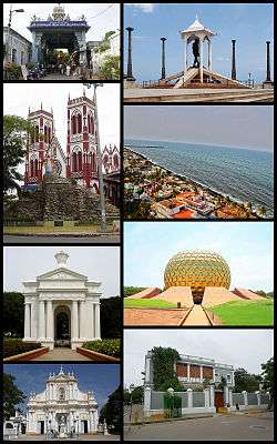 Clockwise from top right: bando statue, Promenade Beach, Matrimandir, Sri Aurobindo Ashram, Immaculate Conception Cathedral, Aayi Mandapam (monument), Basilica of the Sacred Heart of Jesus, Manakula Vinayagar Temple | |
| Nickname(s): "Paris of the East",[1] "Pondy" | |
  | |
| Coordinates: 11°55′N 79°49′E / 11.917°N 79.817°ECoordinates: 11°55′N 79°49′E / 11.917°N 79.817°E | |
| Country | India |
| State | Puducherry (PY) |
| District | Puducherry |
| Established | 1674 |
| Government | |
| • Type | Municipal Council |
| • Body | Pondicherry Municipal Council (PDY) |
| Elevation | 3 m (10 ft) |
| Population (2011) | |
| • City | 654,392 |
| • Density | 9,166/km2 (23,740/sq mi) |
| • Metro | 654,392 |
| Languages | |
| • Official | Tamil, French, English, |
| Time zone | UTC+5:30 (IST) |
| PIN CODE | 605001-605014 |
| Telephone code | (International) +91-413-, (National) 0413- |
| Vehicle registration | PY-01,PY-05 |
| Website | pdymun.in |
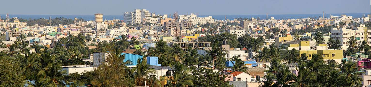
Pondicherry (/pɒndɪˈtʃɛri/ or /-ˈʃɛri/), officially known as Puducherry, is the capital and the most populous city of the Indian Union Territory of Puducherry, with a population of 745,600 and an area of 492 sq km. The city is situated in Puducherry district of the union territory, and is surrounded by the state of Tamil Nadu to which it shares most of its culture. It is affectionately known as Pondy and short code as "Pdy", and has been officially known by the alternative name Puducherry in Tamil (New Town) since 2006.[2]
Pondicherry city consists of 42 wards. Wards 1–10 are located in north of the city. Wards 11–19 are located in Boulevard Town and remaining wards are located in the southwest of the downtown.[3]
History
The history of the city of Pondicherry is recorded only after the arrival of Dutch, Portuguese, British and French colonialists. By contrast, nearby places such as Arikamedu, Ariyankuppam, Kakayanthoppe, Villianur and Bahur, which were colonised by the French East India Company over a period of time and which later became the union territory of Pondicherry, have recorded histories that predate the colonial period.
A marketplace named Poduke or Poduca is recorded as a Roman trading destination from the mid 1st century. The area was part of the Pallava Kingdom of Kanchipuram in the 4th century. The Cholas of Thanjavur held it from the 10th to 13th centuries, only to be replaced by the Pandya Kingdom in the 13th century. The Vijayanagar Empire took control of almost all of the South of India in the 14th century and maintained control until 1638 when they were supplanted by the Sultan of Bijapur.
The French East India Company established this town as their headquarters in 1674. Five trading posts were established along the south Indian coast between 1668 and 1674. The town was separated by a canal into the French Quarter and the Indian Quarter.[4]
During the Anglo-French wars (1742–1763), Puducherry changed hands frequently. On 16 January 1761, the British captured Puducherry from the French, but the Treaty of Paris (1763) at the conclusion of the Seven Years' War returned it.[5] The British took control of the area again in 1793 at the Siege of Pondicherry amid the Wars of the French Revolution, and returned it to France in 1814. When the British gained control of the whole of India in the late 1850s, they allowed the French to retain their settlements in the country. Pondicherry, Mahé, Yanam, Karaikal and Chandernagor remained a part of French India until 1954 when it was incorporated into the Indian Union along with the rest of French India.
On 18 October 1954 in a general election involving 178 people in Pondicherry Municipal and Commune Panchayat, 170 people were in favour of independence and eight people voted against. The de facto transfer of the French Indian territories from French governance to the Indian union took place on 1 November 1954, and was established as the union territory of Pondicherry. However, the formal de jure transfer of territory agreement between France and India was signed on 16 August 1962.
Topography
The topography of Pondicherry is the same as that of coastal Tamil Nadu. Pondicherry's average elevation is at sea level, and a number of sea inlets, referred to as "backwaters" can be found. Puducherry experiences extreme coastal erosion as a result of a breakwater constructed in 1989,[6] just to the south of the town. Where there was once a broad, sandy beach, now the city is protected against the sea by a 2-km-long seawall. While there was an early seawall made by the French government in 1735, this was not "hard structure coastal defense" so much as an adjunct to the old shipping pier and a transition from the beach to the town, which sits at a height of 8.5 m above sea level.[7]
Today, the seawall consists of rows of granite boulders which are reinforced every year in an attempt to stop erosion. As a consequence of the seawall, Pondicherry experiences severe seabed erosion and turbulence at the coastal margin, resulting in an extreme loss of biodiversity within the critical intertidal zone. Whenever gaps appear as the stones fall into the continually eroding seabed, the government of Puducherry adds more boulders. Pondicherry's seawall has also caused beach erosion to migrate further up the coast, to the fishing villages in Puducherry and Tamil Nadu to the north of the town.[8]
Economy
In 2012, the Ministry of Power inaugurated the Smart Grid project in Puducherry.[9] Farming around Pondicherry include crops such as rice, pulses, sugarcane, coconuts, and cotton. In 2016, the Pondicherry State Government Employees Central Federation presented a status paper on the fiscal and social crisis in Puducherry to Union Home Minister Rajnath Singh. The report stated that a "combination of a staggering debt, stagnant tax revenues and rampant misappropriation of funds has throttled the economy of the Union Territory" and called for measures on a war footing to "deliver good governance and end corruption."[10]
Climate
The climate of Pondicherry is classified by Köppen-Geiger system as tropical wet and dry (As),[11] similar to that of coastal Tamil Nadu. Summer lasts from April to early June, when maximum temperatures frequently hit the 41 °C (106 °F) mark. The average maximum temperature is 36 °C (97 °F). Minimum temperatures are in the order of 28–32 °C (82–90 °F). This is followed by a period of high humidity and occasional thundershowers from June till September.
The northeast monsoon sets in during the middle of October, and Pondicherry gets the bulk of its annual rainfall during the period from October to December. The annual average rainfall is 1,240 mm (49 in).[12] Winters are warm, with highs of 30 °C (86 °F) and lows often dipping to around 18–20 °C (64–68 °F).
| Climate data for Pondicherry Airport | |||||||||||||
|---|---|---|---|---|---|---|---|---|---|---|---|---|---|
| Month | Jan | Feb | Mar | Apr | May | Jun | Jul | Aug | Sep | Oct | Nov | Dec | Year |
| Record high °C (°F) | 33.2 (91.8) |
35.2 (95.4) |
37.2 (99) |
41.8 (107.2) |
43.1 (109.6) |
41.7 (107.1) |
40.7 (105.3) |
40.2 (104.4) |
38.6 (101.5) |
37.9 (100.2) |
36.3 (97.3) |
32.5 (90.5) |
43.1 (109.6) |
| Average high °C (°F) | 29.0 (84.2) |
30.0 (86) |
31.2 (88.2) |
32.8 (91) |
34.6 (94.3) |
35.8 (96.4) |
34.5 (94.1) |
33.9 (93) |
33.1 (91.6) |
31.5 (88.7) |
29.8 (85.6) |
29.0 (84.2) |
32.1 (89.8) |
| Average low °C (°F) | 21.9 (71.4) |
22.5 (72.5) |
23.8 (74.8) |
25.9 (78.6) |
26.8 (80.2) |
26.5 (79.7) |
25.7 (78.3) |
25.2 (77.4) |
24.9 (76.8) |
24.5 (76.1) |
23.6 (74.5) |
22.6 (72.7) |
24.5 (76.1) |
| Record low °C (°F) | 17.1 (62.8) |
17.3 (63.1) |
18.8 (65.8) |
21.9 (71.4) |
21.9 (71.4) |
21.5 (70.7) |
21.6 (70.9) |
21.4 (70.5) |
21.5 (70.7) |
19.6 (67.3) |
16.5 (61.7) |
17.1 (62.8) |
16.5 (61.7) |
| Average precipitation mm (inches) | 12.3 (0.484) |
22.2 (0.874) |
19.3 (0.76) |
7.8 (0.307) |
48.6 (1.913) |
48.0 (1.89) |
89.5 (3.524) |
132.3 (5.209) |
132.8 (5.228) |
273.9 (10.783) |
350.0 (13.78) |
217.3 (8.555) |
1,354 (53.307) |
| Average rainy days | 0.9 | 0.9 | 0.8 | 0.4 | 1.9 | 2.8 | 5.3 | 6.7 | 6.5 | 10.3 | 11.8 | 6.8 | 55.0 |
| Source: India Meteorological Department (record high and low up to 2010)[13][14] | |||||||||||||
Demographics
At the 2011 India census,[15] Pondicherry had a population of 654,392, evenly divided between the sexes. Pondicherry had an average literacy rate of 76%, higher than the national average of 59.5%: male literacy was 82%, and female literacy was 71%. In Pondicherry, 11% of the population was under 6 years of age.
The majority speaks Tamil in Pondicherry, while there is a community of French people in Pondicherry and a number of French institutions such as the consulate of France in Pondicherry, the French Institute of Pondicherry, La liberté(French Learning Institute in Pondicherry) and L'Alliance française.[16]
Urban agglomeration
| Local bodies | Area | Population |
|---|---|---|
| Pondicherry Municipality | 19.54 km2 | 241,773 |
| Oulgaret Municipality | 36.70 km2 | 300,028 |
| Total | 56.24 km2 | 541,801 |
Data according to 2011 census
There are two proposals by the Puducherry government, firstly to merge Pondicherry and Oulgaret municipalities, and upgrade Pondicherry municipality into a '"municipal corporation", and secondly to upgrade Villianur and Ariyankuppam commune panchayats into municipalities, which would increase the Pondicherry region's urban area around 155 km2. of the total 292 km2.
Transport
Road
Pondicherry is connected to Chennai via the East Coast Road through Mahabalipuram.[17] The Pondicherry Road Transport Corporation runs buses within the city.[18] The Tamil Nadu State Transport Corporation operates Volvo air-conditioned services from Chennai to Pondicherry.[19] There are daily bus services from several main stops from Chennai. The Pondicherry road transport corporation also operates Volvo buses to Chennai and to various places.
Rail
PDY/Puducherry (Pondicherry) is connected by train to all metros: Chennai, Delhi, Kolkata, and Mumbai, as well as other important cities such as Kanyakumari, Hyderabad, Pune, Bhubaneshwar, Bangalore,Visakhapatnam and Mangalore.[20][21]
Important trains: 12867/Howrah-Puducherry (Aurobindo) SF Express, 22403/Puducherry – New Delhi SF Express and 12898/Bhubaneswar-Pondicherry Weekly SF Express
Air
Puducherry Airport is located at Lawspet. It has direct flights to Hyderabad, Bangalore operated by SpiceJet Airlines. It also has chartered flights to Chennai operated by TruJet Airlines.
Tourism
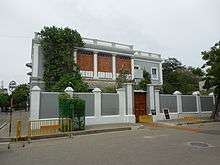
Pondicherry is a popular tourist destination in South India. The city has many colonial buildings, churches, temples, and statues which, combined with the systematic town planning and planned French style avenues, still preserve much of the colonial ambiance.
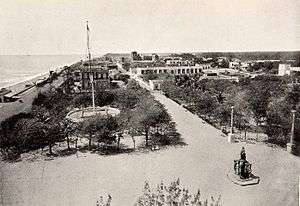
While the sea is a popular draw for tourists, Pondicherry no longer has the beautiful sand beaches that once graced its coastline. The breakwater to the harbour and other hard structures constructed on the shore caused extreme coastal erosion and the sand from Pondicherry's famous Promenade Beach was permitted to disappear entirely. As a result of the town's seawall and groyne construction, the beaches further up the coast to the north have also been lost. An enormous deposition of sand has accrued to the south of the harbour breakwater, but this is not a commodious beach and is not easily accessible from the town.
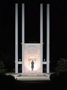
The Sri Aurobindo Ashram, located on rue de la Marine, is one of the most important ashrams in India, founded by the renowned Freedom Fighter and spiritual philosopher Sri Aurobindo. Auroville (City of Dawn) is an "experimental" township located 8 km north-west of Pondicherry. It is meant to be a universal town where men and women of all countries are able to live in peace and progressive harmony, above all creeds, all politics and all nationalities.
There are a number of old and large churches in Pondicherry, most of which were built in the 18th and 19th centuries. A number of heritage buildings and monuments are present around the Promenade Beach, such as the Children's Park & Dupleix Statue, Gandhi statue, Nehru Statue, Le Café, French War Memorial, 19th Century Light House, Bharathi Park, Governors Palace, Romain Rolland Library, Legislative Assembly, Pondicherry Museum and the French Institute of Pondicherry at Saint-Louis Street.
Puducherry is also popular for its eateries that cover a wide variety of cuisines ranging from French, Indian and Italian to Mexican, Thai and Chinese. Some restaurants also serve a unique Indo-French cuisine that gives tourists a taste of Puducherry's colonial influences. Most popular eateries include Baker's Street, The White Town Cafe, Zuka, Carte Blanche and La Maison Rose.
Puducherry Botanical Gardens is located south of the New Bus Stand. Chunnambar Backwater resort is situated 8 km from Pondicherry, along the Cuddalore Main Road. This tropical resort is flanked by a quiet-flowing creek on one side. Boating and tree house are very popular.
Arulmigu Manakula Vinayagar Devasthanam on Manakula Vinayagar Street is a Hindu temple, which houses Lord Ganesha. Sri Manakula Vinayagar Temple was in existence before the French came and settled in Pondicherry i.e. before 1666. According to Sasthra, Lord Ganesha is named in 16 types based on his various forms, out of which this god facing the east coast near the Bay of Bengal was named as Bhuvaneshar Ganapathy, now called as Manakula Vinayagar. In Tamil, 'Manal' means sand and 'Kulam' means pond near the sea. Earlier, there was full of sand around the pond. So, the people called the god as Manal Kulathu Vinayagar [means God near the pond of sand]. Later, it was named as Manakula Vinayagar.
Thirukaameeswarar Temple is one of the ancient temples located in a rural town called Villianur (the ancient name is Vilvanallur, meaning "vilva marangal niraindha nalla vur"), which is located about 10 km away (towards Villupuram) from Pondicherry town. This temple is renowned as Periya Koil "Big Temple". The prime god is Lord Shiva and the prime goddess is Goddess Kokilambigai. In addition, there are also other Hindu gods such as Murugan, Vinayagar, Thakshanamoorthy, Perumal, Bhramah, Chandikeshwarar, Natarajar, Navagrahah, and 63 Naayanmaars. The pioneers in this temple say that the age of this temple is about 1000+ years. It is thought to have been built by one of the Chola kings. There is also a huge "temple pond". The "Ther Thiruvizha" procession is celebrated at this temple.
Apart from sight seeing places for the tourists, there are a number of various bakeries and restaurants that cater to the Europeans taste buds. For others there are many Indian, Continental, Chinese and fast food restaurants to choose from. Pondicherry being once a French colony has good French cuisine i.e. Cafe des Arts, Rendezvous, Le Dupleix, Villa Shanti, Palais de Mahe, Maison Perumal. Some other notable restaurants for pizzas Cafe Xtasi, Auro Pizza and Tanto Pizzeria, & The Sunway Manor and for bakeries Hot Breads, Daily Breads, Bon Bakes, Grand Bakery and Zuka Choco-La.
List of Lieutenant governors
- S.L. Silam
- B.D. Jatti
- Chhedilal
- B.T. Kulkarni
- Ram Kishore Vyas
- R.N. Haldipur
- K.M. Chandy
- Kona Prabhakara Rao
- Tribhuvan Prasad Tewary
- Ranjit Singh Dyal
- Chandrawati
- Har Swarup Singh
- Rajendra Kumari Bajpai
- Rajani Rai
- K. R. Malkani
- Nagendra Nath Jha
- M. M. Lakhera
- Mukut Mithi
- Bhopinder Singh
- Govind Singh Gurjar
- Surjit Singh Barnala^
- Iqbal Singh
- Virendra Kataria
- A. K. Singh[1]
- Kiran Bedi
Literature
- Tamil Poet Bharathiyar.
- Tamil Poet Bharathidasan.
- Anandaraj, Tamil Film Actor
- Kalki Koechlin, Hindi Movie Actress
- Ayesha Kapur, Hindi Movie Actress
- M. Night Shyamalan, Hollywood Director
- Tao Porchon-Lynch, Yoga Instructor, American Actress
- Jc.R.Manivannan , CEO & Founder of Seyfert Infotech
Science and technology
- S. Somasegar, former senior vice-president, Microsoft
- Ganapathi Thanikaimoni, Indian scientist and director of the Palynology laboratory of the French Institute of Pondicherry
- Yvonne Artaud, French educationalist and psychologist.
- Navi Radjou, an innovation and leadership strategist based in Silicon Valley.[22]
Armed forces
- Maréchal Le Marquis de Lauriston (1768–1828), a very senior-ranking military commander in the French Army, was born in Pondicherry.
Fictional
- Home town of the titular character in Yann Martel's Life of Pi.
- Prince Pondicherry, a character from Roald Dahl's Charlie and the Chocolate Factory, is named for the city. The character asked that Willy Wonka build him a palace made of chocolate. Given the heat of the Indian climate, this decision worked out poorly for the fictitious prince.
- Chatur from the Bollywood movie 3 Idiots mentioned that he grew up in Pondicherry
See also
- Mahé, India
- Indira Gandhi Medical College and Research Institute
- Jawaharlal Institute of Postgraduate Medical Education & Research
- Mahatma Gandhi Medical College & Research Institute
- Pondicherry Engineering College
- Pondicherry University
- Pondicherry urban area
- Rajiv Gandhi College of Veterinary and Animal Sciences
- Yanam, India
- Manakula Vinayagar Temple
References
- ↑ "The Paris of the East". Archived from the original on 2012-12-16.
- ↑ "Bill to rename Pondicherry as Puducherry passed". The Hindu. 22 August 2006. Retrieved 2 May 2016.
- ↑ Town and Country Planning Department, Pondicherry, India: City Development Plan – Pondicherry, Final Report, March 2007, S. 159 Archived 19 June 2009 at the Wayback Machine.
- ↑ WORRALL, JILL (11 April 2016). "Peace, love and a French flavour in Pondicherry, South India". www.stuff.co.nz. Retrieved 2 May 2016.
- ↑ Chand, Hukam. History Of Medieval India, 202.
- ↑ The story of Pondicherry's eroding coastline
- ↑ "Archived copy". Archived from the original on 16 September 2009. Retrieved 22 June 2009.
- ↑
- ↑ "Smart grid project inaugurated". Puducherry. The Hindu. 20 October 2012. Retrieved 23 October 2012.
- ↑ Special Correspondent (18 October 2016). "Report paints grim picture of Puducherry's economy". The Hindu. Retrieved 28 October 2017.
- ↑ "Climate: Pondicherry – Climate graph, Temperature graph, Climate table". Climate-Data.org. Retrieved 6 October 2013.
- ↑ "Archived copy". Archived from the original on 26 July 2009. Retrieved 10 July 2009.
- ↑ "Pondicherry Climatological Table Period: 1971–2000". India Meteorological Department. Retrieved 11 April 2015.
- ↑ "Ever recorded Maximum and minimum temperatures up to 2010" (PDF). India Meteorological Department. Archived from the original (PDF) on 21 May 2013. Retrieved 11 April 2015.
- ↑ "Census of India 2001: Data from the 2001 Census, including cities, villages and towns (Provisional)". Census Commission of India. Archived from the original on 16 June 2004. Retrieved 1 November 2008.
- ↑ "Pondicherry: Forever France? by Anand Jha". Boloji.com. 10 November 2002. Retrieved 18 March 2013.
- ↑ Ramakrishnan, Deepa (23 February 2012). "After a decade on fast lane, ECR is set to expand". The Hindu. Chennai. Retrieved 16 September 2012.
- ↑ "20 buses launched in urban routes". The Hindu. Puducherry. 8 June 2010. Retrieved 19 September 2012.
- ↑ V, Venkatasubramanian (19 February 2010). "A boon to Kancheepuram unit of TNSTC". The Hindu. Kancheepuram. Retrieved 15 September 2012.
- ↑ "Delhi-Puducherry train link from July 3". The Hindu. 25 June 2011. Retrieved 16 September 2012.
- ↑ "Changes in train timings". The Hindu. Puducherry. 13 September 2012. Retrieved 16 September 2012.
- ↑ http://thinkbusiness.nus.edu/articles/item/126
External links
| Wikimedia Commons has media related to Pondicherry. |
| Wikivoyage has a travel guide for Pondicherry. |
- (in English) Official website of the Government of the Union Territory of Puducherry
- (in English) Events & Happenings in and around Puducherry
- (in English) Pondicherry Media
- (in English) Puducherry Housing Scheme
|
| Authority control |
|---|