Gumla district
| Gumla district | |
|---|---|
| district | |
 | |
| Country |
|
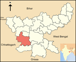
| State | Jharkhand |
| Administrative Division | South Chotanagpur division |
| Headquarters | Gumla |
| Area | |
| • Total | 5,327 km2 (2,057 sq mi) |
| Population (2011) | |
| • Total | 1,025,656 |
| • Density | 193/km2 (500/sq mi) |
| Languages | |
| • Official | Hindi, Odia, kurukh, nagpuri, Ho |
| Time zone | UTC+5:30 (IST) |
| ISO 3166 code | IN-JH |
| Vehicle registration | JH 07 |
| LokSabha | Lohardaga (shared with Lohardaga district) |
| Website | http://gumla.nic.in/ |
Gumla district is one of the twenty-four districts of Jharkhand state, India, and Gumla town is the administrative headquarters of this district.
Etymology
For centuries, the place was a meeting center for people from the hinterland who flocked here to exchange goods using the barter system, and the place was called Gaw-Mela. Gumla is believed to derive its name from Gaw-Mela, which consists of two words of Hindi (also used in several local dialects), namely, Gaw (cows and the cattle) and Mela, that is, a fair. The place became known as Gaw-mela, and then the word transformed itself into Gumla.
Administration
Blocks/Mandals
Gumla district consists of 12 Blocks. The following are the list of the Blocks in Gumla district:
- Basia block
- Bherno block
- Bishunpur block
- Chainpur block
- Dumri block
- Ghaghra block
- Gumla block
- Kamdara block
- Palkot block
- Paramvir Albert Ekka block
- Raidih block
- Sisai block
History
During British rule Gumla was under Lohardaga district. In 1843 it was brought under Bishunpur province that was further named Ranchi. In fact Ranchi district came into existence in 1899. In 1902 Gumla became Sub-division under Ranchi district. On 18 May 1983 Gumla District came into existence. Sri Jagannath Mishra then ruling Chief Minister of Bihar inaugurated it and Sri Dwarika Nath Sinha acquired the post of 1st deputy commissioner of the just born district.
Gumla is considered to be the birthplace of the Hindu God Hanuman. A temple a few kilometers away from the city off the Gumla-Ghaghra road is dedicated to him and his mother. The district contains mountains named "Risyamook", which are mentioned in the Ramayana.
The district is currently a part of the Red Corridor.[1]
The Gumla District had a place in the middle of the town called (Bazar Tanr), still there, where people used to bring their animals, mostly cows, and this way the fair was called [Gow-Mela] (a fair of cows). So this is how it is called Gumla.
Geography
Gumla is located at 23°00′N 84°30′E / 23°N 84.50°E. Geographically, Gumla is located on southern part of the Chota Nagpur plateau which forms the eastern edge of the Deccan plateau system.
There are three major rivers, which flow through the Gumla district viz. the South Koel, the North Koel and the Sankh. There are various streams/ tributaries to the main rivers on which there are some picturesque waterfalls, as for example Sadni Falls.
The terrain is highly undulating and there are existence of many rivers and streams. The forest cover of the district is 1.35 lakh hectares out of the total 5.21 lakh hectares of land i.e. round 27% of the total area of the district.
Climate
Gumla district enjoys a good climate characterized by a pleasant cold and temperate weather conditions. Gumla has a sub-tropical climate. Temperature ranges from maximum 40 to 20 °C during summer, and minimum 21 to 3 °C during winter. The annual rainfall is about 1450 mm. From June to September the rainfall level is about 1,150 mm.
Economy
Gumla district has rich natural and mineral resources. There are 23 bauxite mines and 68 stone mines in Gumla district. Besides these there is good number of brick makers. In Gumla District the important minerals like bauxite and laterite (aluminium ore) are found in villages of Amkipani, Langdatanr, Chirodih, Jalim, Narma, Bahagara and Gurdari of Bishunpur block, Langatanr, Lupungpat and Chota-Agiatu in Chainpur block and Harup, Serengdag and Jalim in Ghaghra block. Beside these china clay is also found in some part of the district. Other mining activities like stone crusher, Brick kiln and stone chip mining lease are also available in different part of the district.
In 2006 the Indian government named Gumla one of the country's 250 most backward districts (out of a total of 640).[2] It is one of the 21 districts in Jharkhand currently receiving funds from the Backward Regions Grant Fund Programme (BRGF).[2]
Demographics
According to the 2011 census Gumla district has a population of 1,025,656,[3] roughly equal to the nation of Cyprus[4] or the US state of Montana.[5] This gives it a ranking of 439rd in India (out of a total of 640).[3] The district has a population density of 193 inhabitants per square kilometre (500/sq mi) .[3] Its population growth rate over the decade 2001-2011 was 23.21%.[3] Gumla has a sex ratio of 993 females for every 1000 males,[3] and a literacy rate of 66.92%.[3]
As of 2011 India census,[6] Gumla had a population of 1,025,656 which is 3.11% of total Jharkhand Population. Out of total 1,025,656: 514,730 are males and 510,926 are female; this makes the sex ratio of Gumla 993, which better than India's sex ratio. Gumla has an average literacy rate of 66.92%. In Gumla, 15% of the population is under 6 years of age.
Higher and Technical Education
From 2018, Deptt. of Higher and Technical Education, Govt. of Jharkhand is going to start Polytechnic College "Gumla Polytechnic".The Polytechnic college will be run and manage under "PPP" Mode by Gumla Educational Foundation.
Languages
The major languages spoken in this region of Jharkhand are Hindi, Nagpuri, Kurukh, Bengali, Odia & Ho.
Languages spoken here also include Asuri, an Austroasiatic language spoken by approximately 17,000.[7]
Languages like Khortha, Oraon, Kudukh, and Mundari are also spoken in Tribal areas Of Gumla District.
Culture
Gumla has a rich Aadiwasi culture, and "Chhotanagpur ki raani" is a hill station located in this district.
- Karma - A holy festival celebrated by the people in almost all places of this district.
- Sarhul - A festival celebrated by the people and Jhankis and Rallies were organised around the main town Gumla. Ladies put flowers (Gulaichi Flower) on their hair and gents put it on their ears.
- Ramnavami - A holy festival celebrated with huge sound, and Jhankies and Rallies.
Gumla has a rich tribal culture. The majority of people (about 80%) speak Nagpuri, but Hindi is used for communicating with non-tribal people.
Tourist attractions
- Netarhaat - A few kilometers away from the Gumla District, is also called 'The Door of Heaven'.
- Ramrekha - A tourist spot it is said that here you can see many marks of "Maa Sita" including Charan Paduka, many pictures are taken on the rocks. People believe that Maa Sita used to live there.
- Ranida -It is about 12 kilometers away from Gumla main town. It is a mind-blowing tourist spot. There is also some rumors about this place that it is haunted. According to many people it is said that a couple who had recently got married went there for a picnic tour , and they saw something terrible and were scared badly. You can feel the sound of water colliding with rocks here. During winter session this place becomes more romantic.
- Palkot-This is a place located 40–45 km from the district headquarters.
There is a gufa which is said to be used by Pandavas, during epic Mahabharata.
- Pampapur - There are many places like Shitalpur, Malmalpur, Ghodlata, Panchmukhi around this place.
It is said that maa sita used to make powder of turmeric and some stones (big pieces) of this place are still found in yellow color.
- a place called Rakas Rock (Rakas Tangra) where Bali and Sugreev fought (in Ramayan) you can find still there is some blood around the rocks.
- Ninjhar - here water flows and no one knows the source of the water. It is still a mystery.
- Anjan - Small village about 18 km away from Gumla. The name of the village has been derived from the name of goddess Anjani, mother of Hanuman. Many objects of archeological importance obtained from this place has been placed at Patna Museum. It is birthplace of Hanuman.
- Baghmunda - It is known for religious stone idols (Ajanta caves stone idols).
- Rajendra - Is surrounded by hills on all sides. It is as well-known as any other hill stations in India.
- Dewaki - It is a place of religious importance, and has a Shiv-Parvati temple. During Sawan month devotees from every corner visit here to offer water to the Shiva Linga and the place becomes a fair ground.
- Hapamuni - The ancient village Mahamaya temple that is the identity of this village.
- Palkot
- Nagfeni - It is knownfor the Jagannath temple and there is a big rock in the shape of snake 'Nag'.
- Tanginath
- Birsa Munda Agro Park
- Rock Garden.
Flora and fauna
References
- ↑ "83 districts under the Security Related Expenditure Scheme". IntelliBriefs. 2009-12-11. Retrieved 2011-09-17.
- 1 2 Ministry of Panchayati Raj (September 8, 2009). "A Note on the Backward Regions Grant Fund Programme" (PDF). National Institute of Rural Development. Archived from the original (PDF) on April 5, 2012. Retrieved September 27, 2011.
- 1 2 3 4 5 6 "District Census 2011". Census2011.co.in. 2011. Retrieved 2011-09-30.
- ↑ US Directorate of Intelligence. "Country Comparison:Population". Retrieved 2011-10-01.
Cyprus 1,120,489 July 2011 est.
- ↑ "2010 Resident Population Data". U. S. Census Bureau. Retrieved 2011-09-30.
Montana 989,415
- ↑ "Gumla Census 2011 Highlights". Registrar General, India, Ministry of Home Affairs. Archived from the original on 2011-09-12. Retrieved 2011-05-05.
- ↑ M. Paul Lewis, ed. (2009). "Asuri: A language of India". Ethnologue: Languages of the World (16th ed.). Dallas, Texas: SIL International. Retrieved 2011-09-28.
External links
Places adjacent to Gumla district | |
|---|---|