Buldhana
| Buldhana | |
|---|---|
| City | |
| Nickname(s): Bhilthana | |
 Buldhana Location in Maharashtra, India  Buldhana Buldhana (Maharashtra) | |
| Coordinates: 20°31′58″N 76°10′58″E / 20.53278°N 76.18278°E | |
| Country |
|
| State | Maharashtra |
| Region | Vidarbha |
| District | Buldhana |
| Government | |
| • Type | Municipality |
| • Body | Buldhana Municipal Council |
| Population (2011) | |
| • Total | 67,431 |
| • Density | 268/km2 (690/sq mi) |
| Languages | |
| • Official | Marathi |
| Time zone | UTC+5:30 (IST) |
| Vehicle registration | MH 28 |
| Website |
buldhana |
Buldhana is the district headquarters and a Municipal Council in the Buldhana District of Amravati division in the Indian State of Maharashtra. Buldhana is the biggest city in the Buldhana district.
Demographics
As of the 2011 India census,[1] Buldana city had a population of 67,431. Males constitute 52% of the population and females 48%. Buldana has an average literacy rate of 82%, higher than the national average of 59.5%, with male literacy at 82% and female literacy at 72%. 13% of the population is under six years of age.
Languages
The most common language spoken in Buldhana is the Marathi language. Hindi is also spoken by some of the population.[2]
Transport
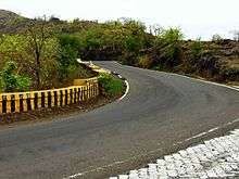
Motor bus, jeep, two-wheeler and railway are the popular modes of transport. There is a Maharashtra State Road Transport Corporation bus stand in the city. There are State Transport bus depots at Buldhana, Malkapur, Chikhli, Mehkar, Khamgaon, Shegaon, and Jalgaon-Jamod. Buldhana is connected to National Highway 6 through Malkapur town by NH753A. There is a construction of 4 lane highway between Ajintha-Buldhana(NH753E) begins, which connect the city to the bigger cities like Aurangabad, Jalgaon, Dhule, Nashik, Mumbai
Malkapur is the nearest railway station. A computerised railway reservation facility is available at Buldhana, while manual a reservation facility is available at the city booking office.
The nearest airport is at Aurangabad, which is 150 kilometres (93 mi) from the city.
Economy
Cotton, sorghum and other cereals, oil seeds, soybean, sunflower, and groundnuts are the predominant crops grown in the district.
Places of interest
- Balaji Temple, Vyankatgiri, Buldhana
- Brudhneshwar Temple, Madh, Buldhana (From this place the river Painganga originates)
- Temple of Jagadamba Mata, Buldhana
- Kondhana Jagdamba Utsav Mandal, Buldhana
- Rajur ghat on Malkapur-Buldhana NH753A
- Girda Anand Sagar on NH753E
- Dyanganga wild life sanctuary which is 20 km from Buldana city
- Sailani Baba dargah ,Sailani
- Jalicha Dev
See also
References
| Wikivoyage has a travel guide for Buldhana. |
| Wikisource has original text related to this article: |
- ↑ "Census of India 2011: Data from the 2011 Census, including cities, villages and towns (Provisional)". Census Commission of India. Archived from the original on 2004-06-16. Retrieved 2008-11-01.
- ↑ M. Paul Lewis, ed. (2010). "Andh: A language of India". Ethnologue: Languages of the World (16th ed.). Dallas, Texas: SIL International. Retrieved 2011-09-28.
Places adjacent to Buldhana | ||||||||||
|---|---|---|---|---|---|---|---|---|---|---|
| ||||||||||
Buldhana district topics | ||
|---|---|---|
| Subdivisions and tehsils |  | |
| Cities, towns and villages |
| |
| Railway stations | ||
| Roads | ||
| Historical places | ||
| Geography | ||
| Lok Sabha constituencies | ||
| Vidhan Sabha constituencies |
| |
| Religious | ||
| People |
| |
| See Also |
| |