Chitradurga district
| Chitradurga district | |
|---|---|
| District | |
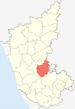 Location in Karnataka | |
| Coordinates: 14°00′N 76°30′E / 14.00°N 76.50°ECoordinates: 14°00′N 76°30′E / 14.00°N 76.50°E | |
| Country |
|
| Division | Bangalore Division |
| Headquarters | Chitradurga |
| Talukas | Chitradurga, Hiriyur, Hosdurga, Molakalmuru, Challakere, Holalkere |
| Government | |
| • Deputy Commissioner | Rajnaik |
| • Member of Parliament | N Chandrappa |
| Area[1] | |
| • Total | 8,440 km2 (3,260 sq mi) |
| Population (2001)[1] | |
| • Total | 1,517,896 |
| • Density | 180/km2 (470/sq mi) |
| Languages | |
| • Official | Kannada |
| Time zone | UTC+5:30 (IST) |
| PIN | 577 501, 502 |
| Telephone code | + 91 (8194) |
| ISO 3166 code | IN-KA-CT |
| Vehicle registration | Chitradurga KA-16 |
| Sex ratio | 1.047 ♂/♀ |
| Literacy | 64.5% |
| Lok Sabha constituency | Chitradurga Lok Sabha constituency |
| Precipitation | 522 millimetres (20.6 in) |
| Website |
chitradurga |
Chitradurga district is an administrative district of Karnataka state in southern India.[2] The city of Chitradurga is the district headquarters. Chitradurga gets its name from Chitrakaldurga, an umbrella-shaped lofty hill found there. Tradition dates Chitradurga District to the period of the Ramayana and Mahabharata. The whole district lies in the valley of the Vedavati River, with the Tungabhadra River flowing in the northwest. During the British times it was named Chitaldroog. The district was practically ruled by all the well known dynasties that ruled Karnataka.
Demographics
According to the 2011 census Chitradurga district has a population of 1,660,378,[3] roughly equal to the nation of Guinea-Bissau[4] or the US state of Idaho.[5] This gives it a ranking of 297th in India (out of a total of 640).[3] The district has a population density of 197 inhabitants per square kilometre (510/sq mi).[3] Its population growth rate over the decade 2001–2011 was 9.39%.[3] Chitradurga has a sex ratio of 969 females for every 1000 males,[3] and a literacy rate of 73.82%.[3]
Economy
In 2006 the Ministry of Panchayati Raj named Chitradurga one of the country's 250 most backward districts (out of a total of 640).[6] It is one of the five districts in Karnataka currently receiving funds from the Backward Regions Grant Fund Programme (BRGF).[6]
People
- Madakari Nayaka — Ruler of Chitradurga
- Onake Obavva — Legendary woman who fought Hyder Ali's army.
- Malladihalli Sri Raghavendra Swamiji (Tiruka) — yogi and Ayurvedic guru
- S. Nijalingappa (vinayak) — politician, ex-CM, ex-MP and ex All India Congress lead
- T.R. Subba Rao (TaRaSu) — a novelist, 1985 winner of Sahitya Akademi Award for his novel Durgasthamana
See also
References
- 1 2 "District at a Glance". Chitradurga district website. Retrieved 3 January 2011.
- ↑

- 1 2 3 4 5 6 "District Census 2011". Census2011.co.in. 2011. Retrieved 30 September 2011.
- ↑ US Directorate of Intelligence. "Country Comparison:Population". Retrieved 1 October 2011.
Guinea-Bissau 1,596,677 July 2011 est.
- ↑ "2010 Resident Population Data". U.S. Census Bureau. Archived from the original on 19 October 2013. Retrieved 30 September 2011.
Idaho 1,567,582
- 1 2 Ministry of Panchayati Raj (8 September 2009). "A Note on the Backward Regions Grant Fund Programme" (PDF). National Institute of Rural Development. Archived from the original (PDF) on 5 April 2012. Retrieved 27 September 2011.
External links
| Wikimedia Commons has media related to Chitradurga district. |
District HQ: Chitradurga | |
| Villages and Towns |
|