Madhubani district
| Madhubani district | |
|---|---|
| District of Bihar | |
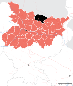 Location of Madhubani district in Bihar | |
| Country | India |
| State | Bihar |
| Administrative division | Darbhanga |
| Headquarters | Madhubani, India |
| Government | |
| • Lok Sabha constituencies | Madhubani, Jhanjharpur |
| • Assembly seats | Harlakhi, Benipatti, Khajauli, Babubarhi, Bisfi, Madhubani, Rajnagar, Jhanjharpur, Phulparas, Laukaha |
| Area | |
| • Total | 3,501 km2 (1,352 sq mi) |
| Population (2011) | |
| • Total | 4,476,044 |
| • Density | 1,300/km2 (3,300/sq mi) |
| Demographics | |
| • Literacy | 60.9 per cent |
| • Sex ratio | 925 |
| Major highways | NH 104, NH 105 |
| Average annual precipitation | 1,273 mm |
| Website | Official website |
Madhubani district is one of the thirty-eight districts of Bihar state, India, and Madhubani town is the administrative headquarters of this district. Madhubani district is a part of Darbhanga division. The district occupies an area of 3,501 square kilometres (1,352 sq mi) and has a population of 4,487,379 (as of 2011).
History
Madhubani became a district in 1972 when it was split from Darbhanga district.[1]It is believed that Baliraajgadh, a place which lies in modern-day Madhubani district was capital of ancient Mithila Kingdom.[2]
Art
Madhubani art or Mithila painting [3] was traditionally created by the women of various communities in Mithila region of India and Nepal. It originated from Madhubani district of Mithila region of Bihar, and, it is popularly called Mithila painting or Madhubani art. Madhubani is also a major export centre of these paintings. [4] This painting as a form of wall art was practiced widely throughout the region; the more recent development of painting on paper and canvas mainly originated among the villages around Madhubani, and it is these latter developments led to the name Madhubani art being used alongside the name "Mithila Painting."[5]
Geography
Madhubani district occupies an area of 3,501 square kilometres (1,352 sq mi),[6] comparatively equivalent to the Bahamas' North Andros island.[7]
Economy
In 2006 the Ministry of Panchayati Raj named Madhubani one of the country's 250 most backward districts (out of a total of 640).[8] It is one of the 36 districts in Bihar currently receiving funds from the Backward Regions Grant Fund Programme (BRGF). But in last few years there a lot of changes happened. This sansk city is going to adopt urbanisation.[8]
Places
Saurath, a road side village on Madhubani-Jaynagar road, contains a temple known as Somnath Mahadev. It owes its importance to the annual Sabha held by Maithili Brahmins for negotiating marriages. Many Panjikars who keep the genealogical records of the different families reside here and outside.[9]
Demographics
According to the 2011 Census of India, Madhubani district has a population of 4,476,044, roughly equal to the nation of Croatia[10] or the U.S. state of Louisiana.[11] This gives it a ranking of 37th in India (out of a total of 707). The district has a population density of 1,279 inhabitants per square kilometre (3,310/sq mi). Its population growth rate over the decade 2001–2011 was 25.19%. Madhubani has a sex ratio of 925 females for every 1000 males, and a literacy rate of 43.35%.
See also
References
- ↑ Law, Gwillim (25 September 2011). "Districts of India". Statoids. Archived from the original on 17 October 2011. Retrieved 11 October 2011.
- ↑ https://hindi.news18.com/blogs/satyam/balirajharh-a-ancient-mithila-915917.html
- ↑ https://books.google.co.uk/books?id=UvuJyvtsCjwC&pg=PA96&dq=madhubani+art+madhubani+district&hl=en&sa=X&ved=0ahUKEwj8kJ761p_SAhUrIsAKHb2ZDfYQ6AEIIzAC#v=onepage&q=madhubani+art+madhubani+district&f=false
- ↑ "Madhubani Painting". Abhinav Publications. 30 September 2017. Archived from the original on 21 February 2017 – via Google Books.
- ↑ Carolyn Brown Heinz, 2006, "Documenting the Image in Mithila Art," Visual Anthropology Review, Vol. 22, Issue 2, pp. 5-33
- ↑ Srivastava, Dayawanti et al. (ed.) (2010). "States and Union Territories: Bihar: Government". India 2010: A Reference Annual (54th ed.). New Delhi, India: Additional Director General, Publications Division, Ministry of Information and Broadcasting (India), Government of India. pp. 1118–1119. ISBN 978-81-230-1617-7.
- ↑ "Island Directory Tables: Islands by Land Area". United Nations Environment Program. 18 February 1998. Archived from the original on 1 December 2015. Retrieved 11 October 2011.
North Andros Island 3,439km2
- 1 2 Ministry of Panchayati Raj (8 September 2009). "A Note on the Backward Regions Grant Fund Programme" (PDF). National Institute of Rural Development. Archived from the original (PDF) on 5 April 2012. Retrieved 27 September 2011.
- ↑ "Archived copy". Archived from the original on 6 May 2018. Retrieved 6 May 2018.
- ↑ US Directorate of Intelligence. "Country Comparison:Population". Archived from the original on 27 September 2011. Retrieved 1 October 2011.
Croatia 4,483,804 July 2011 est.
- ↑ "2010 Resident Population Data". U. S. Census Bureau. Archived from the original on 2013-10-19. Retrieved 2011-09-30.
Louisiana 4,533,372
Places adjacent to Madhubani district | ||||||||||
|---|---|---|---|---|---|---|---|---|---|---|
| ||||||||||
| State symbols | |
|---|---|
| History |
|
| Administration | |
| Overviews | |
| Divisions and districts | |
| Cities | |
| Municipal Corporation |
|
| Poltics | |
| Culture | |
Coordinates: 26°21′00″N 86°04′48″E / 26.35000°N 86.08000°E