Sant Kabir Nagar district
| Sant Kabir Nagar district | |
|---|---|
| District of Uttar Pradesh | |
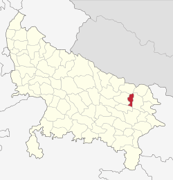 Location of Sant Kabir Nagar district in Uttar Pradesh | |
| Country | India |
| State | Uttar Pradesh |
| Administrative division | Basti |
| Headquarters | Khalilabad, India |
| Tehsils | Khalilabad, Mehdawal, Dhanghata |
| Government | |
| • Lok Sabha constituencies | Sant Kabir Nagar(Rajesultanpur, Alapur, Khajni, Mehdawal) |
| Area | |
| • Total | 1,659.15 km2 (640.60 sq mi) |
| Population (2011) | |
| • Total | 1,714,300 |
| • Density | 1,000/km2 (2,700/sq mi) |
| Demographics | |
| • Literacy | 66.72 per cent |
| Major highways | National Highway 233B (India) |
| Website | Official website |
Sant Kabir Nagar district is one of the 75 districts of Uttar Pradesh state in northern India. Khalilabad city is the district headquarters. Sant Kabir Nagar district is a part of Basti division.
Economy
In 2006 the Ministry of Panchayati Raj named Sant Kabir Nagar one of the country's 250 most backward districts (out of a total of 640).[1] It is one of the 34 districts in Uttar Pradesh currently receiving funds from the Backward Regions Grant Fund Programme (BRGF).[1]
Demographics
According to the 2011 census Sant Kabir Nagar district has a population of 1,714,300,[2] roughly equal to the nation of The Gambia[3] or the US state of Nebraska.[4] This gives it a ranking of 283rd in India (out of a total of 640).[2] The district has a population density of 1,041 inhabitants per square kilometre (2,700/sq mi).[2] Its population growth rate over the decade 2001-2011 was 20.71%. [2] Sant Kabir Nagar has a sex ratio of 969 females for every 1000 males[2] and a literacy rate of 69.01%.[2] As per 2001 census, Muslims account for nearly 24% of the districts population, the remaining being Hindus.
People from Sant Kabir Nagar district
- Sant Kabir Das, poet
References
- 1 2 Ministry of Panchayati Raj (8 September 2009). "A Note on the Backward Regions Grant Fund Programme" (PDF). National Institute of Rural Development. Archived from the original (PDF) on 5 April 2012. Retrieved 27 September 2011.
- 1 2 3 4 5 6 "District Census 2011". Census2011.co.in. 2011. Retrieved 2011-09-30.
- ↑ US Directorate of Intelligence. "Country Comparison:Population". Retrieved 2011-10-01.
Gambia, The 1,797,860 July 2011 est.
- ↑ "2010 Resident Population Data". U. S. Census Bureau. Retrieved 2011-09-30.
Nebraska 1,826,341
External links
| Wikimedia Commons has media related to Sant Kabir Nagar district. |
- Sant Kabir Nagar district website
- Sant Kabir Nagar District Court Website
- Sant Kabir Nagar census 2011 data
Places adjacent to Sant Kabir Nagar district | ||||||||||
|---|---|---|---|---|---|---|---|---|---|---|
| ||||||||||
Coordinates: 26°46′48″N 83°03′36″E / 26.78000°N 83.06000°E