Akola
| Akola | |
|---|---|
| City and District Headquarters | |
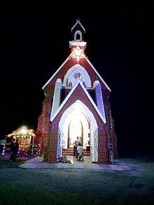
 Akola Fort | |
| Nickname(s): The Cotton City, Rajeshwar Nagari | |
 Akola Location of Akola city.  Akola Akola (India) | |
| Coordinates: 20°42′N 77°00′E / 20.7°N 77.00°ECoordinates: 20°42′N 77°00′E / 20.7°N 77.00°E | |
| Country |
|
| State |
|
| Region | Vidarbha |
| District | Akola |
| Established | 17th century |
| Named for | King Akolsingh |
| Government | |
| • Type | Municipal Corporation |
| • Body | AMC |
| • Mayor | Vijay Agrawal |
| • Municipal Commissioner | Jitendra Wagh |
| Area[1] | |
| • Total | 128 km2 (49 sq mi) |
| Highest elevation | 316 m (1,037 ft) |
| Lowest elevation | 287 m (942 ft) |
| Population (2011)[2] | |
| • Total | 537,149 |
| • Rank |
IN: 85th MH: 14th Vidarbha: 3rd |
| • Density | 4,200/km2 (11,000/sq mi) |
| Language | |
| • Official | Marathi |
| Time zone | UTC+5:30 (IST) |
| PIN | 444001, 444002, 444003, 444004, 444005, 444006, 444104, 444109, 444302 |
| Telephone code | 0724 |
| Vehicle registration | MH-30 |
| Literacy | 92% |
| Sex ratio | 0.968 |
| HDI | Medium[3] |
| Website | http://akola.nic.in |
Akola is called the Cotton City; it is one of the largest cotton-producing districts in central India. The city is also known for the vibrant Varhadi language. The city of Akola is located in the north central part of Maharashtra state, western India, on the banks of Morna River and it is an important district in Vidarbha region of Maharashtra State. Although not much of a tourist destination, it still is an important historical, cultural, political, agricultural city. The place is a prominent road and rail junction in the Tapti River valley; which is a commercial trading center chiefly in cotton. This is a city in Vidarbha region in the state of Maharashtra in central India. It is the 3rd largest city in Vidarbha after Nagpur and Amravati, situated about 290 miles (580 km) east of the state capital Mumbai and 140 miles (250 km) west of the second capital Nagpur. Akola is the administrative headquarters of Akola District located in Amravati Division. Akola city is governed by Akola Municipal Corporation.
Akola is an important educational center as well with several colleges affiliated with the Sant Gadge Baba Amravati University. The place is gradually developing into a great market center. The main language spoken by the people of Akola is Marathi. Some communities also speak Urdu and Hindi.
Akola District has an area of about 5,431 square kilometres and a population of 1,818,617 (2011 census). Akola is the third largest city in Vidarbha region after Nagpur and Amravati. Marathi is the most spoken and dominant language. Akola District is bordered on the north and east by Amravati District, on the south by Washim District, and on the west by Buldhana District.
History
Akola District along with the rest of the Berar province was part of the legendary kingdom of Vidarbha mentioned in the Mahabharata. Barar also formed part of the Mauryan Empire during the reign of Ashoka (272 to 231 BCE). Berar later came under the rule of the Satavahana dynasty (2nd century BCE–2nd century CE), the Vakataka dynasty (3rd to 6th centuries), the Chalukya dynasty (6th to 8th centuries), the Rashtrakuta dynasty (8th to 10th centuries), the Chalukyas again (10th to 12th centuries) and finally the Yadava dynasty of Devagiri (late 12th to early 14th centuries). A period of Muslim rule began when Ala ud din Khalji, Sultan of Delhi, conquered the region in the early 14th century. The region was part of the Bahmani Sultanate, which broke away from the Delhi Sultanate in the mid-14th century. The Bahmani Sultanate broke up into smaller sultanates at the end of the 15th century, and in 1572 Berar became part of the Nizam Shahi sultanate, based at Ahmadnagar. The Nizam Shahis ceded Berar to the Mughal Empire in 1595. The Mughals ruled the Berar Province during 17th century. As Mughal rule started to unravel at the start of the 18th century, Asaf Jah I, Nizam of Hyderabad seized the southern provinces of the empire (including Berar) in 1724, forming an independent state.
Akola has been a part of India's mythological past. The place is mentioned as a part of the Berar province and the legendary kingdom of Vidarbha in the Mahabharata. Berar also formed a part of the Mauryan Empire during the reign of Ashoka (272 to 231 BCE). The province later came under the rule of the Satavahana dynasty (2nd century BCE-2nd century CE), the Vakatakas (3rd to 6th centuries), the Chalukyan dynasty (6th to 8th centuries), the Rashtrakuta dynasty (8th to 10th centuries). The Chalukyas regained control of the region in the 10th to 12th centuries respectively and finally the Yadava dynasty of Devagiri (late 12th to early 14th centuries). Allauddin Khilji of the Delhi Sultanate conquered the region in the early 14th century that eventually became a part of the Bahmani Sultanate, which broke away from the Delhi Sultanate in the mid-14th century. The Bahmani Sultanate broke up into smaller sultanates at the end of the 15th century, and in 1572 Berar became part of the Nizam Shahi sultanate, based at Ahmednagar. The Nizam Shahs conceded Berar to the Mughal Empire in 1595. The Mughals ruled the province during 17th century. As Mughal rule started to unravel at the start of the 18th century, Asaf Jah I, Nizam of Hyderabad seized the southern provinces of the empire (including Berar) in 1724, forming an independent state.
The rise of Maratha Empire from 1674 to 1760 saw the region coming under the command of Chhatrapati Shivaji succeeded by his sons. In 1749, at the time of death of Shahu, he appointed Peshwa as the head of the Maratha Empire with certain conditions to follow. The Third battle of Panipat in 1761 crippled the Maratha Empire and corroded the power of Peshwa forever. But still the Berar province remained under the Marathas.
The Battle of Argaon in1803 was fought here between the British and the Marathas during Second Anglo-Maratha War. The Third Anglo-Maratha War saw the defeat of the last Peshwa, Baji Rao II by the British. In 1853, the Akola district together with the rest of Berar came under the administration of the British East India Company. Berar was divided into East and West Berar with Akola district being included in West Berar. In 1903, Berar was leased to the Nizam of Hyderabad by the British East India Company in return of the debt.
After India's Independence in 1947 from British Government the entire India including Berar province was divided in different states and a new Maharashtra state under Government of Maharashtra was formed, with Akola district under it.
Mauryan Empire, Satavahana, Chalukyas, the Rashtrakutas, Vakatakas, Sultan of Delhi, Bahmani Sultanate, Nizam Shahi sultanate, Mughals, Nizams, Marathas, Peshwas and British. Chhatrapati Shivaji, Sambhaji, Shahuji, Gopalrao Bajirao Khedkar, Dr. Panjabrao Deshmukh, King Akol Singh, Sant Gajanan Maharaj, Brijlal Biyani, Sundarabai Khandelwal, Raosaheb Devraobaba Digambarji, Bhartiya, Samarth Ramdas Swami, etc.
The rise of Maratha Empire (from 1674 to 1760) under the command of Chhatrapati Shivaji succeeded by his son Sambhaji and grandson Shahu brought the whole Berar province including Akola district under the Maratha Empire around 1734. In 1749 at the time of his death, Shahu appointed the Peshwa as the head of the Maratha Empire with certain conditions to follow. The Berar province remained under the Marathas.
The Battle of Argaon, (or Adgaon near Akot) in took place on 28 November 1803 between the British under the command of Governor Arthur Wellesley and the forces of Maratha under Bhonsle of Nagpur during Second Anglo-Maratha War. In the third Anglo-Maratha War, the last Peshwa Baji Rao II, was defeated by the British. In 1853, Akola district together with the rest of Berar came under the administration of the British East India Company. Berar was divided into East and West Berar with Akola district being included in West Berar. In 1903, Berar was leased to the Nizam of Hyderabad by the British East India Company in return of the debt.
The Congress's proposed linguistic provinces plan before the Independence of India had positioned Akola as the headquarters of the Berar region.[4][5]
After India gained its independence in 1947, the states and provinces were reorganised in 1956. Berar was divided among different states. Akola became a part of bilingual Bombay state which was further divided into two states in 1960. Akola became a part of the new Maharashtra State. The Narnala fort, Akot fort, Akola fort and Balapur Fort are some of the famous monuments in Akola.
Demographics
| Population growth | |||
|---|---|---|---|
| Census | Pop. | %± | |
| 1981 | 225,412 | — | |
| 1991 | 328,043 | 45.5% | |
| 2001 | 400,520 | 22.1% | |
| 2011 | 427,146 | 6.6% | |
| Source:Census of India[6] | |||
As of 2011 India census,[7] Akola City had a population of 537,248 and an area of about 124 km2.
Geography and climate
Akola is located at latitude 20.7° North and longitude 77.07° East. It is at an altitude of 925 ft (287m) to 1036.745 ft (316m) above sea level. Akola has a tropical savanna climate (Köppen climate classification Aw) bordering humid subtropical climate (Köppen climate classification Cwa), and people predominately wear cotton clothes. Akola has a National Weather Station which serves as the local weather centre. Annual temperatures range from a high of 47.6 °C (117.68 °F) to a low of 2.2 °C (35.96 °F). Akola lies near the Tropic of Cancer and becomes very hot during the summer, especially in May. Although it can be very hot in the day, it is cooler at night. The annual rainfall averages 800 mm. Most of the rainfall occurs in the monsoon season between June and September, but some rain does fall during January and February.
On the north, Akola is bordered by the Melghat Hills and forest region. The highest point in Akola District at about 950–970 m is present there in the northern Satpuda region. The Morna River flows through Akola. Purna River forms a part of the north border of the district, and the top north portion of the district lies within its watershed along with Aas River and Shahnur River. Vaan River forms a part of the northwest boundary of the district after entering from the Amravati district. Maan River drains the southwestern portion of the district. Morna River drains the mid-south portion of the district, while the southeast is drained by the Katepurna and Uma rivers.
Some of the rivers in Akola and their tributaries are Purna, Uma, Katepurna, Shahnur, Morna, Man, Aas and Vaan. There are many dams in Akola district; Mahan, on Katepurna river is one of them. There were floods in 1978, 1992, and 2003.
| Climate data for Akola | |||||||||||||
|---|---|---|---|---|---|---|---|---|---|---|---|---|---|
| Month | Jan | Feb | Mar | Apr | May | Jun | Jul | Aug | Sep | Oct | Nov | Dec | Year |
| Record high °C (°F) | 35.0 (95) |
38.2 (100.8) |
42.6 (108.7) |
45.8 (114.4) |
47.1 (116.8) |
45.4 (113.7) |
39.7 (103.5) |
36.6 (97.9) |
39.2 (102.6) |
39.3 (102.7) |
35.8 (96.4) |
34.3 (93.7) |
47.1 (116.8) |
| Average high °C (°F) | 29.9 (85.8) |
32.8 (91) |
37.3 (99.1) |
40.9 (105.6) |
42.5 (108.5) |
37.6 (99.7) |
32.4 (90.3) |
30.6 (87.1) |
32.5 (90.5) |
34.1 (93.4) |
31.7 (89.1) |
29.5 (85.1) |
34.3 (93.8) |
| Average low °C (°F) | 13.1 (55.6) |
15.4 (59.7) |
19.7 (67.5) |
24.2 (75.6) |
27.3 (81.1) |
25.5 (77.9) |
23.5 (74.3) |
23.0 (73.4) |
22.5 (72.5) |
19.7 (67.5) |
15.6 (60.1) |
12.4 (54.3) |
20.2 (68.3) |
| Record low °C (°F) | 5.8 (42.4) |
7.8 (46) |
10.0 (50) |
16.4 (61.5) |
20.2 (68.4) |
20.8 (69.4) |
20.4 (68.7) |
19.8 (67.6) |
15.2 (59.4) |
13.0 (55.4) |
8.0 (46.4) |
6.8 (44.2) |
5.8 (42.4) |
| Average precipitation mm (inches) | 10.4 (0.409) |
8.1 (0.319) |
10.0 (0.394) |
4.1 (0.161) |
9.8 (0.386) |
144.9 (5.705) |
217.2 (8.551) |
196.6 (7.74) |
122.7 (4.831) |
47.7 (1.878) |
18.7 (0.736) |
12.1 (0.476) |
802.3 (31.586) |
| Average rainy days | 1.4 | 1.4 | 0.9 | 0.4 | 1.4 | 9.2 | 13.4 | 13.4 | 7.6 | 3.3 | 1.3 | 0.9 | 54.6 |
| Average relative humidity (%) | 46 | 37 | 26 | 24 | 31 | 56 | 73 | 78 | 68 | 55 | 48 | 47 | 49 |
| Source #1: India Meteorological Department (1901-2000)[8] | |||||||||||||
| Source #2: NOAA (extremes, mean, rain days, humidity, 1971-1990)[9] | |||||||||||||
Extreme temperatures ever recorded at Akola are shown as a table below
| Climate data for Akola | |||||||||||||
|---|---|---|---|---|---|---|---|---|---|---|---|---|---|
| Month | Jan | Feb | Mar | Apr | May | Jun | Jul | Aug | Sep | Oct | Nov | Dec | Year |
| Record high °C (°F) | 35.4 (95.7) |
40.0 (104) |
43.0 (109.4) |
45.9 (114.6) |
47.7 (117.9) |
47.2 (117) |
40.5 (104.9) |
40.0 (104) |
38.4 (101.1) |
39.0 (102.2) |
36.1 (97) |
34.3 (93.7) |
47.7 (117.9) |
| Record low °C (°F) | 3.9 (39) |
2.2 (36) |
5.6 (42.1) |
11.1 (52) |
11.9 (53.4) |
18.3 (64.9) |
17.7 (63.9) |
18.3 (64.9) |
12.5 (54.5) |
10.0 (50) |
5.1 (41.2) |
3.9 (39) |
2.2 (36) |
| Source: India Meteorological Department Pune (up to 1990)[10] | |||||||||||||
| Climate data for Weather Station Akola | |||||||||||||
|---|---|---|---|---|---|---|---|---|---|---|---|---|---|
| Month | Jan | Feb | Mar | Apr | May | Jun | Jul | Aug | Sep | Oct | Nov | Dec | Year |
| Record high °C (°F) | 36.2 (97.2) |
40.0 (104) |
44.4 (111.9) |
46.1 (115) |
47.8 (118) |
45.2 (113.4) |
40.6 (105.1) |
40.0 (104) |
40.0 (104) |
40.0 (104) |
36.1 (97) |
36.7 (98.1) |
47.8 (118) |
| Record low °C (°F) | 3.9 (39) |
2.2 (36) |
5.6 (42.1) |
11.1 (52) |
11.9 (53.4) |
20.0 (68) |
20.6 (69.1) |
18.3 (64.9) |
15.4 (59.7) |
10.0 (50) |
5.6 (42.1) |
3.9 (39) |
2.2 (36) |
| Source: India Meteorological Department Pune (up to 1990)[11] | |||||||||||||
| Climate data for Weather station Akola(A) | |||||||||||||
|---|---|---|---|---|---|---|---|---|---|---|---|---|---|
| Month | Jan | Feb | Mar | Apr | May | Jun | Jul | Aug | Sep | Oct | Nov | Dec | Year |
| Record high °C (°F) | 35.4 (95.7) |
39.1 (102.4) |
43.0 (109.4) |
45.9 (114.6) |
47.7 (117.9) |
46.0 (114.8) |
40.5 (104.9) |
36.8 (98.2) |
38.4 (101.1) |
39.0 (102.2) |
36.5 (97.7) |
34.3 (93.7) |
47.7 (117.9) |
| Record low °C (°F) | 4.9 (40.8) |
7.7 (45.9) |
9.0 (48.2) |
12.6 (54.7) |
18.6 (65.5) |
18.3 (64.9) |
17.7 (63.9) |
19.6 (67.3) |
12.5 (54.5) |
10.8 (51.4) |
5.1 (41.2) |
4.4 (39.9) |
4.4 (39.9) |
| Source: India Meteorological Department Pune (up to 1990)[12] | |||||||||||||
Akola district has another fact to record the lowest temperature in the month of May. Akola has recorded a minimum temperature of 11.9 °C in the month of May which is considered to be the hottest month in the state of Maharashtra.
Education
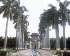
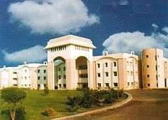
Akola city has been the education hub for students in Western Vidarbha region. Akola city hosts multiple engineering, medical, Pharmacy, Law and other Colleges. Akola being the main campus of Dr. Panjabrao Deshmukh Krishi Vidyapeeth (PDKV) attracts numerous students from state and country.

Agriculture University
Akola is home to Dr. Panjabrao Deshmukh Krishi Vidyapeeth (PDKV), established by the government of Maharashtra on 20 October 1969. Earlier, it was part of Maharashtra Krishi Vidyapeeth since 1968. The university attracts students from far distances for its agricultural science and agricultural engineering and technology courses. PDKV jurisdiction covers all 11 districts of Vidarbha.[13]
Major Colleges in Akola City associated with PDKV are:[14]
- College of Agriculture, Akola - B.Sc. (Agriculture)[15]
- College of Horticulture, Akola - B.Sc. (Horticulture)[16]
- College of Forestry, Akola - B.Sc. (Forestry)[17]
- College of Agri. Engineering & Technology, Akola - B.Tech. (Agri. Engineering)[18]
- University Post Graduate Institute, Akola - M.Tech. (Agri. Engineering)[19]
- University Post Graduate Institute, Akola - M.Sc. (Agriculture)[19]
- University Post Graduate Institute, Akola - Ph.D.[19]
Veterinary colleges
- Post Graduate Institute Of Veterinary & Animal Sciences, Akola (PGIVAS)[20] PGIVAS is affiliated to Maharashtra Animal and Fishery Sciences University (MAFSU)[21]
Engineering colleges
- Shivaji Engineering College, Akola COETA
- Bhonsla College of Engineering & Research
- Manav School of Engineering & Management, Vyala
- Mauli Group of Institution's, College Of Engineering & TECHNOLOGY, Shegaon.
Medical science colleges
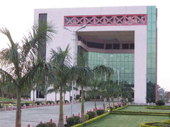
- Government Medical College, Akola
- Jamnalal Goenka Dental College
- R.T. Ayurved Mahavidyalay
- Homeopathic Medical College[22]
- Shri Janta Homeopathic Medical College[22]
Pharmacy colleges
Other prominent colleges of Akola city
- Shankarlal Khandelwal College of Science, Commerce and Arts
- RLT College of Science[25]
- LRT Commerce College
- Shri Shivaji Arts, Commerce and Science College[26]
- Sitabai Arts and commerce College
- Radha Devi Goenka Mahila Mahavidyalaya (RDG)
- Sudhakarrao Naik Arts and Commerce College
- Government College of Education
- Tirupati Tantra Niketan
- KM Asghar Husain Junior Art, Commerce and Science College
- Akola Law College
- Gajanan Maharaj College of Engineering[27] (SSGMCE) at Shegaon (in Buldhana District) is a renowned engineering college of the region, 38 km away from Akola city.
- NCC's 11 MAH Battalion is based in Akola, on the outskirts of the city near Jawaharlal Nehru Public Park.
High schools
Most schools in Akola are affiliated to Maharashtra State Board of Technical Education (MSBTE). The Municipal Corporation controls all public schools in the city.
Notable People
- Vijay P. Bhatkar, architect of India's national initiative in supercomputing
- Patrick Barr (1908-1985) was a British film and television actor,[28]
- Vitthal Wagh, Marathi poet, writer and craft artist.
- Kamal Narayan Seetha (born 1943), Vedic teacher in yoga, pranayama and alternative healing
- Sudharak Olwe, a Mumbai-based documentary photographer
- Shivdeep Lande, an IPS Officer of 2006 Batch
Medical facilities
Major hospitals in Akola include:
- Government District Hospital and Medical College, Akola[29]
- District Ladies Hospital[30]
- Sant Tukaram Cancer Hospital,[31]
- Damani Eye Hospital, Akola[32]
- Cotton City Hospital,[33]
- Icon Hospital,[34]
- Ozone Multi-Speciality & Critical Care Center,[35]
- Smile Institute of Child Health and Akola Test tube Baby Centre[36]
- Radhakisan Toshniwal Ayurvedic Hospital[37]
Local government
Civic government
Akola city is divided into 80 electoral wards and 4 zones stretching up to an area of 124 km2. The Akola Municipal Corporation was established on 1 Oct. 2001 is headed by a Municipal Commissioner and Mayor who is assisted by the Deputy Mayor. They carry out the work through various committees such as the Standing Committee, Law Committee, Education Committee, Women and Child Welfare Committee, City Development Committee and Four Zonal Committees for the Four Zones. Vijay Agrawal is the mayor of Akola city. Akola Municipal Transport (AMT) runs Akola's public transport service. The neighbouring suburbs like Umri, Gurdhi, Khadki, Shivani (Shioni), Malkapur, Akoli, Kharap and so on are decided to be included into municipal limits. Akola Municipal Corporation launched its website on 29 December 2011.[38]
Law and Order Governance
Law and Order in the city is maintained by the District Police Administration called Akola Police. Akola City Subdivision has 8 Police Stations and cover the metropolitan area of growing Akola city.[39]
The Government approved creation of new Railway Police Akola Sub-Division that will including Akola, Wardha and Badnera railway police units. Akola Police Sub Division falls under Nagpur District of Railway Police.[40]
Industry and economy
Today, Akola is a developing city and it is one of the major cities of the vidarbha region. Akola has a very good grain market, oil mills, dal (pulses) mills and is known for production of cotton. The IT sector is also growing at a fast pace.
Akola, called Cotton City, is known for its cotton production and is the largest cotton-producing district in India. The city is also famous for its pulses (dal), oil, and textile mills. The city had all along been an important commercial and trading centre. The facility of goods transportation and communication system in the form of railway and roads in addition to the extension of the electric grid system and establishment of the Paras Thermal Power Station ensuring adequate electric power supply have contributed to the industrial development of the city in recent years.
The Dr. Panjabrao Deshmukh Krishi Vidyapeth with its headquarters at Akola came into existence on 20 October 1969 and it added to the importance and development of the city.
Agriculture

Agriculture is the main occupation of the people in rural parts of the region. Cotton, Soybean and jawar (sorghum) are the essential crops grown in the district. Other important crops of the region are wheat, sunflower, canola, peanut, Bajra (pearl millet), Harbara (chick peas), Toor (pigeon peas), Urad and Moong (green gram). Most crops are dependent on the monsoon. Only 15% of Maharashtra's gross cropped area is irrigated, compared with the national average of 32.9% in 1989–90. Vidarbha's Amravati division's (including Akola District) share of gross cropped area under irrigation of 9%.
Considered one of Maharashtra's least developed regions, Vidarbha has seen not only farmers' suicides but also deaths caused by malnutrition. In some tribal are major reasons[41] of recent suicide deaths of farmers in the Akola region and other surrounding parts of Vidarbha, which has rung alarm bells in the Maharashtra state government and government of India. Bharat Krishak Samaj, one of the leading organisations of farmers in India, is very active in the Akola region. It has played a crucial role in promoting the voice of the common farmers of the Vidarbha region to the attention of the Indian government under the chairmanship of Prakash Shriram Mankar. Oil and dal mills are becoming rampant in this region because of the crops taken. Textile mills are also increasing to support the cotton growing industry.
Akola MIDC Industrial Area
The Akola MIDC Industrial Area is the largest and most economical industrial area in the division. It has four prominent industrial zones on the outskirts of the city. Cotton and jowar are the predominant crops grown in the district. Oil and dal mills are also rampant. The economy is mostly agriculture based. Nowadays, the soybean crop is an important crop as major soybean plants have come up in the area. The total land under Akola MIDC Industrial area is 6.25 km2. There are about 25 factories (3 large factories and 22 small factories) currently in production and another 10 small factories are in the process of being constructed. Maharashtra Government has sanctioned growth centres close to Akola MIDC area. An application of the Maharashtra Industrial Development Corporation (MIDC) for setting up an agro-processing Special Economic Zone (SEZ) in Akola district has been approved. Maharashtra State Seeds corporation (Mahabeej) has head office at Akola. There is a growing demand for setting up divisional MIDC office at Akola to cater to Akola, Washim and Buldhana districts which are away from the current divisional office and also lack good industrial growth.
Well known industrial groups like the Birla Group and the Mafatlal Group have established their industries and important industries such as Berar Oil Industries, Simplex Mill, Polyophin Industry now known as NOCIL, Co-operative Spanning mill, Mohata Cotton Mill (NTC Ltd) are located in the city.
Power supply
Maharashtra State Electricity Distribution Company Limited (MAHAVITARAN) provides the electric supply to the city.
Paras Thermal Power Station: Paras thermal power station is the oldest of all Mahagenco power plants, and is located about 20 km west of the city. The station has witnessed the third generation technology. The station had 30 MW installed capacity in 1961 with a stroke boiler. The same unit was abandoned in 1993 due to aging.[42]
Media and communication
- Telecommunication: STD code of Akola tehsil is (0724).
- Newspapers: Dainik Deshonnati, one of the well-known Marathi newspapers in the Vidharbha region, originated from Akola. Other prominent newspapers published from Akola include Dainik Matrubhumi, Samrat, Divya Marathi, and City News Superfast.
- Radio: Akola Aakashwani 102.4, Radio City 91.1 FM, Radio Orange 91.9 FM,My FM 94.3,Radio Mirchi 95 FM
- Entertainment: There is one four-screen multiplex, Big Cinemas, situated on Murtizapur Road. There are also many single screen theaters situated in Akola including Manek Talkies, Vasant Talkies, Uday Theater, and Regal Talkies.
Sports
Akola has a good tradition of sports. A number of state level tournaments as well as national tournaments of various indoor and outdoor games are hosted here. The most played sports in Akola city include Football, cricket, carrom, hockey, volleyball, boxing, kabaddi, chess, and badminton. Akola was called Home of Football, Akola produced many renowned Footballers, Akola police was best team for many years,some of the great footballers of Akola are:- Pandharinath Gopnarayan, Pappu Pandey,Gajanan Shelar, Devidas Sarjekar, Krishna Shelar,Baban Patade, Sheikh Chand, Farooq Sheikh, and many more Some of the famous stadiums and playground in Akola region include:
Akola Cricket Club Ground (ACC) is the prominent cricket grounds in the region and is the home ground of the Akola cricket club. The ground has held two first-class matches, the first of which came in the 1983/84 Ranji Trophy when Vidarbha played the Railways, while the second saw Rajasthan as the visitors in the 1984/85 Ranji Trophy.[43]
Vasant Desai Stadium is famous in the region as it always hosts the district level tournaments of games such as running, volleyball, swimming, boxing, and kabaddi.
Lal Bahadur Shastri Stadium is located near Sundarabai Khandelwal Tower which is a landmark of Akola city. The stadium hosts the games like football and cricket.
Other prominent stadiums of Akola include
- Officer's Club
- PDKV's Sports Stadium
- Lal Bahadur Shastri Stadium
- Akola Cricket Club Stadium
- Umri Kabaddi Stadium
- Mitra Samaj Club Stadium
Achievements
- Vidarbha medium-pacer Aditya Thakare, an Akola boy proud India national under-19 cricket team in 2018 Under-19 Cricket World Cup as a bowler.
- Keliveli is the neighborhood of Akola is known as Kabaddi capital of Vidarbha
Transportation
Air
Akola Airport (also known as Shivani Airport) (IATA: AKD, ICAO: VAAK) is the domestic airport of Akola city and is at an elevation of 999 ft. It was built by the British authorities in the 1940s and regularly sent flights to Mumbai. Now it is non-functional, and has one runway (4,600×145 ft). The expansion and functioning of the airport has been delayed as it is unable to get land from Dr. Panjabrao Deshmukh Krishi Vidyapeeth.[44] It is one of the oldest airports in India. The airport is just 7 km from the city on National Highway No. 6. The nearest international airport is at Nagpur (140 miles). Renovation and operation of Akola airport are taken by Airport Authority of India. The Nagpur bench of Mumbai High Court has recently given the decision to take over the required land for extension of Akola Airport from the Dr. PDKV. The work is expected to be started soon. After the extension of runway and renovation of other infrastructure, the regular flight service is supposed to be commenced. Akola Airport (also known as Shivani Airport) is the domestic airport of Akola city at an elevation of 999 ft (304 m) and has one runway (4,600×145 ft). The airport is just 7 km away from the city on National Highway No. 6. The nearest international airport is at Nagpur (250 km) and at Aurangabad, Maharashtra (265 km) . Renovation and operation of Akola airport is taken by Airport Authority of India.
Road
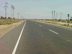
Akola city is well connected to major cities by road. The NH6 runs through Akola from Hazira (Surat) to Kolkata. NH6 is a part of Asian Highway 46. The National Highway 161 (new) starts in Akola connecting Nanded and then Sangareddy (Telangana). Government has declared new National Highway 161A National Highway 161A(new) connecting Akot, Akola to Mangrulpir, Mahur, and Mudkhed.
State Highway no. 68 and 69 also pass through the municipal limits. Other highways include State Highway 204, State Highway 200: Akola - Amravati, and State Highway 197. The "NH6" runs through Akola from Hazira (Surat) to Kolkata. NH6 is a part of Asian Highway 46. Maharashtra state transport buses are most commonly used by people to travel to rural parts of the region. They are the cheapest means of transport.State-owned and private air-conditioned bus services run daily to most major cities to and from Akola. The bus frequency is good. Bus service is available for cities like Nagpur, bhopal, Indore, Hyderabad, Nanded, Amravati, Mumbai, Nashik, Jabalpur.[45] Akola has the vehicle registration code as MH-30.
City transport:
Akola Municipal Transport (AMT) runs Akola's public transport service. Autorickshaws are also widely used in Akola city for city transport. The municipal corporation is working with the IRDP (Integrated Rural Development Planning) to develop the roads of the city. The stopped service of AMT bus transport was restarted in December 2015 with a total of 35 buses.
Inter-city transport:
Maharashtra state transport buses are most commonly used by people to travel to rural parts of the region. State-owned and private air-conditioned bus services run on daily basis to most major cities to and from Akola. Bus service is available for cities like Pune, Nagpur, Bhopal, Indore, Hyderabad, Nanded, Amravati, Mumbai, Nashik, Surat and Jabalpur, as well as other important cities and towns in Maharashtra and the neighbouring states.
Railway

Akola, situated on both the Howrah-Nagpur-Mumbai line and the Kacheguda-Jaipur line, is an important junction for passengers from North and South India and also for freight trains. The Kacheguda-Jaipur line is being recently converted to broad gauge and the number of trains connecting to Hyderabad has increased since then.
Broadgauging of the Akola Junction-Purna railway line has recently been completed and passenger trains have started running on this route. The work ofgauge conversion (meter gauge-broad gauge) of Akola Junction - Indore Junction MG and Indore Junction MG - Ratlam railway line of SCR zone has started and is projected to be completed in a few years.
Akola has good railway connectivity with direct trains to Mumbai, Delhi, Ahmedabad, Rajkot, Okha, Surat, Nanded, Jodhpur, Jaipur, Kolhapur, Pune, Kamakhya, Indore, Mhow, Ujjain, Khandwa, Ratlam, Bhopal, Chittorgarh, Nagpur, Bilaspur, Howrah, Hatia, Puri, Chennai, Hingoli, Purna, Parli, Tirupati, Ganganagar, Secundarabad, and many more important railway stations in the country.
Important railway stations in Akola region with their codes are Paras, Gaigaon, Akola Junction (AK), Murtizapur Junction (MZR) and are under the Bhusawal-Badnera section of Bhusawal Division of Central Railway.
Some of the trains originated from Akola Junction are:
- Akola - Kacheguda Intercity Express
- Akola - Purna Passenger
- Akola - Parli - Adilabad Passenger
- Akola - MHOW Passenger
- Akola - Ujjain Fast Passenger
- Akola - Narkher Special Express
The other stations under meter gauge are Hiwarkhed (HWK), Adgaon Buzurg (ABZ), Akot (AKOT), Patsul (PTZ), Ugwe (UGWE), Akola Junction, Shivani Shivpur (SVW), Barshitakli (BSQ), Lohogad (LHD), Aman Vadi (AMW), and Jaulka (JUK) under Purna - Khandwa section of South Central Railway.
The stations under narrow gauge are Lakhpuri, Murtizapur Junction, Karanja under two Narrow Gauge Branch lines viz Murtizapur-Achalpur and Murtizapur-Yavatmal of Bhusawal Division of Central Railway.
In 2009, a new railway station was built at Shivani-Shivar to reduce the load of goods transport of Akola Junction railway station. It is the modification of a meter gauge station into a broad gauge station. It now connects Purna to Hyderabad through Akola. Akola Junction railway station is one of the Top 100 Booking Stations in India. Now Akola urban area has two stations - Akola Junction and Shivani-Shivapur Railway Station.

Culture and religion
Marathi Sahitya Sammelan, the conference on Marathi Literature, was held twice in Akola city. They were presided over by Hari Narayan Apte in 1912 and Gopal Nilkanth Dandekar in 1981.
Akola is a city with a mix of religions and cultures. There are several places of worship for Hindus, Buddhists, Muslims, Sikhs, Jains, and Christians in Akola.

Temples:
- Shri Rani Sati Dham is a Devi (Mata) temple located near Collector office.
- Shri Rani Sati Dham 2 is a Devi (Mata) temple located near Hotel Tushar National Highway No. 6
- Shri Khatu Shyam Mandir Tulshiyan Layout Geeta Nagar National Highway No. 6
- Shri Salasar Dham Ganga Nagar National Highway No. 6
- Shri Laxminarayan Mandir Toshniwal layout
- Shri Tirupati Balaji Mandir Gaurakshan Sansthan Gaurakshan Road
- Gram-daivat Shree Rajrajeshwar Mandir, Old City
- Birla Mandir (Ram Temple)
- Shreenath Dutta Mandir, Ramdas Peth
- Annapurna Devi Mandir, NH6, Balapur Naka
- Jain Temple at City Market Place
- Swami Samarth mutthh (temple) at Ramdas peth
- Shree Kala Maruti temple at Old City
- Shree Bara Jyotirlinga Mandir, Jatharpeth Road
- Shree Sidhivinayak Temple Jathar peth Nr Prasad Colony is a popular temple of Lord Ganesha.
- Jalaram Mandir Birla Colony
- Gurudwara Railway station Road
- Shri Ram Temple at Tilak Road
- Hanuman Temple at Balapur Marg Railway Gate, Dabki Road
- Shri Salasar Balaji Hanuman Temple
- Shani Mandir, Mahatma Gandhi Road.
Mosques in Akola city: There are a number of mosques in the town. Important amongst them are the Badi Masjid (Markaz), Masjid Mominpura and Kachchhi Masjid.
- Mominpura Masjid Mominpura
- Kacchan Masjid Tajnapeth
- Jama Masjid Inamdar Pura
- Raza Masjid Akot File
- Nagina Masjid Akot Stand
- Masjid Al-Falah 1600 Plots
- Akbar-plot Masjid Akot File
- Chaand Hafiz Masjid
- Ammajaan Masjid Old City
- Masjid Turaab Ali Nawab Pura
Churches:
- Mount Carmel Church
- All Saints Church
- Catholic Church
- Alliance Church
Akola Tourism
Shegaon (in Buldana District), a popularpilgrimage place of Gajanan Maharaj, is just 35 km from Akola. Gajanan Maharaj Sansthan is the biggest temple trust in the Vidarbha region and is called "Pandharpur of Vidarbha". The origin of Gajanan Maharaj is untraceable in history. People from all over Maharashtra visit Shegaon and offer their prayers to Gajanan Maharaj.
(Marathi नरनाळा), also known as "Shahanur Fort", is an Indian hill fortress in Maharashtra. The name Narnala was given after the Rajput Ruler Narnal Singh or Narnal Swami. The fort was built in 10 A.D. by Gond Kings. Narnala Wildlife Sanctuary which is situated 40 km from Akola city is a principal tourist destination. Home to leopards, birds and sambars, this wildlife sanctuary also has many trees like teal, kusum and salai. In 15th Century Mughals have occupied and rebuild the fort and hence it has been called Shahnoor Fort. Narnala was one of the thirteen sarkar of Berar Subah. Narnala consists of three small forts named Zafarabad fort (or Jafarabad) on the east, Narnala in the centre and Teliagarh on the west.
It is a historical place since the Khilji Dynasty, and it was one of the Sarkar Subah Berar in the medieval period. The fort is known for the great Muslim saint Hazrat Burhanuddin "BAGH SAWAR WALI" and it is said that many white tigers were seen with the hazrat at that time. ADLI BEG or ATALU BEG erected many Arabic Scripts and the "TUP" named "KADAK BIJLI". It is also the birthplace of Aurangzeb's great grand son. Sardar Beg Mirza and Qader Beg Mirza were the hereditary descendant of Mughal Dynasty in the 18th century.They to stay near Argaon 9 km away from Hiwarkhed because Shah Beg Subedar of Berar was holding the fort. It is located in the Akot Taluka,Akola District, Berar (also called Amravati Division)at coordinates of 21o 15' N and 77o 4' E. The closest city is Akot which is 18 km away. It is at the southernmost tip of the Satpura Hills at an elevation of 3161 feet(912 m) above sea level.[1]Currently, this area falls within the Melghat Tiger Reserve.
Akola Fort(also called Asadgad or Asagad) along with the Narnala and Akot forts forms the major fortifications of the Akola district, Maharashtra, India. It is notable in that it is bereft of any decorative embellishments.There are several inscriptions on the fort. An inscription on the Dahi handa gate gives its date of constructions as 1114 AH (1697 CE), 'during the reign of emperor Aurangzeb when Nawab Asad Khan was minister.' Another on the Fateh Buruj bastion has no exact date. It too mentions the same minister but a different emperor (Shah Alam). One on the Eidgah, contains texts and statement that the building was finished by Khawja Abdul Latif in 1116 AH (1698 CE). On the Agarves gate an inscription in Marathi reads that Govind Appaji in 1843 CE constructed the fort. The latter statement contradicts all the other inscriptions.
- Nehru Park
Nehru Park is the well-known amusement park. A laser show and musical fountain are added attractions.
- Ashok Vatika
Ashok Vatika is an important religious place for Buddhist and Dalit people in Akola city. There are statues of Dr. B R Ambedkar, Siddharth Gautam Buddha and Mahatma Jyotirao Phule inside the Garden, People gather in large number to offer prayers, it is located at the centre of Akola city.
- Raj Rajeshwar Temple
Akola's oldest Shiva temple is Rajeshwar Mandir. The city derives its nickname as "Rajeshwar Nagari" from it.
See also
References
- ↑ http://www.demographia.com/db-worldua.pdf
- ↑ http://www.ijpret.com/publishedarticle/2016/4/IJPRET%20-%20Civil%20138.pdf
- ↑ https://www.maharashtra.gov.in/Site/upload/WhatsNew/Economic%20Survey%20of%20Maharashtra...pdf
- ↑ "101". Retrieved 19 September 2014.
- ↑ "101a". Retrieved 19 September 2014.
- ↑ "Mahapopulation" (PDF). Census of India (in Marathi). www.maharashtra.gov.in. Archived from the original (PDF) on 3 March 2009. Retrieved 2008-06-04.
- ↑ "Census of India 2001: Data from the 2001 Census, including cities, villages and towns (Provisional)". Census Commission of India. Archived from the original on 2004-06-16. Retrieved 2008-11-01.
- ↑ "Climate of Ahmedabad" (PDF). India meteorological department. Archived from the original (PDF) on 14 April 2010. Retrieved 31 May 2014.
- ↑ "Akola Climate Normals 1971–1990". National Oceanic and Atmospheric Administration. Retrieved 24 December 2012.
- ↑ "histext.pdf" (PDF). India meteorological department.
- ↑ "histext.pdf" (PDF). India meteorological department.
- ↑ "histext.pdf" (PDF). India meteorological department.
- ↑ https://www.pdkv.ac.in/?page_id=69#sthash.vqqIHqmN.dpbs
- ↑ https://www.pdkv.ac.in/?page_id=141#sthash.nWg2vDCB.dpbs
- ↑ https://www.pdkv.ac.in/?page_id=3772#sthash.OcqE8psi.dpbs
- ↑ https://www.pdkv.ac.in/?page_id=3798#sthash.eTdhTiXm.dpbs
- ↑ https://www.pdkv.ac.in/?page_id=3811#sthash.3gPiesX7.dpbs
- ↑ https://www.pdkv.ac.in/?page_id=3838#sthash.IIgrCPQb.dpbs
- 1 2 3 https://www.pdkv.ac.in/?page_id=3898#sthash.zA8ZNuzK.dpbs
- ↑ "Welcome to PGIVAS, Akola". www.pgivasakola.in.
- ↑ "Maharashtra Animal & Fishery Sciences University". www.mafsu.in.
- 1 2 http://www.dmer.org/bhms.htm
- ↑ "gspsiop.com".
- ↑ Administrator. "Course Offering". gkipakola.com.
- ↑ http://rltsc.org RLT Science College, Akola
- ↑ "shivajiakola.org". Retrieved 19 September 2014.
- ↑
- ↑ "BFI | Film & TV Database | BARR, Patrick". Ftvdb.bfi.org.uk. Retrieved 2013-07-23.
- ↑ Akola, Government Medical College. "Govt. Medical College & Hospital Akola - 444001 Mshsrashtra State INDIA". www.gmcakola.in.
- ↑ https://www.nhp.gov.in/hospital/zailla-stree-rugnalay,-akola-akola-maharashtra
- ↑ "Sant Tukaram Cancer Hospital in Akola - Sehat". www.sehat.com.
- ↑ "Damanieyehospital.com". www.damanieyehospital.com.
- ↑ https://www.nhp.gov.in/hospital/cotton-city-hospital-and-critical-care-centre-akola-maharashtra
- ↑ https://www.justdial.com/Akola/Icon-Hospital-Ratnanlal-Plot-Chowk-Akola-City/9999PX724-X724-120618130305-B2J5_BZDET
- ↑ "Contact Us – Ozone Multispeciality Hospital". ozonehospitals.org.
- ↑ "Smile Children Hospital and Akola Test Tube Center, Akola". www.smileich.com.
- ↑ http://rtam.in/contactus.aspx
- ↑ www.amcakola.in
- ↑ "Akola Police". akolapolice.gov.in.
- ↑ "State bifurcates Nagpur GRP district, carves out Aurangabad railway unit". thehitavada.com.
- ↑ "Agriculture". LiveAkola. Archived from the original on 14 September 2013. Retrieved 23 July 2013.
- ↑ "Paras Thermal Power Plant". Maharashtra State Power Generation Company Ltd. Archived from the original on 22 September 2012.
- ↑ "First-class Matches played on Akola Cricket Club Ground, Akola". CricketArchive. Retrieved 29 October 2011.
- ↑ "AAI redflags Akola airport extension - Times of India".
- ↑ "अकोला जिल्हा शासकीय संकेत स्थळ". akola.nic.in. Retrieved 2017-11-05.
- ↑ "Population by religion community - 2011". Census of India, 2011. The Registrar General & Census Commissioner, India. Archived from the original on 25 August 2015.
External links
| Wikimedia Commons has media related to Akola. |
Places adjacent to Akola | |
|---|---|
Akola district topics | ||
|---|---|---|
| Cities and towns | 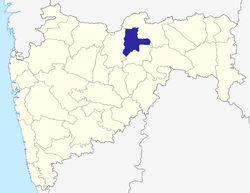 | |
| Monuments | ||
| Transport | ||
| Lok Sabha constituencies | ||
| Vidhan Sabha constituencies | ||
| Education |
| |
| Industry | ||
| People from Akola |
| |
| Districts of Vidarbha | |
|---|---|
| Cities with municipal corporations | |
Portal: Maharashtra | |
| Topics | |||||||||||||
|---|---|---|---|---|---|---|---|---|---|---|---|---|---|
| Regions | |||||||||||||
| Divisions and Districts |
| ||||||||||||
| Million-plus cities in Maharashtra | |||||||||||||
| Other cities with municipal corporations | |||||||||||||
Portal: Maharashtra | |||||||||||||