Jajpur district
| Jajpur Biraja Kshetra | |
|---|---|
| District | |
| Nickname(s): Jajra nagar | |
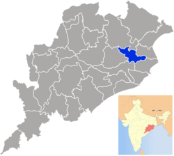 Location in Odisha, India | |
| Coordinates: 20°51′00″N 86°19′59″E / 20.85°N 86.333°ECoordinates: 20°51′00″N 86°19′59″E / 20.85°N 86.333°E | |
| Country |
|
| State | Odisha |
| Headquarters | Jajpur |
| Government | |
| • Collector | Ranjan Kumar DasIAS |
| • Member of Lok Sabha | Smt. Rita Tarai |
| Area | |
| • Total | 2,888 km2 (1,115 sq mi) |
| Elevation | 331 m (1,086 ft) |
| Population (2001) | |
| • Total | 1,900,054 |
| • Density | 658/km2 (1,700/sq mi) |
| Languages | |
| • Official | Odia, English |
| • Other local language | Ho |
| Time zone | UTC+5:30 (IST) |
| PIN | 755 xxx |
| Vehicle registration | OD-04, OD-34 |
| Literacy | 72.19% |
| Lok Sabha constituency | Jajpur |
| Vidhan Sabha constituency |
7
|
| Climate | Aw (Köppen) |
| Precipitation | 1,014 millimetres (39.9 in) |
| Avg. summer temperature | 38 °C (100 °F) |
| Avg. winter temperature | 12 °C (54 °F) |
| Website |
www |
| This article is part of a series on |
| Odisha |
|---|
 |
| Governance |
|
| Topics |
| GI Products |
|
Districts Divisions |
|
|
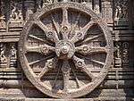
Jajpur is a district of Odisha, India, and an historic place of pilgrimage. As Jajpur was once the capital of the Kalinga kingdom, it is now an area of archeological wealth, including the famous Saktipitha of the Goddess Biraja, as well as the shrines of the Goddess Biraja (Durga), Yajnya Varaha (incarnation of Lord Vishnu as the white boar), Sapta Matruka, and a host of other religious figures, all located along the bank of the River Baitarani. Ashokajhar, Chandikhol, Chhatia, Gokarneswara, Kuansa Mangala, Mahavinayak, Patharajpur, Ratnagiri, Udayagiri, Satyapira, Singhapur, Vyas Sarovar, and Varuneswar Pitha are some of the destinations that attract tourists to the district, and the region's various natural resources support mines and industries.
Geography
The district is 2,888 square kilometres (1,115 sq mi) in area, of which 202 square kilometres (78 sq mi) is forested. The population is 1, 622,868 and the literacy rate is 72.19%. The district headquarters is at Jajpur. The district is home to some 1,781 villages and two major towns. Annual rainfall is 1,771.8 millimetres (69.76 in).
Important Places
- Biraja Khetra: This is the ancient name of its district headquarters Jajpur town. Jajpur town also known as Biraja Kshetra, the place sacred to Goddess Biraja, the symbol of Sakti (Power). It is a small city surrounded by the river Baitarani in semicircle and a high level canal at the other end. Jajpur town is believed to be the capital of Yayati Keshari the then king of Kalinga Empire during 11th–12th. century AD.
- Chhatia Batta: Chhatia is famous for Lord Jagannath Temple. It is 25 km from Cuttack. It is believed as the second Shreekhetra of Odisha according to the facts described in Malika. The accommodation facility can be availed at Chandikhol and Cuttack by hiring Hotels and Lodges. For financial purpose, the nearest bank located to this tourist place is S.B.I Chatia. The common languages spoken in the area are Odia, Hindi and English. PHC, Chatia is the nearest hospital for accessing medical facilities. People wear light cotton in summer and woolen in winter.
- Chandikhol: Chandikhol, which is 40 km from Cuttack, is an attractive picnic spot with natural springs and scenery.
- Dasaswamedha Ghat is situated on the bank of river Baitarani. This famous holy spot was built during the rule of Jajati Kesari. Baruni Snana is a significant occasion when many pilgrims visit the place for holy bath, which is celebrated during the month of February and March. It is believed that you are blessed if you take bath at Dasaswamedha Ghat in any holy day of Hindu calendar. The accommodation facility can be availed at Jajpur Road and Jajpur Town by hiring hotels and lodges. For financial purpose, the nearest banks located to this tourist place are S.B.I Chandikhol and a few nationalized banks. The common languages spoken in the area are Odia, Hindi and English. District Headquarters Hospital, Jajpur is the nearest hospital for accessing medical facilities. People wear light cotton in summer and woolen in winter.
- Janpada Shri Dadhibaman Jiew Temple: Janpada is situated at distance of 15 km from district headquarters and 25 km from Chandikhole. According to Mukti Mandap Mahasabha & various historical manuscripts Shri Dadhibaman jiew at Janpada is more-than-900-year-old deity and worshipped by Pujaris ( Dash)communities originally from UP. Ratha Yatra is the main function of Shri Dadhibana Jiew apart from so many festivals, Hera Panchami at Mausima Temple situated at Janpada eastern parts of the village and Sunabesa on Chariot at main temple creates a different spiritual atmosphere. Adhikari Madan Dash is the chief priest and as per family tradition Mahendra Nayak is the Chief Sevayat ( Servant) of Shri Dadhibaman Jiew.
- Golkunda Maa Bata Mangala Temple: At a distance of 16 from District Headquarter near to Janpada. According to local beliefs, if any one has serious health issues then s/he can be cured by the blessings of Maa Mangala. Every year from Pana/Bisuba Sankranti a Mahayangya takes place when lakhs of devotees come to witness and seek blessings. It is situated on the bank of River Brahmani and beautiful Golkunda Village.One should visit this beautiful place. Near by town is Brahmabarada.
- Budha Gosain Temple.... It is a historic and cultural place of Arangabad village of Bari Block. The distance of the temple is 26 km from Jajpur towards the Saheed Smruti Pitha of Kalamatia. There is Lord Jagannath, Balbhadra and Suvadra, worshipped by the pujaris. All the festivals of Lord Jagannath are observed here except Ratha Yatra.
- Mahabinayak: At a distance of 2 km from Chandikhol to the west, is situated the Mahabinayak temple. Tourists can enjoy its natural surroundings and the temples of Lord Binayak.
- Lalitgiri, Ratnagiri and Udayagiri: These three Buddhist monasteries (viharas) are between 60 km and 65 km northeast of Cuttack. They are said to be the ancient seat of Puspagiri, the Buddhist university of the 7th century A.D. Recently a statue of emperor Ashoka was excavated at Langudi hill. A new Buddha vihara at Hatikhal village was discovered in 2012[1]
- Duburi: At a distance of 38 km from Chandikhol towards the Daitari mines on the Express Highway, Duburi is home to a number of steel plants.
- Korai: Korai is a Block of Jajpur district, having a Primary Health Centre, a college, a few high schools, a 125-year-old minor school, and one of the oldest police stations of the erstwhile Cuttack district. This is an Assembly Constituency of Odisha State. It is situated alongside Calcutta Madras railway line of Indian Railway having a railway station named Jajpur-Keonjhar Road and about 9 km from National highway No.16 linking Calcutta.
- Baruneswar Temple: Situated in the village of Arei, the Baruneswar Temple stands beside a small stream named Kushabhadra branched off from the river Baitarani on the South Eastern Limit of the Triangular Biraja Kshetra. The Siva Linga is submerged under water. It is a famous spot for devotees and tourists during Rain and winter season. Makar Mela/Baruneswar Mela is one of the biggest fairs in Odisha. Every year it begins on 14 January (Makarasankranti i.e. 1st day of Magha). This is the right time for a visitor to visit this holy place. This place is 15 km from Jajpur Town.
- Vyasa sarovar mela (now called Vyasa Mahotsava) is the most famous festivals in Jajpur Road. Kalinga Nagar Mahotsav is being held at Jakhapura on June 30 every year.
- Jajpur Road Atta and Haripur in the Sukinda block. Situated near the Brahamni River Sukinda visit place is the Ashokjhar.
- Singhpur: A very ancient historical site situated on the bank of river Kharashrota in Binjhapur Tehsil of Jajpur district of Odisha. It was capital of Kalinga Kingdom during the period of King Sinha Bahu, a contemporary of Lord Buddha and king Bimbisara of Rajgriha.
- Jaraka :At a distance of 8 km from Chandikhol to the north towards balasore via nh 16, is situated the Gokarneswar temple (temple of Lord Shiva) in bank of river Brahmani. Tourists can enjoy its natural surroundings and nearby Budhhist heritages like Deuli, Langudi, etc.
Economy
Kalinga Nagar is situated in Danagadi Block where currently six big steel plants are operating like Jindal Stainless Limited, Neelanchal Ispat Nigam Limited, VISA Steel, Maithan Ispat Ltd., Mesco Steel, TATA STEEL and other seven are on their way to start production like Brahmani River Pellets Ltd or BRPL, Maharashtra Seamless Ltd etc.
Divisions
There are seven Vidhan Sabha (seats in the lower house).
Block Tehsil Subdivisions
- Badachana
- Bari
- Binjharpur
- Danagadi
- Dasarathpur
- Darpan
- Dharmasala
- Jajpur
- Jajpur sadar
- Korai
- Panikoili
- Rasulpur
- Sukinda
The district has 2 municipalities, 10 tehsils and 280 gram panchayats.
Demographics
According to the 2011 census Jajpur district has a population of 1,826,275,[2] roughly equal to the nation of Kosovo[3] or the US state of Nebraska.[4] This gives it a ranking of 261st in India (out of a total of 640).[2] The district has a population density of 630 inhabitants per square kilometre (1,600/sq mi) .[2] Its population growth rate over the decade 2001–2011 was 12.43%.[2] Jajpur has a sex ratio of 972 females for every 1000 males,[2] and a literacy rate of 80.44%.[2]
Languages
As the Jajpur area has been dominated by Ho people, local people widely speak in the Ho language [it is written with the "Varang Kshiti" (also "Warang Chiti" script)] as their mode of communication.Most people can speak, write all three languages Odia, Hindi & English.
Politics
Vidhan Sabha Constituencies
The following is the 7 Vidhan sabha constituencies[5][6] of Jajpur district and the elected members[7] of that area
| No. | Constituency | Reservation | Extent of the Assembly Constituency (Blocks) | Member of 14th Assembly | Party |
|---|---|---|---|---|---|
| 48 | Binjharpur | SC | Binjharpur, Dasarathpur (part) | Smt. Pramila Mallik | BJD |
| 49 | Bari | None | Bari, Jajpur (part), Rasulpur (part) | Debasis Nayak | BJD |
| 50 | Barchana | None | Barchana | Amar Prasad Satpathy | BJD* |
| 51 | Dharmasala | None | Dharmasala, Rasulpur (part) | Pranab Kumar Balabantray | BJD |
| 52 | Jajpur | None | Jajpur (M), Jajpur (part), Dasharathpur (part) | Pranab Prakash Das | BJD |
| 53 | Korei | None | Vyasanagar (M), Vyasanagar (O. G), Korei, Rasulpur (part) | Akash Das Nayak | BJD |
| 54 | Sukinda | None | Sukinda, Dangadi | Pritiranjan Ghadai | BJD |
Colleges
- N.C. Autonomous College, Jajpur Town
- Maa Tarinee Mahavidyalaya, Panikoili, Jajpur
- Vyasanagar Autonomous College, Vyasanagar, Jajpur Road
- A.S.College, Balia, Jajpur[8]
- Kalinganagar Polytechnic, Tarapur, Pahanga, Jajpur Road
- S G College, Kanikapada, Jajpur
- A.P.College, Sujanpur
- Biraja Women's College, Jajpur
- Biraja Law College, Jajpur
- Indira Gandhi Women's College, jajpur Road
- G.C.College, Ramchandrapur
- Kanhu Charana Mahavidyalaya, korai
- L.B.Jew College, Angalo
- Mangalpur Women's College, Mangalpur
- Regional College, Rambag
- P.K.Mohabidyalaya, Baitarni Road
- B.B.Mohabidyalaya, Chandikhole
- Sahaspur College, Sahaspur
- M.H.D.Mohabidyalaya, Chatia
- B.S.College, Nuahat
- U.N.S Mohabidyalaya, Mugupal
- Madhupur College, Kalan
- Brahmabarada Mohabidyalaya, Barada Vihar
- Kharasrota Mahabidyalaya, Singhapur
- Baruneswar Mohabidyalaya, Arei
- Junabhadra College, Bitana
- A.B.J.Women's College, Alkund
- Chitalo Mohavidyalaya, Birajakshetra, Jajpur.
- Dharmasala Mahabidyalaya, Dharmasala
- Jenapur College, Jenapur
- Sukinda College, Sukinda
- Jhadeswar College, Tolkani
- B.V.Mohabidyalaya, Haripur
- Dasarathpur college, Dasarathpur
- Bajragiri Mahavdyalay Boudhavihar, Kotpur
- Private:-
- Excelsior +2 College, Jajpur Town
- Hitech +2 College, Kuakhia
- Gokarnika +2 College, Jaraka.
- Reneinshaw +2 College, Jaraka
References
- ↑ "Buddha Vihar Unearthed in Odisha's Jajpur district, Odisha Current News". orissadiary.com. 2012. Retrieved 17 August 2012.
The remains of a Buddha vihar along with some stone images of Lord Buddha, Ganesh, Saraswati, Padmapani and others were unearthed from a land in village Hatikhal in Jajpur district
- 1 2 3 4 5 6 "District Census 2011". Census2011.co.in. 2011. Retrieved 2011-09-30.
- ↑ US Directorate of Intelligence. "Country Comparison:Population". Retrieved 2011-10-01.
Kosovo 1,825,632 July 2011 est.
- ↑ "2010 Resident Population Data". U. S. Census Bureau. Archived from the original on 2013-10-19. Retrieved 2011-09-30.
Nebraska 1,826,341
- ↑ Assembly Constituencies and their EXtent
- ↑ Seats of Odisha
- ↑ "List of Member in Fourteenth Assembly". ws.ori.nic.in. Archived from the original on 2 May 2007. Retrieved 19 February 2013.
MEMBER NAME
- ↑ http://www.icbse.com/colleges/a-s-college-balia-jajpur/30011/2
8. ^Mahavamsa. Ceylon Government. 1912.
External links
Places adjacent to Jajpur district | |
|---|---|
| Governance |
|  | |||||
|---|---|---|---|---|---|---|---|
| Topics | |||||||
| GI Products | |||||||
| Districts and divisions |
| ||||||
| Cities | |||||||
v