Jiribam
| Jiribam ꯖꯤꯔꯤꯕꯥꯝ | |
|---|---|
| Town | |
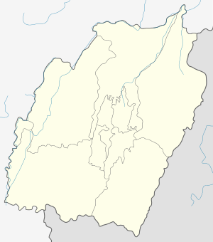 Jiribam Location in Manipur, India  Jiribam Jiribam (India) | |
| Coordinates: 24°48′N 93°07′E / 24.80°N 93.12°ECoordinates: 24°48′N 93°07′E / 24.80°N 93.12°E | |
| Country |
|
| State | Manipur |
| District | Jiribam |
| Population (2011) | |
| • Total | 43,838 |
| Languages | |
| • Official | Meiteilon (Manipuri) |
| Time zone | UTC+5:30 (IST) |
| Vehicle registration | MN |
| Website |
manipur |
Jiribam is a municipal council in the Jiribam district of Manipur, India. Followed by the Hmar, it is one of the fastest growing towns in Manipur.
The town is located on the state's western-most boundary, adjoining the Cachar district of Assam. It is also known as the western gate of Manipur. Jiribam is inhabited by various tribal communities, such as the Meiteis, Pangals, Nagas, Thadou-Kuki, Kabui (Rongmeis) and Hmar. The Meitei people are the majority ethnic group of Jiribam.
History
The recorded history of Jiribam began during the British colonial period. At the beginning of the 19th Century, several tribes and religious groups began to migrate to the area along the Jiri River. During this era, the Jiri River was a famous landmark and Jiribam was a major trade center. The area was ruled by Maharaja Meidingngu Churachand from 1891-1941. He was a minor at the time of his ascendancy. In 1907, the Manipur State Durbar was established to assist the Maharaja in the administration of the area. His son, the Maharaja Bodhchandra Singh, ruled the area from 1941-1955. In 1940, Jiribam became a Mauza and the office of the Mauzardar of Jiribam was converted into an S.D.C. office in 1950.
Following independence, an agreement was signed on September 2, 1949, between the Government of India and the Maharaja of Manipur. As a result of this agreement, the region of Manipur was merged with the Indian Union on October 15, 1949. After the enactment of the Union Territories Act of 1956, Manipur became one of the Union Territories. Imphal was then declared as the state capital.[1]
In 2017, an M.L.A candidate from Bengali community, Ashab Uddin Ahmad, became the first member of the Jiribam minority community to win an election.
Geography
Jiribam is located at 24°48′N 93°07′E / 24.80°N 93.12°E.[2]
Climate
Jiribam's climate is humid subtropical, characterized by short winters and long summers with heavy rainfall. Depending on the location, some areas may experience snowfall during the winter months. As with many areas in India, Jiribam is also subject to powerful monsoons.
Rainfall
Jiribam lies under the direct influence of S-W monsoon and rainfall is abundant, as compared to other places in the state. About 20-30% of annual rainfall occurs during the pre-monsoon season in the month of May whereas about 60-70% of rainfall occurs in the rainy season running from the second half of June to September, where the average rainfall ranges from 1,000 mm to 1,600 mm.
Temperature
Jiribam is humid with a moderately hot temperature. The months of May and June are the hottest season. The hottest temperature is recorded in May, which is about 40 °C (104 °F). The temperature is very pleasant in autumn, which falls around September to November. The lowest temperatures are recorded from the second half of December to the first half of January (i.e., below 2.78 °C) at late night. However, days are comfortably warm even in this period.
Demographics
As of 2001 India census,[3] Jiribam had a population of 6426. Males constitute 49% of the population and females 51%. Jiribam has an average literacy rate of 73%, higher than the national average of 59.5%: male literacy is 80%, and female literacy is 66%. In Jiribam, 13% of the population is less than 6 years of age.
Economy
The Jiribam town consists of administrative headquarters of the subdivision and as a growth center, which provides medical, educational and commercial facilities in and around the region. According to the 2001 census, 80% of its working population is engaged in non-agricultural activities and the main function of the town is categorized as “Services”. One important sector is a tertiary sector in which government servants play a vital role. About 20% of the population are government employees, which provides more income than the secondary sector.[4]
Transport
Jiribam is home to Manipur's first railway station.[5] Jiribam is currently connected to the rest of India by a recently converted Broad Gauge track towards Silchar. A rail project to connect Imphal through Jiribam–Tupul–Imphal is being executed and is expected to be complete by 2018. This project is on the alignment of a railway line proposed to connect with Myanmar. There are 2 highways that connect with Imphal: one with the capital of Manipur and the other with Assam and Meghalaya. Railway construction is not expected to be completed soon.
Politics
Jiribam is part of the Outer Manipur (Lok Sabha constituency).[6]
Population
This small town is currently composed of many Bengali immigrants. The majority of the population is meitei at 40%, Bengali Muslim 35%, 15% Bengali Hindus and the remaining comprises hmar, rongmei and paite.
References
- ↑ http://www.hoparoundindia.com/manipur/history-of-jiribam.aspx
- ↑ "Yahoo maps location of Jiribam". Yahoo maps. Retrieved 30 December 2008.
- ↑ "Census of India 2001: Data from the 2001 Census, including cities, villages and towns (Provisional)". Census Commission of India. Archived from the original on 16 June 2004. Retrieved 1 November 2008.
- ↑ http://townplanningmanipur.nic.in/documents/IHSDP_DPR_jiribam%5Bpermanent+dead+link%5D
- ↑ http://news.oneindia.in/2011/01/21/imphaljiribam-railway-line-spearheadinginfrastruc-aid0121.html
- ↑ "Assembly Constituencies - Corresponding Districts and Parliamentary Constituencies" (PDF). Manipur. Election Commission of India.