Simdega district
| Simdega district | |
|---|---|
| District of Jharkhand | |
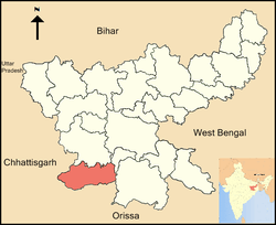 Location of Simdega district in Jharkhand | |
| Country | India |
| State | Jharkhand |
| Administrative division | South Chotanagpur division |
| Headquarters | Simdega |
| Government | |
| • Lok Sabha constituencies | Khunti |
| • Assembly seats | 3 |
| Area | |
| • Total | 3,774 km2 (1,457 sq mi) |
| Population (2018) | |
| • Total | 599,813 |
| • Density | 160/km2 (410/sq mi) |
| • Urban | 42,933 |
| Demographics | |
| • Literacy | 67.59 per cent |
| Average annual precipitation | 85% mm |
| Website | Official website |
Simdega district is one of the twenty-four districts of Jharkhand state, India, and Simdega town is the administrative headquarters of this district. This district is the least population density district of jharkhand(2011).This district was carved out from erstwhile Gumla district on 30 April 21. It is currently a part of the Red Corridor.[1] As of 2011 it is the third least populous district of Jharkhand (out of 24), after Lohardaga and Khunti districts.[2]
Economy
In 2006 the Ministry of Panchayati Raj named Simdega one of the country's 250 most backward districts (out of a total of 640).[3] It is one of the 21 districts in Jharkhand currently receiving funds from the Backward Regions Grant Fund Programme (BRGF).[3] Simdega is a minority concentrated district.
Administration
Blocks/Mandals
The following are the list of blocks in Simdega district.
Demographics
According to the 2011 census Simdega district has a population of 599,813,[2] roughly equal to the nation of Solomon Islands[5] or the US state of Wyoming.[6] This gives it a ranking of 526th in India (out of a total of 640).[2] The district has a population density of 160 inhabitants per square kilometre (410/sq mi) .[2] Its population growth rate over the decade 2001-2011 was 16.62%.[2] Simdega has a sex ratio of 1000 females for every 1000 males,[2] and a literacy rate of 67.59%.[2] It is the only Christian majority district in Jharkhand.[4]
Culture
Popular places in Simdega District
- Chhinda Dam
- Ramrekha dham - it is commonly believed by the tribals in the area that Lord Rama had visited this place in his exile years.
- Ramjanki Mandir
- Gandhi Maidan
- Kelaghagh
- Kobang Dam
- sarna mandir
- Dhangadi- It is a picnic place of Shankh river in bolba block. Where naturally rocks cut by river water looked very attractive.
See also
References
- ↑ "83 districts under the Security Related Expendure Scheme". IntelliBriefs. 2009-12-11. Retrieved 2011-09-17.
- 1 2 3 4 5 6 7 "District Census 2011". Census2011.co.in. 2011. Retrieved 2011-09-30.
- 1 2 Ministry of Panchayati Raj (September 8, 2009). 27, 2011 "A Note on the Backward Regions Grant Fund Programme" Check
|url=value (help). National Institute of Rural Development. - 1 2 Simdega District Population Census 2011, Jharkhand literacy sex ratio and density
- ↑ US Directorate of Intelligence. "Country Comparison:Population". Retrieved 2011-10-01.
Solomon Islands 571,890 July 2011 est.
- ↑ "2010 Resident Population Data". U. S. Census Bureau. Retrieved 2011-09-30.
Wyoming 563,626
External links
Places adjacent to Simdega district | |
|---|---|
Coordinates: 22°36′36″N 84°30′00″E / 22.61000°N 84.50000°E