Malappuram district
| Malappuram district | |
|---|---|
| District | |
 Kottakkunnu Hills in 2009, Malappuram | |
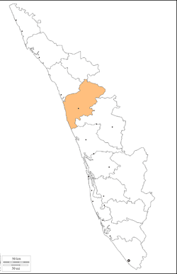 Location in Kerala, India | |
 Malappuram district Location in Kerala, India | |
| Coordinates: 11°02′N 76°03′E / 11.03°N 76.05°ECoordinates: 11°02′N 76°03′E / 11.03°N 76.05°E | |
| Country | India |
| State | Kerala |
| Headquarters | Malappuram |
| Government | |
| • Collector |
Amit Meena IAS District police chief. = Prateesh Kumar, IPS |
| Area | |
| • Total | 3,550 km2 (1,370 sq mi) |
| Population (2011) | |
| • Total | 4,110,956 |
| • Rank | 1 |
| • Density | 1,158/km2 (3,000/sq mi) |
| Languages | |
| • Official | Malayalam, English |
| Time zone | UTC+5:30 (IST) |
| ISO 3166 code | IN-KL-MLP |
| Vehicle registration | KL-10, KL-53, KL-54, KL-55, KL-65, KL-71 |
| Sex ratio | 1096 ♂/♀ |
| Literacy | 93.55% |
| Website |
www |
Malappuram district, with its headquarters at Malappuram, is a district in the state of Kerala, India. The district was formed on 16 June 1969. Malappuram district is composed of portions of the former Palakkad and Kozhikode districts: Ernad taluk and portions of Tirur taluk in Kozhikode district, and portions of Perinthalmannna and Ponnani taluks in Palakkad district.
Historically a stronghold of orthodox Brahminical Hinduism many famous scholars like Melpathur Narayana Bhattathiri who composed the Narayaneeyam in Sanskrit, poonthanam namboodiri and Thunchaththu Ramanujan Ezhuthachan came from Malappuram. The ancient Kerala school of astronomy and mathematics though mainly centred in Thrissur also had namboodiri and nair scholars coming from malappuram. Today the district includes Thirunavaya, the classic medieval centre of Vedic learning; Kottakkal, home of Ayurveda medicine. Islam came to Malappuram early in prophet Mohammed's era itself. Ponnani, one of the oldest centres of Islamic education in the region is located here.
In 1921 the present-day Malappuram district was part of the Moplah rebellions, followed by decades of stagnant economic, social and political development. In the early years of Communist rule in Kerala, Malappuram experienced land reform under the Land Reform Ordinance. During the 1970s Persian Gulf oil reserves were opened to commercial extraction, and thousands of unskilled workers migrated to the Gulf. They sent money home, supporting the rural economy, and by the late 20th century the region had First World health standards and near-universal literacy.[1]
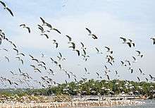
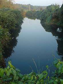
Malappuram district contains abundant wildlife and a number of small hills, forests, rivers and streams flowing to the west, backwaters and paddy, arecanut, cashew nut, pepper, ginger, pulses, coconut, banana, tapioca, and rubber plantations. Malappuram is one of two Muslim-majority districts in south India. The Hindu temples and Moplah mosques of the region are known for their colorful festivals, and it is the most populous district in Kerala.[2] Religions practised in the district include Hinduism, Islam, Christianity, Buddhism, Sikhism, Jainism and tribal religions.[3]
History
Malappuram, meaning "terraced place atop the hills", derives from the geography of the district headquarters. Before the district's formation, the region was known as Eranad, Valluvanad, Vettathunad etc.
The district has a rich cultural and political heritage. The port of Ponnani (roughly identified with Tyndis) was a centre of trade with Ancient Rome. After the Chera Dynasty a number of dynasties controlled the area, and by the ninth century the region was ruled by the Kulasekharas of Mahodayapuram. After the disintegration of the Kulasekhara kingdom a number of Nair city-states emerged, including Valluvanad, Vettattunadu (Tanur), Parappanad and Nediyiruppu (ruled by the Zamorins). During the 13th century, the Samoothiri of Calicut expanded their territories to Malabar. Thirunavaya, the seat of Mamankam, was in Malappuram district.
European colonial powers first landed in Malabar during the 15th century, and the Samoothiris often allied with foreign powers. During the 18th century, the de facto Mysore kingdom rulers Hyder Ali and Tipu Sultan marched into the Samoothiris’ districts.
Malappuram has been part of movements such as Khilafat Movement and Moplah Rebellion in the early 20th century. Before Indian independence in 1947, Malappuram was part of Malabar District in the Madras Presidency of British India. The present district was administered as parts of Kozhikode, Eranad taluk, Valluvanad Taluk and Ponnani taluk. Malabar District remained part of Madras state for some time after independence, but on 1 November 1956 it merged with Travancore-Cochin to form the state of Kerala. Large-scale changes in the territorial jurisdiction of the region took place in 1957 and 1969. On 1 January 1957, Tirur taluk was formed from portions of Eranad taluk and Ponnani taluk. Another portion of Ponnani taluk was transferred to the new Chavakkad taluk in Thrissur district, and the remainder is present-day Ponnani taluk. Perinthalmanna taluk was formed from the former Valluvanad Taluk. Of these, Eranad Taluk and Tirur remained in Kozhikode District and Perinthalmanna Taluk and Ponnani taluk remained in Palakkad District. The new district of Malappuram was formed with four taluks (Eranad, Perinthalmanna, Tirur and Ponnani), four towns, fourteen developmental blocks and 100 panchayats. Two more taluks, Tirurangadi, Nilambur and Kondotty were formed from Tirur Taluk and Eranad taluk.
Geography
The district, in northern Kerala, is bounded on the northeast by Wayanad and northwest by Kozhikkode districts, on the northeast by Tamil Nadu, on the southeast and south by Palakkad District, on the southwest by Thrissur District and on the west by the Arabian Sea.
Demographics
In the 2011 census the district had a population of 4,112,920.[2]
Malappuram is the 50th-most-populous of India's 640 districts,[2] with a population density of 1,158 inhabitants per square kilometre (3,000/sq mi).[2] Its population-growth rate from 2001 to 2011 was 13.39 percent.[2] Malappuram has a sex ratio of 1096 women to 1000 men,[2] and its literacy rate is 93.55 percent.[2]
Languages
Malayalam is the district's principal language. Minority Dravidian languages are Allar (350 speakers)[4] and Aranadan, kept alive by the low education level of its 200 speakers.[5]
Administration
Indian Parliament Constituencies
- Malappuram
- Ponnani
- Wayanad (part)
Taluks
- Eranad
- Tirur
- Tirurangadi
- Ponnani
- Perintalmanna
- Nilambur
- Kondotty
Kerala Assembly Constituencies
Malappuram, Manjeri, Kondotty, Eranad, Mankada, Perinthalmanna, Thirurangadi, Vengara, Vallikkunnu, Tirur, Tanur, Kottakkal, Nilambur, Wandoor, Ponnani and Tavanur
Industry
About 1,000 people are aided annually under a self-employment programme. There are KINFRA food-processing and IT industrial estates in Kakkancherry, Inkel SME Park at Panakkad for Small and Medium Industries and a rubber plant and industrial estate in Payyanad. MALCOSPIN, The Malappuram Spinning Mills Limited is one of the oldest industrial establishment in the district under state Government. Wood-related industries are common in Kottakkal, Edavanna, Vaniyambalam, Karulai, Nilambur and Mampad. Sawmills, furniture manufacturers and the timber trade are the most important businesses in the district. Employees' State Insurance has its branch office at Malappuram. Wood-related industries are in Kottakkal, Edavanna, Vaniyambalam, Karulai, Nilambur and Mampad. Sawmills, furniture manufacturers and the timber trade are the most important businesses in the district. Employees' State Insurance has a branch office in Malappuram.
As of July 2013, Malappuram is the highest beneficiary in receiving donations from migrants abroad among all the districts in Kerala.[6]
See also
References
- ↑ "Summer Journey 2011". Time. 21 July 2011.
- 1 2 3 4 5 6 7 "District Census 2011". Census2011.co.in. 2011. Retrieved 2011-09-30.
- ↑ pp. 396, Malayala Manorama Yearbook 2006, Kottayam, 2006 ISSN 0970-9096
- ↑ M. Paul Lewis, ed. (2009). "Allar: A language of India". Ethnologue: Languages of the World (16th ed.). Dallas, Texas: SIL International. Retrieved 2011-09-28.
- ↑ M. Paul Lewis, ed. (2009). "Aranadan: A language of India". Ethnologue: Languages of the World (16th ed.). Dallas, Texas: SIL International. Retrieved 2011-09-28.
- ↑ "Gulf money fueling Muslim extremism in Kerala; IUML grows more militant to take on other radical islamist parties". The Economic Times. 3 July 2013.
External links
| Wikimedia Commons has media related to Malappuram district. |
| Wikivoyage has a travel guide for Malappuram District. |
Places adjacent to Malappuram district | |
|---|---|
| Authority control |
|---|