Arrah
| Arrah Ara, Ara Zila | |
|---|---|
| City | |
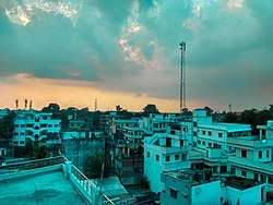 Arrah City View | |
 Arrah Location in Bihar, India | |
| Coordinates: 25°33′27″N 84°40′12″E / 25.55750°N 84.67000°ECoordinates: 25°33′27″N 84°40′12″E / 25.55750°N 84.67000°E | |
| Country | India |
| State | Bihar |
| District | Bhojpur |
| Named for | Aaranya Devi Temple |
| Government | |
| • Type | Municipal Corporation |
| • Body | Arrah Municipal Corporation |
| Elevation | 190 m (620 ft) |
| Population (2011) | |
| • Total | 261,430 [1] |
| Time zone | UTC+5:30 (IST) |
| PIN | 802 301; 802302; 802312 |
| Telephone code | +916182 |
| Vehicle registration | BR-03 |
| Website |
bhojpur |

.jpeg)
Arrah is a city and a municipal corporation in Bhojpur district in the state of Bihar, India. The name is also sometimes transliterated as Ara.[2] The term Ara or Arrah comes from the famous temple of goddess Aaranya (Aaranya Devi) which is situated in the city. It is the district headquarters of Bhojpur district, located near the confluence of the Ganges and Sone rivers, some 24 miles from Danapur and 36 miles from Patna.[3]
History
During the Indian rebellion of 1857, a group of 18 British civilians and 50 Indian soldiers was besieged in the Little House at Arrah, by a band of 2500–3000 armed soldiers and around 8000 others under the command of 80-year-old Veer Kunwar Singh, the Zamindar of adjacent Jagdishpur. A British regiment, despatched to their assistance from Danapur, was repulsed,[4] but the group withstood the siege for eight days until relieved by other East India Company troops.[5]
Demographics
As per 2011 census, Arrah Municipal Corporation had a total population of 261,099, out of which 139,319 were males and 121,780 were females. It had a sex ratio of 874. The population below 5 years was 34,419. The literacy rate of the 7+ population was 83.41 per cent.[6]
Notable people
Climate
Climate is characterised by relatively high temperatures and evenly distributed precipitation throughout the year. The Köppen Climate Classification sub-type for this climate is "Cfa" (Humid Subtropical Climate).[7]
| Climate data for Arrah | |||||||||||||
|---|---|---|---|---|---|---|---|---|---|---|---|---|---|
| Month | Jan | Feb | Mar | Apr | May | Jun | Jul | Aug | Sep | Oct | Nov | Dec | Year |
| Average high °C (°F) | 23 (73) |
26 (78) |
32 (90) |
37 (99) |
38 (100) |
36 (96) |
33 (91) |
32 (89) |
32 (90) |
32 (89) |
28 (82) |
24 (75) |
31 (88) |
| Average low °C (°F) | 11 (51) |
13 (55) |
18 (64) |
23 (74) |
26 (78) |
27 (80) |
27 (80) |
27 (80) |
26 (79) |
23 (73) |
16 (61) |
11 (52) |
21 (69) |
| Average precipitation mm (inches) | 15 (0.6) |
18 (0.7) |
10 (0.4) |
8 (0.3) |
36 (1.4) |
180 (7.1) |
295 (11.6) |
333 (13.1) |
218 (8.6) |
58 (2.3) |
8 (0.3) |
5 (0.2) |
1,186 (46.7) |
| Average precipitation days | 1.4 | 1.7 | 1 | 0.7 | 3 | 10.1 | 14 | 15.1 | 8.1 | 4 | 0.8 | 0.6 | 60.5 |
| Source: Weatherbase[8] | |||||||||||||
See also
References
- ↑ http://www.census2011.co.in/census/city/176-arrah.html
- ↑ Bhojpur District
- ↑ "Arrah", Falling Rain Genomics
- ↑

- ↑ John James Halls, Two Months in Arrah in 1857, London, Longman, Green, Longman and Roberts (1860) Online, Google Books
- ↑ "Cities having population 1 lakh and above" (PDF). Provisional Population Totals, Census of India 2011. Retrieved 2012-04-16.
- ↑ Climate Summary for Arrah (from Weatherbase.com
- ↑ "Weatherbase.com". Weatherbase. 2013. Retrieved on 31 July 2013.
External links
| Authority control |
|---|