Dewas district
| Dewas district | |
|---|---|
| District of Madhya Pradesh | |
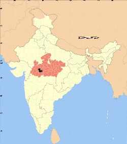 Location of Dewas district in Madhya Pradesh | |
| Country | India |
| State | Madhya Pradesh |
| Administrative division | Ujjain |
| Headquarters | Dewas |
| Tehsils | 9 Sonkatch, Dewas, Bagli, Kannod, Tonk Khurd and Khategaon, Hatpiplya, Satwas, Udaynagar dewas Nagar |
| Government | |
| • Lok Sabha constituencies | Dewas |
| Area | |
| • Total | 70,020 km2 (27,030 sq mi) |
| Website | Official website |
Dewas District is a district of Madhya Pradesh state in central India. The town of Dewas is the district headquarters.
Dewas District roughly corresponds to the territories of the twin princely states of Dewas. The district straddles the Vindhya Range; the northern portion of the district lies on the Malwa plateau, while the southern portion lies in the valley of the Narmada River. The Narmada forms the southern boundary of the district. The district is bounded to the east by Sehore District, to the south by the Harda and Khandwa districts, to the west by the Khargone and Indore districts, and to the north by the Ujjain and Shajapur districts. Dewas District is part of Ujjain Division. Devsaal Rawats of Uttarakhand are said to have their origins in Dewas at the time of legendary king Vikramāditya.[1]
Dewas District is now divided into nine tehsils namely Sonkatch, Dewas, Bagli, Kannod, Tonk Khurd, Khategaon, Hatpiplya, Satwas, Udaynagar. Dewas tehsil is situated on the north-western part of the district, Sonkatch on the north-eastern part, Bagli on the south, Kannod on the south-central part and Khategaon on the South-east. Dewas, the headquarters of Dewas tehsil, which is also the district headquarters, is situated on National Highway No. 3 and is also connected by broad-gauge railway line of western Railway.[2]
Demographics
According to the 2011 census Dewas District has a population of 1,563,107,[3] roughly equal to the nation of Gabon[4] or the US state of Hawaii.[5] This gives it a ranking of 319th in India (out of a total of 640).[3] The district has a population density of 223 inhabitants per square kilometre (580/sq mi) .[3] Its population growth rate over the decade 2001-2011 was 19.48%.[3] Dewas has a sex ratio of 941 females for every 1000 males,[3] and a literacy rate of 70.53%.[3]
Languages
Languages spoken include Hindi, Maalvi, Bangla, English, Marathi and Bareli Rathwi, a Bhil language with approximately 64,000 speakers.[6]
Places of interest
Pushpgiri Tirth, Sanwer, Sonkatch
Shri Digambar Jain Teerth Kshetra, Pushpagiri is located 4 km (2.5 mi) west toward Sonkatch in the area of the Songiri Hills.[7][8] The temple here is dedicated to Lord Mahavir. This Jain kshetra is a sprawling 250-acre complex housing Jain Sthanaks, schools, hospital, museum, cottages, shopping centers and a 108-foot-tall (33 m) idol of Bhagwan Paraswanath in an Yogic (Padmasan) posture, one of the tallest Jain idols.
Kheoni wildlife Sanctuary
Kheoni or Khinvi wildlife Sanctuary was established in 1955.[9] The area of reserved forest is 115.320 sq km and of protected forest is 16.678 sq km and totalling to 132.778 sq km. This sanctuary houses different types of animals, birds, and aquatic creatures.
Kavadia Hills
This pahaad, situated next to Potla and Pipri villages in Bagli Taluk, Dewas district is a series of small rocky mountains.[10] There are total seven mountain-like formations of shaped interlocking basalt columns that were probably created simultaneously as a result of volcanic eruption millions of years ago.[11] These rock columns are arranged in a pattern that gives an appearance of a man made structure. Most of the columns are hexagonal and interlocked with similar rocks on all the edges that emit a musical sound when struck.[12] Most visible columns are 8 to 10 feet long but there can be longer rocks further deep inside the mountain. Although basalt columns are not unique and are found at several places around the world (including St. Mary's Islands in Karnataka, India), the quality, quantity, geometrical arrangement and location (far from an ocean) of this place is unique.
Gidya Khoh
Situated on the Indore-Nemawar [Road NH 59A], Gidya Khoh or Gidiya Khoh lies in the Dewas District, and has a waterfall surrounded by a valley. The waterfall cascades from a height of 500–600 ft. Khudel devta temple is located here.. Gidya Khoh is located about 48 km south of Dewas and 42 km east of Indore, and Double Chwki is the nearest junction from which Gidya Khoh is 9 km away.[10]
Dewas' water management programs
The United Nations awarded Dewas district's community water management works the 3rd place under the category of "Best Water Management Practices" for 2011–2012.[13] The United Nations also praised Bhagirath Krishhak Abhiyan of Dewas district, started by district administrator Umakant Umrao.[13] A documentary film made by Public Service Broadcasting Trust about Dewas water revolution was featured on Lok Sabha TV.[14]
References
- ↑ http://dic.mp.nic.in/dewas/default.aspx
- ↑ http://dic.mp.nic.in/dewas/Dewas/HTML/genrel.htm
- 1 2 3 4 5 6 "District Census 2011". Census2011.co.in. 2011. Retrieved 2011-09-30.
- ↑ US Directorate of Intelligence. "Country Comparison:Population". Retrieved 2011-10-01.
Gabon 1,576,665
- ↑ "2010 Resident Population Data". U. S. Census Bureau. Archived from the original on 2013-10-19. Retrieved 2011-09-30.
Hawaii 1,360,301
- ↑ M. Paul Lewis, ed. (2009). "Bareli, Rathwi: A language of India". Ethnologue: Languages of the World (16th ed.). Dallas, Texas: SIL International. Retrieved 2011-09-28.
- ↑ http://www.pushpgiri.emsindia.com/
- ↑ http://jinaagamsaar.com/tirth/pushpgiri.php
- ↑ http://www.mpforest.org/kheoni.html
- 1 2 http://dic.mp.nic.in/dewas/Dewas/html/tourist.htm
- ↑ http://timesofindia.indiatimes.com/city/indore/Rare-rock-formation-found-in-Dewas-district/articleshow/17744224.cms?referral=PM
- ↑ http://www.dewasonline.in/city-guide/dewas-tourism
- 1 2 "'Water for Life' UN-Water Best Practices Award: 2012 edition: Finalists". Retrieved 2015-05-21.
3rd ranked: Bhagirath Krishhak Abhiyan, Water Conservation for Food Security
- ↑ "Umakant Umrao "Dewas Ke Bhagirath"". Retrieved 2015-05-21.
External links
| Wikimedia Commons has media related to Dewas district. |
Places adjacent to Dewas district | |
|---|---|
Coordinates: 22°57′36″N 76°03′00″E / 22.96000°N 76.05000°E