Jhabua
| Jhabua | |
|---|---|
| city | |
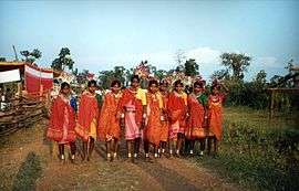 Bhil tribe girls in Jhabua | |
 Jhabua  Jhabua | |
| Coordinates: 22°46′N 74°36′E / 22.77°N 74.6°ECoordinates: 22°46′N 74°36′E / 22.77°N 74.6°E | |
| Country | India |
| State | Madhya Pradesh |
| District | Jhabua |
| Elevation | 318 m (1,043 ft) |
| Population (2001) | |
| • Total | 30,577 |
| Languages | |
| • Official | Hindi |
| Time zone | UTC+5:30 (IST) |
| Vehicle registration | MP-45 |
| Website |
www |
Jhabua (Hindi: झाबुआ) is a town and a municipality in Jhabua district in the Indian state of Madhya Pradesh. It is the administrative headquarters of Jhabua District.
History
Jhabua Princely State
Jhabua was the capital of a princely state of the British Raj's Central India, in the Bhopawar agency. Its area, with the dependency of Rutanmal, was approx 1,336 square miles (3,460 km2).[1] The Rajas of Jhabua belonged to the Rathor dynasty. [2]
The ancestor of the family was Rao Bar Singh a.k.a. the Birji, fifth son of Jodha of Mandore of Marwar. His descendant, Kunwar Kesho Das or Kishan Das, founded Jhabua in 1584.
Raja Kesho Das was first Raja of Jhabua 1584/1607. He was granted the title of Raja by the Emperor of Delhi, as a reward for a successful campaign in Bengal, and for punishing the Bhil chiefs of Jhabua who had murdered an Imperial Viceroy of Gujarat. The names of the rulers are:[3]
| Name | Year |
|---|---|
| Karan Singh | 1607 – 1610 |
| Mah Singh | 1610 – 1677 |
| Kushal Singh | 1677 – 1723 |
| Anup Singh | 1723 – 1727 |
| Sheo Singh | 1727 – 1758 |
| Bahadur Singh | 1758 – 1770 |
| Bhim Singh | 1770 – 1821 |
| Pratap Singh | 1821 – 1832 |
| Ratan Singh | 1832 – 1840 |
| Gopal Singh | 1841 – 1895 |
| Udai Singh | 1895 – 1942 |
| Dilip Singh (titular post independence) | 1942 – 1965 |
| Ajit Singh (titular) | 1965 – 2002 |
| Narendra Singh (titular) | 2002 – present |
Post-Independence
After India's independence in 1947, its rulers acceded to India, and Jhabua became a part of the newly created Madhya Bharat state, which in 1956 was merged into Madhya Pradesh.
Bhabhara which was once part of the Jhabua district, is the place where Chandrasekhar Azad, the freedom fighter spent his early life when his father Pandit Sitaram Tiwari was serving in the erstwhile estate of Alirajpur. But, when Alirajpur district (which was once the part of Jhabua district) got separated from Jhabua, Bhabhra became the part of Alirajpur district.
Geography
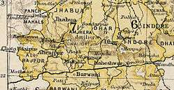
Jhabua has an average elevation of 318 metres (1043 feet).[4] Jhabua is located at the bottom right side of MP, mainly towards Gujarat.
Demographics
As of 2001 India census,[5] Jhabua had a population of 30,577. Males constitute 52% of the population and females 48%. As per 2011 census, Jhabua has an average literacy rate of 44%. Male literacy is at 54% and female literacy is 34%. In Jhabua, 20% of the population is under 6 years of age.[6]
Jhabua city is famous for its black cotton soil commonly known as "White Gold". There are many interesting places in Jhabua Thasil.
Educational status of Jhabua
Development is seen in Jhabua in past 10-15 years. Now it has become a good and transformed town from the earlier 'tribal' jhabua. There is one government college SCAMV(Shaheed Chandra Shekhar Azad Mahavidyalaya) which imparts post graduate education and a government engineering college Dr. APJ Abdul Kalam UIT Jhabua And some of the private colleges are Maa Tripura College Of Nursing, Padma College Of Education, Maa Sharda College Of Nursing, Maa Sharda College Of Education. And Some of the top English schools are Kendriya Vidyalaya, New Catholic Mission School, Jain Public School, Sharda Vidhya Mandir, Keshav International School, Keshav Vidya Peeth, Indore Public School, Keshav's Baby's Office, etc.
.PNG)
References
- ↑

- ↑ http://rulers.org/indstat1.html
- ↑ http://members.iinet.net.au/~royalty/ips/j/jhabua.html
- ↑ Falling Rain Genomics, Inc - Jhabua
- ↑ "Census of India 2001: Data from the 2001 Census, including cities, villages and towns (Provisional)". Census Commission of India. Archived from the original on 2004-06-16. Retrieved 2008-11-01.
- ↑ "Profile of Jhabua District" (PDF).