Budgam
| Budgam | |
|---|---|
| town | |
| Nickname(s): Badgaon | |
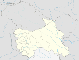
 Budgam Location in Jammu and Kashmir, India  Budgam Budgam (India) | |
| Coordinates: 34°00′54″N 74°43′19″E / 34.015°N 74.722°ECoordinates: 34°00′54″N 74°43′19″E / 34.015°N 74.722°E | |
| Country |
|
| State | Jammu and Kashmir |
| District | Budgam |
| Founded by | Ayatollah Aga Syed Yousuf Mosavi and Sheikh Mohammad Abdullah |
| Government | |
| • Type | Democratic |
| • Body | Nagar Palika |
| Area | |
| • Total | 1,300 km2 (500 sq mi) |
| Area rank | 8 |
| Elevation | 1,610 m (5,280 ft) |
| Population (2011) | |
| • Total | 753,745 |
| • Density | 580/km2 (1,500/sq mi) |
| Languages | |
| • Official | Urdu and Kashmiri |
| Time zone | UTC+5:30 (IST) |
| Vehicle registration | JK 04 |
| Website |
budgam |
Budgam is a town and a notified area committee in Budgam district in the state of Jammu & Kashmir, India.
Demographics
As of 2001 India census,[1] Budgam had a population of 15,932. Males constitute 69% of the population and females 31%. Budgam has an average literacy rate of 68%, higher than the national average of 59.5%; with 81% of the males and 19% of females literate. 6% of the population is under 6 years of age.
About 25℅ of the Muslim population of Budgam district belong to Shia sect.
.
Transport
Road
Budgam is connected with National Highway 444 to rest of India.
Railways
Budgam has two Railway stations on the Jammu–Baramulla line called Budgam railway station (Ompora) and Mazhom railway station.
Tehsils of Budgam
See also
External links
References
- ↑ "Census of India 2001: Data from the 2001 Census, including cities, villages and towns (Provisional)". Census Commission of India. Archived from the original on 2004-06-16. Retrieved 2008-11-01.
This article is issued from
Wikipedia.
The text is licensed under Creative Commons - Attribution - Sharealike.
Additional terms may apply for the media files.