Kaithal district
| Kaithal district | |
|---|---|
| District of Haryana | |
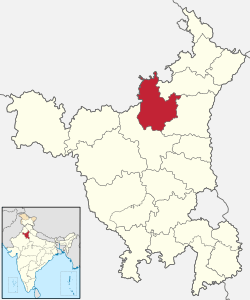 Location of Kaithal district in Haryana | |
| Country | India |
| State | Haryana |
| Administrative division | Karnal |
| Established | 1 November 1989 |
| Headquarters | Kaithal |
| Tehsils | 1. Kaithal, 2. Guhla, 3. Pundri, 4. Kalayat |
| Government | |
| • Lok Sabha constituencies | Kurukshetra (shared with Kurukshetra and Yamuna Nagar districts) |
| • Assembly seats | 4 |
| Area | |
| • Total | 2,317 km2 (895 sq mi) |
| Population (2011) | |
| • Total | 1,072,861 |
| • Density | 460/km2 (1,200/sq mi) |
| • Urban | 19.39 |
| Demographics | |
| • Sex ratio | 880 (2011 census) |
| Major highways | NH-152[1] |
| Average annual precipitation | 563 mm |
| Website | Official website |
Kaithal district is one of the 22 districts of Haryana, state in northern India. Kaithal town is the district headquarters. The district occupies an area of 2317 km². It has a population of 1,072,861 (2011 census). It is part of Karnal division.
This district came into existence on 1 November 1989.
Divisions
Kaithal district comprises four tehsils: Kaithal, Guhla, Pundri and Kalayat; and the three sub-tehsils of Rajaund, Dhand and Siwan.[2][3] The four Haryana Vidhan Sabha constituencies located in this district are Guhla, Kalayat, Kaithal and Pundri.[4] All of these are part of Kurukshetra Lok Sabha constituency.
Kaithal Bar Association
The Kaithal Bar Association was established in 1905-06. The membership of Bar in 1970 was 60 (including 3 pleaders) and the District Bar Association was established on 01.11.1989 after creation of District Kaithal. There is also a Bar Association at Sub Division, Guhla. The name of the eminent Lawyers from the District Bar Association Kaithal are Babu Jyoti Parshad, Pt. Amarnath Tewari, Malik Murari Lal, Mulakh Raj Grover, Ch. Barumal, Sarv Shri Dinanath Advocate, Choudhary Baru Ram Advocate and Shri O.P.Tiwari Advocate.[5]
Demographics
| Rank | Language | 1961[7] | 1991[8] | 2001[9] |
|---|---|---|---|---|
| 1 | Haryanvi | 81.00% | 89.12% | 87.28% |
| 2 | Punjabi | 18.40% | 10.81% | 12.43% |
| 3 | Urdu | — | 0.02% | 0.07% |
| — | Other | 0.60% | 0.05% | 0.22% |
According to the 2011 census Kaithal district has a population of 1,072,861,[10] roughly equal to the nation of Cyprus[11] or the US state of Rhode Island.[12] This gives it a ranking of 423rd in India (out of a total of 640).[10] The district has a population density of 463 inhabitants per square kilometre (1,200/sq mi) .[10] Its population growth rate over the decade 2001-2011 was 13.39%.[10] Kaithal has a sex ratio of 880 females for every 1000 males,[10] and a literacy rate of 70.6%.[10]
References
- ↑ "Rationalisation of Numbering Systems of National Highways" (PDF). New Delhi: Department of Road Transport and Highways. Retrieved 3 April 2012.
- ↑ "Basic Statistics". Official Website of Kaithal Administration. Retrieved 13 August 2017.
- ↑ "History". Kaithal District.
- ↑ "District Wise Assembly Constituencies" (PDF). Chief Electoral Officer, Haryana website. Archived from the original (PDF) on 21 July 2011. Retrieved 28 April 2011.
- ↑ "History". District Courts.
- ↑ http://www.census2011.co.in/census/district/212-kaithal.html
- ↑ http://14.139.60.114:8080/jspui/bitstream/123456789/955/8/Pathankot%20Tehsil%20(25-46).pdf Archived 2016-08-07 at the Wayback Machine.
- ↑ http://esaharyana.gov.in/Data/StateStatisticalAbstract/2010-11(English)/StateAbst10-11/27-95.pdf
- ↑ http://esaharyana.gov.in/Data/StateStatisticalAbstract/StatisticalAbstract(2011-12).pdf Archived 2013-08-17 at the Wayback Machine.
- 1 2 3 4 5 6 "District Census 2011". Census2011.co.in. 2011. Retrieved 2011-09-30.
- ↑ US Directorate of Intelligence. "Country Comparison:Population". Retrieved 2011-10-01.
Cyprus 1,120,489 July 2011 est.
- ↑ "2010 Resident Population Data". U. S. Census Bureau. Archived from the original on 2011-08-23. Retrieved 2011-09-30.
Rhode Island 1,052,567
External links
Places adjacent to Kaithal district | ||||||||||
|---|---|---|---|---|---|---|---|---|---|---|
| ||||||||||
Coordinates: 29°48′00″N 76°23′24″E / 29.80000°N 76.39000°E