Lucknow district
| Lucknow district | |
|---|---|
| District of Uttar Pradesh | |
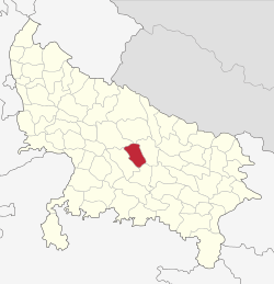 Location of Lucknow district in Uttar Pradesh | |
| Country | India |
| State | Uttar Pradesh |
| Administrative division | Lucknow |
| Headquarters | Lucknow |
| Government | |
| • Lok Sabha constituencies | Lucknow & Mohanlalganj |
| Area | |
| • Total | 2,528 km2 (976 sq mi) |
| Population (2011) | |
| • Total | 4,588,455 |
| • Density | 1,800/km2 (4,700/sq mi) |
| Website | Official website |
Lucknow district is a district located in the Uttar Pradesh state in northern India. The city of Lucknow is the district headquarters and the district is part of Lucknow Division. and also is the capital of Uttar Pradesh.
Historical Background
Located in what was historically known as the Awadh region, Lucknow has always been a multicultural place.[1]
Climate
| Lucknow | ||||||||||||||||||||||||||||||||||||||||||||||||||||||||||||
|---|---|---|---|---|---|---|---|---|---|---|---|---|---|---|---|---|---|---|---|---|---|---|---|---|---|---|---|---|---|---|---|---|---|---|---|---|---|---|---|---|---|---|---|---|---|---|---|---|---|---|---|---|---|---|---|---|---|---|---|---|
| Climate chart (explanation) | ||||||||||||||||||||||||||||||||||||||||||||||||||||||||||||
| ||||||||||||||||||||||||||||||||||||||||||||||||||||||||||||
| ||||||||||||||||||||||||||||||||||||||||||||||||||||||||||||
The climate of Lucknow district is predominantly subtropical in nature. Hot atmosphere during the months of May and June and heavy rainfalls during the months of June, July and August are the typical characteristics of Lucknow.
Demography
According to the 2011 census Lucknow district has a population of 4,588,455, roughly equal to the nation of Georgia[2] or the US state of Louisiana.[3] This gives it a ranking of 31st in India (out of a total of 640).[4] The district has a population density of 1,815 inhabitants per square kilometre (4,700/sq mi).[4] Its population growth rate over the decade 2001-2011 was 25.79%.[4] Lucknow has a sex ratio of 906 females for every 1000 males,[4] and a literacy rate of 79.33%.[4]
According to the 2001 census Lucknow district had a population of 3,681,461.
District Map

Blocks in Lucknow District
The following are the blocks in the district of Lucknow:
- Bakshi Ka Talab
- Chinhat
- Gosainganj
- Kakori
- Mal
- Malihabad
- Mohanlalganj
- Sarojini Nagar
Religion
There is harmony between people of different religions in the city of Lucknow.[6] The Lucknow Pact between the Indian National Congress and the Muslim League was agreed upon at the joint session of both parties in 1915. Religious institutions include Sankat Mochan Hanuman Temple, Sri Ramakrishna Math and Chandrika Devi Temple.
Languages
Languages spoken here include Awadhi, a vernacular in the Hindi continuum spoken by over 38 million people, mainly in the Awadh region.[7] Urdu and Hindi are also the two mainstream languages of the district.
References
- ↑ "Welcome to the city of Nawabs". Lucknow Online. 2012. Retrieved 2012-01-16.
- ↑ US Directorate of Intelligence. "Country Comparison:Population". Retrieved 2011-10-01.
Georgia 4,585,874 July 2011 est.
- ↑ "2010 Resident Population Data". U. S. Census Bureau. Archived from the original on 19 October 2013. Retrieved 2011-09-30.
Louisiana 4,533,372
- 1 2 3 4 5 "District Census 2011". Census2011.co.in. 2011. Retrieved 2011-09-30.
- ↑ "Lucknow District Religion Census 2011". Census 2011. Retrieved 24 April 2018.
- ↑ Akins, Harrison. "India's model for tolerance". bbc.com. Retrieved 19 March 2018.
- ↑ M. Paul Lewis, ed. (2009). "Awadhi: A language of India". Ethnologue: Languages of the World (16th ed.). Dallas, Texas: SIL International. Retrieved 2011-09-28.
External links
Places adjacent to Lucknow district | ||||||||||
|---|---|---|---|---|---|---|---|---|---|---|
| ||||||||||