Gir Somnath district
| Gir Somnath district | |
|---|---|
| district | |
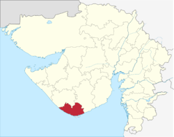 Location of district in Gujarat | |
| Country |
|
| State | Gujarat |
| Region | Saurashtra |
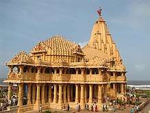
| Headquarters | Veraval |
| Area[1] | |
| • Total | 3,755 km2 (1,450 sq mi) |
| Population (2011[1]) | |
| • Total | 946,790 |
| • Density | 250/km2 (650/sq mi) |
| Languages | |
| • Official | Gujarati, Hindi, English |
| Time zone | UTC+5:30 (IST) |
| Vehicle registration | GJ 32 |
| Website |
gujaratindia |
Gir Somnath District is a district of Gujarat, India. It is located on the southern corner of the Kathiawar peninsula with its headquarters at the town of Veraval. Veraval has a population around 3.5 lacs.
Gir Somnath District was split from Junagadh district in August 2013, when seven new districts came into existence in Gujarat.[2][3]
Patan-Veraval, Talala, Sutrapada, Kodinar, Una and Gir-Gadhada are the talukas of Gir Somnath District.[4]
The Gir Forest is a home of many wildlife creatures including lions, deer, and monkeys. Asiatic Lions can be only be found in the Gir Forest.[4]
See also
Notes and references
- 1 2 Industrial Potentiality Survey Report of Gir Somnath District [2016-17
- ↑ "Promises Delivered! Gujarat Cabinet approves creation of 7 New Districts and 22 New Talukas". Narendra Modi. 25 January 2013. Archived from the original on 15 April 2015.
- ↑ "Maps of Gujarat's new 7 districts and changes in existing districts". Desh Gujarat. 13 August 2013. Archived from the original on 16 August 2013.
- 1 2 About Gir Somnath - Collectorate - District Gir Somnath
Places adjacent to Gir Somnath district | |
|---|---|
| Topics | 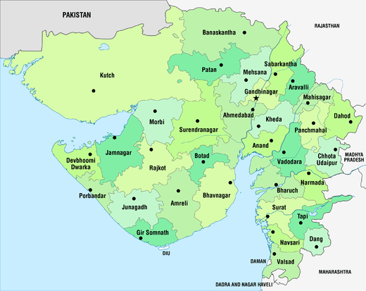 | |
|---|---|---|
| Regions of Gujarat | ||
| Districts | ||
| Major cities | ||
| Ecoregions | ||
| Economy |
| |
| ||
This article is issued from
Wikipedia.
The text is licensed under Creative Commons - Attribution - Sharealike.
Additional terms may apply for the media files.