Gorakhpur
| Gorakhpur | |
|---|---|
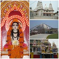 Gorakhnath Math, Taramandal, Geeta Press | |
 Gorakhpur  Gorakhpur | |
| Coordinates: 26°45′32″N 83°22′11″E / 26.7588°N 83.3697°ECoordinates: 26°45′32″N 83°22′11″E / 26.7588°N 83.3697°E | |
| Country | India |
| State | Uttar Pradesh |
| District | Gorakhpur |
| Government | |
| • Type | Municipal corporation |
| • Body | Gorakhpur Municipal corporation |
| • MP | Praveen Nishad (SP) |
| • Mayor | Sitaram Jaiswal (BJP) |
| Area | |
| • Metropolitan | 144 km2 (56 sq mi) |
| Elevation | 84 m (276 ft) |
| Population (2011) | |
| • Total | 692,519[1] |
| Languages | |
| • Official | Hindi |
| Time zone | UTC+5:30 (IST) |
| PIN | 2730xx |
| Telephone code | +91-551 |
| Vehicle registration | UP-53 |
| Sex ratio | 1000/944 ♂/♀ |
| Avg. annual temperature | 26 °C (79 °F) |
| Avg. summer temperature | 40 °C (104 °F) |
| Avg. winter temperature | 18 °C (64 °F) |
| Website |
gorakhpur |
Gorakhpur is a city located along the banks of Rapti river in the north-eastern part of the Indian state of Uttar Pradesh. It is located near the Nepal border, 273 kilometres east of the state capital Lucknow. It is the administrative headquarters of Gorakhpur district and Gorakhpur division. The city is home to the Gorakhnath Math, a Gorakshanath temple.
Etymology
The name "Gorakhpur" comes from the Sanskrit Gorakshapuram, which means abode of Gorakshanath, a renowned ascetic who was a prominent saint of the Nath Sampradaya.[2][3]
Geography
Gorakhpur is one of the most flood vulnerable districts in Eastern Uttar Pradesh. Data over the past 100 years show a considerable increase in the intensity and frequency of floods, with extreme events occurring every three to four years. Roughly 20% of the population is affected by floods, which are an annual occurrence in some areas, causing huge loss of life, health and livelihoods for the poor inhabitants, as well as damage to public and private property.[4]
Research from the Climate and Development Knowledge shows that measures are in place to mitigate disaster risk in the form of the Gorakhpur District Disaster Management Plan.
However, this plan focuses on how agencies can co-ordinate following floods and lacks a systematic approach to identifying weather-related hazards and vulnerability.[5]
Climate
The Köppen Climate Classification subtype for this climate is "Cfa" (Humid Subtropical Climate).[6]
| Climate data for Gorakhpur | |||||||||||||
|---|---|---|---|---|---|---|---|---|---|---|---|---|---|
| Month | Jan | Feb | Mar | Apr | May | Jun | Jul | Aug | Sep | Oct | Nov | Dec | Year |
| Average high °C (°F) | 23.2 (73.8) |
26.5 (79.7) |
32.7 (90.9) |
37.9 (100.2) |
39.5 (103.1) |
37.2 (99) |
33.2 (91.8) |
32.7 (90.9) |
33.1 (91.6) |
32.6 (90.7) |
29.3 (84.7) |
24.6 (76.3) |
31.9 (89.4) |
| Average low °C (°F) | 9.5 (49.1) |
12.0 (53.6) |
16.9 (62.4) |
22.3 (72.1) |
25.2 (77.4) |
26.2 (79.2) |
25.7 (78.3) |
25.5 (77.9) |
24.7 (76.5) |
21.2 (70.2) |
15.0 (59) |
10.6 (51.1) |
19.6 (67.3) |
| Average precipitation mm (inches) | 21.7 (0.854) |
11.4 (0.449) |
10.2 (0.402) |
13.7 (0.539) |
27.4 (1.079) |
163.6 (6.441) |
322.3 (12.689) |
349.5 (13.76) |
213.9 (8.421) |
83.8 (3.299) |
4.5 (0.177) |
6.1 (0.24) |
1,228.1 (48.35) |
| Source: IMD | |||||||||||||
Transport
Railways

Gorakhpur is well connected through rail network and Gorakhpur railway station is one of the important stations in the area, as it serves as the headquarters of North Eastern zone of the Indian Railways.
The station offers Class A railway station facilities. On 6 October 2013, Gorakhpur has the world's Longest Railway platform, after inauguration of the remodelled Gorakhpur Yard, with a stretch of around 1.36 kilometres (0.85 mi).[7][8][9][10]
Gorakhpur is the headquarters of North Eastern Railways.[11]
Air
An airforce station in Gorakhpur was established in 1963 and extended for public transport. Named Mahayogi Gorakhnath Airport,[12] Air India, Indigo and SpiceJet flights connect with Delhi.[13]
Education
Gorakhpur has 2 universities named Deen Dayal Upadhyay Gorakhpur University and Madan Mohan Malaviya University of Technology, a medical college named Baba Raghav Das Medical College and a sports college named Veer Bahadur Singh Sports College.
Notable people
- Paramahansa Yogananda, Yoga Guru, Founder of Self-Realization Fellowship/Yogoda Satsanga Society of India. Born here January 5, 1893.
- Vir Bahadur Singh – Former Chief Minister of Uttar Pradesh.
- Yogi Adityanath – Chief Minister of Uttar Pradesh from Bharatiya Janata Party (BJP) and Former Member of Parliament who had represented Gorakhpur in the Lok Sabha (lower house of the Indian Parliament) from 1998 to 2017 and Mahanth of Gorakhnath Temple
- Raghupati Sahay, writer, critic
- Shakir Ali, barrister
- Ram Upendra Das, economist
- Mahmood Farooqui Indian writer, artist and director
- Narendra Hirwani international cricket player
- Syed Modi, badminton player, winner of Arjuna Award
- Asit Sen Bollywood and Bengali
- Jimmy Shergill, actor
- Saurabh Shukla, actor
- Kedarnath Singh, poet, critic
- Amrapali Dubey, actress
- Lilavati Singh, educator
- Ravi Dubey, actor
- Anurag Kashyap, Filmmaker
- Leopold Amery, British Cabinet Minister
Geographic location
See also
Know More
- Tehsil - 7
- Gram Panchayat -1354
- Villages -3448
- Blocks - 19
- Municipal Corporation -1
- Town Area - 8
- Police station - 26
References
- ↑ "Gorakpur population".
- ↑ "History – Origin of Name". gorakhpur.nic.in. Retrieved 10 January 2017.
- ↑ Mallinson, James (2011) 'Nāth Saṃpradāya.' In: Brill Encyclopedia of Hinduism Vol. 3. Brill, pp. 407–428.
- ↑ Integrating climate change concerns into disaster management planning: The case of Gorakhpur, India by Shiraz A. Wajih and Shashikant Chopde, the Climate and Environment Knowledge Network, 2014
- ↑ Integrating climate change concerns into disaster management planning: The case of Gorakhpur, India
- ↑ Climate Summary for Gorakhpur (from Weatherbase.com)
- ↑ http://timesofindia.indiatimes.com/city/lucknow/Gorakhpur-gets-worlds-largest-railway-platform/articleshow/23616764.cms
- ↑ "Archived copy". Archived from the original on 2 October 2013. Retrieved 1 September 2013.
- ↑ http://articles.timesofindia.indiatimes.com/2013-06-02/varanasi/39690667_1_gorakhpur-railway-station-final-stage-cabway
- ↑ "Gorakhpur gets world's longest railway platform". अमर उजाला (Amar Ujala). 13 February 2012. Retrieved 7 October 2013.
- ↑ North Eastern Railway. Ner.indianrailways.gov.in. Retrieved on 2011-10-21.
- ↑ No. 105 Helicopter Unit. Indian Air Force
- ↑ "Gorakhpur Airport, Flights to / from Gorakhpur | Information on Gorakhpur Airport (GOP) Gorakhpur".
- ↑ About District Gorakhpur