Dausa
| Dausa | |
|---|---|
| city | |
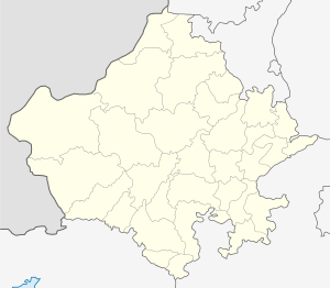
 Dausa Location in Rajasthan, India  Dausa Dausa (India) | |
| Coordinates: 26°53′36″N 76°20′15″E / 26.8932°N 76.3375°ECoordinates: 26°53′36″N 76°20′15″E / 26.8932°N 76.3375°E | |
| Country |
|
| State | Rajasthan |
| District | Dausa |
| Elevation | 327 m (1,073 ft) |
| Population (2011) | |
| • Total | 85,960 |
| Languages | |
| • Official | Hindi |
| Time zone | UTC+5:30 (IST) |
| Website |
dausa |
Dausa is a city and administrative headquarters of Dausa district in the state of Rajasthan, India. It is 55 km from Jaipur, 240 km from Delhi and located on Jaipur-Agra National Highway (NH-11). It is also known as "Dev Nagari." and now Getolav is main attraction of Dausa as Getolav Bird Habitat
5 districts with the highest population density Jaipur = 595 Bharatpur = 503 Dausa. = 476 Alwar. = 438 Dholpur. = 398
History
Dausa is situated in a region widely known as Dundhar. The Chouhans & Raos ruled this land in 10th Century A.D. Dausa has privileged to become First capital of the then Dundhar Region. Dausa was an important political place for Dundhar region. The Chauhan Raja Soodh Dev ruled this region during 996 to 1006 AD. Later, from 1006 AD to 1036 AD, Raja Dule Rai ruled this region for 30 years.[1]
As Dausa city is surrounded by Mahadev in five directions (Nilkanth, Gupteshwer, Sahajnath, Somnath and Baijnath), so it was named from Sanskrit word "Dhau and Sa". 'Dhau' means Swarg sa (Like Heaven) and 'Sa' means Sundar ( Beautiful). Means Swarg sa Sundar ( Beautiful like Heaven).
Dausa has given prominent freedom fighters to the nation. Late Shri Tikaram Paliwal & Late Shri Ram Karan Joshi were amongst the freedom fighters who gave their valuable contribution for fight for independence and for amalgamation of the Princely States to form Rajasthan State. Late Shri Tikaram Paliwal was the first elected Chief Minister of Rajasthan in 1952 after independence. Also, Late Shri Ram Karan Joshi was the First Panchayati Raj Minister of the Rajasthan state who submitted the First Panchayati Raj Bill in the Vidhansabha in 1952.
The poet Sant Sunderdas was born on Chaitra Shukla Navami in Vikram Samvat 1653 in Dausa. He was a renowned Nirgun Panthi Sant and wrote 42 Grantha, out of which Gyan Sundaram & Sunder Vilas are famous. Current Dausa MP is Harish Meena, A former DGP of Rajasthan Police.
Geography
Dausa is located at 26°53′N 76°20′E / 26.88°N 76.33°E.[2] It has an average elevation of 333 metres (1072 feet). It is one of the 5 Districts of Jaipur division (Alwar, Dausa, Jaipur, Jhunjhunun, Sikar.) and is surrounded with 6 districts, namely, Jaipur, Tonk, Sawai Madhopur, karauli, Bharatpur & Alwar. The total area of dausa city is 16.00 km2 . Dausa has 5 sub-divisions and their MLAs- Dausa- Shankar Lal Sharma (BJP) Sikrai- Geeta Verma (RJP) Mahuwa- Om Prakash Hudla (BJP) Lalsot- Dr. Kirori Lal Meena (RJP) Bandikui- Dr. Alka Singh (BJP)
Demographics
As of 2011 India census,[3] Dausa city had total population of 85,960. Males constitute 45,369 of the population and females 40,591. Dausa has an average literacy rate of 69.17%, lower than the national average of 74.04%: male literacy is 84.54% and, female literacy is 52.33%. In Dausa, 11,042 of the population is under 6 years of age.
Dausa district ranks 20th in terms of population, 32nd in terms of area and 3rd in terms of population density.Dausa district consists 87.7 percent rural and 12.3 percent urban population whereas the State percent of rural and urban population is 75.1 and 24.9 respectively. The sex ratio of Dausa district (905) is significantly lower than the State sex ratio (928). The literacy rate in Dausa district is 68.2 percent which is higher than the State Average (66.1 percent) and it ranks 10th among the other districts of the state. Gender Gap of the literacy rate is 31.1 percent in the district. The Scheduled Caste and Scheduled Tribe population in Dausa district is 21.7 percent and 26.5 percent respectively whereas the State percent of Scheduled Caste and Scheduled Tribe population is 17.8 and 13.5 respectively.
Economy & Occupation
The economy of Dausa district is mainly dependent on agriculture as 68.2 percent workers in the district are either cultivators or agricultural labourers. However the district percent of such workers is higher than the state average of 62.1 percent. Work participation rate (WPR) of Dausa district has recorded 41.9 percent and gender gap in WPR is 9.5 percent points. In Dausa district among the workers the percentage of cultivators, agricultural labourers, workers in household industry and other workers (category of workers) are 57.1, 11.1, 2.5 and 29.2 percent respectively.
Industrial development in Dausa started when District Industry center was established. There are 3497 small and micro industries registered up to 31 March 2015 having investment of Rs. 5171.00 lacs and providing employed to 13201 persons.Many industrial area have been developed by RIICO in the district.
Travel and transportation
- Rail Network:The district is well connected by rail. It is on Delhi-Jaipur and Agra-Jaipur train route, which gives it great connectivity. District has also one important railway station, namely, Bandikui Junction. Dausa railway station is a very important railway station of north-western railway under Jaipur division and now the new railway line is under construction and starts very soon, after this dausa railway station will be the junction.
- Road distances:NH 11 passes through the district. It covers about 85 km in the district which includes district headquarters, Sikandra and Mahwa. Dausa is 55 km from Jaipur on NH-11 and well connected with Agra, Delhi and other surrounding districts viz. Karauli, Sawai Madhopur and Bharatpur by road. Further, NH-11A also passes through the district covering Dausa & Lalsot Tehsil regions. Two Mega Highways, to be constructed by RIDCOR, namely Alwar to Sikandra (81 km) and Lalsot to Kota (195 km) will pass through the district. The district has four-lane facility on NH 11.
Culture
Stone Carving
Sikandra is situated at 25 km on NH-11 towards Agra. This place has made its mark in the domestic as well as international market for its sandstone carvings from districts adjoining Dausa.
Local Festivals
Basant Panchmi Mela
At district headquarters, Basant Panchmi Mela (During February every year) is organised with the worship of idols of Raghunathji, Narshingji and god Surya. The festival is celebrated for three days with a large local market for villagers to procure essential requirements for the entire year. Besides this, it has all arrangements for rural entertainment. Therefore, it has very much attention and importance for rural population scattered in the district.
Dolchi Holi
In Pavta village, the young men of Gurjar caste, celebrates the traditional Holi with a difference. On the next day of Dhulandi, those young men throw a jet of water on each other using a small pot made up of leather from the four adjacent ponds prepared for this purpose. It goes on for one hour and they face it with brevity and enthusiasm.[4]
Tourism
Dausa has many places to visit like as Abhaneri and Mehandipur Balaji Temple . In Abhaneri many movies have been shot including Paheli.[5]Mehandipur Balaji Temple is a divine places for devotees specially from nearby states like Uttar Pradesh, Haryana, Delhi
- Abhaneri: Abhaneri is known for its post-gupta or early medieval monuments. It is situated at about 33 km from the district headquarters towards Bandikui. The Chand Baori (Step Well) and Harshat Mata Temple are the important places to visit.
- Getolav Bird Habitat- Located at 200 meter from National Highway 11, migratory birds like Isabellin Shrike, Great white pelicans & Dalmatian pelican, River Tern, Northern Shoveler N Black-tailed Godwit, Greylag Goose, Ruff, Little Cormorant, Purple Heron, Indian spotbilled Duck Grey Heron, Little Ringed Plover, Little Grebe, Northern Shoveler, Black headed Ibis, Eurasian Coot, Purple Swamphen, pied kingfisher and Sarus Crain are abundant here.
- Bhandarej: Bhandarej is known for the walls, sculptures, decorative lattice work, and terracotta utensils found in excavation. It is situated at about 10 km from the district headquarters towards Sikandra on NH-11.
- Khawaraoji: Khawaraoji was the residence of the then ruler Raoji and Jaiman purohits.khawaraoji is called Baawani which means a village of 52000 bighas of land. It is situated at about 25 km from the district headquarters towards Sikrai. The fort-like residence is 350+ years old and converted into the Hotel Khawa Palace. There is one more fort on the top of hills which is said to be 1200 years old. Surrounded by hills on three sides, and having Amol Ghati nearby, this place is visited by tourists. There is a lake behind the hills in Khawaraoji Village which is called moroli dam.places near khawaroji:- Amol Ghati A natural water source; Basna Mahadev Temple situated on the bank of lost basna river; Garhmora A natural water source and in law home of Mata narayani.
- Jhajhirampura : Jhajhirampura is known for the natural water tank and temples of Rudra (Shiv), Balaji (Hanuman) and other religious god and goddess. It is situated at around 45 km from district headquarters towards Baswa (Bandikui). Surrounded by hills and with natural water resource, this place has natural and spiritual glory.[6]
Temples and Religious Spots

- Mehandipur Balaji Temple: The temple of Bajrang Bali (Hanuman) god is known for treatment of mentally disturbed people. With the tremendous growth in medical sciences in the world, still people from all over India come to this place to overcome such diseases. It is situated about 40 km from district headquarters on NH11 towards Mahwa/Agra.
- Neelkanth & Panch Mahadev: Dausa is also known as DEVNAGRI. In fact, Sahajnath, Somnath, Gupteshwar & Neelkanth, the five images of God Shive (Mahadev) are situated in the temples at Dausa. The temple of Neelkanth, situated on the plateau of the nearby hill, shows its ancient glory and spiritual presence. The roap-way also attracts the tourists to enjoy the faith of this religious place.
- Gatolav: Gatolav, at the district headquarters, the birthplace of Sant Sunderdas who had been preached by his master, Sant Dadudayal, the founder of Dadupanthi religion.[7]
- Shri Paplaj Mata Mandir:The Temple of Paplaj Mata Ji is situated in the sub-district Lalsot. The goddess is worship by Gurjar & Meena Caste.
- Shri Binouri Balaji Mandir:The Temple of Binouri Balaji Ji is situated in the sub-district Lalsot. It is approx 15 km away from sub-district Lalsot and 55 km away from district Dausa. The god Hanuman is worship by All caste Caste.
- Moroli Balaji Mandir: this temple is situated near khawaraoji village in the middle of aravali mountain.it is about 30 km. away from dausa district headquarter.
References
- ↑ "DISTRICT CENSUS HANDBOOK DAUSA" (PDF). Census India.
- ↑ Falling Rain Genomics, Inc - Dausa
- ↑ "Census of India 2001: Data from the 2001 Census, including cities, villages and towns (Provisional)" (PDF). Census Commission of India. Archived from the original (PDF) on 2004-06-16. Retrieved 2008-11-01.
- ↑ jitendra (dharam singh)PAVTA. "Culture Of Dausa". Missing or empty
|url=(help) - ↑ Times of India Publications
- ↑ "Tourism in dausa". Archived from the original on 31 January 2008. Retrieved 23 May 2011.
- ↑ "Temples at Dausa". Archived from the original on 31 January 2008. Retrieved 23 May 2011.
