Chennai district
| Chennai district | |
|---|---|
| District | |
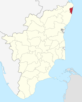 Location in Tamil Nadu, India | |
| Coordinates: Coordinates: 13°5′2″N 80°16′12″E / 13.08389°N 80.27000°E | |
| Country |
|
| State | Tamil Nadu |
| Headquarters | Chennai |
| Talukas | Alandur, Aminjikarai, Ambattur, Ayanavaram, Egmore, Guindy, Madhavaram, Maduravoyal, Mylapore, Mambalam, Purasawalkam, Perambur, Shollinganallur, Thiruvottiyur, Tondiarpet, Velachery |
| Area[1] | |
| • Total | 426 km2 (164 sq mi) |
| Population (2011)[2] | |
| • Total | 4,646,732 |
| • Density | 11,000/km2 (28,000/sq mi) |
| Languages | |
| • Official | Tamil |
| Time zone | UTC+5:30 (IST) |
| Sex ratio | 929 female / 1000 male[2] |
| Literacy | 90.2%[2] |
Chennai district, formerly known as Madras district or "Madarasapattinam", is a district in the state of Tamil Nadu, in India. It is the smallest of all the districts in the state, but has the highest human density. The district is a city district which means that it does not have a district headquarters. Most of the Greater Chennai City comes under this district, erstwhile under Kancheepuram and Tiruvallur districts . As of 2011, the district had a population of 4,646,732 with a sex-ratio of 989 females for every 1,000 males.[2]
Expansion of the district due to take place in April 2018 will align the district with the Greater Chennai Corporation boundary, an increase from 178 square kilometres (69 sq mi) to 426 square kilometres (164 sq mi).[1][3]
Etymology
The name Chennai was derived from Damarla Chennappa Nayakudu, the father of a general of the Vijayanagar Empire.[4]
Geography
Chennai district covers an area of 426 km2 located on the Eastern Coastal Plains of India. It is situated on the northeastern corner of Tamil Nadu along the Coramandel coast, a region bounded by the Bay of Bengal and is surrounded inland by the districts of Tiruvallur and Kanchipuram. It lies between 12°59' and 13°9' of the northern latitude and 80°12' and 80°19' of the eastern longitude at an average altitude of 6 metres above sea level on a 'sandy shelving breaker swept' beach. Terrain slope varies from 1:5000 to 1:10,000.[5] The terrain is very flat with contours ranging from 2 m to 10 m above mean sea level with a few isolated hillocks in the southwest beyond the district limits at St. Thomas Mount, Pallavaram and Tambaram.[6] The district runs inland in a rugged semi-circular fashion and its coastline is about 25.60 km (2.5% of the total coastline of Tamil Nadu). Because of its strategic location and economic importance, it is referred to as the "Gateway of South India." The drainage system includes two rivers, namely, Cooum (flowing in the northern part) and Adyar (flowing in the southern part), a canal (the Buckingham), and a stream (the Otteri Nullah) slicing the district into several islands.
The district falls under Seismic Zone III indicating a moderate risk of earthquake. Geologically the district is divided into three regions, namely, sandy, clayey and hard-rock regions. The soil comprises clay, shale and sandstone.[7]
Of the total land area, reserved forests cover 2.71 km2 and is concentrated in and around the Guindy National Park region, one of the few national parks in the world located within a city. The forest cover of the district is as follows:[8]
| Class | Area (Ha) | Percentage |
|---|---|---|
| Dense forest | 151.01 | 1.16 |
| Moderate dense TOF | 121.16 | 0.93 |
| Non-forest | 12,215.56 | 94.06 |
| Open forest | 114.24 | 0.88 |
| Open TOF | 153.73 | 1.18 |
| Water | 231.46 | 1.78 |
| Total | 12,987.16 | 100 |
Climate
| Climate data for Chennai, India | |||||||||||||
|---|---|---|---|---|---|---|---|---|---|---|---|---|---|
| Month | Jan | Feb | Mar | Apr | May | Jun | Jul | Aug | Sep | Oct | Nov | Dec | Year |
| Record high °C (°F) | 33 (91) |
37 (99) |
39 (102) |
43 (109) |
45 (113) |
43 (109) |
41 (106) |
40 (104) |
39 (102) |
39 (102) |
34 (93) |
33 (91) |
45 (113) |
| Average high °C (°F) | 29 (84) |
31 (88) |
33 (91) |
35 (95) |
38 (100) |
38 (100) |
36 (97) |
35 (95) |
34 (93) |
32 (90) |
29 (84) |
29 (84) |
33 (92) |
| Average low °C (°F) | 19 (66) |
20 (68) |
22 (72) |
26 (79) |
28 (82) |
27 (81) |
26 (79) |
26 (79) |
25 (77) |
24 (75) |
22 (72) |
21 (70) |
24 (75) |
| Record low °C (°F) | 14 (57) |
15 (59) |
17 (63) |
20 (68) |
21 (70) |
21 (70) |
22 (72) |
21 (70) |
21 (70) |
17 (63) |
15 (59) |
14 (57) |
14 (57) |
| Average precipitation mm (inches) | 16.2 (0.638) |
3.7 (0.146) |
3.0 (0.118) |
13.6 (0.535) |
48.9 (1.925) |
53.7 (2.114) |
97.8 (3.85) |
149.7 (5.894) |
109.1 (4.295) |
282.7 (11.13) |
350.3 (13.791) |
138.2 (5.441) |
1,266.9 (49.878) |
| Source: Indian Meteorological Department[9] | |||||||||||||
Demographics
According to 2011 census, Chennai district had a population of 4,646,732 with a sex-ratio of 989 females for every 1,000 males, much above the national average of 929. A total of 459,324 were under the age of six, constituting 235,519 males and 223,805 females. Scheduled Castes and Scheduled Tribes accounted for 16.78% and .22% of the population respectively. The average literacy of the district was 81.27%, compared to the national average of 72.99%.[2]
The district had a total of 154,982 households. There were a total of 1,817,297 workers, comprising 10,210 cultivators, 10,251 main agricultural labourers, 29,143 in house hold industries, 1,569,950 other workers, 197,743 marginal workers, 4,244 marginal cultivators, 3,423 marginal agricultural labourers, 8,202 marginal workers in household industries and 181,874 other marginal workers.[10]
The expansion of the district announced in 2018 is estimated to increase the population to about 7.1 million.[3]
Administration and politics

Further expansion announced in January 2018 will match the district to the boundary of the Greater Chennai Corporation. This will integrate six additional taluks from the Tiruvallur and Kanchipuram districts into Chennai district, and is expected to take place on 1 April 2018. The new divisions and taluks of the district will be:[1][3]
North Chennai Revenue Division, headquartered at Tondiarpet, contains taluks of Madhavaram, Perambur, Purasaiwalkam, Tiruvottiyur and Tondiarpet.
Central Chennai Revenue Division, headquartered at Ambattur, contains the taluks of Ambattur, Aminjikarai, Ayanavaram, Egmore, Maduravoyal, and Mambalam
South Chennai Revenue Division, headquartered at Guindy, contains the taluks of Alandur, Guindy, Mylapore, Sholinganallur and Velachery.
Assembly representatives
| PC No. | Constituency | Political Party |
Elected Representative |
|---|---|---|---|
| 1 | Thiruvallur | AIADMK | P. Venugopal |
| 2 | Chennai North | AIADMK | T. G. Venkatesh Babu |
| 3 | Chennai South | AIADMK | J. Jayavardhan |
| 4 | Chennai Central | AIADMK | S. R. Vijayakumar |
| 5 | Sriperumbudur | AIADMK | K. N. Thiru Ramachandran |
| AC No. | Constituency | Political Party |
Elected Representative |
| 7 | Maduravoyal | AIADMK | Benjamin P |
| 8 | Ambattur | AIADMK | Alexander V |
| 9 | Madavaram | DMK | Sudharsanam S |
| 10 | Tiruvottiyur | DMK | Samy.K.P.P |
| 11 | Dr. Radhakrishnan Nagar | Independent | T. T. V. Dhinakaran |
| 12 | Perambur | CPIM | A. Soundararajan |
| 13 | Kolathur | DMK | M. K. Stalin |
| 14 | Villivakkam | DMK | Vengatesh Prasath |
| 15 | Thiru. Vi. Ka Nagar | DMK | Thayagam kavi |
| 16 | Egmore | DMK | Ravichandiran K S |
| 17 | Royapuram | AIADMK | D. Jayakumar |
| 18 | Harbour | DMK | Sekhar babu |
| 19 | Chepauk-Thiruvallikeni | DMK | J. Anbazhagan |
| 20 | Thousand Lights | DMK | Selvan ku.ka |
| 21 | Anna Nagar | DMK | Mohan |
| 22 | Virugampakkam | AIADMK | V.N. Virugai Ravi |
| 23 | Saidapet | DMK | maa.subramanian |
| 24 | Thiyagaraya Nagar | AIADMK | V. P. Kalairajan |
| 25 | Mylapore | AIADMK | R. Nataraj |
| 26 | Velachery | DMK | Vaagai Chandrasekar |
| 27 | Sholinganallur | DMK | Aravind Ramesh S |
| 28 | Alandur | DMK | Anbarasan T M |
| Source: Office of the CEO, Tamil Nadu,[12] Indian Elections / Election Commission of India.[13][14][15] | |||
See also
References
- 1 2 3 Dennis S. Jesudasan (5 January 2018). "Chennai district doubles in size". The Hindu.
- 1 2 3 4 5 "District Census Handbook Chennai, Part XII - B" (PDF). Census of India 2011. 16 June 2014.
- 1 2 3 Yogesh, Kabirdoss (19 January 2018). "Chennai district boundaries likely to be redrawn on April 1". The Times of India.
- ↑ "District Profile, Chennai". Government of Tamil Nadu. Retrieved 27 November 2015.
- ↑ "Session-3 River and Drainage System in CMA" (pdf). CMDA. Retrieved 30 Dec 2011.
- ↑ Chapter IX Macro Drainage System in CMA
- ↑ John, Ekatha Ann (29 September 2012). "Disaster body for panel to monitor highrises in Chennai". The Times of India. Chennai. Retrieved 25 July 2015.
- ↑ "Forest at Glance". Tamil Nadu Forest Department.
- ↑ "Climatological Information for Chennai". Indian Meteorological Department. Archived from the original on 2009-02-05. Retrieved 2009-01-25.
- ↑ "Census Info 2011 Final population totals – Chennai district". Office of The Registrar General and Census Commissioner, Ministry of Home Affairs, Government of India. 2013. Retrieved 26 January 2014.
- ↑ Julie Mariappan (21 December 2013). "Chennai now has 10 taluks, as govt gets close to you". The Times of India.
- ↑ "Chennai District MLA details" (PDF). Election Commission of India. Archived from the original (PDF) on 2013-04-02.
- ↑ "Election results". Indian Elections.
- ↑ "Parties Statistics". Election Commission of India. Archived from the original on 2008-12-18.
- ↑ "City Constituency post-delimitation details" (PDF). Election Commission of India. Archived from the original (PDF) on 2011-08-10.
External links
| Wikimedia Commons has media related to Chennai district. |
| State symbols |
|
|---|---|
| Governance |
|
| Topics | |
| Districts |
|
| Major cities | |
