Amravati district
| Amravati district | |
|---|---|
| District of Maharashtra | |
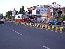 A road in the Amravati district headquarters | |
 | |
| Coordinates: 20°56′N 77°45′E / 20.93°N 77.75°ECoordinates: 20°56′N 77°45′E / 20.93°N 77.75°E | |
| Country |
|
| State | Maharashtra |
| Headquarters | Amravati |
| Area | |
| • Total | 12,235 km2 (4,724 sq mi) |
| Population (2011) | |
| • Total | 28,87,826 |
| • Density | 213/km2 (550/sq mi) |
| Languages | |
| • Official | Marathi |
| Time zone | UTC+5:30 (IST) |
| Vehicle registration | MH-27 (Amravati District) |
| Website |
amravati |
Amravati District is a District of Maharashtra state in central India. Amravati is the administrative headquarters of the district.
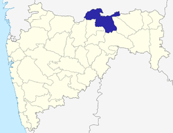
The district is situated between 20°32' and 21°46' north latitudes and 76°37' and 78°27' east longitudes. The district occupies an area of 12,235 km². The district is bounded by Betul District of Madhya Pradesh state to the north, and by the Maharashtra districts of Nagpur to the northeast, Chindwara district of Madhya Pradesh to the northeast Wardha to the east, Yavatmal to the south, Washim to the southwest, and Akola and Buldhana districts to the west.
History
In 1853, the present-day territory of Amravati district as a part of Berar Province was assigned to the British East India Company, following a treaty with the Nizam of Hyderabad. After the Company took over the administration of the province, it was divided into two districts. The present-day territory of the district became part of North Berar district, with headquarters at Buldhana. Later, the province was reconstituted and the territory of the present district became part of East Berar district, with headquarters at Amravati. In 1864, Yavatmal District (initially known as Southeast Berar district and later Wun district) was separated. In 1867, Ellichpur District was separated but in August, 1905, when the whole province was reorganized into six districts, it was again merged into the district. In 1903, it became part of the newly constituted province of Central Provinces and Berar. In 1956, Amravati district became part of Bombay State and after its bifurcation in 1960, it became part of Maharashtra state.[1][2]
Geography
The climate is tropical and most people wear cotton clothes. In summer temperatures can go up to higher than 47 °C (117 °F).
Economy
In 2006 the Ministry of Panchayati Raj named Amravati one of the country's 250 most backward districts (out of a total of 640).[3] It is one of the twelve districts in Maharashtra currently receiving funds from the Backward Regions Grant Fund Programme (BRGF).[3]
Agriculture
Amravati is the main growing region for the cotton and 'Tur' in ChandurRly,Dhamangaon, Tiosa,NandgaonKh.,Achalpur particularly. Ellachipur Sanman Chili pepper.[4] Anjangaon Surji and Achalpur are known for growing betel leaves, piper longum, orange and banana. Warud, Morshi, Chandur bazar and Achalpur are known for growing Nagpuri oranges. Soyabean has become a popular kharip crop.
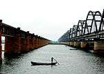
Rivers
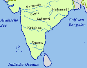
The Wardha River forms the eastern boundary of the district, and the eastern portion of the district lies within its watershed. The Purna River drains the southwestern portion of the district, while the northwest is drained by the Tapti River. Other important rivers are Shahanoor and Chandrabhaga.*Musali and Cherry are successfully introduced and cultivated now in Chikhaldara Hills.
The Purna rises near Bhainsdehi in Betul district of Madhya Pradesh in the Satpudas. After flowing for about 50 km in a general southerly and south-easterly direction enters the district. It travels across the district in a south-westerly direction dividing it into two halves, first through the Achalpur taluka and then along the boundary between the Amravati and Daryapur talukas. Finally, it turns due westwards forming the boundary of the district and continues further to join the Tapti near Muktainagar in Jalgaon district. The only significant left bank tributary of the Purna is the Pedhi. The first of the principal right bank tributaries is the Arna. The next is a small river known as the Bodi. The next tributary, the Chandrabhaga is a very important one, flowing in a general south-westerly direction to join the Purna. The principal right bank affluent of the Chandrabhaga is the Bhuleshwari. The westernmost tributary of the Purna of some significance within the district is the Shahanur, with its tributary, the Bordi.[5]
The following are some of the other rivers in Amravati District, with their tributaries.
- Burshi River
- Surkhi River
- Tigria River
- Khandu River
- Khapra River
- Sangiya River
- Gadaga River
- Vaan River
- Wardha River
- Vidarbha River
- Bor River
- Pak Nala
- Maru River
- Narha River
- Chargar River
- Shahanoor River *Bembala
Divisions
The district consists of six sub-divisions, which are further divided into 14 talukas. Amravati sub-division is divided into three talukas: Amravati, Bhatukali and Nandgaon Khandeshwar. Daryapur sub-division is further divided into two talukas: Anjangaon and Daryapur. Achalpur sub-division also consists of two talukas: Achalpur and Chandur Bazar. Morshi sub-division has also two talukas: Morshi and Warud. Dharni sub-division is also divided into two talukas: Dharni and Chikhaldara. Finally, Chandur (Railway) sub-division is divided into three taulkas: Chandur (Railway), Tiosa and Dhamangaon.[6]
There are eight Vidhan Sabha constituencies in this district. Six of these, Badnera, Amravati, Teosa, Anjangaon-Daryapur (SC), Melghat (ST) and Achalpur, are part of Amravati Lok Sabha constituency. The other two constituencies, Dhamangaon Railway and Morshi, are part of Wardha Lok Sabha constituency.[7]
Major towns
Major towns include Achalpur, Paratwada, Anjangaon, Chandur railway, Dhamangaon Railway, Hiwarkhed, Chikhaldara, Kholapur, Warud, Ambada, Morshi, Shendurjana Ghat, Chandurbazar, Daryapur, Nandgaon Khandeshwar, Dharni, Tivasa, and Ashtgaon.
Demographics
According to the 2011 census Amravati district has a population of 2,887,826,[8] roughly equal to the nation of Jamaica[9] or the US state of Arkansas.[10] This gives it a ranking of 131st in India (out of a total of 640).[8] The district has a population density of 237 inhabitants per square kilometre (610/sq mi) .[8] Its population growth rate over the decade 2001-2011 was 10.77%.[8] Amravati has a sex ratio of 947 females for every 1000 males,[8] and a literacy rate of 88.23%.[8]
Languages
Marathi is the official and the most spoken language in the district. The dialect spoken here is called Varhadi dialect. Deccani Urdu is also prominent among the Muslim community. Korku and Gondi languages are also spoken by a significant number of people. [11]
Transport
Important railway stations are Badnera Junction and Amravati Main Terminal under Bhusawal-Badnera Section of Bhusawal Division of Central Railway. The other stations under meter gauge are Wan Road Dhulghat and Dabka. These are under Purna - Khandwa section of South Central Railway. The stations under narrow gauge are Achalpur, Anjangaon Surji and Daryapur under Narrow Gauge Branch lines viz Murtajapur-Achalpur of Bhusawal Division of Central Railway.
Amravati - Narkhed line has been ready since January 2014. Railways are now available to travel from Narkhed to Bhusaval. Warud's railway station has been given the name Warud Orange City because it is the biggest exporter of oranges from all over India.
The Amravati - Chandur Bajar - Morshi - Warud Orange City - Narkher railway track is electrified.
Due to this Amravati - Narkher railway line ; Railway network in Amravati district become strong. It serves three talukas and some villages also have station so people travel via railway towards Amravati, Akola, Bhusawal, Nashik and Mumbai.
Amravati Airport is located at Belora, 15 kilometres south of Amravati city on NH-6 towards Akola.
Prominent persons
- Gadge Maharaj (1876-1956), social reformer
- Rastra Sant Tukdoji Maharaj (1900-1968), social reformer
- Pratibha Patil, first female president of India (2008-2012)
- Dr Panjabrao Deshmukh (1888-1965), social reformer, educationist and Central Agriculture Minister
- Dr Abasaheb Khedkar, first President of Maharashtra Pradesh Congress Committee
- Suresh Bhat (1932-2003), Marathi poet, Marathi Ghazal Samrat
- Hemant Kanitkar, Indian cricketer
- Mohan Atmaram Deshmukh (1939-1992), Hindi movie comedy actor
- Yusuf Shah Wali, Sufi saint; tomb is behind Amba Devi Temple, Amba Gate, Amravati
Places of interest
- Borgaon Dori is a well known pilgrimage village near south west from paratwada, on the banks of Saapan river previously known as Wardha river, Maharashtra, India.The temple of Lord Shiva attracts about a million Hindu pilgrims during the major yātrā (pilgrimages) in the month of jan to feb the comety of priti sangam situated at borgaon dori.
- Melghat Tiger Reserve, of Project Tiger
- Chikhaldara Hill Station is 85 km from Amravati via Paratwada
- Gugarnal National Park
- Wan Wildlife Sanctuary
- Gawilgarh Fort
- Ambadevi temple - historic and ancient place to visit, related to 'Rukhminiharan' by Lord Krishna.
- Manjarkhed Kasba - historic and ancient place to visit, Temple tirth kshetra Shree pataleshwar= gupteshwar deosthan
- Savanga Vithoba, Awadhut Maharaj Temple
- Hanuman Vyayam Prasarak Mandal (HVPM) Institute - India's biggest sport institute
- Koudanyapur birthplace of Rukmini, Koundanyapur
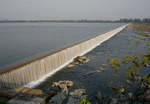
- Shahanur Dam, Anjangaon Surji
- Simbhora Dam(upper wardha dam), Morshi
- Salbardi pilgrimage of Lord Shiva, Morshi and religious place Swami Chakradhar
- Vedhapur pilgrimage of Lord Hanuman-ji, Warud
- Musalkheda pilgrimage of Saint Yashwant Maharaj, Warud
- The Leprosy Mission Community Hospital, Kothara, Paratwada
- Bahiram Fare in December–February, Paratwada
- Dharkhora Waterfall, Paratwada
- Bakadari Waterfall, Paratwada
- Riddhpur, Kashi of Mahanubhav Panth. *Dattaziri and Ashtamahasiddhi Temple, Paratwada
- Haud Katora, Achalpur-Paratwada
- Chandrabhaga Dam, Paratwada
- Vazzar Dam, Paratwada
- Shah Dulha Rehman Gazi Dargha, Achalpur-Paratwada
- Gayatri Temple, Paratwada
- Muktagiri Temple, Paratwada
- Deonath Math, Anjangaon Surji
- Ekveera Temple, Murha, Anjangaon Surji
- Vitthal Mandeer, Anjangaon Surji
- Bettle leaf farming, Anjangaon Surji
- Saint Gulab Baba Ashram, Takarkheda, Anjangaon Surji
- Khandeshwar Bhagawan Temple, Nandgaon Khandeshwar
- Mozari Gurukunj is 35 km from Amravati city on Amravati- Nagpur National Highway No. 6. It is famous for Mahasamadhi (tomb) of great Sant (national reformer) Rastrasant Tukdoji Maharaj. Many people come to Mozari throughout year to attend various programs which are being organized to bring constructive changes in the society.
- Gulabrao maharaj Mandir, Chandur Bazar
- Khandeshwar Temple (Hemadpanthi temple of Lord Shiva at Nandgaon Khandeshwar)
- Changapur (famous Hanuman Temple)
- Vaygaon (famous Ganesh Temple mnetioned in Ganeshpurana)
- Rinmochan(pligrim )
- Bhiltek (pilgrim)
- Jahangirpur (famous Hanuman Temple)*Gawilgada-a historic fort at Chikhaldara
- Usmaniya Masjid (famous mosque constructed by Nizam Of Hydrbad; a copy of Jama Masjid of Delhi)
- Shri Kartik Swami Rath Yatra, Shirajgaon Kasba,Chandur Bazar,Amravati
- Tapovan-Ashram for lepers providing living with self esteem & employing their skills and hard work, established by Dajisaheb Patwardhan. ]]
Education in Amravati district
Engineering colleges
- Dhamangaon Education Society's College of Engineering & Technology, Dhamangaon Rly.
- Government College of Engineering, Amravati
- P. R. Patil Group of Educational Institutes
- Sipna Shikshan Prasarak Mandals College of Engineering Amravati
- Prof.Ram Meghe Institute of Technology and Research, Badnera
- Prof.Ram Meghe College of Engineering and Management, Badnera
- HVPM College Of Engineering, Amravati
- Dr. Rajendra Gode Institute of Technology & Research, Amravati (formerly known as IBSS College of Engineering, Amravati)
- GH. Raisoni College of Engineering, Amravati
- Shri Sant Gajanan Maharaj College of Engineering, Shegaon (SSGMCE, Shegaon)
- Babasaheb Naik College of Engineering, Pusad
- Shri Dadasaheb Gawai Charitable Trusts Dr Smt Kamaltai Gawai Institute of Engineering and Technology, Amravati
- College of Engineering and Technology, Akola
Polytechnic college
- Government Polytechnic Amravati
- N.P.T.N. Paratwada-Semi Autonomous Institute
- Panjabrao Deshmukh Polytechnic Shivaji Nagar, Amravati
- Dr. Rajendra Gode Polytechnic Amravati
- P. R. Pote (Patil) Polytechnic Amravati
- Shree shivaji education society's Dr. Panjabrao Deshmukh Polytechnic Amravati
- Dr. Ram Meghe Polytechnic Amravati
- G. H. Raisoni Polytechnic, Amravati
- B.J.E.S's Amravati Polytechnic Bhankheda
- Kirti Polytechnic, Uttam Nagar, Amravati
- V. Y. W. S. Polytechnic, Badnera[12]
Other colleges
- Gotkhade Education societies
Tilak Maharashtra Vidhyapith, Pune - Study Center Amravati
- Mahila Mahavidyalaya, Jog Chouk, Amravati
- Indira Meghe Mahila Mahavidyalaya, Amravati
- Shri. Ramkrishna Krida Vidhyalaya and College
- Bhartiya Mahavidhyalaya, Amravati
- Govt. Vidarbha Institute of Science and Humanities (GVISH) (formerly Vidarbha Maha Vidhyalaya (VMV))
- Shri Shivaji Science and Arts College
- Manbai Gujarati Junior College, Ambapeth, Rajkamal, Amravati
- Brijlal BIyani Science College
- G. S. Tompe Arts, Commerce & Science College, Chandur-Bazar
- Rural Institute, Amravati
- Vidyabharati Mahavidyalaya, C.K. Naidu Road Camp, Amravati
- Shri. Shivaji College of Agriculture Biotechnology
- STK Gujarati Junior College, Ambapeth, Amravati
- Government College of Pharmacy, Katora Naka, Amravati
- Dr Gopalrao Khedkar Mahavidyalaya Khed
- Bar. Ramrao Deshmukh Arts, Smt. Indiraji Kapadiya Commerce And Nyaymurthi Krishnarao Deshmukh Science College, Badnera
- Vinayak Vidyamandir, Chhatri Talao, Amravati
- N.A.D.College, Chandur Bazar
- Degree College of Physical Education
- shri shivaji college of agriculture, Amravati
- Maharashtra Tantra Shikshan Vidyalaya (Mahatantra), Prashant Nagar, Amravati
- Maharashtra Vyavasay Prashikshan Kendra, Bhambora, Taluka-Morshi Dist. Amravati
- Maharashtra Tantra Shikshan Vidyalaya, Yawakar Wadi Warud enter - Mahesh Nagar
- Y.D.V. D. Arts and Commerce College Teosa Dist. Amravati
- Urdu Saifee Jubilee Junior College, Paradise Colony, Walgaon Road, Amravati 444601[13]
Medical colleges
- Dr Panjabrao Deshmukh Memorial Medical College
- Takhatmal Shrivallabh Homoeopathic Medical College & Hospital
- V.Y.W.S Dental College & Hospital
- Pandit Jawaharlal Neheru Memorial Institute of Homeopathic Medical Sciences
- Vidarbha Ayurveda College, H.V.P.M., Amravati
Other institutions
- Anmol Computer Institute Gopal Nagar Amravati
- Search Project Training Institute, Rathi Nagar, Amravati
- Shree E Seva Kendra, Gopal Nagar Amravati
Folk arts
- Dandar
- Powada
- Bhajan
- Keertan
- Kakada (Kakad aarti with Bhakti-feri in villages during winters)
- Korku dance
- Holi of Korku's
References
- ↑ "Gazetteers of the Bombay Presidency-Amraoti district-History and Archaeology". Amravati district website. Retrieved 2009-03-24.
- ↑ "Amravati District Gazetteer-General Introduction". Amravati district website. Archived from the original on 10 April 2009. Retrieved 2009-03-24.
- 1 2 Ministry of Panchayati Raj (8 September 2009). "A Note on the Backward Regions Grant Fund Programme" (PDF). National Institute of Rural Development. Archived from the original (PDF) on 5 April 2012. Retrieved 27 September 2011.
- ↑ "Indian Chilli Varieties". Archived from the original on 21 July 2011. Retrieved 21 February 2011.
- ↑ "Amravati District Gazetteer-General-Rivers". Amravati district website. Archived from the original on 10 April 2009. Retrieved 2009-03-23.
- ↑ "About Amravati District". Amravati district website. Archived from the original on 6 April 2009. Retrieved 2009-03-23.
- ↑ "Districtwise List of Assembly and Parliamentary Constituencies". Chief Electoral Officer, Maharashtra website. Archived from the original on 25 February 2009. Retrieved 2009-03-23.
- 1 2 3 4 5 6 "District Census 2011". Census2011.co.in. 2011. Retrieved 2011-09-30.
- ↑ US Directorate of Intelligence. "Country Comparison:Population". Retrieved 2011-10-01.
Jamaica 2,868,380 July 2011 est
- ↑ "2010 Resident Population Data". U. S. Census Bureau. Archived from the original on 2013-10-19. Retrieved 2011-09-30.
Arkansas 2,915,918
- ↑ "Language and mother tongue: Census 2011, District level data". Ministry of Home Affairs, Government of India.
- ↑ http://www.polybadnera.ac.in/
- ↑ http://www.urdusaifee.org/staff.html
External links
| Wikimedia Commons has media related to Amravati district. |
Places adjacent to Amravati district | |
|---|---|
| Districts of Vidarbha | |
|---|---|
| Cities with municipal corporations | |
Portal: Maharashtra | |
| Topics | |||||||||||||
|---|---|---|---|---|---|---|---|---|---|---|---|---|---|
| Regions | |||||||||||||
| Divisions and Districts |
| ||||||||||||
| Million-plus cities in Maharashtra | |||||||||||||
| Other cities with municipal corporations | |||||||||||||
Portal: Maharashtra | |||||||||||||