Munger district
| Munger district | |
|---|---|
| District of Bihar | |
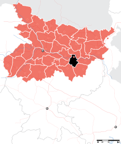 Location of Munger district in Bihar | |
| Country | India |
| State | Bihar |
| Administrative division | Munger |
| Headquarters | Munger |
| Government | |
| • Lok Sabha constituencies | Munger |
| • Assembly seats | Tarapur, Jamalpur and Munger |
| Area | |
| • Total | 1,419.7 km2 (548.1 sq mi) |
| Population (2011) | |
| • Total | 1,359,054 |
| • Density | 960/km2 (2,500/sq mi) |
| Demographics | |
| • Literacy | 73.30 per cent |
| • Sex ratio | 879 |
| Major highways | NH-80, NH-333, NH-333B |
| Average annual precipitation | 1146 mm |
| Website | Official website |
Munger district is one of the thirty-eight districts of Bihar state in eastern India. Munger city is the administrative headquarters of this district. Munger district is a part of Munger Division. Its literacy rate of 73.3% is higher than the state literacy rate of 63.8% and lower than national rate of 74.04.
The present collector and District Magistrate of Munger is Shri Uday Kumar Singh.[1]
History
Munger has seen five districts partitioned off from its territory: Begusarai in 1976;[2] Khagaria in 1988;[2] and Jamui in 1991;[3] and Lakhisarai district and Sheikhpura in 1994.[4][5]
The district is a part of the Red Corridor.[6]
Geography
Munger District is located in the southern part of Bihar and its headquarters is located on the southern bank of river Ganges. Munger district occupies an area of 1,419 square kilometres (548 sq mi),[7] comparatively equivalent to Russia's Urup Island.[8]
Economy
In 2006, the Ministry of Panchayati Raj named Munger one of the country's 250 most backward districts (out of a total of 640).[9] It is one of the 36 districts in Bihar have been receiving funds from the Backward Regions Grant Fund Programme (BRGF).[9]
Religion
According to the 2011 census Munger district has a population of 1,359,054,[10] roughly equal to the nation of Swaziland[11] or the US state of Hawaii.[12] This gives it a ranking of 358th in India (out of a total of 640).[10] The district has a population density of 958 inhabitants per square kilometre (2,480/sq mi) .[10] Its population growth rate over the decade 2001-2011 was 19.45%.[10] Munger has a sex ratio of 879 females for every 1000 males,[10] and a literacy rate of 73.3%.[10]
Flora and fauna
In 1976, Munger district became home to the Bhimbandh Wildlife Sanctuary, which has an area of 682 km2 (263.3 sq mi).[13]
References
- ↑ http://munger.bih.nic.in
- 1 2 Law, Gwillim (2011-09-25). "Districts of India". Statoids. Retrieved 2011-10-11.
- ↑ "Welcome To District Jamui,(Bihar) Website". jamui.bih.nic.in. Retrieved 2016-07-06.
- ↑ "Welcome To District Lakhisarai,(Bihar) Website". lakhisarai.bih.nic.in. Retrieved 2016-07-06.
- ↑ "This is the official website of District Administration of Sheikhpura, State Government of Bihar(India)". sheikhpura.bih.nic.in. Retrieved 2016-07-06.
- ↑ "83 districts under the Security Related Expenditure Scheme". IntelliBriefs. 2009-12-11. Retrieved 2011-09-17.
- ↑ Srivastava, Dayawanti et al. (ed.) (2010). "States and Union Territories: Bihar: Government". India 2010: A Reference Annual (54th ed.). New Delhi, India: Additional Director General, Publications Division, Ministry of Information and Broadcasting (India), Government of India. pp. 1118–1119. ISBN 978-81-230-1617-7.
- ↑ "Island Directory Tables: Islands by Land Area". United Nations Environment Program. 1998-02-18. Retrieved 2011-10-11.
Urup 1,436km2
- 1 2 Ministry of Panchayati Raj (September 8, 2009). "A Note on the Backward Regions Grant Fund Programme" (PDF). National Institute of Rural Development. Archived from the original (PDF) on April 5, 2012. Retrieved September 27, 2011.
- 1 2 3 4 5 6 "District Census 2011". Census2011.co.in. 2011. Retrieved 2011-09-30.
- ↑ US Directorate of Intelligence. "Country Comparison:Population". Retrieved 2011-10-01.
Swaziland 1,370,424
- ↑ "2010 Resident Population Data". U. S. Census Bureau. Retrieved 2011-09-30.
Hawaii 1,360,301
- ↑ Indian Ministry of Forests and Environment. "Protected areas: Bihar". Archived from the original on August 23, 2011. Retrieved September 25, 2011.
External links
Places adjacent to Munger district | |
|---|---|
| State symbols | |
|---|---|
| History |
|
| Administration | |
| Overviews | |
| Divisions and districts | |
| Cities | |
| Municipal Corporation |
|
| Poltics | |
| Culture | |