Hathras district
| Hathras district हाथरस जनपद | |
|---|---|
| District of Uttar Pradesh | |
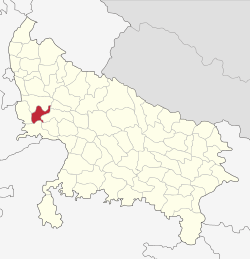 Location of Hathras district in Uttar Pradesh | |
| Country | India |
| State | Uttar Pradesh |
| Administrative division | Aligarh |
| Headquarters | Hathras |
| Government | |
| • Lok Sabha constituencies | Hathras |
| Area | |
| • Total | 1,840 km2 (710 sq mi) |
| Population (2011) | |
| • Total | 1,565,678 |
| • Density | 850/km2 (2,200/sq mi) |
| Demographics | |
| • Literacy | 73.1 per cent |
| • Sex ratio | 872 |
| Website | Official website |
Hathras district, is a district of Uttar Pradesh state of india.[1] The town of Hathras is the district headquarters. Hathras district is a part of Aligarh Division. This district occupies an area of 1800.1 km². The district has a population of 1,565,678 (2011 census).
History
Hathras District was created on 3 May 1997 by incorporating parts of the Aligarh, Mathura and Agra districts. It was given the name Hathras District shortly after.
Divisions
The district comprises four tehsils: Hathras, Sadabad, Sikandra Rao and Sasni, which are further divided into seven blocks: Sasni, Hathras, Mursan, Sadabad, Sahpau, Hasanpur Baru, Sikandra Rao and Hasayan.
There are three Vidhan Sabha constituencies in this district: Hathras, Sadabad and Sikandra Rao. All of these are part of Hathras Lok Sabha constituency.
- Akbarpur is a village on the Sasni-Nanau Road. While Akbarpur and Seekur are separate, the revenue department counts them as one village. The Sasni-Nanau Road through this village links NH 93 to NH 91. According to the 1991 census, the population of the village was 2000 people. The village is a residential region for both Hindu and Muslim populations, including multiple Hindu castes. Brahmins, Jats, Jatav (Chamar) Khatiks, Harijans, and Telis, among other castes, reside or have resided there. The socio-economic status of the villagers is in line with the national average. Bauhre Chandan Singh Shiksha Mandir, a private school in the village, provides education up to the eighth grade and is accompanied by a primary school. Sushila Kaushik Academy of Education, covers grades nine to twelve. The school is run Bauhre Chandan Singh Shiksha Samiti.[2]
Demographics
According to the 2011 census Hathras district has a population of 1,565,678,[3] roughly equal to the nation of Gabon[4] This gives it a ranking of 318th in India (out of a total of 640).[3] The district has a population density of 851 inhabitants per square kilometre (2,200/sq mi).[3] Its population growth rate over the decade 2001–2011 was 17.19%.[3] Hathras has a sex ratio of 870 females for every 1,000 males,[3] and a literacy rate of 73.1%.Hinduism and Islam are the predominant religions followed in the district.[3]
Transport
Four railway stations serve Hathras - Hathras Junction railway station, Hathras Road railway station, Hathras City railway station, and Hathras Kila railway station.
References
- ↑ "Important Cabinet Decisions". Information and Public Relations Department. Retrieved 17 January 2013.
- ↑ "Villages of Sasni Sub District Hathras". Local Government Directory. Ministry of Panchayati Raj. Archived from the original on 17 November 2015. Retrieved 28 August 2013.
- 1 2 3 4 5 6 "District Census 2011". Census2011.co.in. 2011. Retrieved 2011-09-30.
- ↑ US Directorate of Intelligence. "Country Comparison:Population". Retrieved 2011-10-01.
Gabon 1,576,665
Places adjacent to Hathras district | ||||||||||
|---|---|---|---|---|---|---|---|---|---|---|
| ||||||||||