Visakhapatnam district
| Visakhapatnam district | |
|---|---|
| District of Andhra Pradesh | |
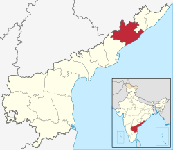 Location of Visakhapatnam district in Andhra Pradesh | |
| Country | India |
| State | Andhra Pradesh |
| Headquarters | Visakhapatnam |
| Tehsils | 46[1] |
| Government | |
| • District collector | Praveen Kumar IAS[2] |
| • Lok Sabha constituencies | Araku, Anakapalli, Visakhapatnam |
| • Assembly seats | 15 |
| Area | |
| • Total | 11,161 km2 (4,309 sq mi) |
| Population (2011) | |
| • Total | 4,288,113[3] |
| • Urban | 47.51% |
| Demographics | |
| • Literacy | 67.70% |
| • Sex ratio | 1003 |
| Vehicle registration | AP-31, AP-33 |
| Major highways | NH-16 |
| Coordinates | 17°58′N 82°50′E / 17.967°N 82.833°ECoordinates: 17°58′N 82°50′E / 17.967°N 82.833°E |
| Website | [Visakhapatnam district website Official website] |
Visakhapatnam District is a district in the Indian state of Andhra Pradesh. It is one of the nine coastal districts in the state, with the administrative headquarters located at Visakhapatnam. It is surrounded by Vizianagaram district on the north and East Godavari district on the south.[1]
History
In 1979, part of the district was split to help form Vizianagaram district.[4] Visakhapatnam District is currently a part of the Red Corridor.[5]
Demographics
According to the 2011 census Visakhapatnam district has a population of 4,288,113[6] This gives it a ranking of 44th in India (out of a total of 640) and 4th in its state.[6] The district has a population density of 384 inhabitants per square kilometre (990/sq mi) .[6] Its population growth rate over the decade 2001-2011 was 11.89%.[6] Visakhapatnam has a sex ratio of 1003 females for every 1000 males,[6] and a literacy rate of 67.7%.[6]
Visakhapatnam district has a population of 4,288,113 people of which 57.95% is urban as of 2011 census.[7]
| Population | 4,288,113 |
| Males | 2,140,872 |
| Females | 2,147,241 |
| Growth (1991–2001) | 15.36% |
| Rural | 2250655 |
| Urban | 2037458 |
| Scheduled Caste Population | 291,219 (7.6%) |
| Scheduled Tribe population | 557,572 (14.55%) |
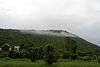
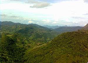
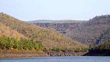
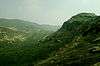
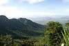
Geography
Visakhapatnam district occupies an area of approximately 11,161 square kilometres (4,309 sq mi),[8] comparatively equivalent to Canada's Cape Breton Island.[9]
Climate
| Climate data for Visakhapatnam | |||||||||||||
|---|---|---|---|---|---|---|---|---|---|---|---|---|---|
| Month | Jan | Feb | Mar | Apr | May | Jun | Jul | Aug | Sep | Oct | Nov | Dec | Year |
| Average high °C (°F) | 28.9 (84) |
31.3 (88.3) |
33.8 (92.8) |
35.3 (95.5) |
36.2 (97.2) |
35.3 (95.5) |
32.9 (91.2) |
32.7 (90.9) |
32.5 (90.5) |
31.7 (89.1) |
30.4 (86.7) |
28.9 (84) |
32.5 (90.5) |
| Average low °C (°F) | 18.0 (64.4) |
19.9 (67.8) |
23.0 (73.4) |
26.1 (79) |
27.7 (81.9) |
27.3 (81.1) |
26.1 (79) |
26.0 (78.8) |
25.6 (78.1) |
24.3 (75.7) |
21.6 (70.9) |
18.6 (65.5) |
23.7 (74.7) |
| Average precipitation mm (inches) | 11.4 (0.449) |
7.7 (0.303) |
7.5 (0.295) |
27.6 (1.087) |
57.8 (2.276) |
105.6 (4.157) |
134.6 (5.299) |
141.2 (5.559) |
174.8 (6.882) |
204.3 (8.043) |
65.3 (2.571) |
7.9 (0.311) |
945.7 (37.232) |
Economy
The Gross District Domestic Product (GDDP) of the district is ₹73,276 crore (US$10 billion) and it contributes 14% to the Gross State Domestic Product (GSDP). For the FY 2013–14, the per capita income at current prices was ₹124,162 (US$1,700). The primary, secondary and tertiary sectors of the district contribute ₹6,300 crore (US$880 million), ₹21,654 crore (US$3.0 billion) and ₹45,321 crore (US$6.3 billion) respectively.[10] The major products contributing to the GVA of the district from agriculture and allied services are, sugarcane, paddy, betel leaves, mango, milk, meat and fisheries. The GVA to the industrial and service sector is contributed from manufacturing, construction, minor minerals, software services and unorganised trade.[10]
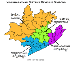
Divisions
The district has four revenue divisions, namely Anakapalli, Paderu, Narsipatnam and Visakhapatnam, each headed by a sub collector.[11] These revenue divisions are divided into 46 mandals in the district. The district consists of 3265 villages and 15 towns including, 1 municipal corporation, 2 municipalities and 12 census towns. Visakhapatnam city is the only municipal corporation and the 2 municipalities in the district are Yelamanchili and Narsipatnam.[12] The census towns are Bowluvada, Chodavaram, Chintapalle, Gudivada, Kantabamsuguda, Mulakuddu, Nakkapalle, Narsipatnam, Peda Boddepalle, Payakaraopeta, Upper Sileru Project Site Camp.[13]
Mandals
There are 13 mandals in Visakhapatnam division, 11 each in Narsipatnam, Anakapalle and Paderu divisions.[11][13] The 43 mandals under their revenue divisions are listed below:
Politics
There are three parliamentary and 15 assembly constituencies in Visakhapatnam district. The parliamentary constituencies are
The assembly constituencies are[14]
Transport
The total of core road network of the district is 945.443 km (587.471 mi). It includes, 298.783 km (185.655 mi) of existing and a proposed length of 646.660 km (401.816 mi).[15]

Education
The primary and secondary school education is imparted by government, aided and private schools, under the School Education Department of the state.[16][17] They include, 162 government, 2,793 mandal and zilla parishads, 9 residential, 1225 private, 5 model, 34 Kasturba Gandhi Balika Vidyalaya (KGBV), 147 municipal and 829 other types of schools.[18] The total number of students enrolled in primary, upper primary and high schools of the district are 609,587.[19]
Temples
There are thirty six temples under the management of Endowments Department.[20]
| S.no | Temple | Mandal | Village |
| 1 | Sri Satyanarayana Swamy Temple | ANAKAPALLI | ANAKAPALLI TOWN |
| 2 | Sri Venkateswara Swamy Temple | ANAKAPALLI | ANAKAPALLI TOWN |
| 3 | Sri Brahmalingeswara Swamy Temple | NARSIPATNAM | BALIGHATTAM |
| 4 | Sri Nookalamma Ammavari Temple | BHEEMUNIPATNAM | BHEEMUNIPATNAM |
| 5 | Sri Jagannadha Swamy Temple | VISAKHAPATNAM(U) | CHINAWALTAIR |
| 6 | Sri Kanaka Mahalakshmi (Durga) Ammavari Temple | VISAKHAPATNAM(U) | CHINAWALTAIR |
| 7 | Sri Dharamalleswara Swamy Temple | GOLUGONDA | DARAPALEM |
| 8 | Sri Erukumamba Ammavari Temple | VISAKHAPATNAM(U) | DONDAPARTHI |
| 9 | Sri Ramamandiram & Paradesamma Ammavari Temple | VISAKHAPATNAM(U) | DONDAPARTHI |
| 10 | Sri Anjaneya Swamy Temple | GAJUWAKA | GAJUWAKA |
| 11 | Sri Nookalamma Ammavari Temple | GOLUGONDA | Lingampeta |
| 12 | sri pramadha umavisweswara kumara swamy temple | VISAKHAPATNAM | GOPALAPATNAM |
| 13 | Sri Satyanarayana Swamy Temple | KASIMKOTA | KASIMKOTA |
| 14 | Sri Pardhasaradhi Swamy Temple | MADUGULA | MADUGULA |
| 15 | Sri Venkateswara & Vinayaka Swamy Temple | GAJUWAKA | MINDI |
| 16 | Sri Nookalamma Ammavari Temple | NARSIPATNAM | NARSIPATNAM |
| 17 | Sri Venkateswara Swamy Temple | NARSIPATNAM | NARSIPATNAM |
| 18 | Sri Nookalamma & Gangadevi Ammavari Temple | NATHAVARAM | NATHAVARAM |
| 19 | Sri Panduranga Swamy Temple | PAYAKARAOPETA | PAYAKARAOPETA |
| 20 | Sri Somalingeswara Swamy Temple | SABBAVARAM | SABBAVARAM, Somanadhapuram |
| 21 | Sri Jai Santhosimatha Sahita Saibaba Temple | VISAKHAPATNAM(U) | VISAKHAPATNAM |
| 22 | Sri.Kona Malleswara & Anjaneya swamy temples | LINGALA | PARNAPALLE |
| 23 | Sri Karakachettu Polamamba Ammavari Temple | VISAKHAPATNAM(U) | PEDAWALTAIR |
| 24 | Sri Mahaganapati Prasanna Venkateswara Sri Ayyappa Shiridi Saibaba etc., Temples | VISAKHAPATNAM(U) | Seethammadara North Extension |
| 25 | Sri Nookambica Ammavari Temple | VISAKHAPATNAM(U) | VISAKHAPATNAM Barmacamp |
| 26 | Sri Panduranga Swamy Temple | VISAKHAPATNAM(U) | VISAKHAPATNAM Beach Road |
| 27 | Sri Parvatieswaralayam | VISAKHAPATNAM(U) | VISAKHAPATNAM Ganesh Nagar |
| 28 | Sri Ramalingeswara Swamy Temple | VISAKHAPATNAM(U) | VISAKHAPATNAM R.K.Nagar |
| 29 | Sri Satyanarayana Swamy Temple | VISAKHAPATNAM(U) | VISAKHAPATNAM Sand Hill |
| 30 | Sri Sivarama Krishnalayam | VISAKHAPATNAM(U) | VISAKHAPATNAM Assamgardens |
| 31 | Sri Someswara Swamy Temple | VISAKHAPATNAM(U) | VISAKHAPATNAM Satyanagar NH-5 |
| 32 | Sri Venkateswara Swamy Temple | VISAKHAPATNAM(U) | VISAKHAPATNAM Lawsonsbay Colony |
| 33 | Sri Venkateswara Swamy Temple | VISAKHAPATNAM(U) | VISAKHAPATNAM Port Area |
| 34 | Sri Visweswara Swamy Temple | VISAKHAPATNAM(U) | VISAKHAPATNAM Suryabagh |
| 35 | Sri.Madhava & Anjaneya Swamy Temple | S MYDUKUR | S.MYDUKUR |
| 36 | Sri Yellamma Ammavari Temple | VISAKHAPATNAM(U) | VISAKHAPATNAM Yellammathota |
References
- 1 2 "District - Visakhapatnam". Andhra Pradesh Online Portal. Archived from the original on 19 April 2014. Retrieved 23 August 2014.
- ↑ "ALL INDIA SERVICES". Visakhapatnam District Official Website. NIC, Dept. of I.T., Ministry of C&I.T., Government of India. Retrieved 4 August 2014.
- ↑ "Visakhapatnam district profile". Andhra Pradesh State Portal. Archived from the original on 17 March 2015. Retrieved 18 March 2015.
- ↑ Law, Gwillim (25 September 2011). "Districts of India". Statoids. Retrieved 11 October 2011.
- ↑ "83 districts under the Security Related Expenditure Scheme". IntelliBriefs. 11 December 2009. Retrieved 17 September 2011.
- 1 2 3 4 5 6 "District Census 2011". Census2011.co.in. 2011. Retrieved 30 September 2011.
- ↑ "Archived copy". Archived from the original on 17 March 2015. Retrieved 18 March 2015.
- ↑ Srivastava, Dayawanti et al. (ed.) (2010). "States and Union Territories: Andhra Pradesh: Government". India 2010: A Reference Annual (54th ed.). New Delhi, India: Additional Director General, Publications Division, Ministry of Information and Broadcasting (India), Government of India. pp. 1111–1112. ISBN 978-81-230-1617-7.
- ↑ "Island Directory Tables: Islands by Land Area". United Nations Environment Program. 18 February 1998. Retrieved 11 October 2011.
Cape Breton Island 10,311km2
- 1 2 "Economy of Visakhapatnam District". Andhra Pradesh Economic Development Board. Retrieved 25 April 2017.
- 1 2 "GO issued for creation of Anakapalle revenue division". The Hindu. Viskhapatnam. 4 April 2013. Retrieved 21 November 2015.
- ↑ "Adminsistrative divisions of Visakhapatnam district". Official Website of Visakhapatnam District. National Informatics Centre. Retrieved 16 January 2015.
- 1 2 "District Census Handbook - Visakhapatnam" (PDF). Census of India. pp. 26–27, 52. Archived from the original (PDF) on 19 November 2015. Retrieved 21 December 2015.
- ↑ "District-wise Assembly-Constituencies:". ceoandhra.nic.in.
- ↑ ":: APRDC ::". Andhra Pradesh Road Development Corporation. Roads and Buildings Department. Retrieved 9 November 2016.
- ↑ "School Education Department" (PDF). School Education Department, Government of Andhra Pradesh. Archived from the original (PDF) on 19 March 2016. Retrieved 7 November 2016.
- ↑ "The Department of School Education - Official AP State Government Portal". www.ap.gov.in. Archived from the original on 7 November 2016. Retrieved 7 November 2016.
- ↑ "School Information Report". Commissionerate of School Education. Government of Andhra Pradesh. Archived from the original on 8 November 2016. Retrieved 8 November 2016.
- ↑ "Student Information Report". Commissionerate of School Education. Child info 2015-16, District School Education - Andhra Pradesh. Archived from the original on 22 May 2015. Retrieved 8 November 2016.
- ↑ "Trust Boards Abstract". AP Temples Portal, Government of Andhra Pradesh. Retrieved 24 July 2018.
External links
| Wikimedia Commons has media related to Visakhapatnam district. |
- Official Website
- Vizagport

Places adjacent to Visakhapatnam district | |
|---|---|