Bijnor district
| Bijnor district | |
|---|---|
| District of Uttar Pradesh | |
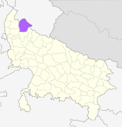 Location of Bijnor district in Uttar Pradesh | |
| Country | India |
| State | Uttar Pradesh |
| Administrative division | Moradabad |
| Headquarters | Bijnor |
| Area | |
| • Total | 4,049 km2 (1,563 sq mi) |
| Population (2011) | |
| • Total | 3,683,896 |
| • Density | 910/km2 (2,400/sq mi) |
| Website | Official website |
Bijnor district is one of the districts of Uttar Pradesh state of India. Bijnor city is the district headquarters. The Uttar Pradesh Government wants Bijnor to be included under National Capital Region (NCR) due to its close distance from Delhi.[1]
Geography
Bijnor, or more correctly Bijnaur, occupies the north-west corner of the Moradabad Division (historically, Rohilkhand or Bareilly region), and is a roughly triangular stretch of country with its apex to the north. The western boundary is formed throughout by the deep stream of the river Ganges, beyond which lie the four districts of Dehradun, Saharanpur, Muzaffarnagar and Meerut. To the north and north-east in the hill country of Garhwal, the dividing ling being the submontane road, which runs from Hardwar along the foot of the Himalayas to Ramanagar, Haldwani and Tanakpur. This road, popularly known as the Kandi Saradk, belongs throughout its length to Garhwal, the transfer having taken place a few years since. On the east the Phika river for the greater part of its course constitutes the boundary, separating this district from Naini Tal and Moradabad, as far as its junction with the Ramganga; and to the south lie the Thakurdwara Tehsil of Moradabad. Amroha, and Hasanpur tahsils of Amroha District. The boundary being conventional and undetermined by natural features. The extreme parallels of north latitude are 29° 2' and 29° 58' and of east longitude 78° 0' and 78° 57' from Lalitpur, the most northerly point, to koti Rao in the furthest eastern corner the distance in 56 miles (90 km); and from koti Rao to Kamharia in the south-westerly angle 57 miles (92 km); and from Kamharia to Lalitpur 62 miles (100 km). The total area of the district is liable to change slightly from time to time by reason of the erratic action of the Ganges and Ramganga: in 1906 it amounted to 1,145,272 acres (1789.5 square miles, 4634.75 km²) the average for the last five years being 1,147,967 acres (4,645.66 km²).
There remains the low fringe of khadir along the Ganges to the west. This generally resembles the lowlands that skirt the rivers of the interior, the low flats which adjoin the stream itself being purely alluvial in character, while above them rises a terrace of higher ground extending inland as far as the chain of stagnant morasses lying immediately under the bangar cliff.
Divisions
Politics
The MP of Bijnor is Kunwar Bhartendra Singh. He represents Bharatiya Janta Party. He belongs to the Jat community and is a native of Sahanpur Village.
Assembly constituencies
Najibabad, Chandpur, Noorpur, Dhampur, Nagina (reserved), Bijnor, Barhapur, Nehtaur (Reserved)
Demographics
According to the 2011 census Bijnor district has a population of 3,683,896,[2] roughly equal to the nation of Liberia[3] or the US state of Oklahoma.[4] This gives it a ranking of 74th in India (out of a total of 640).[2] The district has a population density of 808 inhabitants per square kilometre (2,090/sq mi) .[2] Its population growth rate over the decade 2001-2011 was 17.64%.[2] Bijnor has a sex ratio of 913 females for every 1000 males,[2] and a literacy rate of 70.43%.[2]
Languages
The common tongue of the people in the Hindi and Urdu dialect of Western Hindi. It has sometimes been classified separately as Rohilkhandi, but there is really no marked distinction in idiom or vocabulary between this and Hindustani. The last census returns show that the entire population gave either Hindi or Urdu as their mother tongue.
Culture
Agriculture is the main source of income in Bijnor, with sugarcane being the main crop.
Tourism
Vidur Kuti is about 12 km from Bijnor and has historical importance. Vidur spent his rest of life after dispute with Duryodhan. This is the place where Lord Krishana visited. During Mahabharat when the battle between Kauravas and Pandavas was about to begin, then on the request of both the sides, all wives and children were to be guardianed by Mahatma Vidur. He had no sufficient space for their living then he decided an exclusive area for ladies and children, which is now known as Daranagar.
This place popularly known as a village Saindwar where Jawahar Navodaya Vidhalaya is established. Two of the Akbar's Navratnas, namely Abul Fazzal and his brother Faizi, were born in the village Azampur which is 4 km from Basta . They studied in this village and were very intelligent. Najibudaulah's Fort is situated in Najibabad. This fort was built by "Gulam Kadir" alias "Najibudaulah" during the 18th century after the downfall of the Mughal Empire.
Settlements in the district
- Bijnor city
- Jhalu Town
- Chandok
- Nagina city
- Sherkot city
- Najibabad city is a city founded by Nawab Najib-ud-Daula, also known as Najib Khan.
- Chandpur city
- Ratangarh village
- Dhampur city
- Seohara city
- Bahupura or Kalanpur Buzurg village
- Askaripur village
- Haldaur city
- Umri Village
- Harewali Village
- Shahzadpur Village
- Tajpur Town/ Village
- Basi Kiratpur is situated with the tiger reserve forest on a bank of the Vanaily River. it is just 70 km from Ramganga Dam (Kalagarh Dam).
- Sahanpur village is famous for its Soan Papri, Batisa, Sohan Halwa and Namkeen (Indian Snacks). It is situated on Najibabad - Haridwar highway and just 2 km. from najibabad.
- Nehtaur
- Ranipur, Uttar Pradesh
- Afzalgarh city
- Shikarpur Village
- Linderpur village
- Mandawali village
.
Religion
Kanva Ashram is an ashram in broken condition near Rawli town according to the great legend "Abhigyan Shakuntalam". Hastinapur's King Dushyant reached there while hunting and fell in love with Shakuntala at first sight. Ganj is about 12 km from District HQ and just 1 km from Daranagar on the banks of the Ganges. There are ancient temples and ashrams. Jahanabad is situated on the bank of river Ganges and just about 1 km from Ganj. This village used to be a riyasat with around 101 villages under it during Mughal Period. Around that period a saint was living there who was famous for curing snake bites. Once when Shahjahan's wife got bit by a snake, he treated and got "Jahanabad Riyasat" as a prize from Shah Jahan. Presently Ganges flows 2 km from here. Sita's temple without any idol is situated one km from Nanore Village on Chandpur-Jalilpur road. This is popularly known as "Sita Mandir Math". It is believed that this is the place where the earth tored and Sita jumped into. Sena Ka Dawar means Army's Gate where Pandavas had settled their Army. There is a temple of Dronacharya presently. This place popularly known as a village Saindwar where Jawahar Navodaya Vidhalaya is established.Bakharpur Garhi village is situated on the bank of Malan river and known for its ancient GOGAJI temple. Village is about 5 km from District HQ. Every year, GOGAJI's fair is organized in the first week of Shravan month. Urban areas of Bijnor district are predominantly Muslim.[6] There are poorer living conditions for Muslims than for Hindus.[7] In rural areas, there are particular processes against Muslim women.[8] Few Muslim villages have government primary schools.[8] Bakharpur Garhi village is situated on the bank of Malan river and known for its ancient GOGAJI temple. Village is about 5 km from District HQ. Every year, GOGAJI's fair is organized in the second week of Shravan month.
References
- "History of the Bijnor Rebellion," Sir Sayyid Ahmad Khan, Idarah-i-Adabiyat-i-Dlli, Delhi, 1982. Originally, "Tareekh-e-Sarkashi-e-Zilaa-e-Bijnor," published in 1858.
- "History of Bijnor," B.C. Verma, 1974.
- ↑ "UP seeks to include 6 districts in NCR". indianexpress.com. 11 January 2015. Retrieved 18 March 2018.
- 1 2 3 4 5 6 "District Census 2011". Census2011.co.in. 2011. Retrieved 2011-09-30.
- ↑ US Directorate of Intelligence. "Country Comparison:Population". Retrieved 2011-10-01.
Liberia 3,786,764 July 2011 est.
- ↑ "2010 Resident Population Data". U. S. Census Bureau. Archived from the original on 1 January 2011. Retrieved 2011-09-30.
Oklahoma 3,751,351
- ↑ "Bijnor Religion Census 2011". Office of the Registrar General and Census Commissioner, India. Retrieved 2015-11-16.
- ↑ http://www.e-migration.ro/jims/Vol11_No2_2017/JIMS_Vol11_No2_2017_pp74_97_AHMAD.pdf
- ↑ http://icssr.org/Bijnor%20Final%20Report%20(Baseline).pdf
- 1 2 https://books.google.co.uk/books?id=BifL_A9RN4wC&pg=PA127&dq=bijnor+gender&hl=en&sa=X&ved=0ahUKEwiyzuGZ--DXAhWLcBoKHdBsCeUQ6AEIMjAB#v=onepage&q=bijnor%20gender&f=false
External links
Places adjacent to Bijnor district | ||||||||||
|---|---|---|---|---|---|---|---|---|---|---|
| ||||||||||