List of enclaves and exclaves
In political geography, an enclave is a piece of land that is totally surrounded by a foreign territory. An exclave is a piece of land that is politically attached to a larger piece but not physically conterminous (having the same borders) with it because of surrounding foreign territory. Many entities are both enclaves and exclaves.
Enclaves that are also exclaves
Each enclave listed in this section has the equivalent administrative level as the one other entity that entirely surrounds it. Each enclave is also a part of a main region; hence, it is an exclave of that region.
National level
| Name[1][2] | Area (km2) | Exclave of | Enclaved within | Coordinates | Notes |
|---|---|---|---|---|---|
| Apipé Islands[3] (4) | ~320 | 27°31′S 56°51′W | Four adjacent islands (Isla Apipé Grande, Isla Apipé Chico, Isla Los Patos and Isla San Martín) with territorial water borders in the Río Paraná, 39 km east of Isla Entre Rios. Island areas are about 276, 23.8, 11.8 and 3.7 km², respectively. | ||
| Isla Entre Ríos[3] | ~36 | 27°25′S 57°30′W | Uninhabited island with territorial water border in the Río Paraná, 39 km west of Isla Apipé. | ||
| Isla Martín García | 1.84 | 34°10′47″S 58°15′0″W | Territorial water border on the Uruguay side of Río de la Plata. Designated as a nature reserve under the jurisdiction of Argentina in 1973. | ||
| Artsvashen | ~40 | 40°38′N 45°30′E | Controlled by Azerbaijan since the Nagorno-Karabakh War in 1992. | ||
| Torres Strait Islands (7) | ~2,200 (including water area) | 9°25′23″S 142°32′10″E | The islands of Anchor Cay, Aubusi Island, Black Rocks, Boigu Island (89.6 km²), Bramble Cay (0.036 km²), Dauan Island (4 km²), Deliverance Island, East Cay, Kaumag Island, Kerr Islet, Moimi Island, Saibai Island (107.9 km²), Turnagain Island (12 km²) and Turu Cay, along with their territorial seas, form seven enclaves within the maritime area of Papua New Guinea under a treaty effective in 1985. The territorial sea of each island does not extend beyond three nautical miles.[4][5] The mainland of Papua New Guinea is only 6 km from Boigu. | ||
| Jungholz | 7.05 | 47°34.3′N 10°27.3′E | Connected at a quadripoint at the summit of the mountain Sorgschrofen (1636 m); accessible only through Germany. Vinokurov (2007) states, "For all purposes, a connection in a single point does not mean anything. It is just like being completely separated. One cannot pass through a single point, nor is it possible to transport goods. It is not even possible to lay a telephone line."[3] | ||
| Yukhari Askipara | ~37 | 41°03′58″N 45°01′24″E | A destroyed village controlled by Armenia since the Nagorno-Karabakh War in May 1992; west of the town of Qazax. | ||
| Barkhudarli | ~22 | 40°59′36″N 45°13′31″E | Controlled by Armenia since the Nagorno-Karabakh War in May 1992; west-southwest of the town of Qazax. | ||
| Karki | 19 | 39°47.3′N 44°57′E | Controlled by Armenia since the Nagorno-Karabakh War in May 1992; north of Azerbaijan's exclave of Nakhchivan. | ||
| Yaradullu (north and south) | 0.12 and 0.06 | 41°00′51.8″N 45°26′12.2″E | Two farmland enclaves just across the border from the village of Yaradullu[6][7] (55 m at the closest point). They are 750 m and 1500 m southwest of the municipality of Tatli on the west bank of the Akhum River; approximately 300x400 m and 300x200 m. The surrounding Armenian territory has been occupied by Azerbaijan since the Nagorno-Karabakh War in May 1992, so that these two small pockets of land are de facto no longer exclaves. | ||
| Dahagram-Angarpota | 25.95 | 26°18′N 88°57′E | Dahagram–Angarpota is a composite enclave of two adjoining chhits. It is separated from the contiguous area of Bangladesh at its closest point by 178 metres (584 ft). The enclave has an estimated population of 20,000. After the exchange of enclaves with India under the Land Boundary Agreement on 31 July 2015, Bangladesh retained it as an exclave. The Tin Bigha Corridor, a strip of Indian territory 85 metres (279 ft) wide running from the enclave to the Bangladesh mainland at its nearest approach, was leased to Bangladesh for 999 years for access to the enclave.[1][8][9] | ||
| Baarle-Hertog (22 parcels) | 2.3448 | 51°26′13″N 4°55′43″E (H1) | A group of 22 Belgian enclaves in the southern Netherlands. Enclaves H1 and H2 are connected at a single point. | ||
| Međurečje | 3.9584 | 43°33′30″N 19°25′30″E | Home land of Bosnia-Herzegovina is 1,130 meters to the north. Sastavci is the name of the neighboring village in Serbia. | ||
| Quitasueño | 3,577, including water area[10] | 14°24′1″N 81°7′47″W[11] (QS32)[10] | On 19 November 2012, the International Court of Justice upheld Colombia's claim to Quitasueño, plus a 12-NM territorial zone, and re-defined Nicaragua's EEZ, thus surrounding the island bank.[12] It deemed one of the bank's 54 features to be an island at high tide (elevation 70 cm, area 1 m²)[13] and created enclaves as an equitable solution.[14] The area of the bank, excluding the 12-mile zone, is ~290 km².[15] | ||
| Serrana | ~2,800, including water area | 14°17′13″N 80°21′48″W (Southwest Cay) | On 19 November 2012, ICJ upheld Colombia's claim to Serrana, plus a 12-NM territorial zone, and re-defined Nicaragua's EEZ, surrounding the island bank.[12] The land area is ~0.11 km², and the area of the bank, excluding the 12-mile zone, is ~322 km².[15] Colombia decried the loss of maritime areas and creation of "'enclaves' around Quitasueño and Serrana that could restrict" access.[12] | ||
| Brezovica Žumberačka (2) | 0.0183+ | 45°41′22″N 15°18′12″E | The first enclave contains four dwellings surrounded by agricultural land near the Slovenian village of Brezovica pri Metliki. It is about 437 m long and 60 m wide covering 1.83 ha. Confirmed by both Croatian and Slovenian cadaster maps, it lies about 100 meters away from the main border at the closest point.[6][7][16][17]
A second enclave lies within 300 meters of the first. It was created on 29 June 2017 when the Permanent Court of Arbitration decided that a disputed 2.4 ha parcel is part of Slovenia and that the border follows Slovenian cadastral limits, thus completing the encirclement of the second Croatian enclave.[18][19] Croatia has stated that it will ignore the arbitration decision.[20] | ||
| Ormidhia | 1.694 | 34°59′33″N 33°46′49″E | Small exclave surrounded by Dhekelia, a British Overseas Territory in southeastern Cyprus. | ||
| Xylotymbou | 0.947 | 35°01′03″N 33°44′37″E | Small exclave surrounded by Dhekelia, a British Overseas Territory. | ||
| "Electricity Authority of Cyprus" Refugee Settlement | ~0.28 | 34°59′04″N 33°44′37″E | North of Dhekelia Power Station from which it is separated by a British road; the closest point between the two territories is 21 meters. | ||
| Dhekelia Power Station | ~0.161 | 34°58′49″N 33°44′45″E | Partially borders the coast but enclosed by UK land and waters disputed between Cyprus and the UK elsewhere; the power station is owned by the Electricity Authority of Cyprus (EAC); no permanent population. | ||
| Münsterbildchen | 1.826 | 50°39′36″N 6°11′24″E | West of Vennbahn trackbed; northernmost German enclave, mainly home to industrial and warehouse structures. | ||
| Roetgener Wald | 9.98 | 50°38′12″N 6°14′32″E | Western part of Lammersdorf, southern part of Roetgen, and intervening forest (Forst Rötgen); west and south of Vennbahn trackbed. From 1922 to 1958, the center portion (between Grenzweg and a boundary with three turning points west of the Schleebach stream) was Belgian territory. Until 1949, the east–west road that connected the two outer (German) portions was also German territory; therefore, the German land formed one oddly-shaped enclave (that also included the road to Konzen). In 1949, it was split into two enclaves when Germany ceded the roads to Belgium;[21] in 1958, Belgium returned the east–west road and also ceded the center section of the current enclave to Germany. | ||
| Rückschlag | 0.016 | 50°35′52″N 6°14′53″E | Part of city of Monschau, west of Vennbahn trackbed; smallest German exclave, consisting of a house and a garden. | ||
| Mützenich | 12.117 | 50°33′54″N 6°13′5″E | West of Belgium's Vennbahn trackbed. | ||
| Ruitzhof | 0.937 | 50°31′29″N 6°11′39″E | Part of city of Monschau, west of Vennbahn trackbed; southernmost Vennbahn enclave after 1949 (when Belgium annexed the Hemmeres enclave). | ||
| Büsingen am Hochrhein | 7.62 | 47°42′N 8°42′E | At its closest, less than 700 metres (2,300 ft) from Germany proper (to the east). Part of Swiss customs | ||
| Campione d'Italia | 1.6 | 45°58′10″N 8°58′25″E | Uses the Swiss franc, Former part of swiss customs (until 2020). Separated by less than 1 km, at the shortest distance, from the rest of Italy by Lake Lugano and mountains, but the terrain requires a 14 km road journey to reach the nearest Italian town, Lanzo d'Intelvi. | ||
| Barak (de facto) | 2.07[22] | 40°40′N 72°46′E | Kyrgyzstan's 1991 pre-independence border is the de jure international border, but much of it is hotly disputed with its neighbors. In August 1999, the area around Barak was occupied by Uzbekistan, cutting it off from Kyrgyz territory. Uzbek forces dug up and blockaded the road to Ak-Tash[23] while also allegedly seizing large areas of Kyrgyz land that had been loaned in the Soviet era but never returned.[24] They entrenched themselves within much of Kyrgyz border territory and refused to leave.[25] Barak became a de facto enclave only 1.5 km from the shifted main border.[26] Four Uzbek enclaves and Barak are major sticking points in delimitation talks,[27] and disputes have centered on the areas of Barak, Sokh, Gava and Gavasay (stream).[28] (Map) In August 2018 Kyrgyz and Uzbek authorities agreed to a land swap that would eliminate the exclave. The exchange process may take up to two years.[29] | ||
| Likoma Island | 130.0 (incl a territorial water area) | 12°04′S 34°44′E | Lacustrine enclave, including smaller islets, with territorial water border in Lake Malawi (Lake Nyasa); only ~5 kilometers from the Mozambique shore; combined land area of Likoma Is. and the smaller Chizumulu Is. is 18 km². | ||
| Chizumulu Island (incl Lundu Is., Papia Is., Ngkyvo Is.) | 101.4 (incl 2-NM territorial water area) | 12°01′0″S 34°37′14″E | Lacustrine enclave with territorial water border in Lake Malawi (Lake Nyasa); Malawian mainland is 46 km away. | ||
| Baarle-Nassau (8 parcels) | 0.150684 | 51°24′43″N 4°52′16″E (N8) | Seven of the eight Dutch enclaves are counter-enclaves inside two Belgian enclaves (H1 and H8); one is in the main body of Belgium (N8). | ||
| Laguna Los Portillos and beach | ~0.46 | 10°55′55.1″N 83°40′12.4″W | On 2 Feb 2018, the ICJ rendered a decision in a border dispute between Nicaragua and Costa Rica regarding Isla Portillos. Nicaragua was left with just the Laguna Los Portillos and its short strip of beach. The court also decided that the sea just outside of the lagoon would be Costa Rican waters. The ICJ concluded that the whole beach is Costa Rican except for the part directly between the lagoon and the Caribbean Sea – now a tiny enclave of Nicaraguan territory separated from the rest of the country.[30] | ||
| Madha | ~75 | 25°17′N 56°17′E | Halfway between the Omani fragment on the Musandam Peninsula and the rest of Oman; surrounds the UAE counter-enclave of Nahwa. | ||
| San'kovo-Medvezh'e | 4.54 | 52°28′48″N 31°33′51″E | Contains two small villages that have been depopulated since the 1986 Chernobyl disaster in Ukraine. | ||
| Llívia | 12.84 | 42°28′N 1°59′E | To the east of Andorra, separated from the rest of Spain by a corridor about 2 km wide containing the French communes of Ur and Bourg-Madame. | ||
| Vorukh | ~96.7 | 39°51′04″N 70°38′00″E | South of the mountain Ak-Tash; population is 95% Tajik and the rest Kyrgyz. | ||
| "Kayragach" | ~0.88 | 40°04′05″N 69°32′41″E | Near the railway station of Stantsiya Kayragach, next to the Kyrgyz–Tajik border; also referred to as "Western Qal'acha" due to proximity to the Tajik town of Qal'acha; apparently there is no named settlement. | ||
| Sarvan (also Sarvaksoi, Sarvaki-bolo) | 8.4 | 40°58′00″N 70°36′56″E | Long, narrow territory located in the Fergana and Isfara valleys region where Kyrgyzstan, Tajikistan and Uzbekistan meet. | ||
| Nahwa | ~5.2 | 25°16′N 56°16′E | A counter-enclave surrounded by Madha, reported to consist of around forty houses.[31] | ||
| Filomena Islands (5 islands) | ~23 | 32°59′S 58°6′W | Five adjacent islands (Isla Filomena Grande, Isla Filomena Chica, Isla Palma Chica, Isla Bassi, Isla Tres Cruces) with territorial water borders in the Uruguay River. Uninhabited islands that form part of the Esteros de Farrapos National Park. | ||
| Sokh | ~234 | 40°02′39″N 71°05′39″E | Large enclave with 99% Tajik population, the rest Kyrgyz and almost no ethnic Uzbeks. | ||
| Shakhimardan | ~38.2 | 39°58′59″N 71°48′18″E | Located in a narrow valley in the Alay Mountains where the rivers Ok-su and Kok-su meet to form the Shakhimardan-sai.[6][7][32] | ||
| Chon-Qora or Qalacha (the 2 Uzbek villages in the enclave) | ~3 | 40°14′37″N 71°02′14″E | Tiny enclave lying on the Sokh River, immediately north of Sokh; measures about 3 km long by 1 km wide, with the Uzbek villages of Chon-Qora (or Chongara 40°15′03″N 71°02′15″E) and Qalacha (40°14′10″N 71°02′12″E) at either end; the Kyrgyz village of Chong-Kara (or Chon-Kara 40°15′37″N 71°00′41″E) lies 2 km northwest.[6][7][32] [Note: The Kyrgyz Cyrillic alphabet contains three characters not present in the Uzbek alphabet. One of these characters is romanized from Kyrgyz as the digraph "ng," which is not present in romanized Uzbek words.][33] | ||
| Jani-Ayil (also Jangy-ayyl or Khalmion) | ~0.8 | 40°12′09″N 71°39′58″E | Tiny enclave north-northwest of the Shakhimardan enclave; within 1 km of the Uzbek main border; the Kyrgyz towns of Jani-Ayil (40°10′56″N 71°40′49″E) and Kalmion (40°12′44″N 71°37′58″E) lie outside opposite edges of this enclave.[6][7][32] | ||
| High Seas | ~180,000 | 26°19′N 135°52′E | Surrounded by Japan's EEZ; it lies between the territorial zones of Honshu, Shikoku, the Bonin Islands, Okino-tori-shima and Okinawa Island | ||
| High Seas | ~1,300 | 44°19′S 178°12′E | Surrounded by New Zealand's EEZ; it lies between the territorial zones of the Chatham Islands, North Island and the Bounty Islands | ||
| High Seas | ~14,000 | 49°32′S 173°6′E | Surrounded by New Zealand's EEZ; it lies between the territorial zones of Campbell Island, South Island and the Antipodes Islands | ||
| High Seas | ~3,700 | 24.2°S 143.3°W | Surrounded by France's EEZ; it lies between the territorial zones of the Bass Islands, Raivavae, Nukutepipi, and Tematagi |
First-order subnational level
Other subnational
- In Australia:
- The larger of the two parts of the Aboriginal Shire of Doomadgee in Queensland is surrounded by the Shire of Burke. Except for the ocean, the smaller part is nearly surrounded also by the Shire of Burke.
- In China:
- Chaoyang District has one exclave that comprises Terminals 1 and 2 of Beijing Capital International Airport and the immediately surrounding service area. It is an enclave of Shunyi that used to be Shunyi Subdistrict of Chaoyang District. The main reason for the existence of this exclave is because the financing for the building of these Terminals was largely carried by Chaoyang District and this political organization ensures that they continue to pay taxes to Chaoyang District. Note: Terminal 3 is not a part of this exclave as it was built for the 2008 Olympics and was built after the formation of Shunyi District. See a map of the exclave, not including Terminal 3, on Google Maps.[53]
- In Croatia:
- In Osijek-Baranja County, the municipality of Bilje has one exclave (Zlatna Greda) inside the municipality of Kneževi Vinogradi.
- In Estonia:
- In Ida-Viru County, the town of Kohtla-Järve consists of five separated areas within a distance of 22 km. Of these exclaves, Kukruse and Oru districts are also enclaves, since they are surrounded by Toila Parish.
- Kudruküla and Olgina districts of Narva town are surrounded by the town of Narva-Jõesuu.
- In France (départements):
- Meurthe-et-Moselle has one exclave inside Meuse.
- Nord has one exclave in Pas-de-Calais.
- Oise has three exclaves in Aisne: one comprises the village of Chavres, while the other two are uninhabited parcels of land in the Forest of Retz.
- In Germany: Brunn is an exclave of Nuremberg, Middle Franconia, Bavaria.
- In Indonesia, the district of Mulyorejo in Surabaya has an exclave inside the neighboring Sukolilo district.
- In Italy:
- In Aosta Valley: the municipality of La Magdeleine has an exclave within the municipality of Antey-Saint-André.
- In Apulia: the Metropolitan City of Bari (the municipality of Locorotondo) has three exclaves inside the Province of Taranto;
- In the Metropolitan City of Bari: Castellana Grotte has an exclave within Alberobello and one within Conversano; Polignano a Mare has two exclaves inside Conversano; Santeramo in Colle has an exclave within Cassano delle Murge; Terlizzi has an exclave inside Ruvo di Puglia.
- In the Province of Taranto: Massafra has five exclaves inside Crispiano; Taranto has an exclave inside Grottaglie.
- In the Province of Foggia: San Marco in Lamis has an exclave inside San Giovanni Rotondo; Manfredonia has one exclave inside San Giovanni Rotondo, and San Giovanni Rotondo has one inside Manfredonia; San Severo has two exclaves inside Foggia; Pietramontecorvino has four exclaves inside Lucera; Stornara has two exclaves inside Orta Nova.
- In Basilicata: the Province of Matera has an exclave inside the Province of Potenza.
- In Campania: Pannarano is an exclave of the Province of Benevento inside the Province of Avellino.
- In the Province of Caserta: Caserta has three exclaves inside Capua.
- In the Metropolitan City of Naples: Ottaviano has two small exclaves within Nola.
- In Friuli Venezia Giulia: Grimacco has an enclave within Drenchia, and Drenchia has one in Grimacco.
- In Lombardy
- In the Province of Pavia: Pieve del Cairo has enclave inside Mezzana Bigli.
- In Marche: the Province of Pesaro and Urbino (the municipality of Monte Porzio) has two small exclaves within the Province of Ancona.
- In Molise:
- In the Province of Campobasso: Montenero di Bisaccia has an exclave inside Tavenna.
- In Piedmont, the Province of Cuneo has an enclave (Carutti in the municipality of Barge) inside the Metropolitan City of Turin.
- In the Province of Asti, Soglio has two and Cinaglio one exclave inside Camerano Casasco.
- In the Metropolitan City of Turin, Carignano has three exclaves inside Carmagnola.
- In Sicily, the Metropolitan City of Palermo has an enclave within Agrigento (San Biagio); the province of Caltanissetta has an enclave within Palermo (Resuttano); and the province of Enna has an enclave within Caltanissetta.
- In the Metropolitan City of Palermo: Roccapalumba has an exclave within Caccamo.
- In the Province of Trapani: Gibellina has a small exclave within Santa Ninfa.
- In the Province of Enna: Piazza Armerina has one exclave within Enna and another one within Aidone.
- In the Province of Caltanissetta: Serradifalco has an exclave inside Caltanissetta.
- In Trentino-Alto Adige/Südtirol:
- In the Autonomous Province of Trentino: Pellizzano has an exclave within Peio; Calliano has an exclave inside Besenello.
- In Norway, the municipality of Sandefjord has one exclave, Himberg, inside the neighbouring municipality of Larvik.[54][55][56]
- In Portugal, as a consequence of administrative reforms during the 19th century (in the 1830s, then again in the 1850s, and to a much lesser extent in the 1890s), as well as more recent legislation forbidding the creation of territorial discontinuities,[57][58] there are almost no sub-national exclaves or enclaves, and the few that persist are on the municipal or civil parish level:
- In the Coimbra municipality, the civil parish of Taveiro has an exclave that is enclaved within the civil parish of Ribeira de Frades.
- In the Vila Real de Santo António municipality, the entire civil parish of Vila Nova de Cacela is an exclave that is enclaved within the Castro Marim municipality.
- In Spain:
- In Andalusia, Villar is an exclave of Córdoba province surrounded by Seville province.
- In Castile and León:
- San Llorente is an exclave of the province of Valladolid and is surrounded by the province of León.
- Three exclaves of the province of Palencia — La Rebolleda, Villodrigo and Aguanares — are enclaves within the province of Burgos.
- In Catalonia:
- In Sweden many municipalities have exclaves (most notably the municipalities of Dalarna County).
- In the United States of America:
- In Alaska, the community of Klukwan is surrounded by Haines Borough, even though the community is part of the Hoonah-Angoon Census Area, which is in turn part of the Unorganized Borough.
- In California
- The high-security jail for the independent city/county of San Francisco is located in San Bruno in neighbouring San Mateo County, making the jail both an exclave and enclave at the local level.
- San Jose has an exclave (Cherry Flat Reservoir) that is surrounded by Santa Clara County.
- In Colorado, Arapahoe County has two exclaves within the City and County of Denver: the city of Glendale and the unincorporated neighborhood of Holly Hills. Additionally, Boulder and Weld counties both have an exclave within the City and County of Broomfield, and Broomfield has an exclave in Boulder County.
- In Georgia, Bibb County has an exclave within Monroe County. This boundary is disputed, however.[59][60]
- In Kentucky, following the merger of the Louisville and Jefferson County governments in 2003, the new Louisville Metro has several disjoint parcels of land throughout the county, of which some are enclaves in other cities.
- In Minnesota, Mendota Heights has an exclave that is surrounded by Lilydale.
- In New Jersey, Middletown Township in Monmouth County has an exclave surrounded by the borough of Keansburg.[61]
- In Ohio:
- In Montgomery County, there are several cities with enclaves and exclaves. Dayton has one exclave, consisting of Dayton International Airport. Dayton also surrounds several enclaves that belong to the cities of Trotwood and Riverside. Riverside also has several exclaves that border more than one city as well as additional parcels that are connected to the city only by a roadway. Clayton contains several enclaves surrounded by Englewood and one that is completely surrounded by Union. Other than Dayton's exclave, these enclaves and exclaves were formed by municipality-township mergers in the 1990s.
- In Summit County:
- The city of Cuyahoga Falls has four small enclave/exclaves along its border with the city of Akron. Several houses along Smith Road are legally in the Falls, while neighbors and municipal lands on all sides of the properties are legally within Akron.
- Bath Township has four exclaves, of which one is an enclave of Akron.
- Springfield Township has six exclaves, of which two are enclaves in Akron.
- Coventry Township has six exclaves, of which five are enclaves in Akron. Two of these are joined at a quadripoint.
- Twinsburg Township has seven exclaves, of which four are enclaves in the city of Twinsburg. The city in turn has one piece connected by only a quadripoint, otherwise surrounded by the township.
- In Oregon, the location of several businesses, including the world headquarters of Nike, Inc., is surrounded by the city of Beaverton, but is within unincorporated Washington County.
- In Pennsylvania, Cumru Township in Berks County has two exclaves, both separated by the city of Reading, and one of them is an enclave in Reading.
- In Virginia, Fairfax County has an exclave within the City of Fairfax that houses the county courthouse and some other county governmental offices. Prince William County has an exclave within the City of Manassas that houses the county courthouse and some other county governmental offices. Montgomery County has a small exclave consisting of two houses inside the independent city of Radford.[62] Note that in Virginia, communities that are incorporated as cities are completely separate from counties; see Political subdivisions of Virginia.
Enclaves that are not exclaves
Each enclave listed in this section has a legal status equivalent to the one other entity that entirely surrounds it. None of the enclaves has a separate main region of which it is a part.
National level
Some enclaves are sovereign states, completely surrounded by another one, and therefore not exclaves. Three such sovereign countries exist:
| Name | Area (km2) | Enclaved within | Coordinates | Notes |
|---|---|---|---|---|
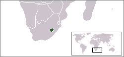
| 30,355 | 29.6°S 28.3°E | |||
| 61.2 | 43°56′30″N 12°27′30″E | |||
| 0.44 | 41°54.2′N 12°27.2′E |
First-order subnational level
Other subnational
- In Australia:
- In New South Wales, the City of Broken Hill is surrounded by the Unincorporated Far West Region.
- In South Australia:
- The District Council of Coober Pedy is surrounded by the Outback Communities Authority.
- The City of Mount Gambier is surrounded by the District Council of Grant.
- The Municipal Council of Roxby Downs is surrounded by the Outback Communities Authority.
- In Queensland
- The Cherbourg Aboriginal Shire Council is surrounded by the South Burnett Regional Council.
- In the Northern Territory
- The Town of Alice Springs is surrounded by the MacDonnell Regional Council.
- In Victoria, a few unincorporated areas for ski resorts form enclaves within the surrounding shires: Falls Creek and Mount Hotham within Alpine Shire and Mount Baw Baw in Baw Baw Shire. In addition, Mount Buller and Mount Stirling share a border with each other, but are surrounded by Mansfield Shire.
- In Austria: In Tyrol, Innsbruck-Land District completely surrounds the district of Innsbruck.
- In Brazil:
- In Goiás: Portelândia is surrounded by Mineiros.
- In Mato Grosso do Sul: Ladário is surrounded by Corumbá.
- In Rio Grande do Sul: Arroio do Padre is surrounded by Pelotas.
- In São Paulo: Águas de São Pedro is surrounded by São Pedro.
- In Canada:
- In Quebec, the city of Westmount, the town of Mount Royal, and, collectively, the municipalities of Hampstead, Côte Saint-Luc and Montreal West (Montréal-Ouest) are all enclaves in the city of Montreal. Similarly, the city of L'Ancienne-Lorette is an enclave in Quebec City after the demerger on 1 January 2006.
- In the People's Republic of China: In the Xinjiang autonomous region, the prefecture-level city of Karamay (that has two non-contiguous parts) and the county-level city of Kuytun (a part of the Ili Kazakh Autonomous Prefecture) are completely surrounded by the Tacheng Prefecture (that is also technically part of the Ili Kazakh Autonomous Prefecture).
- In Colombia, in the Capital District, La Candelaria municipality is an enclave of SantaFé.
- In Estonia, two towns are enclaves, surrounded by a single parish:
- Viljandi town is surrounded by Viljandi Parish
- Võru town is surrounded by Võru Parish
- In Ethiopia:
- The town and woreda of Debre Berhan is an enclave inside Basona Werana ("Baso and Werana") woreda, located in the Semien Shewa Zone in the Amhara Region.
- The city and separate woreda of Gambela is surrounded by Gambela Zuria ("Greater Gambela") woreda, located in the Anuak Zone in the Gambela Region.
- The city and special zone of Mek'ele (comprising two woredas) is an enclave within Enderta woreda, located in the Debub Misraqawi (Southeastern) Zone in the Tigray Region.
- The town and woreda of Weldiya is an enclave inside Guba Lafto woreda, located in the Semien Wollo Zone in the Amhara Region.
- The town and woreda of Debre Marqos is an enclave inside Guzamn woreda, located in the Misraq Gojjam Zone in the Amhara Region.
- In Finland:
- The town of Kauniainen is enclosed by the city of Espoo. The two are located west of Helsinki, in the Helsinki Metropolitan Area.
- The municipality of Enonkoski is encircled by the city of Savonlinna.
- In France, in Côtes-d'Armor département, the commune of Plessix-Balisson is surrounded by the commune of Ploubalay.
- In Iceland, the municipality of Hveragerði is an enclave in Sveitarfélagið Ölfus.
- In Indonesia:
- Pematangsiantar City is surrounded by Simalungun Regency.
- Bogor City is surrounded by Bogor Regency.
- Sukabumi City is surrounded by Sukabumi Regency.
- Magelang City is surrounded by Magelang Regency.
- Salatiga City is surrounded by Semarang Regency.
- Kediri City is surrounded by Kediri Regency.
- Blitar City is surrounded by Blitar Regency.
- Malang City is surrounded by Malang Regency.
- Samarinda City is surrounded by Kutai Kartanegara Regency.
- In Italy:
- In Apulia, in the Province of Lecce, the municipality of Surbo is an enclave inside the municipality of Lecce.
- In Sicily:
- In the Province of Agrigento: San Giovanni Gemini is an enclave inside Cammarata.
- In the Province of Catania: Maletto is an enclave within Bronte and meets Bronte and eight other municipalities (Adrano, Belpasso, Biancavilla, Castiglione di Sicilia, Nicolosi, Randazzo, Sant'Alfio, Zafferana Etnea) at one point at the top of Mt. Etna.
- In Trentino-Alto Adige/Südtirol:
- In the Autonomous Province of Trentino: Samone is an enclave inside Castel Ivano.
- In Israel, the political system where regional councils are distinct from city councils leads to a plethora of subnational enclaves. For instance,
- Sderot is an enclave within the Sha'ar HaNegev Regional Council.
- The Bedouin towns of Rahat and Laqiya, as well as the suburb of Lehavim, are enclaves within the Bnei Shimon Regional Council.
- Yeruham and Mitzpe Ramon are enclaves in the Ramat Negev Regional Council.
- Beit She'an is an enclave within the Emek HaMaayanot Regional Council.
- In Lithuania, a few city municipalities are enclaved in the district municipalities of the same names, including Šiauliai, Panevėžys, and Alytus.
- In Mexico, in the state of Nuevo León, the municipality of Hualahuises is surrounded by the municipality of Linares.
- In New Zealand, the Kawerau District territorial authority is completely surrounded by the Whakatane District.
- In North Korea, in South Pyongan province, Ch'ŏngnam district is an enclave in Mundŏk county.
- In the Republic of China: Chiayi City is an enclave of Chiayi County.
- In Romania, Bucureşti-Ilfov development region is enclaved within the Sud (South) development region.
- In Togo, in Centrale Region, the prefecture of Blitta is surrounded by the prefecture of Sotouboua.
- In the United Kingdom:
- The English unitary authorities of Nottingham, Derby, Stoke-on-Trent, and Leicester are enclaves in the administrative counties of Nottinghamshire, Derbyshire, Staffordshire, and Leicestershire, respectively.
- In Cambridgeshire: the City of Cambridge is a local government district completely surrounded by the district of South Cambridgeshire.
- In Cheshire: the unpopulated civil parish of Chester Castle is completely surrounded by the unparished area of Chester. Both form part of the borough of Cheshire West and Chester.
- The City of London is an enclave within the ceremonial county of Greater London. It forms its own ceremonial county. Also, the rest of Greater London consists of London boroughs, whilst the City is not a London borough.
- In the United States of America:
- In Arizona:
- The Hopi Reservation is surrounded by the Navajo Reservation.
- The city of South Tucson is an enclave in the city of Tucson.
- In Arkansas, the City of Cammack Village is an enclave of Little Rock.
- In California:
- In 1956, Newark withdrew from the incorporation of the communities of Washington Township as the city of Fremont and is now surrounded by Fremont.
- Piedmont incorporated in 1907 to avoid annexation by Oakland and is now surrounded by Oakland.
- San Pablo, along with two small unincorporated areas, is completely surrounded by Richmond
- The city of San Fernando is an enclave in the city of Los Angeles. Beverly Hills and West Hollywood together form another. Culver City and the unincorporated community of Ladera Heights form a third enclave.
- The city of Signal Hill is entirely surrounded by the city of Long Beach.
- The city of Villa Park is an enclave of the city of Orange.
- The unincorporated area of Broadmoor is surrounded by Daly City.
- The unincorporated area of Fig Garden is surrounded by Fresno.
- Many other California cities have small enclaves of unincorporated area.
- In Florida, the town of Baldwin is an enclave within the city of Jacksonville. The Village of Lazy Lake is contained entirely within the borders of the city of Wilton Manors.
- In Georgia, Remerton is an enclave of Valdosta; similarly, Payne City was an enclave within the city of Macon until it was dissolved in 2015.[63]
- In Idaho, Garden City is an enclave in the city of Boise.
- In Illinois, Norridge and Harwood Heights together form an enclave in the city of Chicago.
- In Indiana, after the passage of Unigov in 1970 by the state legislature that merged the government of Indianapolis and Marion County, four cities remained independent and did not merge with Indianapolis – three of those cities Beech Grove, Southport, and Speedway became enclaves of Indianapolis.
- In Iowa, the city of University Heights is entirely surrounded by Iowa City.
- In Kansas, the city of Eastborough is entirely surrounded by Wichita.
- In Kentucky, when the governments of Louisville and Jefferson County merged in 2003, a bewildering array of enclaves was created, as all other incorporated cities in Jefferson County retained their status as separate cities.[64] Note that the entire Ohio River between the northern and southern low-water marks is now part of Louisville Metro.
- Three other cities were, and still are, enclaved in cities other than Louisville:
- Norbourne Estates and Richlawn are enclaves of St. Matthews.
- Woodland Hills is an enclave of Middletown.
- The merger created many other enclaves within the portion of Louisville Metro that includes pre-merger Louisville but excludes all other pre-existing cities, an entity defined by the United States Census Bureau as the "Louisville-Jefferson County balance". As municipalities, these enclaves are not parts of the "balance," but rather, they are surrounded by the "balance."
- These individual enclaves: Creekside, Fincastle, Glenview Hills, Hickory Hill, Hills and Dales, Hollow Creek, Hollyvilla, Lynnview, Minor Lane Heights, Shively, South Park View, Spring Mill, and Thornhill.
- The combination of Cambridge, Houston Acres, Lincolnshire, and St. Regis Park.
- The combination of Poplar Hills, Watterson Park, and West Buechel.
- The aforementioned cities of Middletown, Norbourne Estates, Richlawn, St. Matthews, and Woodland Hills, along with 46 other municipalities are part of a large composite enclave within the "balance."
- Three other cities were, and still are, enclaved in cities other than Louisville:
- In Michigan:
- The city of Center Line is completely surrounded by Warren.
- Highland Park and Hamtramck border each other, but the two together are completely surrounded by Detroit.
- The city of Lathrup Village is completely surrounded by Southfield.
- The city of Springfield is completely surrounded by Battle Creek.
- In Minnesota:
- The city of Centerville is completely surrounded by Lino Lakes.
- The city of Hilltop is completely surrounded by Columbia Heights.
- The city of Landfall is completely surrounded by Oakdale.
- The city of Long Lake is completely surrounded by Orono.
- The city of Loretto is completely surrounded by Medina.
- The city of Medicine Lake is completely surrounded by Plymouth.
- The city of Peterson is completely surrounded by Rushford Village.
- The city of Rushford is completely surrounded by Rushford Village.
- The city of St. Bonifacius is completely surrounded by Minnetrista.
- The city of Willernie is completely surrounded by Mahtomedi.
- In Missouri, the cities of Gladstone and North Kansas City are separately surrounded by Kansas City.
- In Montana, when the governments of Butte and Silver Bow County merged in 1977, the town of Walkerville voted not to join the consolidated government, thus becoming an enclave.
- In New Jersey:
- In Arizona:
- In New York, the city of Cortland, New York, seat of Cortland County, is entirely surrounded by the town of Cortlandville, from which it is legally separate. Likewise, the city of Beacon is surrounded by the Town of Fishkill.
- In North Dakota, the city of Prairie Rose is an enclave of Fargo.
- In Ohio:
- The cities of Brice, Bexley, and Whitehall are all enclaves of Columbus.
- The city of Norwood is an enclave of Cincinnati. The cities of Elmwood Place, to the north, and St. Bernard, to the south, together form another enclave of Cincinnati.
- In Stark County, the village of Hills & Dales is enclaved within Jackson Township.
- In Summit County, the village of Lakemore is surrounded by Springfield Township.
- In Oregon, the city of Maywood Park is surrounded by Portland, which annexed the surrounding lands after Maywood Park incorporated.
- In Pennsylvania, every county in the state other than the counties of Fulton, Philadelphia, Pike and Union contains at least one municipality in another municipality. There are at least 338 enclaves in the state comprising incorporated places and census-designated places within other county subdivisions.[65][66] Usually, the enclave takes the form of a borough that is surrounded by the township of which it was originally a part, but other scenarios are possible (e.g., the Borough of Mount Oliver is an enclave of Pittsburgh; Pitcairn borough, of Monroeville; Dale borough, of Johnstown; and the Lackawanna County township of Elmhurst, of Roaring Brook Township). While Pennsylvania's urban counties contain few enclaves due to municipal fragmentation, rural areas feature numerous enclaved municipalities. Many resulted from small town centers separating from their rural surrounding areas.
- In Tennessee:
- The cities of Red Bank and Ridgeside are enclaves in the city of Chattanooga.
- The city of Berry Hill is an enclave of the city of Nashville.
- The cities of Belle Meade, Forest Hills and Oak Hill together form an enclave of the city of Nashville.
- Ooltewah is an enclave of Collegedale.
- In Texas:
- The cities of Alamo Heights, Balcones Heights, Castle Hills, Hill Country Village, Hollywood Park, Kirby, Leon Valley, Olmos Park, Shavano Park, and Terrell Hills are all enclaves of San Antonio.[67]
- The cities of Bellaire, West University Place, and Southside Place together form an enclave of Houston. The cities of Bunker Hill Village, Hedwig Village, Hilshire Village, Hunters Creek Village, Piney Point Village, and Spring Valley Village together form another enclave of Houston.
- The cities of Highland Park and University Park, collectively known locally as the "Park Cities", together form an enclave of Dallas. In addition, the city of Cockrell Hill is also an enclave of Dallas.
- The city of Sunset Valley is enclave of Austin.[68]
- The cities of Blue Mound, Edgecliff Village, Haslet, Lake Worth, River Oaks, Saginaw, Sansom Park, Westover Hills, Westworth Village, and White Settlement are enclaves of Fort Worth
- The cities of Dalworthington Gardens and Pantego together form an enclave of Arlington.
- The city of Beverly Hills is an enclave of Waco.
- In Vermont:
- The city of Rutland is an enclave of the town of Rutland.
- The city of St. Albans is an enclave of the town of St. Albans.
- In Virginia, under Virginia law, all municipalities that are incorporated as cities are legally independent of any county. Fifteen such enclaves — thirteen individual cities, plus two pairs of adjoining cities — exist within the state; some of the cities that form these enclaves serve as county seat of the surrounding county:
- Bedford, enclaved within and the county seat of Bedford County
- Buena Vista, enclaved within Rockbridge County
- Charlottesville, enclaved within and the county seat of Albemarle County
- Covington, enclaved within and the county seat of Alleghany County
- Emporia, enclaved within and the county seat of Greensville County
- Fairfax, enclaved within and the county seat of Fairfax County. As noted above, the county courthouse is located in an unincorporated portion of Fairfax County that is completely surrounded by the city.
- Harrisonburg, enclaved within and the county seat of Rockingham County
- Lexington, enclaved within and the county seat of Rockbridge County
- Manassas and Manassas Park together form an enclave within Prince William County. Manassas is the county seat; as noted above, the county courthouse is located in an unincorporated portion of Prince William County that is completely surrounded by the city.
- Martinsville, enclaved within and the county seat of Henry County
- Norton, enclaved within Wise County
- Roanoke and Salem together form an enclave within Roanoke County. The Roanoke County Courthouse is located in Salem, but the rest of the county government is located in the unincorporated community of Cave Spring.
- Staunton, enclaved within and the county seat of Augusta County
- Waynesboro, enclaved within Augusta County
- Winchester, enclaved within and the county seat of Frederick County
- In Wisconsin, the village of Thiensville is an enclave of the city of Mequon in Ozaukee County.
Exclaves that are not enclaves
An exclave must always be grouped with a main region of which it is a legal part. In the case of international waters, the main region consists of all international waters not in EEZs. All potential paths of travel from the exclave to its main region must cross one or more different administrative-territorial regions having the equivalent legal level. Each exclave listed in this section borders on more than one other region.
National level
| Name | Area (km2) | Exclave of | Coordinates | Notes |
|---|---|---|---|---|
| Nakhichivan Autonomous Republic | 5500 | 39°20′N 45°30′E | Bounded by Armenia, Iran, and Turkey | |
| Strovilia (de facto) | 35.095°N 33.900°E | Borders the British Sovereign Base Area (SBA) of Dhekelia and the de facto independent Turkish Republic of Northern Cyprus (TRNC), which is unrecognized internationally. The TRNC has occupied and controlled the exclave; on 30 June 2000 the TRNC unilaterally absorbed it, despite United Nations condemnation and lack of recognition. | ||
| Gulf of Fonseca outer tridominium | ~190 | 13°5′N 87°46′W | Honduras, El Salvador and Nicaragua border the Gulf of Fonseca, a closed sea under international law. Each enjoys a 3-nautical mile littoral zone of sovereignty along its shores and islands in the gulf. The remaining water area in the gulf comprises a tridominium that is shared in common among all three nations. The littoral zones (territorial waters) abut each other in a way that forms two separate areas of tridominium waters in the gulf. The outer area opens directly to the Pacific Ocean and is separated from the inner area by the territorial waters of Salvadoran and Nicaraguan islets. The inner area is bordered by the waters of all three countries. The larger outer area is bordered only by the waters of El Salvador and Nicaragua and the closing line of the gulf, such that one cannot travel within the gulf from Honduras to the outer area except by passing through El Salvadoran and Nicaraguan waters. Therefore, the outer water area is an exclave of Honduras that is shared territorially with two other countries.[69][70][71] All three nations are "entitled outside the closing line to territorial sea, continental shelf and exclusive economic zone. Whether this situation should remain in being or be replaced by a division and delimitation into three separate zones is, as inside the Gulf also, a matter for the three States to decide."[70] | |
| Gaza Strip (de jure) | 360 | 31°25′N 34°20′E | Bounded by Israel, Egypt and the Mediterranean Sea. | |
| High Seas | ~190,000 | 57°6′N 179°4′W | Surrounded by the EEZs of Russia and the United States (Alaska).[72] | |
| High Seas | ~310,000 | 71°38′N 3°40′E | Surrounded by the EEZs of Norway (including Svalbard), Faeroe Islands, Greenland, Jan Mayen (Norway) and Iceland | |
| "Eastern Gap", High Seas | ~20,000 | 25°41′N 87°01′W | Surrounded by the EEZs of Mexico (EEZ defined by Cape Catoche and Scorpion Reef in the Gulf of Mexico), USA (EEZ defined by Loggerhead Key and the Gulf coast) and Cuba (EEZ extends northwest from Cayo Ines de Soto)[73] | |
| High Seas | 12°31′S 53°46′E | Surrounded by the EEZs of Mauritius (Agalega Islands), Tromelin Island (France), Madagascar and Seychelles (Farquhar Atoll) | ||
| High Seas | 16°4′N 116°14′E | In the South China Sea, the EEZs that are defined by Taiwan (Pratas Reef), the Philippines (Luzon Island and Cabra I.), the Spratly Islands of Dao Dinh Ba and Flat Island, and the Paracel Island of Dao Hoang Sa enclose an exclave. National sovereignty over many of the Spratly and Paracel Islands in the South China Sea is disputed. Hence, depending upon the claims involved, this exclave may be considered as being created by the EEZs of Taiwan and the Philippines, or by the EEZs of Taiwan, the Philippines and Viet Nam, or by the EEZs of Taiwan and mainland China, or by the EEZ of mainland China alone. | ||
| High Seas | ~100,000 | 14°7′S 158°35′W | Surrounded by the EEZs of French Polynesia, Cook Islands and Kiribati | |
| High Seas | ~77,000 | 15°16′S 173°0′E | Surrounded by the EEZs of Vanuatu, Solomon Islands and Fiji | |
| High Seas | ~380,000 | 2°43′N 142°53′E | Surrounded by the EEZs of Palau, Micronesia, Indonesia and Papua-New Guinea | |
| High Seas | ~1,400,000 | 15°26′N 133°0′E | Surrounded by the EEZs of Japan (outer islands, including Okino-tori-shima), Palau, the Philippines, Northern Marianas Islands and Micronesia | |
| High Seas | ~800,000 | 5°0′S 166°10′E | Surrounded by the EEZs of Nauru, Tuvalu, Micronesia, Northern Marianas Islands, Papua-New Guinea, Fiji, Kiribati and the Solomon Islands | |
| "Western Gap", High Seas | 17,467 | 25°39′N 92°46′W | Surrounded by the EEZs of Mexico (EEZ defined by Scorpion Reef and Cayo Arenas in the Gulf of Mexico) and the United States (EEZ defined by the Gulf of Mexico coast, including Wolf Island (south of Freeport, Texas, and Raccoon Island, Louisiana)) – This exclave no longer exists per se. In areas with natural resource deposits on the continental shelf, the UNCLOS allows nations to claim territory beyond the EEZ to a maximum of 350 NM. On 9 June 2000, the U.S. and Mexico divided the Western Gap by a line equidistant from both countries' coastlines. The new boundary divided the Western Gap, giving 38% of the area (6562 km2) to the U.S. and 62% to Mexico (10,905 km2).[73] |
First-order subnational level
Other subnational
- In Australia:
- The state of Victoria's Murrindindi Shire has an exclave along the border with Shire of Yarra Ranges. It is separated from the rest of Murrindindi Shire by the Lake Mountain unincorporated area, which was originally a part of the shire.
- The Aboriginal Shire of Woorabinda consists of five non-contiguous pieces; four are sub-parts of their four communities. Three are in the Central Highlands Region (previously excised from the Shire of Duaringa), and two are in the Rockhampton Region (previously excised from the Shire of Fitzroy), meaning the main settlement of Woorabinda itself has four exclaves.
- In Belgium:
- Apart from Baarle-Hertog, there are three municipalities consisting of non-contiguous parts: Ixelles/Elsene and Sint-Gillis/Saint-Gilles [77] in the Brussels Capital Region and Mesen in West-Flanders.
- In Brazil:
- In Goiás: Sítio d'Abadia was cut in two as a result of the expansion of Alvorada do Norte.
- In Mato Grosso: Barra do Bugres was cut in two as a result of the expansion of Salto do Céu and Reserva do Cabaçal.
- In Pará: the town of Senador José Porfírio was cut in two as a result of the formation of Anapu.
- In Canada:
- The Caniapiscau Regional County Municipality in Quebec is separated into multiple sections.
- Greenstone, Ontario has a large principal section and two exclaved townsites, Nakina and Caramat.
- In China:
- In Qinghai province, Tanggulashan town is an exclave of the city of Golmud and the Haixi Mongol and Tibetan Autonomous Prefecture that Golmud is part of, separated from the rest of the prefecture by a "panhandle" of Yushu Tibetan Autonomous Prefecture.
- In Croatia:
- In Koprivnica-Križevci County, the municipality of Legrad is split in two, separated by the municipality of Đelekovec.
- In Osijek-Baranja County:
- In Estonia:
- In Harju County, Harku small borough is an exclave of Harku Parish.
- In Ida-Viru County, the town of Kohtla-Järve is divided into five separated districts. Of these exclaves, Ahtme, Järve and Sompa districts are not enclaves.
- In Tartu County, Piirissaar island in Lake Peipus is an exclave of Tartu Parish, which otherwise doesn't have a coastline at the lake.
- In Võru County, sixteen villages form an exclave of Setomaa Parish.
- In Finland:
- In Ostrobothnia, the former municipality of Vähäkyrö is now an exclave of the city of Vaasa.
- In Kymenlaakso, the municipality of Iitti has a small exclave called Supinkulma, which surrounded by Lahti and Heinola, both located in Päijänne Tavastia.
- In France, the commune of Ménessaire is an exclave of the department of Côte-d'Or between Nièvre and Saône-et-Loire.
- In Germany:
- The Samtgemeinde Baddeckenstedt is separated from the greater part of the district Wolfenbüttel by the urban district of Salzgitter.
- In Indonesia, the subdistrict of Colomadu is cut from other parts of the Karanganyar Regency by land that belongs to the regencies and cities of Boyolali, Surakarta, and Sukoharjo in Central Java.
- In Italy:
- In Abruzzo:
- In the Province of L'Aquila: the municipality of L'Aquila has an exclave between the municipalities of Lucoli, Rocca di Mezzo, Magliano de’ Marsi and the region of Lazio; Carapelle Calvisio and Castelvecchio Calvisio have two adjoining exclaves between Santo Stefano di Sessanio, Calascio and the Province of Teramo; Ofena consists of two parts separated by Castel del Monte and Villa Santa Lucia degli Abruzzi; Sulmona has an exclave between Pratola Peligna and Prezza; Cerchio has an exclave between Aielli, Collarmele and Celano; Celano consists of two non-contiguous parts separated by Aielli and Ovindoli.
- In the Province of Chieti: Atessa has an exclave separated from the rest of the municipality by Tornareccio and is bordering six other municipalities; San Buono has an exclave between Furci and Fresagrandinaria.
- In Apulia:
- In the Metropolitan City of Bari: Castellana Grotte has an exclave between Alberobello and Monopoli; Monopoli has an exclave between Castellana Grotte and Alberobello; Acquaviva delle Fonti has an exclave between Gioia del Colle and Santeramo in Colle; Putignano has an exclave between Gioia del Colle and Turi; Binetto has an exclave between Toritto, Palo del Colle and Bitonto.
- In the Province of Foggia: San Marco in Lamis has three exclaves between Foggia and San Giovanni Rotondo and one between Foggia, San Giovanni Rotondo and Manfredonia; San Severo has an exclave between Foggia, San Marco in Lamis and Rignano Garganico; Manfredonia has an exclave between Foggia and Carapelle; Poggio Imperiale has two non-contiguous parts separated by Lesina; Castelnuovo della Daunia has an exclave between Torremaggiore and Casalvecchio di Puglia and another one between Torremaggiore, Casalvecchio di Puglia, Casalnuovo Monterotaro and Santa Croce di Magliano in the region of Molise.
- In the Province of Lecce: Leverano has an exclave between Arnesano and Copertino; Squinzano has an exclave between Lecce and Torchiarolo in the Province of Brindisi.
- In Basilicata:
- In the Province of Matera: Tricarico has an exclave between Grottole and Grassano.
- In the Province of Potenza: Fardella has four exclaves; Chiaromonte has three; Atella and Noepoli have two each; Tito has one.
- In Calabria:
- In the Province of Catanzaro: Feroleto Antico has an exclave between Pianopoli and Serrastretta; Fossato Serralta has an exclave between Cicala, Gimigliano and Sorbo San Basile.
- In the Province of Cosenza: Bianchi has an exclave between Panettieri and the Province of Catanzaro; Oriolo has an exclave between Albidona, Alessandria del Carretto and Castroregio; Castroregio has an exclave between Oriolo, Alessandria del Carretto and the Province of Potenza; Cerchiara di Calabria has an exclave between San Lorenzo Bellizzi, Castrovillari and the Province of Potenza; Mormanno has an exclave between Laino Castello and Papasidero; Mongrassano has an exclave between Cervicati, San Marco Argentano, Cerzeto and Bisignano; Cervicati has an exclave between Mongrassano and San Marco Argentano; Acquappesa has an exclave between Mongrassano, Fagnano Castello, Cetraro and Guardia Piemontese.
- In the Metropolitan City of Reggio Calabria: the seat of the municipality of Roghudi is an enclave within Melito di Porto Salvo and the other, larger part of the municipality is about 40 km away and is an exclave surrounded by 6 other municipalities. Similarly, the seat of the municipality of Africo is a semi-exclave in Bianco with the larger part being an exclave between 7 other municipalities.
- In Emilia-Romagna:
- In the Metropolitan City of Bologna: Castello d'Argile has an exclave between Sala Bolognese and Argelato.
- In the Province of Forlì-Cesena: Sarsina consists of three non-contiguous parts, the larger two separated by Bagno di Romagna and Mercato Saraceno and the smallest one separated by Verghereto.
- In the Province of Modena: Modena has two exclaves between Carpi and Soliera.
- In the Province of Rimini: Verucchio has an exclave between San Leo and the Republic of San Marino.
- In Friuli Venezia Giulia: Dogna has an exclave between Moggio Udinese and Pontebba; Tramonti di Sopra has an exclave between Meduno and Tramonti di Sotto.
- In Lazio, the Province of Viterbo (the municipality of Gallese) has an exclave between Umbria and the Province of Rieti.
- In the Province of Rieti: Rieti has an exclave between Colli sul Velino, Contigliano, Greccio and the Province of Terni; Concerviano has an exclave between Rieti and Longone Sabino; Longone Sabino consists of two non-contiguous parts separated by southern part of Concerviano; Rocca Sinibalda consists of two non-contiguous parts separated by southern exclave of Longone Sabino and northern exclave of Ascrea; Ascrea consists of three non-contiguous parts separated by Castel di Tora (north and south part) and Paganico Sabino (south and east).
- In the Metropolitan City of Rome Capital: Polline Martignano is an exclave of Rome between Anguillara Sabazia, Campagnano di Roma and Trevignano Romano; Monte Compatri consists of three non-contiguous parts; Grottaferrata has an exclave between Marino, Rocca di Papa and Castel Gandolfo; Artena has an exclave between Lariano, Velletri and the Province of Latina; Rocca Priora has an exclave between Artena, Lariano and Rocca di Papa.
- In the Province of Viterbo: Viterbo has an exclave between Ronciglione and Vetralla; Vejano has an exclave between Blera and the Metropolitan City of Rome Capital.
- In Lombardy: Comune di San Colombano (named after the Irish missionary Saint Columbanus) is an exclave of the Metropolitan City of Milan between the provinces of Lodi and Pavia
- In the Province of Pavia: Cornale e Bastida has an exclave between Sannazzaro de' Burgondi, Corana and an exclave of Silvano Pietra; Silvano Pietra has an exclave between Sannazzaro de’ Burgondi, Corana and an exclave of Cornale e Bastida; Casei Gerola has three exclaves (between Mezzana Bigli, Cornale e Bastida, Silvano Pietra and the region of Piedmont); Pancarana has an exclave between Mezzana Rabattone, Zinasco and Bastida Pancarana; Santa Maria della Versa has an exclave between Golferenzo and Montecalvo Versiggia.
- In Marche:
- In the Province of Ascoli Piceno: Ascoli Piceno has an exclave (Piana della Forcella) between Acquasanta Terme, Roccafluvione and Forcella (an exclave of Roccafluvione), itself between Acquasanta Terme and Piana della Forcella (Ascoli Piceno).
- In the Province of Fermo: Fermo has one exclave between Francavilla d’Ete, Montegiorgio, Massa Fermana and the Province of Macerata, and another one between Montegiorgio, Grottazzolina and Magliano di Tenna.
- In the Province of Pesaro and Urbino: Sassofeltrio has an exclave between Monte Grimano Terme and the Republic of San Marino.
- In Molise:
- In the Province of Campobasso: Campobasso has an exclave between Oratino, Castropignano and Ripalimosani; Montenero di Bisaccia has an exclave between San Felice del Molise and Tavenna, and another one between Mafalda and Tavenna.
- In Piedmont:
- In the Province of Asti: Camerano Casasco has two exclaves between Chiusano d’Asti and Montechiaro d’Asti; Pino d’Asti has one between Castelnuovo Don Bosco and Passerano Marmorito; Monastero Bormida has an exclave between Roccaverano, Bubbio and Loazzolo.
- In the Province of Biella: Callabiana, Pettinengo, Tavigliano, Valdilana, Bioglio, Veglio, Vallanzengo, Valle San Nicolao, Caprile and Ailoche have mountain exclaves in the northern part of the province, between the Province of Vercelli and the region of Aosta Valley; Valle San Nicolao has another exclave between Pettinengo, Bioglio and Valdilana; Muzzano has an exclave between Graglia and Sordevolo; Andorno Micca and Sagliano Micca have adjoining exclaves between Piedicavallo, Rosazza, Campiglia Cervo, Biella and the region of Aosta Valley; Pollone has an exclave between Biella, Sordevolo and the region of Aosta Valley; Magnano has an exclave between Zimone and the Metropolitan City of Turin.
- In the Metropolitan City of Turin: Carignano has an exclave between Castagnole Piemonte and Osasio; Carmagnola has an exclave between Carignano and Lombriasco; Claviere consists of two exclaves between Cesana Torinese and France; Traversella has an exclave between Quincinetto and Aosta Valley region; Brosso has an exclave between Traversella and Valchiusa; Castelnuovo Nigra has two exclaves between Cintano and Colleretto Castelnuovo; Castellamonte, Valchiusa, Vistrorio and Val di Chy have exclaves, some bordering each other, between Traversella, Castelnuovo Nigra, Rueglio and Lessolo. Castellamonte has another one between San Martino Canavese, Torre Canavese, Quagliuzzo and Parella; Vistrorio has two more between Issiglio and Rueglio; Prascorsano has one between Canischio and Pratiglione; Rivara has one between Pratiglione and Forno Canavese; and Pertusio has one between Valperga and Prascorsano (connected at a quadripoint).
- In the Province of Vercelli: Cigliano has an exclave between Moncrivello and the Metropolitan City of Turin.
- In Sardinia:
- In the Metropolitan City of Cagliari: Assemini consists of two non-contiguous parts of approximately same sizes separated by Uta; Decimomannu also has two non-contiguous parts separated by Uta; Quartucciu has two non-contiguous parts separated by Maracalagonis and Quartu Sant’Elena.
- In the Province of Nuoro: Triei has an exclave between Urzulei, Talana and Baunei; Arzana has an exclave (Acetorri) between Contissa (exclave of Jerzu), Quirra (exclave of Lanusei) and the Province of South Sardinia; Loceri has an exclave (Bacu Orca) between Sa Tuvada (exclave of Osini), Quirra (exclave of Lanusei) and Tertenia; Osini consists of four non-contiguous exclaves; Lanusei has an exclave (Quirra) between Sa Tuvuda (exclave of Osini), Acetorri (exclave of Arzana) and Bacu Orca (exclave of Loceri); Jerzu has an exclave (Contissa) between Ulassai, Acetorri (exclave of Arzana), Sa Tuvuda (exclave of Osini) and the Province of South Sardinia; Elini has an exclave between Ilbono, Arzana and Lanusei; Gairo has an exclave (Su Sirboni) between Tertenia and Cardedu.
- In the Province of Sassari: Cheremule has an exclave between Giave and Thiesi; Tempio Pausania has an exclave between Palau, Santa Teresa Gallura, Aglientu, Luogosanto and Arzachena.
- In the Province of South Sardinia: Iglesias has an exclave separated by Domusnovas; Gonnosfanadiga has an exclave between Guspini and Arbus.
- In Sicily:
- In the Province of Caltanissetta: Mazzarino consists of three non-contiguous parts, all three separated by Riesi.
- In the Metropolitan City of Catania: Motta Sant’Anastasia has an exclave between Catania and Belpasso; Tremestieri Etneo has an exclave between Catania, Sant’Agata li Battiati, San Giovanni la Punta and San Gregorio di Catania.
- In the Province of Enna: Piazza Armerina has an exclave between five municipalities; Assoro has three exclaves between various other municipalities.
- In the Metropolitan City of Palermo: Bisacquino has an exclave between Monreale, Contessa Entellina and Roccamena.
- In the Province of Trapani: Gibellina has an exclave (Nuova Gibellina) surrounded by Santa Ninfa except for a quadripoint with Salemi, and Santa Ninfa has an exclave between Nuova Gibellina and Salemi.
- In Trentino-Alto Adige/Südtirol:
- In the Autonomous Province of Trentino: Canal San Bovo, Carisolo, Cimego, Cinte Tesino, Comano Terme, Giustino, Imèr, Malosco, Massimeno, Pellizzano, Pergine Valsugana, Pieve Tesino, Ronzone, Spiazzo, Stenico, Tione di Trento, Tre Ville consist of two or three non-contiguous parts separated by other municipalities
- In Tuscany:
- In the Province of Arezzo: Poppi has one exclave between Bibbiena, Chiusi della Verna and the region of Emilia-Romagna, and another one between Bibbiena, Ortignano Raggiolo and Castel Focognano.
- In the Province of Lucca: Gallicano has an exclave between Barga, Fosciandora, Castelnuovo di Garfagnana and Molazzana.
- In Abruzzo:
- In South Korea, Dasa region is an exclave of Dalseong, Daegu and Iseo-myeon is an exclave of Wanju, North Jeolla Province.
- In the Netherlands, Amsterdam Zuidoost is cut from other parts of the municipality of Amsterdam by land that belongs to the municipalities of Ouder-Amstel and Diemen.
- In the Philippines:
- Caloocan City is divided in two by Quezon City.
- In Cotabato province, the municipality of President Roxas is divided in two by Antipas municipality.
- In Poland:
- Sławków is an exclave of Będzin County. Sławków is separated from the rest of the county by the cities of Dąbrowa Górnicza and Sosnowiec. All of these are within the Silesian Voivodeship (province).
- Rybnik County is split into three disjoint parts, separated by the city of Rybnik.[78] The three parts are the municipalities of Czerwionka-Leszczyny, Świerklany, and the combined area of Lyski, Gaszowice and Jejkowice. All of these are within the Silesian Voivodeship.
- In Portugal, as a consequence of administrative reforms during the 19th century (in the 1830s, then again in the 1850s, and to a much lesser extent in the 1890s), as well as more recent legislation forbidding the creation of territorial discontinuities,[57][58] there are almost no subnational exclaves or enclaves, and the few that persist are on the municipal or civil parish level:
- Municipalities with exclave civil parishes (at least one civil parish is separated from the main body): Montijo and Oliveira de Frades.
- Municipalities with sub-civil parish level exclaves (at least one civil parish is itself territorially discontinuous, creating an exclave also at the municipal level): Soure.
- Exclaves that are sub-parts of civil parishes and that yet remain within the municipal-level boundary are located in the following municipalities: Ansião, Belmonte, Coimbra, Oliveira de Frades, Penela.
- In Spain:
- In Castile-La Mancha, Anchuras is an exclave of the Ciudad Real province between Toledo province and the Extremadura province of Badajoz.
- Between the provinces of Zamora and León there is an exclave with the cities of Roales de Campos and Quintanilla del Molar belonging to the Province of Valladolid.
- The Province of Palencia possesses an exclave Berzosilla between Cantabria and the Province of Burgos.
- Orduña is an exclave of the province of Biscay located between the provinces of Álava and Burgos.
- In Turkey, İstanbul Maslak is an exclave of Şişli county.


- In the United States of America:
- In Alaska, the Unorganized Borough is separated into multiple sections; however, the only true exclave that is not an enclave is the town of Hyder, which belongs to Prince of Wales – Hyder Census Area.
- In California, Vacaville has an exclave with a quadripoint in its northwest, and a separate exclave to the southeast separated from the main city limits by the unincorporated village of Elmira; both are surrounded by unincorporated Solano County.
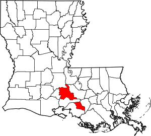
- In Louisiana, a portion of St. Martin Parish is separated by Iberia Parish. A portion of West Feliciana Parish is separated by Concordia Parish. A portion of Madison Parish is separated by Warren County, Mississippi.
- In Massachusetts, Norfolk County has two exclaves: Brookline between Middlesex and Suffolk counties, and Cohasset on the coast of Plymouth County.
- In Michigan:
- In Houghton County: The city of Houghton divides Portage and Adams townships into two sections apiece, and the city of Hancock divides Quincy Township in two as well.
- Brownstown Township, Wayne County is separated into three parts. The two smaller parts are separated from the main portion of the township by Woodhaven. Both smaller parts are further separated by Rockwood and Gibraltar.
- In New Jersey:
- In Atlantic County, Egg Harbor Township is split into three parts.
- In Bergen County, the township of South Hackensack is divided into three separate parts as a result of other municipalities withdrawing from it.
- In Burlington County, the borough of Wrightstown has two sections.
- In Camden County, Haddon Township is split into three parts, of which two are joined at a quadripoint.
- In Monmouth County, Aberdeen Township is divided into two pieces.
- In Morris County, the township of Randolph has a tiny exclave, and Rockaway Township has a small portion that is joined by only a quadripoint.
- In New Mexico, Sandoval County has an exclave. During World War II, Los Alamos County was created out of parts of Sandoval and Santa Fe Counties, for the convenience of the Manhattan Project. That portion of Sandoval County that is within the San Ildefonso Indian Reservation, about 3 km², became an exclave bounded by Los Alamos County on the southwest, Santa Fe County on the east and Rio Arriba County on the north.
- In New York: In Westchester County, Rye Town has an exclave separated by Harrison and Rye City.
- In Pennsylvania:
- In Allegheny County, O'Hara Township consists of five non-contiguous areas, with Sharpsburg, Aspinwall and Fox Chapel separating them. One area (Sixmile Island) is enclaved within Sharpsburg.
- In Berks County, in addition to the two exclaves of Cumru Township mentioned above, Lower Alsace Township has an exclave separated from the rest of the township by the borough of Mount Penn.
- In Chester County, Schuylkill Township has a small exclave separated by Phoenixville. In addition, Valley Township has an exclave created by a narrow strip of land that is part of Coatesville.
- Three municipalities in Delaware County have exclaves. Springfield Township has an exclave separated from the main body of the township by the village of Swarthmore; Darby Township consists of two non-contiguous areas; and part of Upper Darby is separated from the main body of the township by Aldan and Lansdowne.
- In Lackawanna County, South Abington Township has an exclave along Glenburn Road bordered by Clarks Summit borough and Waverly Township. The township itself is oddly shaped and borders the collective area of Clarks Summit, Clarks Green, and Waverly Township on three sides.
- There are four sets of exclaves in Schuylkill County. Norwegian Township has a small exclave separated by the city of Pottsville, and West Mahanoy Township is split into two sections, separated by the borough of Gilberton. In addition, the borough of Auburn creates exclaves of both South Manheim Township and West Brunswick Township.
- In York County, Spring Garden Township has an exclave separated from the rest of the township by the city of York.
- The lands within numerous Indian reservations have been fragmented, with privately owned real estate intermixed with tribal, city, county, state, and federal authorities in a bewildering array of jurisdictional geographies.
- Red Lake Indian Reservation has one large exclave bordering Canada (itself containing enclaves of non-reservation land) and numerous other small exclaves.
- Rosebud Indian Reservation also has numerous small exclaves.
Semi-enclaves and semi-exclaves
Semi-enclaves and semi-exclaves are areas that, except for possessing an unsurrounded sea border, would otherwise be enclaves or exclaves.[3]:12–14[79]:116 Semi-enclaves can exist as independent states that border only one other state. Vinokurov (2007) declares, "Technically, Portugal, Denmark, and Canada also border only one foreign state, but they are not enclosed in the geographical, political, or economic sense. They have vast access to international waters. At the same time, there are states that, although in possession of sea access, are still enclosed by the territories of a foreign state."[3]:14 Therefore, Vinokurov applies a quantitative principle: the land boundary must be longer than the coastline. Thus he classifies a state as a sovereign semi-enclave if it borders on just one state, and its land boundary is longer than its sea coastline.[3]:14, 20–22 Vinokurov affirms that "no similar quantitative criterion is needed to define the scope of non-sovereign semi-enclaves/exclaves."[3]:14, 26[80]
Non-sovereign semi-enclaves
- Brunei: Temburong District is bounded by Malaysia and Brunei Bay. The Temburong Bridge connects Temburong to the Brunei mainland, bypassing the need to traverse through Malaysian territory.
- Cyprus (de facto): The de facto independent Turkish Republic of Northern Cyprus (TRNC), which is unrecognized internationally, has a semi-enclave in the island's Northwest, Kokkina/Erenköy, which is bounded by the U.N. buffer zone and the Mediterranean Sea.
- East Timor: Oecusse is bounded by Indonesia and the Savu Sea.
- Oman: Musandam is bounded by the United Arab Emirates and the Strait of Hormuz.
- Spain: Ceuta, Melilla, and Peñón de Vélez de la Gomera are bounded by the Mediterranean Sea and by either a neutral zone or Morocco itself.
- United Kingdom:
- The overseas territory of Gibraltar is on the south coast of Spain. A neutral zone had existed at one time but appears no longer to be observed.[81]
- Akrotiri and Dhekelia – British Overseas Territory on the island of Cyprus, administered as two Sovereign Base Areas, an Eastern Sovereign Base Area (ESBA) and a Western Sovereign Base Area (WSBA). The bases were retained by the UK following the independence of Cyprus in 1960. The Western Sovereign Base Area includes Akrotiri and Episkopi Cantonment, while the Eastern Sovereign Base Area includes Dhekelia Cantonment and Ayios Nikolaos.
- United States of America: Alaska is bounded by Canada, the Arctic Ocean, the Bering Sea and the Pacific Ocean. Alaska is the world's largest semi-enclave.
Non-sovereign semi-exclaves
- Angola: Cabinda is bounded by the Democratic Republic of the Congo, the Republic of the Congo and the Atlantic Ocean.
- Equatorial Guinea: continental Río Muni is surrounded by Gabon, Cameroon and the Atlantic Ocean and can only be accessed from the capital by boat or plane.
- France: French Guiana (an Overseas Department), in South America, is bounded by Suriname, Brazil and the Atlantic Ocean.
- Russia: Kaliningrad Oblast is bounded by Lithuania, Poland and the Baltic Sea.
Pene-enclaves/exclaves (including inaccessible districts)
A pene-exclave is a part of the territory of one country that can be approached conveniently — in particular by wheeled traffic — only through the territory of another country.[82]:283 Such areas are enclaves or exclaves for practical purposes, without meeting the strict definition; hence they are also called functional enclaves or practical enclaves.[3]:31 Many pene-exclaves partially border their own territorial waters (i.e., they are not surrounded by other nations' territorial waters). A pene-enclave can also exist entirely on land, such as when intervening mountains render a territory inaccessible from other parts of a country except through alien territory. Thus, a pene-exclave has land borders with other territory but is not completely surrounded by the other's land or territorial waters. They can exhibit continuity of state territory across territorial waters but, nevertheless, a discontinuity on land, such as in the case of Point Roberts.[3]:47 Along rivers that change course, pene-enclaves can be observed as complexes comprising many small pene-enclaves.[3]:50 Attribution of a pene-enclave status to a territory can sometimes be disputed, depending on whether the territory is considered to be practically inaccessible from the mainland or not.[3]:33
National level
- Austria:
- The municipality of Jungholz is connected to the rest of Austria at a quadripoint at the summit of the mountain Sorgschrofen (1636 m). Road access is only via German land. However, Vinokurov (2007) states, "For all purposes, a connection in a single point does not mean anything. It is just like being completely separated. One cannot pass through a single point, nor is it possible to transport goods. It is not even possible to lay a telephone line."[3] (See above: Enclaves that are also exclaves.)
- The Kleinwalsertal, a valley part of Vorarlberg, can only be reached by road from Oberstdorf, Germany.
- Hinterriß and Eng (parts of the communes of Vomp and Eben am Achensee in Tyrol, Austria) are functional exclaves accessible by road only from Germany.
- Belgium/France: Along the river Leie (Lys in French) between Halluin and Armentières, where the river forms the border, there are 7 small pene-exclaves of Belgium (province of Hainaut) on the southern side of the river and 7 small pene-exclaves of France (department of Nord) on the northern side of the river. This is due to minor changes in the course of the river since the border was fixed in 1830.
- Belgium/Netherlands: On the Dutch side of the Meuse River, between the Belgian municipality of Visé and its neighboring Dutch municipalities of Maastricht and Eijsden-Margraten, Belgium has two pene-exclaves, Presqu'ile de L'Ilal and Presqu'ile d'Eijsden. A Dutch pene-exclave, Presqu'ile Petit-Gravier, lies on the Belgian side. The states signed a treaty in 2016 to swap these plots of land, which are the result of river straightening prior to 1980.
- The Zeelandic Flanders (733 km²/283 sq mi) is a part of the Netherlands, but has land access only from Belgium, and through the Western Scheldt undersea tunnel built 2003.
- Belize: Ambergris Caye is an island in Belize located south of the Mexican state of Quintana Roo. It is separated from the rest of the country and can only be reached on land by a bridge from Mexico.
- Bolivia: Copacabana and the surrounding promontory are separated from the rest of Bolivia by Lake Titicaca, only joining by land to Peruvian territory. Access to Bolivia is only available via ferry.
- Cambodia: Prasat Preah Vihear can only be reached by traveling through Thailand.
- Canada:
- St. Regis, Quebec: Part of the Akwesasne Mohawk Nation on the south shore of the Saint Lawrence River, it has a land border with St. Regis Mohawk Reservation in New York State; road access to the rest of Canada is only available through New York State.
- Campobello Island, New Brunswick can be reached by road only by driving through the United States, across the border bridge to Maine. Connection with the rest of Canada is by ferry.
- The entrance to Aroostook Valley Country Club near Fort Fairfield, Maine, is in the U.S., but most of the club's golf course and its clubhouse are in Canada. Members and their guests, as long as they remain on the club's property, are not required to clear Canadian customs. Although a shorter route to Canada exists, members coming from Canada must do a 33 kilometres (21 mi) detour to report to U.S. border inspection before proceeding to the golf club.
- The Haskell Free Library and Opera House straddles the border. The Canadian part of the building is a practical exclave of Canada, as most of the building is physically in Stanstead, Quebec, but the only public access to the building is via the front door on Caswell Avenue in Derby Line, Vermont, in the United States. (Emergency exits from the second floor open to Canada.) People in Canada may not enter or exit the building except by travelling into the U.S. A special exception allows library and opera house patrons to cross the border to enter and move about in the building, but they must return to their home country (or see the Customs office) to avoid being charged with illegally entering the other country.
- The Salmon Glacier and Granduc Mine in Premier, British Columbia can only be reached by road through Hyder, Alaska.
- Chile: Magallanes Region of Chile, the southernmost portion of the Chilean mainland, is a practical exclave. The southernmost location that can be reached by road from the core of Chile is Villa O'Higgins in Aysén Region. Before the construction of the Carretera Austral, and its side-routes, the practical exclave included the Aysén Region and other locations such as Futaleufú.
- Croatia:
- The southern portion of Dubrovnik-Neretva County, including the historic city of Dubrovnik, is bounded by Bosnia and Herzegovina, Montenegro, and the Adriatic Sea. Neum, Bosnia and Herzegovina's only sea access, is sandwiched between the two portions of this county. This pene-exclave relies on national territorial waters as its only alternative connection to the rest of the country. It is accessible to Croatia's much larger region to the north by an 8 km road a short distance from and parallel to the Adriatic coastline, crossing Bosnia via Neum. A 2.3 km bridge under construction (2017) to a Croatian peninsula will bypass the Bosnian transit.[83]
- Croatia/Bosnia and Herzegovina: A few houses and the castle Zrinski, belonging to the municipality of Hrvatska Kostajnica, lie on the right bank of the Una river, and are connected to the municipality by a bridge. The border crosses the FK Partizan Kostajnica football club's pitch, leaving approximately 1/3 of the pitch on the Croatian territory.
- Croatia/Serbia: The Croatian village of Kenđija is a pene-exclave on the left bank of the Danube, and can be reached by road only through Serbia.
- Croatia/Hungary: The Croatian village of Križnica lies on the left bank of the river Drava, and is connected to the rest of the country by a pedestrian bridge.
- Croatia/Slovenia: A small portion of the Croatian village of Mali Tabor lies on the right bank of the river Sutla and can be reached only through Slovenian territory.
- Denmark/Germany: Several farms on the border, e.g. Vilmkærgård (similar situation as Canada's Haskell Free Library, immediately above).[84] Between 1920–1927, the popular German tourist island Sylt was accessible only by boat from Højer, ceded to Denmark in 1920. A direct German route was built in 1927.
- Finland/Sweden: The city centre of the Finnish city of Tornio is a pene-enclave unreachable directly by land from Finnish territory, although connected to the rest of Finland by a pair of bridges. The neighboring Swedish municipality of Haparanda has two similar pene-enclaves unreachable directly from Swedish territory. One is an islet crossed by the international border at a golf course on the line between Tornio and Haparanda.
- France: The territorial water of Canada completely surrounds that of the French territorial collectivity of St Pierre and Miquelon except for a corridor 10.5 NM (19.4 km) wide stretching 200 NM (370 km) south to open sea.
- Germany/Switzerland:
- The smaller part of the German city of Konstanz, which includes the Aldstadt (old town), lies to the south of the Rhine and has no land border with Germany, being otherwise surrounded by Switzerland; it is linked to the rest of Konstanz, and by extension to the rest of Germany, by a bridge.
- The Swiss town of Stein am Rhein has only a bridge over the Rhine connecting it to the rest of Switzerland, which it does not border on land, and is otherwise surrounded by Germany.
- Guatemala/Mexico: The changing course of the Río Suchiate has created pene-exclaves on both banks of the river.
- Indonesia:
- On the island of New Guinea, West Papua is surrounded by Papua New Guinea, the Arafura Sea and the Pacific Ocean;
- Borneo's subdivisions include a part of Malaysia (the states of Sabah and Sarawak) and a part of Indonesia that are conterminous; thus, each part is a pene-exclave of its home country.
- West Timor is surrounded by East Timor, the Timor Sea and the Savu Sea.
- Ireland/United Kingdom: The western-most region of County Monaghan in Ireland contains a pene-enclave jutting into County Fermanagh, United Kingdom, known as the Drummully Polyp or Salient (also locally as Coleman Island after the name of its northernmost townland, Coleman). There are two inaccessible districts: Drumard in the 'polyp' itself, belongs to Ireland and is inaccessible directly by road from any other part of Ireland; the village of Summerhill, County Fermanagh in the United Kingdom is similarly inaccessible from the rest of the United Kingdom. The A3 (UK) and N54 (Ireland) road, known as the Concession Road, crosses the border here 4 times in a short distance.[85]
- Italy:
- The Livigno valley near the Swiss border was at one time accessible only from Switzerland and was exempt from Italian customs, an exemption that continues today even though road access to the rest of Italy has been established. It is therefore excluded from EU VAT area.
- The village of Bagni di Craveggia can only be reached by travelling through the Canton of Ticino in Switzerland. The village never became part of Switzerland, as the pastures surrounding it were owned by the people of Vigezzo Valley, rather than the people of the Swiss Onsernone Valley, at the end of which the village is situated. Consequently, the Swiss franc is commonly used.
- On the San Marino/Italy border, there is Italian land east of the River San Marino that does not join to any other part of 'dry' Italian territory. This area is only a few metres wide, and follows the river's course for around 500 metres, and is close to the Strada del Lavoro.
- Lithuania: Curonian Spit's northern part in the Klaipėda District is bounded by Russia and the Baltic Sea, but has the common territorial waters of Lithuania.
- Mexico/United States of America: Shifts in the meandering course of the lower Rio Bravo del Norte (Rio Grande) have created numerous pene-exclaves. Under the Boundary Treaty of 1970 and earlier treaties, the two nations have maintained the actual course of the river as the international boundary, but both must approve proposed changes. From 1989 to 2009, there were 128 locations where the river changed course, causing land that had been on one side of the river to then occupy the opposite bank. Until the boundary is officially changed, there are 60 small pene-exclaves of the state of Texas now lying on the southern side of the river, as well as 68 such pene-exclaves of Mexico on the northern side of the river. The last such exchange (of pre-1989 river cuts) occurred in 2009, after languishing as a proposal for 20 years.
- Malaysia: In the state of Sarawak on the island of Borneo, the Limbang Division is completely cut off from the rest of the state's road network. The Limbang District in the division is only accessible by road through Brunei, as it is located between Brunei's main portion and the Temburong District. The Lawas District, on the other hand, lies between Temburong and the state of Sabah. As Sabah and Sarawak have autonomy in immigration affairs, immigration checks are required when traveling into or out of the Limbang Division by road.
- Namibia: Mpalila Island can only be reached from the rest of the country by travelling through Botswana.
- Netherlands: Part of the province of Zeeland, namely Zeeuws Vlaanderen is accessible by land only through the country of Belgium, although it is accessible by sea from the rest of the province of Zeeland. There is a tunnel, the Westerscheldetunnel, which also links Zeeuws Vlaanderen to the rest of the province.
- North Korea:
- A small pene-exclave is located on a lake island that is divided between North Korea and Songsan-ri, Paju-si, Gyeonggi-do in South Korea. It can be accessed by boat only.
- Another pene-exclave is located on the south side of a river adjacent to Gadal-ri, Cheorwon-gun, Gangwon-do in South Korea. It can be accessed by boat only.
- Norway/Sweden: Properties 79/3 and 79/4 (59°39′17″N 11°51′50″E) at Trosterud in the Norwegian municipality of Rømskog are only accessible by a road that follows the Norwegian–Swedish boundary.[86] Some nearby houses in Sweden are only accessible from that road that is connected to a larger road only in Norway.
- Portugal: An area north of Tourém is cut off from the rest of Portuguese territory by the lake Encoro de Salas, being surrounded by Spanish territory. It is accessible by a road bridge, but otherwise does not border the rest of Portugal.
- Russia:
- Dubki area is bounded by Estonia and Lake Peipsi-Pihkva.
- The settlement of Maloje Kulisko is separated from the rest of the country by the Kuuleski River; the village is otherwise surrounded by Estonian territory, although as it is a bog island, it is not accessible from Estonia either.
- Vistula Spit's eastern part in the Kaliningrad Area is bounded by Poland and the Baltic Sea, but has the common territorial waters of Russia.
- Senegal: An area of marshy land, approximately 1-mile (1.6 km) south of Tiong, Mauritania is owned by Senegal, but is inaccessible from any other part of Senegal. Coastal waters, however, are contiguous.
- Slovenia: A farmhouse and a few other buildings in the village of Rigonce on the left bank of the river Sotla/Sutla can only be reached through Croatia.
- Spain: Os de Civís is inaccessible via any other part of Spanish territory, as one has to travel via Andorra.
- Togo: A territory in the northwestern end of Togo is only accessible through Burkina Faso.[3]:33
- Turkey:
- The European section of Turkey is bounded by Greece and Bulgaria. Despite that the European section and the Asian sections of Turkey are not geographically conterminous and are separated by international waters, there are two connecting bridges in Istanbul.
- The valley of Macahel, which includes five villages in northeastern Turkey, can only be reached by vehicle via Batumi in Georgia. In winter, as the snow shuts the paths that are completely within the borders of Turkey, the road via Batumi is the only way to travel there.
- Turkey has a pene-exclave west of the Maritsa River opposite Edirne (Adrianople), with a land boundary of 10.8 km with Greece.[87][88]
- Uganda: The extreme tip of Tanzania's Kanyiragwa peninsula is a very small pene-exclave of Uganda on the shore of Lake Victoria, created by the parallel of latitude that defines most of the border between Uganda and Tanzania.
- United Kingdom: Northern Ireland is bounded by Ireland, the Irish Sea and the Atlantic Ocean.
- United States of America/Canada:
- Although Alaska is itself a pene-exclave (road access is primarily via the Alaska Highway), much of the Alaska Panhandle consists of mountainous peninsulas; many communities along the coast lack road connection to other parts of Alaska directly, such as the state capital, Juneau. Three communities are connected by road to Canada with no road to any other point in Alaska: Haines via the Haines Highway; Skagway via the Klondike Highway; and Hyder to Stewart, British Columbia. The distance between Haines and Skagway is about 16 miles (26 km) by the Alaska Marine Highway car ferry but 350 miles (560 km) by road through Canada. Hyder is the only point in the U.S. that can be entered legally without reporting for border inspection; while Canada maintains a border post on the road to Stewart, the U.S. border post was closed in the 1970s. Hyder is connected to the rest of Alaska only by a seaplane service to Ketchikan, with customs inspection done on arrival in Ketchikan.
- Point Roberts, Washington, is bounded by British Columbia, Canada, the Strait of Georgia, and Boundary Bay. It can be reached from the rest of Washington State only via road through two border crossings.
- A slice of land on the edge of Lake Metigoshe lies in North Dakota's Roland Township bordering Winchester, Canada.[89]
- A peninsula juts into North Dakota within the Osthus lake in Rolette County, North Dakota, 500 meters south of Gunnville Lake and 700 meters east of Wakopa Creek, in the Wakopa Wildlife Management Area.[90][91]
- The Northwest Angle – the northernmost part of Lake of the Woods County, Minnesota, and the northernmost part of the contiguous 48 states – is bounded by Manitoba, Canada and Lake of the Woods. Access to the rest of Minnesota is only via boat or by a pair of vehicular border crossings.
- Elm Point, Minnesota and two small pieces of uninhabited land just to its west (Buffalo Bay Point)[92] are also bounded by Manitoba and Lake of the Woods.
- The Alburgh Tongue in Lake Champlain, location of the town of Alburgh, Vermont, is bounded by Quebec, Canada to the north. The community can be reached via road bridges from Vermont or New York.
- Province Point, the small end of a peninsula east of Alburgh, Vermont, is bounded by Quebec and Lake Champlain.
- Estcourt Station, Maine, does not have public road access to the rest of Maine. Instead, Estcourt Station's houses, store and gas station access Rue Frontiere, a street on the Canadian side of the border in Pohenegamook, Quebec.
Divided islands
- Argentina/Chile: Isla Grande de Tierra del Fuego is a shared island; the eastern section is part of Argentina's Tierra del Fuego province and the western is part of Chile. The island is surrounded by the Beagle Channel, the Strait of Magellan, and the Atlantic and Pacific Oceans.
- Bahrain/Saudi Arabia: Middle East Causeway Embankment No. 4 is an island situated on the King Fahd Causeway in the Persian Gulf. On this small hourglass-shaped island is the border between the two nations, each connected to the island by a bridge. The border station was designed as two connected islands, with the west side designated as Saudi Arabian and the east as Bahraini.[93]
- Belarus and Latvia's international border divides an island in Lake Rychy; hence, each has a pene-exclave there.
- Belarus/Lithuania: Sosnovec Island and another nameless island in Lake Drūkšiai are each divided by the two nations; hence, they are pene-exclaves.
- Djibouti and Ethiopia each have a pene-exclave on an island off Cape Aleilou in Lake Abbe. Only the eastern tip of the island belongs to Djibouti.
- Finland and Norway each have pene-exclaves on two divided lake islands and one divided river islet on their international border.
- Finland/Sweden:
- The Finnish municipality of Tornio and the neighboring Swedish municipality of Haparanda share an islet crossed by the international border at a golf course on the line between the two.
- Märket is a small 3.3-hectare (8.2-acre) uninhabited island in the Baltic Sea, which has been divided between the two nations since the Treaty of Fredrikshamn of 1809. The unusual border consists of eight line segments and takes the form of an inverted 'S', with the island's lighthouse connected to the rest of Finland only by a short stretch of land.
- Kataja Island (Inakari in Finnish) is divided into two pene-exclaves, one of each nation. It was formed by the merger of two smaller islands due to post-glacial rebound.
- Finland/Russia:
- Koiluoto Island, located in the Gulf of Finland in the Baltic Sea, is divided by the two nations; hence, it consists of a pene-exclave of each.
- The two nations also each have pene-exclaves on ten divided islands in lakes on their international border.
- Indonesia and Malaysia: Sebatik Island, a satellite island of Borneo, is divided between the two states.
- Ireland/United Kingdom: The islet of Pollatawny 54°32′40″N 8°0′25″W in Lough Vearty[94] lies on the international border; hence, each nation has a pene-exclave there.
- Lithuania/Russia: An island in the Šešupė River is divided between Lithuania and the Kaliningrad Oblast of Russia.
- Norway and Russia each have pene-exclaves on two divided islands and one divided islet in two lakes on their international border.
- Norway/Sweden: On their international border, Norway and Sweden divide 16 lake islands and one river islet into pene-exclaves of each nation.
- Poland and Germany divide Usedom Island, in the northern part of the Szczecin Lagoon.
- St. Martin/Sint Maarten in the Caribbean Sea are pene-exclaves of France and the Kingdom of the Netherlands, respectively.
- Turkey:
- The tripoint junction (41°42′40″N 26°21′28″E) of the borders of Turkey, Greece and Bulgaria is on an island in the Maritsa River known as Kavak Ada or Évros Alpha.[87][95] Thus it contains three pene-exclaves.
- Turkey and Greece divide an island in the Maritsa River known as island Q located at 41°20′10″N 26°36′50″E, thus each nation has a pene-exclave there.[87][96]
- United States of America/Canada: The two nations share extremely long borders defined by two meridians of longitude and the 49th parallel of north latitude, crossing many lakes and rivers and, in at least 44 locations, dividing many islands. Each divided island contains a pene-exclave of each nation:
- Canada and the U.S. divide an island in the Columbia River at 49°0.04′N 117°38.01′W near the Waneta border crossing of Washington and British Columbia.
- Salt Lake in northeastern Montana, known as Alkali Lake in Saskatchewan, contains an island that is crossed by the international border at its southern tip (49°0′0″N 104°18′39.4″W). When the lake is not dry, the island forms pene-exclaves of each nation.
- The two nations also divide two islands[97] on their international border in Boundary Lake, North Dakota and Manitoba. The larger eastern island lies at 48°59′57″N 100°12′47″W; the tiny western island is at 48°59′57″N 100°13′1.5″W.
- Each nation has a pene-exclave on the 77-acre Province Island at 45.00491°N 72.23131°W in Lake Memphremagog, Vermont and Quebec. The small southern tip is on the U.S. side; the remaining 90% of the island is Canadian.
- In addition to the above, the two nations share a border on approximately 16 other lake islands (5 are in Alaska/Yukon) and approximately 50 other river islands (37 in Alaska/Yukon, including at least 18 among greatly bifurcated flows). The 14 river islands outside of Alaska and Yukon border the states of Washington, Montana, North Dakota and Maine (1, 7, 1 and 5, respectively) and the Canadian provinces of British Columbia, Alberta, Saskatchewan, Manitoba, Quebec and New Brunswick (1, 5, 2, 1, 1 and 4, respectively). The 15 lake islands at lower latitudes are shared by the states of Washington, Montana, North Dakota, Vermont and Maine (2, 2, 9, 1 and 1, respectively), and the Canadian provinces of British Columbia, Alberta, Saskatchewan, Manitoba, Quebec and New Brunswick (2, 1, 2, 8, 1 and 1, respectively).
Subnational pene-enclaves/exclaves (inaccessible districts)
- In Australia:
- The sparsely-inhabited Jervis Bay Territory occupies a coastal peninsula. It is not part of the Australian Capital Territory (ACT), but the laws of the ACT do apply to it. The Jervis Bay Territory is administered by the government of the ACT and thus it is a pene-exclave, accessible only by travel through New South Wales.[98]
- The border between Victoria and New South Wales runs along the top of the south bank of the Murray River as far east as the source, thus the entire bank between the source and South Australian border technically constitutes a pene-enclave of New South Wales, accessible by crossing the river by road only through Victoria.
- In Canada:
- The village of Atlin, British Columbia, is only accessible by road through the Yukon Territory.
- The village of Tungsten, Northwest Territories is only accessible by road through the Yukon.
- Similarly, to reach the towns of Fort McPherson, Tsiigehtchic and Inuvik in the Inuvik Region by road from elsewhere in the Northwest Territories, it is necessary to drive into Yukon and take the Dempster Highway.
- Cold Lake, a large C-shaped lake, straddles the border between Alberta and Saskatchewan in such a way that a peninsula in Albertan territory can only be reached overland by passing through Saskatchewan's Meadow Lake Provincial Park.
- In China:
- Most of Chongming Island at the mouth of the Yangtze is administered as Chongming County of Shanghai municipality. However, a long swath of the northern side of the island was added to the island in the 1970s from the formerly separate island of Yonglongsha. It is divided between Haiyong and Qilong townships, which are administered as pene-exclaves of Nantong's county-level cities of Haimen and Qidong, respectively. Formerly connected only by ferry, they joined the mainland's road network with the completion of the Chongqi Bridge, although all routes now pass through Shanghai's territory.
- The northern part of Hong Kong's Sai Kung Peninsula is a part of Tai Po District, not Sai Kung District. There is no direct road link between two areas.
- In Croatia:
- Slatine on the island of Čiovo is a pene-enclave of the city of Split, as it can be reached by road only via three other municipalities (Solin, Kaštela and Trogir).
- The north-western part of the municipality of Tisno is separated from the rest of the municipality by the municipality of Pirovac.
- The villages of Vlašići and Smokvica belong to the town of Pag, but are separated from it by the municipality of Povljana.
- In Estonia:
- Haapsalu urban municipality is a coastal pene-enclave of Lääne-Nigula Parish;
- Loksa is a coastal pene-enclave of Kuusalu Parish;
- Aegna island subdistrict of Tallinn lies on the coast of Viimsi Parish, while Naissaar island of Viimsi Parish lies closer to Tallinn and Harku Parish.
- Kõinastu islet village of Saaremaa Parish is accessible both by sea from Saaremaa island and on land and shallow water from the insular Muhu Parish;
- In Finland, the South Karelian municipality of Taipalsaari is spread across several islands and peninsulas in Lake Saimaa; many are only accessible by road from its neighbouring municipalities. For example, the village of Merenlahti is located on a small peninsula, and the only way to get there by road is through Lappeenranta.
- In Germany, the North Sea tidal island of Neuwerk off the Lower Saxon coast is a pene-exclave of the federal state of Hamburg during low tide, when one can reach it on foot or by horse carriages.
- In Iceland:
- Hafnarfjörður municipality is divided into two sections, on opposite sides of a peninsula.
- Skagabyggð municipality has two noncontiguous pieces with sea access.
- The municipality of Grímsnes- og Grafningshreppur has three sections. Two sections are connected at a quadripoint, and the third is effectively separate, although administrative boundaries are undetermined. If this section is in fact connected, then the municipality of Bláskógabyggð would be divided in two (although still connected at the aforementioned quadripoint).[99]
- In India:
- The Union Territory of Dadra and Nagar Haveli and Daman and Diu includes two coastal exclaves in the state of Gujarat: Diu Island and Daman district
- In Tamil Nadu State, the Kalakkad Mundanthurai Tiger Reserve contains 27 exclaves of the two districts of Kanyakumari and Tirunelveli.[100]
- In Indonesia, the province of Yogyakarta is a coastal enclave of Central Java province with access to Indian Ocean in the south.
- In Ireland, the townland of Aughinish in the parish of Oughtmama is a coastal pene-exclave of County Clare, from where it can be accessed by land only by traveling through County Galway.
- In Italy:
- The southern part of the Province of Venice, Veneto, can be reached by land only by traveling through the Province of Padua.
- The municipality of Oliveto Lario on the shore of Lake Como belongs to the Province of Lecco, Lombardy, but can be reached by land only through the Province of Como.
- The village of Santa Margherita on the shore of Lake Lugano belongs to the municipality of Valsolda (Province of Como), but can be reached by land only by traveling through the municipalities of Claino con Osteno and Porlezza.
- In Malaysia:
- Cape Rachado is an exclave of state of Malacca, which lies on the coast of Negeri Sembilan.
- Cameron Highlands lies in the state of Pahang, but for many years the only road access was from Tapah in the state of Perak. A second route to Simpang Pulai in Perak and Gua Musang in Kelantan was opened in 2004. It was not until 2010 when the Malaysia Federal Route 102 was completed, connecting the highlands to the rest of Pahang.
- In Mexico: Calica and Xel-Há in the municipality of Cozumel in Quintana Roo State have two polygons of land bounded by the Solidaridad Municipality but with a coast.
- In Moldova, Tiraspol, the capital city of the breakaway territory of Transnistria, lies on the left bank of the Dniester River but has two pene-exclaves on the right bank inside an oxbow bend, which must be accessed on land through the Căuşeni district.
- In the Netherlands, the province of Overijssel has two pene-exclaves on the Gelderland bank of the IJssel river opposite the towns of Olst and Wijhe, in which the villages of Marle (northerly), Welsum and Welsumerveld (southerly) are situated. There are cable ferries between Olst and Welsum and between Wijhe and Vorchten in the municipality of Heerde (there is no direct connection between Marle and the rest of Overijssel).
- In Norway, the municipalities Asker and Bærum are separated from the rest of the county of Akershus by land that belongs to the counties of Oslo, Oppland and Buskerud, and Oslofjorden. However, these municipalities border on the bay of Oslofjord.
- In the Philippines:
- Cotabato City is an exclave of Region XII SOCCSKSARGEN found within the boundaries of Maguindanao province of ARMM (Autonomous Region in Muslim Mindanao). It is however the regional center of ARMM.
- In SoCCSKSarGen, Sarangani province is divided by General Santos City and Sarangani Bay.
- In Zamboanga Peninsula:
- Isabela City is part of this region (although it is the capital of the ARMM province of Basilan), but it is separated from it by Basilan Strait.
- Zamboanga del Sur – Zamboanga City, a chartered city, is unofficially part of this province but is separated from it by Zamboanga Sibugay.
- In Romblon Province, the exclave of the municipality of Looc is separated by the Looc Bay forming a peninsula with neighboring municipality of Santa Fe.
- In Portugal, Vila Real de Santo António is divided into 3 freguesias, with one a few kilometers west of the other two. The "main," eastern part of its territory (where the municipal seat stands and where most of its inhabitants live) is more than three times smaller than the "secondary" part. To go from the eastern part to the western, one must pass through territory belonging to the municipality of Castro Marim, or go by sea, as all 3 freguesias face the Atlantic Ocean to the South.
- In the Republic of China (Taiwan), Keelung City (part of Taiwan Province) faces East China Sea on one side and borders New Taipei City (a special municipality not a part of Taiwan Province) on all other sides.
- In Romania, the village of Nămoloasa (Galaţi county) can be accessed only through Vrancea County (where there is a bridge over the Siret River) because it is separated by the Siret River from the rest of Galaţi county.
- In Russia:
- St. Petersburg, the administrative center of Leningrad Oblast, is a pene-enclave of it, as it has a shoreline on the Baltic Sea.
- Adjacent to the northwestern boundary of Moscow, there is a small exclave of the Krasnogorsk administrative district located at the 65-km mark outside of the 137-km Moscow Ring Road (Moskovskaya Koltsevaya Avtomobilnaya Doroga or MKAD), within which the administrative center and regional court are located. This area lacks access to the nearby Moscow River.
- In Samoa, A'ana, Palauli, Satupa'itea, and Va'a-o-Fonoti districts each have one exclave, and Gaga'emauga district has two. All parts of each district have sea access.
- In South Korea:
- Incheon Metropolitan City: Ganghwa Island is administered by Incheon, but is connected by bridges to Gyeonggi Province.
- Yeongjong Island, where Incheon International Airport is located, is administered by Jung-gu, but is connected by bridges to Seo-gu and Yeonsu-gu. (A "gu" is a geo-political subdivision of S. Korea's metropolitan cities).
- In Switzerland:
- Lucerne has two pieces separated from the main territory by Lake Lucerne; one borders Schwyz, the other Nidwalden.
- Nidwalden's district of Hergiswil is separated by an arm of Lake Lucerne.
- One of the pieces of Fribourg is a large exclave bounded by Vaud and Lake Neuchâtel.
- Vaud has one exclave, Avenches, bordered by Lake Neuchâtel, Fribourg and the tiny Bernese exclave of Clavaleyres. The coast of Lake Neuchâtel is thus in seven pieces belonging to four cantons: clockwise from the north they are Neuchâtel, Bern (main), Vaud (Avenches exclave), Fribourg (main), Vaud (main), Fribourg (exclave), Vaud (main).
- Within Vaud, Geneva has a pene-exclave on the shoreline on Lake Geneva. It is one of the two separate parts of the commune of Céligny.
- In Ukraine, Kinburn peninsula is administratively a part of Mykolaiv Oblast but can be reached by land only from Kherson Oblast, as it is surrounded by sea from the main part of Mykolaiv Oblast.
- In the United Arab Emirates:
- The emirate of Sharjah has three pene-exclaves on the Gulf of Oman: Dibba Al-Hisn, Khor Fakkan and Kalbā. Kalbā has two separate parts (east and west) connected by a middle zone that is administered jointly with Fujairah. Al ‘Ayn al Ghumūr, Samāḩ and Waḩlah are located in this middle zone. Western Kalbā contains Zārūb, Maskūnah, Falaj, Ḩarrah, Mazārī’, Fayyāᶁ, Wādī La’ili, Wādī Muᶁayq, Minazif and Dhabābiḩah.
- The emirate of Fujairah comprises two noncontiguous sections on the Gulf of Oman. The southerly of these two sections itself has two separate parts (north and south) connected by the aforementioned middle zone that is administered jointly with Sharjah. Wādī Umm al Ghāt, Wādī al Qūr and Wādī ‘Abd al ‘Aram are in the southernmost part.
- In the United Kingdom:
- England:
- The village of Pentreheyling in Shropshire, near the Welsh border and south-east of Montgomery, is disconnected from the rest of England by road. (see map).
- On the English side of the English/Scottish border, the hamlet of High Cocklaw is not accessible directly from any other part of England except via footpath.
- Newmarket is part of the County of Suffolk, but has only a small strip of land connecting it to the rest of the county and is otherwise entirely surrounded by Cambridgeshire.
- Scotland: There are two parts inaccessible from anywhere else other than by traveling through England: these are Edrington Castle and the village of Cawderstanes, which is accessible to the rest of Scotland by footbridge only. There is also a small area of land adjacent to a weir on the River Tweed, north of the B6350 road, due south of Coldstream and due south west of Cornhill on Tweed, from where one can reach the rest of Scotland directly only by crossing the weir.
- Wales:
- In Flintshire, on the Dee estuary, there are several bits of marshland that are separated from other bits of Wales.
- There is also a small area of land south of Wyastone Leys that is inaccessible from any other area of Wales directly by road, being separated by land and the River Wye.
- Several small uninhabited areas near the hamlet of Part-Y-Seal or Pant-Y-Seal near Grosmont, Monmouthshire are inaccessible from Wales directly; these include one farm, two river banks and a small island in the River Monnow. These appear to be due to shifts in the course of the river.
- England:
- In the United States of America:
- Shifts in the meandering course of the lower Mississippi River have created numerous pene-exclaves.
- Arkansas has territory at 35.65°N 89.87°W across the Mississippi River on the northwest edge of Tennessee's Fort Pillow State Park, north of the Corona/Reverie, Tennessee irregularity (see below).
- Illinois' Kaskaskia, Missouri's Grand Tower Island and other Illinois and Missouri territory on each other's side of the Mississippi River.
- The state of Mississippi controls at least 11 exclaves on the west bank of the Mississippi River in Louisiana, while Louisiana owns 8 exclaves on Mississippi's side.
- Mississippi state also owns 14 exclaves on the bank in Arkansas, while Arkansas has 15 of its own on Mississippi's side.
- In California:
- Coast Guard Island in the Oakland estuary is part of the city of Alameda but it is accessible only via a bridge from Oakland.
- The seaport of San Pedro is part of the City of Los Angeles but is connected to the rest of the city only by a narrow strip of land known as the Harbor Gateway, four city blocks wide and several miles long.
- Santa Monica borders the Pacific Ocean on one side but it is otherwise completely surrounded by the City of Los Angeles.
- The City of San Diego has a significantly large exclave. It includes the communities of San Ysidro, Otay Mesa, Palm, and other neighborhoods considered as parts of San Diego. This piece of San Diego is separated from the main portion of San Diego by 7 miles, divided by the cities of National City and Chula Vista. Technically, it is connected to the rest of San Diego by a seven-mile-long, two-inch-wide strip of land on the bottom of San Diego Bay. Hence, it is essentially an exclave, and it is commonly referred to as "South San Diego".
- The city of Coronado, nearly encircled by San Diego Bay, can be reached by land only via a narrow isthmus connected to Imperial Beach. A bridge also connects it to San Diego. Four other small pene-exclaves occupy the same peninsula. Coastal lands that are north of Wright Ave., at the northern end of First St., part of Coronado Ferry Landing Park, and that surround most of Naval Air Station North Island (island before 1945) are part of the city of San Diego and are accessible on land only through the city of Coronado. A large portion of the famous Coronado beach is in the City of San Diego.
- Redwood Shores on the San Francisco Peninsula is part of Redwood City, but is only connected with the rest of the city by an area of wetland in San Francisco Bay. It is accessible only via the cities of San Carlos and Belmont.
- Devils Postpile National Monument in eastern Madera County, California, is inaccessible from the remainder of the county due to wilderness areas of the Sierra Nevada mountain range. It can be reached only via Mono County near Mammoth Lakes.
- The General Grant Grove is an isolated, noncontiguous section of Kings Canyon National Park.
- Some privately owned land within Mariposa County is surrounded by Yosemite National Park in the area of Wawona, since it was grandfathered at the park's formation to remain private.
- Delaware – At least two parcels of land on the eastern (New Jersey) side of the Delaware River belong to the state of Delaware (the bulk of which is west of the river) and not to New Jersey. This is because within the "Twelve Mile Circle", the entire Delaware River, to the low water mark, is the territory of Delaware and not New Jersey (unlike many other river borders where the border is at some intermediate point in the river itself). As a result, certain areas (including the Killcohook National Wildlife Refuge and a portion of the Salem Nuclear Power Plant) on the New Jersey side of the river that have been expanded by adding fill into areas that were historically below the low water mark are considered part of New Castle County, Delaware, and not Salem County, New Jersey. Both of these areas are accessible by land only by traveling through New Jersey.
- Kentucky – Ellis Park Race Course, a Thoroughbred horse racing track in Henderson, Kentucky, actually lies to the north of the Ohio River that forms the border between Kentucky and Indiana. The border is based on the river's course when Kentucky achieved statehood in 1792; a change in course to the south left the land that would later house Ellis Park cut off from the rest of Kentucky by the river. A pair of bridges across the Ohio connect the track to the rest of Kentucky.
- Iowa – The town of Carter Lake, Iowa, occupied a meander on the left bank of the Missouri River, until 1877 when flooding caused the river to jump its banks, shortening the main stream. The meander became an oxbow lake and Carter Lake now found itself on the right bank, attached to Nebraska. A lengthy court case ensued; the Supreme Court of the United States finally held that the sudden change in the river's course did not change the original boundary, and Carter Lake was still part of Iowa. (Nebraska v. Iowa, 143 U.S. 359 (1892)). The Court delayed a final decree to allow Nebraska and Iowa to reach an agreement consistent with its holding, which the states did. (145 U.S. 519 (1892)). All of the roads into Carter Lake run through Omaha, Nebraska.
- For similar geographic reasons several portions of Nebraska lie east of the Missouri River, mainly due to flooding and changes in the river's path:
- DeSoto National Wildlife Refuge near Blair, which borders Iowa. A portion of Iowa is also on the Nebraska side in the same area.
- McKissick Island near Peru, which borders Missouri.
- A section of land that borders Iowa, Sloan.
- Onawa Materials Yard Wildlife Area and Middle Decatur Bend State Wildlife Management Area near Onawa, Iowa.
- Louisiana – The island of Grand Isle is part of Jefferson Parish but can be reached on land only via a bridge from Lafourche Parish.
- In Massachusetts:
- Humarock, legally part of Scituate, was separated from the rest of the town in the Blizzard of 1898, in which the mouth of the North River shifted. The village is only accessible via a bridge that connects it to Marshfield, but has a peninsular connection to the mainland to the south at the old mouth of the North River, now Rexhame Beach.
- Long Island, situated in Boston Harbor, is part of the City of Boston (Suffolk County) yet remains accessible by road only from Quincy (Norfolk County).
- The town of Sandwich is partially separated in its northern portion by the Cape Cod Canal and is only accessible by road through the neighboring town of Bourne.
- Michigan –
- The "Lost Peninsula" in Monroe County, Michigan, can only be reached via Toledo, Ohio. It is otherwise surrounded by Maumee Bay in Lake Erie. (Map)
- The Upper Peninsula is attached by land to Wisconsin. It is connected to the rest of Michigan via the 5 miles (8 km) Mackinac Bridge on I-75.
- Missouri – St. Joseph Rosecrans Memorial Airport is separated from St. Joseph and Buchanan County by the Missouri River; the airport lies on the west bank of the river, with the remainder of the city and county on the east bank. The only land access to the airport from Missouri is via Kansas Route 238 through Elwood.
- New Hampshire:
- Chatham is only accessible by road through Maine.
- part of Rindge is only accessible by road through Massachusetts.
- In New Jersey: In Ocean County, Long Beach Township is split into four parts, each with sea access.
- Elsewhere in Ocean County, Ortley Beach and some other small sections of Toms River, otherwise inland, are located on Barnegat Peninsula.
- In New York:
- The construction in 1895 of the Harlem River Ship Canal isolated Marble Hill, a small portion of the northern tip of Manhattan (New York County). Initially an island, it was later physically connected to the Bronx by the filling of Spuyten Duyvil Creek. It remains politically part of Manhattan, to which it is connected by the Broadway Bridge. Thus, it is part of the Borough of Manhattan and New York County, but not the island of Manhattan.
- Rockaway Peninsula, part of Queens, is connected to the rest of New York City only by two causeways across Jamaica Bay, or through Nassau County.
- Riker's Island, the jail complex of the City of New York, is considered to be in the borough of The Bronx, but is only accessible via the Riker's Island Bridge, which terminates in the Borough of Queens.
- Manhattan's borders often extend to the shorelines of the other boroughs so that, for example, certain piers extending from the Brooklyn waterfront are part of Manhattan but accessible only from Brooklyn. Manhattan (New York County) claims the entire East River bed.
- A 250-foot-wide (76 m) strip of the Bronx is separated from the rest of the borough by Pelham Bay Park as a result of a past error in drawing the border. The only residential street in this pene-exclave, Park Drive, is accessible by car only via the town of Pelham, in Westchester County.
- A small part of the city of Mount Vernon is cut off from the rest of the city by the Cross County Parkway. The three streets of Alta Drive, Alta Parkway and Labelle Road can only be accessed by car via the town of Eastchester.
- The geography of the Catskill Mountains in upstate New York creates pene-exclaves in two counties. Halcott, at the southwestern corner of Greene County, and Hardenburgh, at the western corner of Ulster County, have extensive borders with neighboring towns in their respective counties. But those are along mountain ridgelines directly crossed only by hiking trails, or (in Halcott's case) poor-quality unpaved roads, and vehicles traveling to those towns from the rest of the county must take roads through neighboring counties to do so.
- The town of Hardenbergh is also an exclave of itself. The only road directly connecting its southern half, along the upper Beaver Kill, and the northern half along Dry Brook, now runs through state-owned Forest Preserve lands and is closed to vehicle traffic. To get between those two halves, cars must travel through neighboring Delaware County.
- Fishers Island is part of the town of Southold in Suffolk County, New York but is accessible only by ferry from Connecticut.
- In North Carolina:
- Knotts Island in Currituck County is only accessible by road through Virginia Beach, Virginia via a narrow strip of land from the west. A 45-minute ferry connects the island to the rest of Currituck.
- On the north shore of Lake Gaston lie several small areas connected only by land to Virginia. Most of these have road and bridge connections to North Carolina, but one small area south of Joyceville, Virginia has road connections only to Virginia.
- In Pennsylvania, the westernmost section of the city of Allentown is a pene-en(ex)clave connected at a quadripoint with the rest of the city; it is surrounded by South Whitehall Township.[101]
- Also in Pennsylvania, Pond Eddy, an unincorporated area along the Delaware River in Pike County's Shohola Township, is not connected by road to anywhere else in the town, county, or state. It can only be reached by driving to the Pond Eddy Bridge via roads in New York.
- In Rhode Island, the city of Warwick has an exclave called Potowomut separated from the main body of the city by Greenwich Bay on the north and the town of East Greenwich on the west.
- Elsewhere in Rhode Island, Newport County consists of three islands and one mainland portion, connected to Aquidneck, by a bridge.
- In Tennessee, over a period of about 24 hours on 7 March 1876, the Mississippi River abandoned its former channel that defined the Tennessee-Arkansas border, and established a new channel east of the town of Reverie, Tennessee. This places Reverie on the Arkansas side, while most of the area of Tipton County is located east of the Mississippi River, the Tennessee side. The direct distance between Reverie and the county seat, Covington, Tennessee, is only 18 miles (29 km), but the road trip to Covington requires the driver to cross the Mississippi River at Memphis, and it is longer than 83 miles (134 km).
- In South Carolina, small parts of Horry County lie on the north shore of the Little River or the nearby Intracoastal Waterway and can only be reached by land connection from neighboring North Carolina. The land is unpopulated and no roads exist in the area.
- Grand Isle County, Vermont, in that state's northwest corner, consists of the Alburgh Tongue (see above) and several islands in Lake Champlain. It is only connected to the rest of the state via bridges.
- In Virginia:
- The Eastern Shore, comprising Accomack County and Northampton County, is located at the southern tip of the Delmarva Peninsula, conterminous only with Maryland on its north. It is connected to the rest of Virginia by the 23-mile-long (37 km) Chesapeake Bay Bridge-Tunnel.
- Several pieces of land along the shores of Kerr Lake and Lake Gaston can only be accessed by land from North Carolina. Some areas are undeveloped, but others, especially along the south shore of Kerr Lake, have state highways and settlement.
- In Washington, Camano Island is part of Island County. Although Camano is contiguous with Island County via the Saratoga Passage, its residents can only drive to the rest of the county via road and bridge by traveling north through Snohomish County and Skagit County on State Route 20, or by traveling south through Snohomish County and then to Clinton via the Mukilteo-Clinton ferry on State Route 525.
- The resort of Mont Du Lac, Wisconsin, and the area to its north are accessible only by a 0.8-mile (1.3 km) section of Minnesota State Highway 23 that runs through Douglas County, in Wisconsin's northwest corner. Several local dead-end roads run off it; there is no way to reach this part of the county or state by vehicle from anywhere else in Wisconsin.
- Washington, D.C. – Theodore Roosevelt Island in the Potomac River is part of Washington, D.C., but only accessible by a footbridge from Virginia. Although the Theodore Roosevelt Bridge from Washington to Virginia passes over the island, one cannot exit from the bridge onto the island.
- Shifts in the meandering course of the lower Mississippi River have created numerous pene-exclaves.
Divided islands
- In Australia: Boundary Islet, historically known as North East Islet, is a Hogan Group islet of less than two hectares (4.9 acres) that straddles the border of the Australian states of Victoria and Tasmania. The islet is Tasmania's only land boundary, and at 85 metres (279 ft) long, it is the shortest land border between any Australian state or territory.[102]
- In Canada:
- Killiniq Island is shared between Nunavut and the province of Newfoundland and Labrador.
- Nunavut and the Northwest Territories (NWT) share four islands that are split by the 110° W meridian: Borden Island, Mackenzie King Island, Melville Island and Victoria Island. Excluding lake crossings, Melville Island contains three separate land boundaries between Nunavut and NWT due to coastal undulation, while Victoria Island contains six such land boundaries, of which one is on a small island.
- In the People's Republic of China:
- Zhongshan Dao is divided between Guangdong Province and the Special Administrative Region and former Portuguese overseas province of Macau.
- Part of Hengqin Island in Zhuhai, Guangdong Province is leased to Macau until 2049 to house the new campus of the University of Macau. The university campus is sealed off from the rest of the island by a fence, and access to the area is provided by an underwater tunnel to Macau.
- In Croatia:
- Pag is divided between Lika-Senj County and Zadar County.
- In the United States, the City and County of San Francisco has four pene-enclaves on three islands in San Francisco Bay, which it shares with neighboring counties:
- On Alameda Island adjoining Alameda County, artificial fill on the border between the two counties to build the Naval Air Station Alameda (now decommissioned) created the pene-enclave. This small piece of open space can be reached on land only by passing through Oakland and Alameda.
- There are two small (5.37 acres) pieces of land on the eastern end of Angel Island (Quarry Point and the tip of Point Blunt) that belong to San Francisco. The rest (99.3%) of Angel Island lies in the town of Tiburon, which is in Marin County.
- San Francisco and Contra Costa County share Red Rock Island. A tripoint with Marin County may sometimes be exposed at low tide.
- Also in the United States,
- Rhode Island and Connecticut share Sandy Point Island in Little Narragansett Bay.
- New Jersey and New York share Shooter's Island, a bird sanctuary located in the south end of Newark Bay off the north shore of Staten Island. (The small portion in New Jersey is further divided between two counties.)
- Delaware and Maryland share Fenwick Island.
- Maryland and Virginia share Smith Island in Chesapeake Bay, as well as Assateague Island on the Atlantic coast.
- Virginia and North Carolina share Knotts Island, Mon Island and Simon Island, separated from the Atlantic by an intracoastal waterway.
- North Carolina and South Carolina share Bird Island on the Atlantic coast.
- Florida and Alabama share Perdido Key in the Gulf of Mexico.
- Alabama and Mississippi share South Rigolets Island in the Gulf of Mexico, as well as an unnamed coastal island at the mouth of Bayou Heron.
- Minnesota and Wisconsin share Interstate Island State Wildlife Management Area in Saint Louis Bay between Duluth, Minnesota, and Superior, Wisconsin.
- Michigan and Ohio share Turtle Island in Lake Erie.
- At the mouth of the Columbia River, Oregon and Washington share Sand Island Dike and Rice Island.[103]
Historic enclaves/exclaves
National level
| Name[1] | Area (km2) | Exclave of | Enclaved within | Coordinates | Notes |
|---|---|---|---|---|---|
| Indo-Bangladesh enclaves (91 parcels) | 21.8 | approx. 26°18′N 88°57′E | All parcels were both enclaves and exclaves. 21 of the 91 former Bangladeshi exclaves were counter-enclaves. These 91 Bangladeshi enclaves were extinguished on 31 July 2015, when the long-delayed Land Boundary Agreement with India was implemented, leaving Dahagram-Angarpota as the only extant enclave.[104] | ||
| Indo-Bangladesh enclaves (106 parcels) | 69.5 | 26°9′0″N 88°45′44″E (former third-order enclave) | All parcels were both enclaves and exclaves. Three of the 106 former Indian exclaves were counter-enclaves and one was the world's only counter-counter enclave. The 106 Indian exclaves were extinguished on 31 July 2015, when the long-delayed Land Boundary Agreement with Bangladesh was implemented.[104] | ||
| Peanut Hole, High Seas[105] | ~46,000 | 53.3°N 149.6°E | Was previously surrounded by Russia's EEZ in the Sea of Okhotsk between 1991-2014; lied between the territorial zones of the Kamchatka Peninsula, Kuril Islands and Sakhalin Island. In March 2014, the area became a part of Russia's exclusive economic zone and was no longer a part of international waters.[106] (Note: EEZs are not areas of sovereignty, but rather of sovereign rights and functional jurisdiction.) | ||
- Altona was a Danish exclave within Germany from 1640 to 1864.
- Bhutan – Tarchen, Cherkip Gompa, Dho, Dungmar, Gesur, Gezon, Itse Gompa, Khochar, Nyanri, Ringung, Sanmar and Zuthulphuk were exclaves of Bhutan within Tibet from the 1640s until 1959.[107][108]
- Bophuthatswana was a bantustan or "black homeland" that was granted nominal independence by apartheid South Africa from 1977 until being re-absorbed in April 1994, but it remained unrecognized internationally. It consisted of a scattered patchwork of individual enclaves, six that were true enclaves within South Africa and two that bordered Botswana and South Africa.
- Cheikh Saïd is a rocky peninsula in present-day Yemen between the Gulf of Aden and the Red Sea. Although as late as 1970, the Petit Larousse described it as having been a "French colony from 1868 to 1936," France never claimed formal jurisdiction or sovereignty over it.
- within China –
- Forbidden City – The Xinhai Revolution led to the overthrow of the Qing dynasty and the establishment of the Republic of China (ROC) in 1912. In exchange for the abdication of the last Qing emperor Puyi, the Qing court and the ROC government signed an agreement for the favourable treatment of the abdicated emperor. Puyi was allowed to retain his title as emperor and was accorded the courtesies as a foreign monarch by the ROC government, and the imperial court remained at the Forbidden City. The Dragon Flag of the Qing Dynasty remained hoisted inside the Forbidden City, certain government organs such as the Imperial Household Department, Imperial Clan Court and Ministry of Justice continued to exist within the palace walls, and the emperor continued to hold court, appoint officials and grant titles of nobility. Following the Beijing coup in 1924, the warlord Feng Yuxiang unilaterally revised the agreement, abolishing Puyi's title of emperor, his right to live in the Forbidden City and other related arrangements.
- Unlike Hong Kong Island, the Kowloon Peninsula and the New Territories that were added later constituted a pene-exclave of the United Kingdom from 1860/1898 until 1997. Kowloon south of Boundary Street was ceded in perpetuity, whereas the New Territories was turned over under a 99-year lease.
- Kowloon Walled City was a counter-enclave belonging to China on the Kowloon Peninsula of Hong Kong from 1898 to 1993. The question of jurisdiction led to a hands-off approach by Chinese and British authorities over the years until the quality of life became intolerable. A mutual decision to demolish the 2.6 hectares of structures was announced in 1987 and completed in 1994.
- Kwang-Chou-Wan was a pene-exclave of France on the south coast of China from 1898, upon its lease to France by Qing China, until its return by France in 1946; its territory included the islands in the bay and land on both banks of the Maxie River, covering 1300 km² of land.
- Kwantung was a pene-exclave of Russia and later Japan in the southern part of the Liaodong Peninsula in Manchuria that existed from 1898 to 1945 and included the ports of Port Arthur (or Ryojun) and Dal'niy (or Dairen), the latter founded in 1899. It was leased to Russia from 1898 until 1905, when Japan replaced Russia as leaseholder. After World War II, the Soviet Union occupied the territory in 1945, jointly administering it with the Chinese before turning it over to the People's Republic of China in 1955.
- Jinzhou walled central city remained an enclave of Chinese territory within Kwantung under the lease with Russia. This provision was substantially ignored by Japan after it replaced Russia.[109]
- Macao was a pene-exclave of Portugal on the coast of the South China Sea from 1557 until 1999.
- Zhongshan Dao island in the Pearl River Delta was divided between China and Macao as a pair of pene-exclaves dating from ratification of the Treaty of Tientsin in 1862 through the 1999 return of Macao to China.
- Qingdao, with an area of 552 km², was a pene-exclave of Germany (also known as the Kiautschou Bay concession), and later Japan, from 1898 to 1922, adjacent to Jiaozhou Bay on the southern coast of the Shandong Peninsula in East China. The village of Qingdao became the German colony of Tsingtau. In 1914, with the outbreak of World War I, the Republic of China canceled the lease with Germany. Japan then occupied the city and province until December 1922, when it reverted to Chinese rule.
- Shanghai was the location of British (from 1846) and American (from 1848) Concessions (later Shanghai International Settlement from 1863–1943) and the Shanghai French Concession from 1849–1946. Unlike the British sovereign colonies of Hong Kong Island and Wei-hai-wei, these foreign concessions always remained Chinese sovereign territory.
- Wei-hai-wei was a pene-exclave of the United Kingdom that bordered the Yellow Sea in eastern Shandong province of China. The city was a British colony, known also as the Weihai Garrison and sometimes as Port Edward, from 1898 to 1 October 1930, when it was returned to China. Its current name is Weihai.
- Wei-hai-wei walled central city was excluded from the leased territory and remained an enclave of Chinese territory within Wei-hai-wei.[110]
- Comtat Venaissin was an exclave of Papal territory within France from 1348–1791. It contained an enclave of another Papal territory, the city of Avignon and had a small exclave around the nearby town of Valréas.
- Despotate of the Morea on the Peloponnesos peninsula of present-day Greece was a geographically detached province of the Byzantine Empire from 1349–1460; during much of that time, in addition to the Mediterranean Sea, it was surrounded by "states under Latin rule."
- East Pakistan (1947–1971), now Bangladesh, was a pene-exclave of Pakistan (if one considers West Pakistan, site of the capital, Islamabad, as the main land) that bordered the Bay of Bengal, India and Burma. East Pakistan, with a distance of 1,600 km separating it from West Pakistan, accounted for 70% of the country's exports and was more populous than West Pakistan.
- Fort of São João Baptista de Ajudá was a Portuguese exclave (initially around 1 km² in area and reduced to only 2 ha by 1961) within Dahomey/Benin from 1680 until 1961 (de facto annexation by Dahomey) or 1975 (Portuguese recognition).
- France – The island of Mont-Saint-Michel at the mouth of the Couesnon River prior to 1879 was a pene-exclave of Normandy, but only during low tide, when it was connected by a tidal causeway to the neighbouring coast. The raised causeway that was then built was replaced with a light bridge opened in 2014, thus making Mont-Saint-Michel an island again.
- Germany –
- East Prussia (1919–1939), a German pene-exclave during the Weimar Republic, was separated from Germany after World War I, when Poland regained access to the Baltic Sea (Polish corridor). The territory of East Prussia (essentially the old Duchy of Prussia) is now divided into Kaliningrad Oblast in Russia, the Warmian-Masurian Voivodship in Poland, and Klaipėda County in Lithuania.
- Hemmeres, (1922–1949), surrounded by Belgian territory, was the sixth and southernmost of the Vennbahn enclaves created in 1922; it contained five households.[3] The railway suffered severe damage during World War II and was not rebuilt. It ceased being an enclave when Belgium annexed the entirety in 1949. Hemmeres was reintegrated into West Germany on 28 August 1958, by an agreement with Belgium.
- Jestetten is a German town in the district of Waldshut in Baden-Württemberg that was inaccessible except by traveling through Switzerland, until a connecting road was constructed.
- Roetgener Wald was two enclaves from 1949 to 1958. Unlike its present configuration, the German enclave in 1922 was smaller in area because the central portion (between Grenzweg and a boundary with three turning points west of the Schleebach stream) was Belgian territory.[111] Because the road connecting the two outer German portions (Highways 258/399) was German territory until 1949, the German land formed one enclave. The intersecting north–south road from Fringshaus to Konzen (now Highway B258, which has no connection to the Belgian road network[112]) was also part of the oddly shaped enclave. In 1949 Belgium annexed these roads, thus separating the enclave into two enclaves for the next nine years. In 1958 Belgium ceded the center section of territory to West Germany, in addition to returning the adjacent east–west connecting road.[113] This created one larger enclave in its present form. Highway B258 is the only portion of land that, once having been a part of the Roetgener Wald enclave, is now not within the enclave.
- Belgium had a counter-enclave located near Fringshaus from 6 November 1922 until 23 April 1949, while Germany owned the connecting roads that were part of the Roetgener Wald enclave. These roads met at a traffic island north of Fringshaus, with the 2279 m2 island itself being a part of Belgium. This counter-enclave was extinguished in 1949 when Belgium annexed the German roads that intersected at the traffic island. In 1958, when Belgium returned the east–west road to Germany, this traffic island also became part of the Roetgener Wald enclave.
- Verenahof was a German exclave within Switzerland until 1967, at which time its border became attached to Germany through a treaty implementing a land swap of a total of just under 1.06 km² in equal shares.[114]
- West Berlin, upon the division of Berlin after World War II and before the reunification of Germany in 1990, was de facto a West German exclave within East Germany. Twelve small West Berlin land areas, such as Steinstücken, were in turn separated from the main body of West Berlin, some by only a few meters. In addition, there were several small areas of East Berlin that were surrounded by West Berlin. All of Berlin was ruled "de jure" by the four Allied powers; this meant that West Berlin could not send voting members to the German Parliament and that its citizens were exempt from conscription.
- West Berlin exclaves:
- Böttcherberg (N) (1949–1971) to East Germany
- Böttcherberg (SE) (1949–1971) to East Germany
- Böttcherberg (SW) (1949–1971) to East Germany
- Erlengrund (1949–1988) land connection to West Berlin established
- Falkenhagener Wiese (1949–1971) to East Germany
- Fichtewiese (1949–1988) land connection to West Berlin established
- Finkenkrug (1949–1971) inhabited, to East Germany
- Große Kuhlake (1949–1971) to East Germany
- Laßzins-Wiesen (1949–1988) to East Germany
- Nuthewiesen (1949–1971) to East Germany
- Steinstücken (1949–1971) inhabited, land connection to West Berlin established
- Wüste Mark (1949–1988) to East Germany
- East Berlin exclaves:[115]
- Eiskeller (E) (1949–1990) dis-enclaved at re-unification
- Eiskeller (N) (1949–1990) dis-enclaved at re-unification
- Eiskeller (S) (1949–1990) dis-enclaved at re-unification
- West-Staaken – de jure part of Soviet sector but de facto administered by Spandau Borough in the British sector; seized by East Germany in 1951 and made an exclave of East Berlin's Borough of Mitte, which it remained officially until being incorporated in 1961 by the neighboring town of Falkensee in non-Berlin East Germany.
- Gwadar was an Omani pene-exclave on the Arabian Sea coast of present-day Pakistan from 1784 until 1958.
- Ifni was a pene-exclave of Spain on the Atlantic coast of Morocco from 1859 to 1969.
- within India –
- Dadra and Nagar Haveli were enclaves inland from the Arabian Sea coast covering an area of 487 km². After invasion by pro-Indian Union forces in 1954, they achieved de facto independence from Portugal. They and three Portuguese pene-exclaves, the city of Goa and the two small coastal exclaves of Daman and Diu, were the last remnants of Portuguese India, which existed from 1505 until military conquest by India on 19 December 1961. (A 1956 map also shows a counter-enclave within Nagar Haveli belonging to Bombay, approximately corresponding to the village of Maghval – this village was not ceded to Portugal because of its inhabitants' caste's sacrosanctity).[116]
- French India – Pondicherry and the other exclaves of Karaikal, Mahé and Yanaon were absorbed into India de facto in 1954 and de jure in 1962 after the Algerian War. In 1761 the British captured all of them from the French (and also Chandannagar), but the Treaty of Paris (1763) returned them to France. Those possessions passed again to British control before finally being handed over to the French in 1816/1817 under the 1814 Treaty of Paris. Pondicherry, Karaikal, Mahé and Yanaon came to be administered as the Union Territory of Puducherry in 1963. All four are now sub-national ex(en)claves within India.
- Pondicherry, was the site of a trading center set up by the French East India Company in 1674, which eventually became the chief French settlement in India, after passing several times between Dutch, British and French control. It comprised 12 non-contiguous parts: three pene-exclaves on the Bay of Bengal and nine nearby true enclaves. Inside the main Pondicherry exclave was a small counter-enclave belonging to India straddling the Chunnambar River.
- Mahé (or Mayyazhi), a small (9 km²) town, was a pene-exclave on the Malabar Coast of the Arabian Sea from 1721. Mahé was composed of three non-contiguous parts, including Mahé town and two true enclaves: Cherukallayi and one consisting of Palloor, Chalakkara and Pandakkal.
- Yanaon (or Yanam), a 30 km² pene-exclave in the delta of Godavari River, nine kilometers from the Coromandel Coast and Bay of Bengal. It was a Dutch colony before France overtook it in 1723 and made it a French colony.
- Karaikal was a small coastal pene-exclave on the Bay of Bengal acquired by France in 1739 from the regime of Raja Pratap Singh of Tanjore. By 1760 it included 81 villages around Karaikal town.
- Chandannagar was a small true enclave established as a French colony in 1673, located on the right bank of the Hooghly River 30 kilometers north of Kolkata. Bengal was then a province of the Mughal Empire. The British returned the city to France in 1816, along with a 7.8 km² nearby enclave. In May 1950, with French approval, India assumed de facto control, with the de jure transfer in June 1952. In 1955 it was integrated into West Bengal state.
- Trincomalee was in present-day Sri Lanka (then a part of India) located on the Indian Ocean east coast of the island. By September 1782 it was occupied by the French after the Battle of Trincomalee with the British, only to be ceded back to the British in 1783.
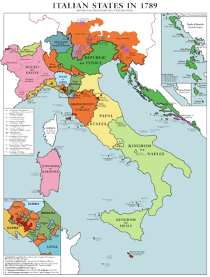
- Italy/Switzerland – In Italy in 1789 before the French Revolutionary Wars, the following states possessed or were true enclaves:
- Lordship of Tarasp was surrounded by the Free States of the Three Leagues.
- An exclave of the Republic of Geneva (1541–1798) was surrounded by the Duchy of Savoy.
- Prinicpality of Torriglia (1760–1797) was surrounded by the Republic of Genoa.
- Republic of Senarica (1343–1797) was surrounded by the Kingdom of Naples.
- The Lado Enclave was a 39,000 km² exclave of the Congo Free State and later of Belgian Congo that existed from 1894 until 1910, situated on the west bank of the Upper Nile in present-day South Sudan and northwest Uganda.
- Mount Scopus (in Jerusalem) was an Israeli exclave in Jordan between 1948 and 1967, before being reunited with West Jerusalem following the Six-Day War. Similarly, Ein Gev, located on the eastern shore of the Sea of Galilee, was a pene-exclave in Syria until Israel took over the Golan Heights territory, again during the Six-Day War.
- Panama –
- Colón, an exclave of Panama from 1903 to July 27, 1939, was surrounded by the U.S. Panama Canal Zone, until a treaty provision connected it to the main part of Panama via a corridor.[3]
- Panama City and the tip of Paitilla Point from 1903 to February 11, 1915, were pene-enclaves surrounded by the U.S. Panama Canal Zone and the Pacific Ocean. Maps of the Canal Zone dated before 1923 clearly show these borders.[117][118][119][120] Maps dated 1924 and later show a changed border that re-connected Panama City with eastern Panama.[121]
- When Madden Road was ceded to the U.S. by treaty on July 27, 1939, a Vennbahn-type Panamanian enclave was created that was bounded by Madden Road, the main Canal Zone boundary, and a contour line above Rio Chagres and Rio Chilibre. Another treaty that took effect on April 11, 1955, de-enclaved it.
- Panama had a water enclave in Limon Bay from 1979 to December 31, 1999. It also had jurisdiction over one building within the U.S. Summit Naval Station from October 1991 until the transfer of the station to Panama on December 31, 1999.[122]
- Pogiriai (Pogiry) was a Lithuanian exclave of 1.7 km² that was ceded to Belarus in 1996.
- The southern section of the Emirate of Ras al-Khaimah was a national-level exclave surrounded by other emirates of the UAE and Oman for three months after UAE independence in 1971 until it joined the UAE in 1972.
- Between 1991 and 2003, Russia had three tiny pene-exclaves on tips of the lakeshore that bordered the Lithuanian side of Lake Vištytis. Before a new border treaty went into force on 12 August 2003, the border ran along most of the waterline of the beaches on the Lithuanian side, so anyone paddling in the water was technically crossing into Russia.
- Saint Pierre and Miquelon, a French territorial collectivity, was completely surrounded by the territorial waters of Canada from 1763 until 1992, when an EEZ corridor 10.5 NM (19.4 km) wide was created, stretching 200 NM (370 km) south to open sea.
- Schirgiswalde – In accordance with terms of the 1635 Peace Treaty of Prague, Austria transferred land (Ober- and Niederlausitz) to Saxony. However, because of religious affiliation with Austria, Schirgiswalde and five other towns (Güntersdorf, Gerlachsheim, Winkel, Taubentränke and Neuleutersdorf) within the transferred land remained with Austria, becoming Austrian enclaves within Saxony. 174 years later, to address problems as states began to consolidate, the 1809 Peace Treaty of Vienna mandated the transfer of these six enclaves from Austria to Saxony. However, the transfer did not occur until 1845 because of the need to correct mistakes in the names of the villages stated in the treaty and subsequent neglect. During that time, Schirgiswalde was de facto independent until economic reasons compelled the final transfer of the enclaves, thus extinguishing them.[3]
- Sikkim – Dopta and Chumbi were exclaves of Sikkim within Tibet until China occupied them in 1958.
- Sweden – The Peace of Westphalia in 1648 granted certain possessions of the Holy Roman Empire to the Swedish Empire (extant 1611–1721) to be held as fiefs of the Holy Roman Empire:
- Bremen-Verden – states of the Holy Roman Empire bordering the North Sea; in "personal union with Sweden" until 1712, when they fell under Danish occupation in wartime.
- Swedish Pomerania – a state on the Baltic coast in present-day Germany and Poland; a small part was ceded to Prussia following war in 1720 and the entirety in 1815 during the Congress of Vienna.
- town of Wismar – town in northern Germany on the Baltic Sea; transferred to Germany in 1903 when Sweden renounced its claim.
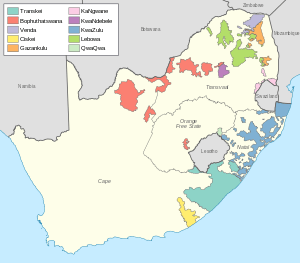
- Syria was a pene-exclave of the United Arab Republic from 1958 to 1961 (if one considers Egypt as the UAR main land), bordering the Mediterranean Sea, Turkey, Iraq, Lebanon, Israel and Jordan.
- Transkei was a bantustan or "black homeland" that was granted nominal independence by apartheid South Africa from 1976 until being re-absorbed in April 1994, but it remained unrecognized internationally. It had two exclaves within South Africa that were true enclaves.
- Taebong and Goryeo – The southwest coast of South Jeolla Province in Korea was an exclave of Taebong or Goryeo, between 903 and 936.
- Turkey –
- The tomb of Suleyman Shah (b. ca. 1178–d. 1236) was located in or near Qal'at Ja'bar in modern-day Syria; in accordance with the 1921 Treaty of Ankara, the tomb "shall remain, with its appurtenances, the property of Turkey, who may appoint guardians for it and may hoist the Turkish flag there." The treaty is silent regarding sovereignty of the 6.3 hectares of land where the tomb rests. The tomb was relocated in 1973 prior to the creation of Lake Assad.
- Ada Kaleh – Prior to the creation of modern Turkey, the Ottoman Empire held a small island in the Danube River surrounded by the waters of Romania, from at least the Berlin Treaty of 1878 until 1923 when, under the Treaty of Lausanne, Romania obtained sovereignty over it. It was submerged in 1970 by the construction of a hydroelectric plant, displacing up to 1000 residents.
- Following the establishment of the Irish Free State, three deep water Treaty Ports at Berehaven, Queenstown (modern Cobh) and Lough Swilly were retained by the United Kingdom in accordance with the Anglo-Irish Treaty of 6 December 1921.[123] As part of the settlement of the Anglo-Irish Trade War in the 1930s, the ports were transferred to Ireland (the Free State's successor) in 1938 following agreements reached between the British and Irish Governments.
- In 1625, King Charles I instituted the Order of the Baronets of Nova Scotia in an effort to colonize New Scotland, by offering the hereditary title, land ownership and power over new baronetcies in exchange for financing and materially supporting new settlements. Under Scots Law, Baronets "took seisin" by receiving symbolic "earth and stone" on the actual land, which was the feudal legal form of taking possession. However, to avoid a trans-Atlantic trip (and thus encourage applicants), the royal charter stated that "the realm of Nova Scotia, and original infeftment thereof, is holden of the kingdom of Scotland, and forms part of the County of Edinburgh." By royal decree, land in the courtyard at Edinburgh Castle was declared to be an integral part of Nova Scotia; thus, seisin at the castle was equivalent to seisin on the lands themselves.[124][125][126][127][128][129][130][131][132][133] The ceremony of seisin was performed in the following years for 64 of the original Baronets. This decree has never been annulled, which fuels a belief that this enclave still exists as a tiny enclave of Canada within the grounds of the famous Scottish castle.
- Horseshoe Reef (1850–1908) in Lake Erie consisted of underwater ledges of sunken rock near Buffalo, New York. Great Britain ceded a fraction of an acre of underwater land that was entirely surrounded by Canadian waters to the United States to construct a lighthouse.[134] A 1908 treaty mandated a new survey in order to shift the boundary to include the reef in U.S. waters.
- The Captain Cook Monument at Kealakekua Bay and about 25 square feet (2.3 m2) of land around it in Hawaii, United States, the place where James Cook was killed in 1779, is owned by the United Kingdom.[135][136][137][138] An historian on the occasion of the 50th anniversary recorded in 1928 that the white stone "obelisk monument [was] erected to the memory of Captain Cook, about 1876, and on land deeded outright to the British Government by Princess Likelike, sister of King Kalakaua, about the same year, so that that square is absolute British Territory."[139] Hawaii was a sovereign nation at the time. According to a recent writer, "The land under the monument was deeded to the United Kingdom in 1877 and is considered as sovereign non-embassy land owned by the British Embassy in Washington DC. ... the Hawaiian State Parks agency maintained that as sovereign British territory it was the responsibility of the UK to maintain the site."[140]
- Lake of the Woods – the American border with present-day Canada as defined under the 1783 Treaty of Paris and the Anglo-American Convention of 1818 inadvertently created two small maritime exclaves of the U.S. in Angle Inlet. The border depended on determining the northwesternmost point of the Lake of the Woods. Johann Tiarks' survey in 1825 placed its location at the edge of a pond on the Angle Inlet.[141] (A 1940 academic study documented the location of Tiarks' point, which is in the immediate vicinity of 49°23′51.324″N 95°9′12.20783″W (NAD83).[134]) In accordance with the 1818 treaty, the border ran south from this point to the 49th parallel. However, this line was "intersected at five points by the winding course of the boundary in the channel of the Northwest Angle Inlet; thus there were anomalously left two small areas of waters totaling two and a half acres belonging to the United States, yet entirely surrounded by Canadian waters."[134] They were centered at 49°23′10.7514″N 95°09′10.8″W and 49°23′17.5914″N 95°09′11.6994″W. By treaty in 1925, the southernmost of these five intersecting points, 4785 ft. farther south than Tiarks' point, was adopted instead, which eliminated these exclaves.[134]
- Panama Canal Zone, surrounded by Panama, the Caribbean Sea and the Pacific Ocean, was an American pene-exclave from 1903 to 1 October 1979, when the entity was extinguished by treaty with Panama. After that date, the former Canal Zone land remaining under U.S. sovereignty, greatly reduced in area, was a pene-exclave until 31 December 1999, when total transfer to Panama was complete.
- At El Cerro de Doscientos Pies ("200-Foot Hill"), 3.19 hectares of land in Panama near Las Minas Bay were annexed by the U.S. on 24 September 1928 and added to the Canal Zone.[142][143] This true enclave apparently existed until 1 October 1979.
- On 1 October 1979, the day the Panama Canal Treaty of 1977 took effect, most of the land within the former Canal Zone transferred to Panama. However, the treaty set aside many Canal Zone areas and facilities for transfer during the following 20 years. The treaty specifically categorized areas and facilities by name as "Military Areas of Coordination", "Defense Sites" and "Areas Subject to Separate Bilateral Agreement". These were to be transferred by the U.S. to Panama during certain time windows or simply by the end of the 243-month treaty period. On 1 October 1979, among the many such parcels so designated in the treaty, 35 emerged as true enclaves (surrounded entirely by land solely under Panamanian jurisdiction). In later years as other areas were turned over to Panama, nine more true enclaves emerged. Of these 44 true enclaves, 14 were related to military logistics, 7 were military communications sites, 5 Federal Aviation Administration facilities,[144] 5 military housing enclaves, 3 military base areas, 2 military research facilities, 2 parts of a bombing range, 4 secondary school parcels, 1 elementary school, and 1 hospital. At least 13 other parcels each were enclosed partly by land under the absolute jurisdiction of Panama and partly by an "Area of Civil Coordination" (housing), which under the treaty was subject to elements of both U.S. and Panamanian public law. In addition, the 1977 treaty designated numerous areas and individual facilities as "Canal Operating Areas" for joint U.S.-Panama ongoing operations by a commission. On the effective date of the treaty, many of these Canal Operating Areas, including Madden Dam, became newly surrounded by the territory of Panama. Just after noon local time on 31 December 1999, all former Canal Zone parcels of all types had come under the exclusive jurisdiction of Panama.[122][145][146][147][148][149]
- The Val d'Aran is a valley in the Pyrenees mountains and a comarca in northwestern Catalonia, northern Spain. Most of it comprises the only part of Catalonia that is on the northern side of the Pyrenees. The Val d'Aran had been without direct access to the south side of the mountains, until the Vielha tunnel was opened in 1948.
- Venda was a bantustan or "black homeland" that was granted nominal independence by apartheid South Africa from 1979 until being re-absorbed in April 1994, but it remained unrecognized internationally. It was an enclave that was not an exclave, bordering only South Africa and separated narrowly from Zimbabwe by the Madimbo corridor to the north. Venda itself also had a small exclave that was a true enclave in South Africa.
- Walvis Bay was a South African pene-exclave bordered by the Atlantic Ocean and Namibia, before being incorporated with Namibia in 1994, four years after that country's independence.
- Zadar (Zara) was a 104 km² pene-exclave of Italy, bordering the Adriatic Sea and Croatia, from 1920 to 1944 (de facto due to abandonment by the Italian civilian administration) or 1947 (de jure under treaty).
- Various other historical foreign concessions
- Innumerable medieval enclaves within Europe
Subnational historic enclaves/exclaves
- Azerbaijan – The former Nagorno-Karabakh Autonomous Oblast was an enclave in Azerbaijan, but the internationally unrecognised Nagorno-Karabakh Republic is not, as it occupies territories bordering Armenia and Iran.
- United Kingdom –
- Cumbernauld and Kirkintilloch formed an exclave at county level, as a part of the Scottish county of Dunbartonshire sandwiched between Stirlingshire and Lanarkshire. The exclave was dissolved after the municipal reforms of 1975.
- Ardnamurchan, Morvern and the surrounding area also formed an exclave at county level, as a part of the Scottish county of Argyllshire bordered by Inverness-shire, separated from the rest of Argyllshire by Loch Linnhe. The exclave was dissolved in 1975 following the municipal reforms of that year.
- Dudley in the West Midlands, England, was an exclave at municipal level, being in a part of the county of Worcestershire surrounded by Staffordshire. Upon the local government reforms of 1974, the exclave was dissolved.
- Furness in England was an exclave of the county of Lancashire, known as "Lancashire-beyond-the-Sands" until 1974, when it became part of Cumbria.
- The district of Wrexham Maelor existed from 1974 to 1996, being formed from parts of two administrative counties, including Flintshire. From Flintshire came the exclave of Maelor Rural District (bounded on three sides by England and on the west by the Welsh county of Denbighshire) and the enclave of the parish of Marford and Hoseley, surrounded and separated from Flintshire also by Denbighshire. They are now part of Wrexham.
- Domesday Hundreds of Cheshire map in 1086 displays an enclave of Hamestan surrounded entirely by Middlewich.
- The counties of Scotland before reorganisation in 1889 included dozens of exclaves. This was especially notable in the case of Cromartyshire, which was split into at least nine parts spread across Ross-shire.
- Before 1974, and especially before 1844, there were many exclaves of counties in England and Wales.
- In Canada, East York became an exclave of York in 1922, when the township of North York was established, causing East York to be sandwiched between North York, Leaside, and Old Toronto. East York became its own township in 1924, ending its status as an exclave. All of these municipalities are part of Toronto since the 1998 amalgamation.
- In Central Finland, the former municipality of Säynätsalo was an exclave of Jyväskylä municipality from 1993 to 2009.
- Germany –
- The former municipality of Hinterhermsdorf in Saxony was an exclave of the town of Sebnitz, being separated from it by the municipality of Kirnitzschtal, until Kirnitzschtal also became a part of Sebnitz.
- Königsberg, located in the Lower Franconia region of present-day Bavaria, Germany, was an enclave within Bavaria, along with two small nearby enclaves, belonging to the Ernestine Duchy of Saxe-Coburg and Gotha (which after 1825 also had five exclaves in Thuringia). In 1918 the post-monarchy duchy was split into two states, making Königsberg an exclave of the Free State of Saxe-Coburg. In 1920, the residents of that state voted to merge with the Free State of Bavaria, thus eliminating the three Bavarian enclaves.
- Schmalkalden/Suhl – Just after World War I, this Prussian enclave within Thuringia was divided between the two Prussian provinces of Saxony and Hesse-Nassau (thus it was a composite enclave). The two entities of Schmalkalden and Suhl separately were exclaves of their respective Prussian provinces.[2]
- Innumerable medieval enclaves
- In India, until 1952, France maintained Chandannagar, which reported to the Governor of Pondichéry, and was an enclave in Bengal, just upriver from Calcutta.
- In Ireland, until 1842, Durrow was an exclave of County Kilkenny surrounded by Queen's County.
- Korea –
- Siheung County, South Korea, had an exclave (nowadays Gwacheon, Gunpo, and Uiwang) since Anyang was separated from Siheung in 1973. In 1989, the old county of Siheung was divided into the cities of Gunpo, Uiwang, and Siheung, thereby dissolving the enclave.
- Seoul was an enclave of Gyeonggi Province until neighbouring Incheon was declared a special city in 1981.
- In Norway, three farmsteads, Øvre Jøsås, Store Jøsås and Lille Jøsås, that belonged to Sør-Trøndelag county (Malvik) comprised two separate enclaves that were surrounded by Nord-Trøndelag county (Stjørdal).[150] The eastern enclave at 63°20′52″N 10°52′37″E consisted of Øvre Jøsås and Store Jøsås, while Lille Jøsås was the western enclave at 63°20′48″N 10°51′44″E. The closest distance between the two enclaves was only about 8 meters. Sør-Trøndelag and Nord-Trøndelag merged into a single county on 1 January 2017, thus eliminating the Jøsås enclaves.
- In Portugal until 2013, two civil parishes comprised the city of Estremoz. The parish of Santa Maria (the new town and its rural environs) surrounded an enclave, the walled old town of the parish of Santo Andre. The citadel inside Santo Andre was also a counter-enclave that belonged to Santa Maria.[151] The two parishes were united to form a new parish called Union of the Parishes of Estremoz (Santa Maria and Santo André), thus ending the only counter-enclave in Portugal.
- In Russia –
- Sheremetyevo is the location of the primary airport for Moscow. From 1995 to 2011 it was officially an enclave of the city of Moscow, but there was ambiguity regarding its association with Moscow Oblast. In 2011, the enclave was returned to Moscow Oblast, thus extinguishing it.
- Vnukovo consisted of two enclaves of the city of Moscow to its southwest. On 1 July 2012, "New Moscow" was created by annexing additional land to the city, including the land that surrounded Vnukovo. The two are now exclaves of a Moscow city subdivision, and one is also an enclave.
- Ust-Orda Buryat Autonomous Okrug was an enclave (not exclave) within Irkutsk Oblast and was merged into it on 1 January 2008.
- Agin-Buryat Autonomous Okrug was an enclave (not exclave) within Zabaykalsky Krai and was merged into it on 3 January 2008.
- In South Africa, the Eastern Cape Province had an exclave that was surrounded by KwaZulu-Natal Province, containing the town of Umzimkulu. KwaZulu-Natal had an exclave, Mount Currie, that was surrounded by the Eastern Cape. Both were extinguished in 2006.
- Switzerland –
- The village of Samnaun could initially only be reached by road from Austria. Thus, in 1892 the village was excluded from the Swiss customs territory. The exemption was maintained even when a road was built to the Engadin valley in 1907–1912.
- Before 1597, the two present-day cantons of Appenzell Ausserrhoden and Appenzell Innerrhoden were one canton, Appenzell, which was an enclave completely surrounded by the Canton of St. Gallen.
- Turkey –
- Maine was a pene-exclave of Massachusetts between 1652 and 1820.
- The Western Reserve in present-day Ohio was a pene-exclave of Connecticut from 13 September 1786 to 1800, when it reverted to the Northwest Territory.
- The following from pre-merger Louisville, Kentucky, no longer exist as enclaves: Audubon Park, Meadowview Estates, Parkway Village, Seneca Gardens, Wellington, and the combination of Kingsley, Strathmoor Manor, and Strathmoor Village.
- District of Columbia – Washington National Airport was built on reclaimed land on the south side of the Potomac River, where the river's high-water line marked the District's boundary with Virginia. Therefore, until 1945, the site was a pene-exclave of the District. Since then, the airport has been officially deemed a part of Arlington County, Virginia, but it is under exclusive federal jurisdiction and is administered as if still part of the District.
- Boston Corner was a pene-exclave of the town of Mount Washington, Massachusetts, and ceded to New York on January 11, 1855, because its geographical isolation from the rest of Massachusetts (as part of the Taconic range) made maintaining law and order difficult.
- Princeton Township surrounded the Borough of Princeton, home of Princeton University, until the two municipalities merged in 2013 to form Princeton, New Jersey.
- Town Line, New York voted 85 to 40 to secede from the United States in 1861, with no legal effect and no well-defined borders, to become an exclave of the Confederate States of America, unrecognized by either side (there are no written records); ceremonially voted to "rejoin" the Union in 1946.
Temporary enclaves or exclaves
Sometimes land is ceded temporarily to another country as a form of legal fiction.
- Suite 212 at Claridges Hotel in London was ceded by the United Kingdom to Yugoslavia on 17 June 1945 to allow Crown Prince Alexander, whose parents were in exile, to be born on Yugoslav soil.[152][153][154]
- To establish jurisdiction, Camp Zeist, a former United States Air Force base in the Netherlands, was, in 2000, temporarily declared sovereign territory of the United Kingdom, in order to allow the Pan Am Flight 103 bombing trial to take place.
- In 1943, the maternity ward at the Ottawa Civic Hospital in Canada was temporarily extraterritorial so that Princess Juliana's daughter Princess Margriet would only have Dutch (by parents' nationality) and not dual nationality, because of her potential birth on Canadian soil. Dual nationality would have excluded her from the royal succession.
- In 1979, at Sender Zehlendorf, East Germany, an area of 300 metres in radius around a radio tower construction site was made an exclave of the Soviet Union. After a Soviet fighter plane had earlier collided with a radio transmission mast at the facility, causing it to collapse, the Soviet Union agreed to rebuild the mast. So that the stricter German safety regulations would not slow the construction progress, the area was declared a Soviet exclave for the duration of the work.[155]
Potential exclaves pending international resolution
- Hans Island – Two pene-exclaves would be created by a land border between Canada and Greenland, the latter an autonomous country within the Kingdom of Denmark. Negotiations in 2012 between Canada and Denmark, not yet finalized, call for either a condominium or splitting the sovereignty over the disputed island. If the island were to be split by a boundary, it would create both Canada's and Denmark's second land border.[156]
- Palanca Marshes – potential Vennbahn-type enclave of Moldova surrounded by Ukraine: Under a 2001 treaty between the two nations, Moldova is to transfer to Ukraine not only the asphalt (as it has already done), but also the real property under 7.7 kilometers of road (a portion of the 300 km road between Odessa and Reni), and to clarify the sovereignty of that land, which under that treaty is to be transferred to Ukraine.[157]
See also
- Serbian enclaves in Kosovo
- Overseas territory
Notes
- Whyte, Brendan (2004). "En Territoire Belge et à Quarante Centimètres de la Frontière" An historical and documentary study of the Belgian and Dutch enclaves of Baarle-Hertog and Baarle-Nassau. The University of Melbourne, School of Anthropology, Geography and Environmental Studies. ISBN 978-0-7340-3032-0.
- Krogh, Jan. "Jan S. Krogh's Geosite: Enclaves and Exclaves". Archived from the original on 2013-03-12. Retrieved 2013-02-21.
- Vinokurov, Evgeny (2007). The Theory of Enclaves. Lexington Books, Lanham, MD.
- "Treaty between Australia and the Independent State of Papua New Guinea concerning Sovereignty and Maritime Boundaries in the area between the two Countries, including the area known as Torres Strait, and Related Matters". Australian Government Publishing Service. Canberra. 1985. Retrieved 2013-08-20.
- "Australian Enclaves off Papua, New Guinea (map)". Association of Canada Lands Surveyors. Archived from the original on 2014-10-17. Retrieved 2013-08-20.
- "Complete Files of Geographic Names for Geopolitical Areas from GNS". Toponymic information is based on the Geographic Names Database, containing official standard names approved by the United States Board on Geographic Names and maintained by the National Geospatial-Intelligence Agency. More information is available at the Maps and Geodata link at http://www.nga.mil. The National Geospatial-Intelligence Agency name, initials, and seal are protected by 10 United States Code Section 425. Archived from the original on 2015-03-13. Retrieved 2013-02-20.
- National Geospatial-Intelligence Agency. "GeoNames WMS Viewer". Archived from the original on 2014-05-21. Retrieved 2013-02-20.
- "Tin Bigha corridor to remain open 24 hours". Bangla News 24. 6 September 2011. Archived from the original on 22 September 2012. Retrieved 7 September 2011.
- "Transit tumbles into Teesta abyss". bdnews24.com. 7 September 2011. Archived from the original on 1 December 2017. Retrieved 28 November 2017.
- "Territorial and Maritime Dispute (Nicaragua v. Colombia), Rejoinder, Republic of Colombia" (PDF). International Court of Justice. 18 June 2010. pp. 99–102. Archived from the original (PDF) on 18 July 2017. Retrieved 2018-01-26.
- "Cartografía". www.cioh.org.co. Archived from the original on 24 June 2017. Retrieved 14 July 2017.
- Kraul, Chris (20 November 2012). "Disputed islands belong to Colombia, court rules". Los Angeles Times. Archived from the original on 22 October 2013. Retrieved 2013-08-12.
- "Territorial and Maritime Dispute (Nicaragua v. Colombia). Judgment" (PDF). International Court of Justice. (para. 37, 202). 19 November 2012. Archived from the original (PDF) on 1 December 2017. Retrieved 2017-11-28.
- Bekker, Pieter (15 January 2013). "The World Court Awards Sovereignty Over Several Islands in the Caribbean Sea to Colombia and Fixes a Single Maritime Boundary between Colombia and Nicaragua" (PDF). Insight (American Society of International Law). 17 (3). Archived (PDF) from the original on 6 January 2018. Retrieved 2018-01-06.
- Cortes, Jorge (2003). Latin American Coral Reefs. Gulf Professional Publishing. p. 283. ISBN 978-0444540256.
- Krogh, Jan. "Jan S. Krogh's Geosite: Enclave/exclave of Brezovica". Archived from the original on 2013-06-22. Retrieved 2013-03-12.
- "Snimka gruntovne mape obćine Sekulić županije žagrebačke po potankoj izmjeri od godine 1898 [S 76 - No. 2333/1-21.]". Hungaricana. National Archives of Hungary. 1898. Archived from the original on 25 March 2018. Retrieved 24 March 2018.
- "PCA CASE NO. 2012-04 IN THE MATTER OF AN ARBITRATION UNDER THE ARBITRATION AGREEMENT BETWEEN THE GOVERNMENT OF THE REPUBLIC OF CROATIA AND THE GOVERNMENT OF THE REPUBLIC OF SLOVENIA, SIGNED ON 4 NOVEMBER 2009 between THE REPUBLIC OF CROATIA and THE REPUBLIC OF SLOVENIA (together, the "Parties") FINAL AWARD 29 June 2017". The Hague, Netherlands: Permanent Court of Arbitration. p. 182. Archived from the original on 2 July 2017. Retrieved 2017-06-29.
The Tribunal determines that, in these circumstances, area 7.1 forms part of the territory of Slovenia, and the boundary runs along Slovenia's cadastral limits. The Tribunal recognizes that the delimitation thus made on the basis of the cadastral limits is one of great complexity. The cadastral boundary creates numerous meanders and even enclaves.
- "Pregledna karta kartografskega prikaza poteka državne meje med Republiko Slovenijo in Republiko Hrvaško po sodbi arbitražnega sodišča (Karta 25) [Cartographic representation of the state border between Slovenia and Croatia according to the award of the arbitral tribunal (Map 25)]" (PDF). Government of the Republic of Slovenia. Archived (PDF) from the original on 2018-04-01. Retrieved 2018-03-25.
- "Slovenia wins battle with Croatia over high seas access". BBC News Services. 29 June 2017. Archived from the original on 3 July 2017. Retrieved 2017-06-30.
- Bartholomew, John (1955). The Times Atlas of the World. Belgium, Plate 61, V. III (Map). Houghton Mifflin Co. Boston London. Archived from the original on 2014-04-15. Retrieved 2013-05-04.
- Area based on this map Archived 2014-05-04 at the Wayback Machine using Google Maps area calculator tool Archived 2014-04-30 at the Wayback Machine
- Megoran, Nick Solly (24 May 2004). "To Survive, Villagers Buck Uzbek Border Controls". EurasiaNet. Archived from the original on 19 March 2014. Retrieved 2014-03-15.
- Megoran, Nick (15 Mar 2000). "Bad neighbors, bad fences". Asia Times Online. Archived from the original on 19 March 2014. Retrieved 2014-03-15.
- Gavrilis, George (22 Sep 2008). The Dynamics of Interstate Boundaries (Cambridge Studies in Comparative Politics) (1 ed.). Cambridge University Press. pp. 120–121. ISBN 978-0521898997.
- "Kyrgyz In Exclave In Uzbekistan Want To Relocate To Kyrgyzstan". EurasiaNet. 12 May 2011. Archived from the original on 19 March 2014. Retrieved 2014-03-15.
- Azizov, Demir (18 Feb 2014). "Uzbekistan, Kyrgyzstan intensify work on delimitation and demarcation of state border". Archived from the original on 19 March 2014. Retrieved 2014-03-15.
- Борис ГОЛОВАНОВ (22 Feb 2002). "Продолжаются споры по линии прохождения узбеко-кыргызской границы. Неделимы Сох, Барак и Гавасай". Вечерний Бишкек. Archived from the original on 19 March 2014. Retrieved 2014-02-15.
- "Kyrgyzstan, Uzbekistan Agree To Work On Land Swap Near Border". RadioFreeEurope/RadioLiberty. Archived from the original on 2019-03-15. Retrieved 2019-01-17.
- "Costa Rica & Nicaragua Settle Border Dispute in Court". Political Geography Now. 3 Feb 2018. Archived from the original on 5 February 2018. Retrieved 2018-02-04.
- Krogh, Jan. "Jan S. Krogh's Geosite: United Arab Emirates". Archived from the original on 2013-04-04. Retrieved 2013-03-12.
- "GeoHack - Batken Province". Retrieved 2013-02-20.
- National Geospatial-Intelligence Agency. "Romanization Systems and Policies". Archived from the original on 2017-07-12. Retrieved 2017-05-24.
- Ministry of Culture and Tourism of Azerbaijan Republic. "GoMap Online Navigator". Archived from the original on 2013-10-22. Retrieved 2013-10-21.
- "1:100,000 Soviet Military Topographic Map". 1991. Archived from the original on 2017-11-19. Retrieved 2018-01-26.
- "Azerbaycan Respublikasi, 2009 il". Archived from the original on 2013-12-24. Retrieved 2013-11-13.
- "Azerbaycan Respublikasinin (map)". 1999. Archived from the original on 2013-12-24. Retrieved 2013-11-13.
- Ministry of Culture and Tourism of Azerbaijan Republic. "GoMap Online Navigator". Archived from the original on 2013-12-03. Retrieved 2013-11-19.
- Ministry of Culture and Tourism of Azerbaijan Republic. "GoMap Online Navigator". Archived from the original on 2013-12-03. Retrieved 2013-11-19.
- "Provence-Hideaways". Archived from the original on 2006-04-21. Retrieved 2006-04-22.
- Gujarat Chief Electoral Officer. Kaprada Assembly Constituency (Map). Retrieved 2019-12-15.
- Damao (Daman) 1954 (Topographic Map) original scale 1:250,000 (Map). 1956. Archived from the original on 2013-09-11. Retrieved 2013-10-06.
Portion of Navsari, Sheet NF 43-13, Series U502, U.S. Army Map Service compiled in 1954 and printed in 1956 (Perry–Castañeda Library Map Collection, University of Texas Libraries)
- "Puducherry Police, Map showing the existing Police Station limits". Archived from the original on 2013-10-17. Retrieved 2013-10-14.
- "Law of the City of Moscow from May 5, 2010 № 17: On the General Plan of Moscow". Archived from the original on January 27, 2018. Retrieved 2018-01-26.
- Committee for Architecture and Urban Planning of the City of Moscow. "The general plan of the city of Moscow - Territorial planning documents". Archived from the original on 2013-10-22. Retrieved 2013-10-16.
- "Area of the planned deployment of federal and regional capital housing, (Map, grid 49)". Archived from the original on 2013-10-22. Retrieved 2013-10-16.
- "Refinement of the description of the borders of the city of Moscow and territories that make up the city of Moscow". Metropolitan Board of Solution. 29 May 2000. Archived from the original on 17 October 2013. Retrieved 2013-10-17.
- "Symbols of the District". (click on "Границы поселка Акулово" to see map). Archived from the original on 2013-12-07. Retrieved 2013-10-17.
- "Рублевка против Москвы". 13 March 2012. Archived from the original on 8 October 2013. Retrieved 2013-10-15.
- Hudson County New Jersey Street Map. Hagstrom Map Company, Inc. 2008. ISBN 978-0-88097-763-0.
- Verkuil, Paul R. (31 March 1997). "In the Supreme Court of the United States, October Term, 1996, State of NEW JERSEY v. State of NEW YORK, Final Report of the Special Master, Appendix F" (PDF). p. 14a. Archived (PDF) from the original on 30 October 2013. Retrieved 2013-10-26.
- Richard G. Castagna; Lawrence L. Thornton, John M. Tyrawski. GIS and Coastal Boundary Disputes: Where is Ellis Island?. ESRI. Retrieved 2013-11-16. "The New York portion of Ellis Island is landlocked, enclaved within New Jersey's territory."
- Google Maps, showing Beijing International airport. https://goo.gl/maps/bWh86. The red-line highlights the exclave including Terminals 1 and 2. Terminal 3 is to the southeast of the exclave at the north end of the road loop seen there.
- Larsen, Erlend (2016). Tre kommuner blir til én. Erlend Larsen Forlag. Page 13. ISBN 9788293057277.
- Davidsen, Roger (2008). Et Sted i Sandefjord. Sandar Historielag. Page 139. ISBN 978-82-994567-5-3.
- Jøranlid, Marianne (1996). 40 trivelige turer i Sandefjord og omegn. Vett Viten. Pages 114-117. ISBN 9788241202841.
- Art. 4, № 5 of Law № 142/85, from 18 November (law on the creation of municipalities)
- Art. 6, № 1 of Law № 8/93, from 5 March (law on the creation of civil parishes)
- "Bibb-Monroe County Line Dispute Front Page". 2 February 2011. Archived from the original on 2 February 2011. Retrieved 14 July 2017.CS1 maint: BOT: original-url status unknown (link)
- "Georgia Supreme Court hears arguments in Bibb-Monroe border war". Archived from the original on 11 September 2013. Retrieved 14 July 2017.
- O'Dea, Colleen (March 23, 2014). "The List: Donuts, Holes, and Exclaves - New Jersey' Weird Geography". NJ Spotlight. Archived from the original on March 25, 2014. Retrieved 2014-03-24.
- Salinas, Orlando (July 8, 2014). "Three voters in Radford will cost Montgomery County thousands of dollars". WDBJ. Archived from the original on July 18, 2014. Retrieved 2014-07-17.
- "HB 575 2015-2016 Regular Session". www.legis.ga.gov. Archived from the original on 16 August 2017. Retrieved 14 July 2017.
- "Urban Neighborhoods, Municipalities & Census-Designated Places: Jefferson County, Kentucky" (PDF). Louisville/Jefferson County Information Consortium. 2018-01-20. Archived (PDF) from the original on 2018-01-27. Retrieved 2018-01-26. Note that this map clearly marks the pre-merger boundaries of Louisville.
- U.S. Census Bureau (2000). "Pennsylvania County Subdivision Outline Maps" (PDF). Archived (PDF) from the original on 2013-11-10. Retrieved 2013-06-23.
- "USGS National Map Viewer". Archived from the original on 2012-04-05. Retrieved 2017-05-24.
- "Browse San Antonio". Archived from the original on 2013-10-19. Retrieved 2013-05-03.
- "Sunset Valley, Texas". Archived from the original on 2014-07-03. Retrieved 2014-07-02.
- Gómez Cruz, Ricardo Alonso (October 2004). Elementos Jurídicos para la Construcción de una Propuesta Tendente a la Recuperación Material y la Soberanía de la Isla Conejo en el Golfo de Fonseca (Legal Elements for the Construction of a Proposal to the Material Recovery and Sovereignty of Isla Conejo in the Gulf of Fonseca) (PDF) (Thesis). Universidad de El Salvador, Ciudad Universitaria, San Salvador, El Salvador. p. 33, 36, 46, 49 and 50. Archived (PDF) from the original on 2016-03-11. Retrieved 2013-07-04.
- Case Concerning Land, Island, and Maritime Frontier Dispute (El Salvador/Honduras, Nicaragua Intervening) (International Court of Justice 1992). Text
- Huezo Urquilla, Luis Salvador (July 1993). La controversia fronteriza terrestre, insular y maritima entre El Salvador y Honduras, y Nicaragua como país interviniente (Thesis). Universidad Dr. José Matías Delgado, San Salvador, El Salvador. Archived from the original on 2016-03-06. Retrieved 2013-07-14.
- "Mapping the Benefits of the Law of the Sea" (PDF). Retrieved 2013-06-09.
- Soler, Tomas; et al. (May 2001). "Parting the Waters" (PDF). GPS World: 28–33. Archived (PDF) from the original on 2013-02-22. Retrieved 2013-06-09.
- Ministry of Culture and Tourism of Azerbaijan Republic. "GoMap Online Navigator". Archived from the original on 2013-11-25. Retrieved 2013-11-25.
- Ministry of Culture and Tourism of Azerbaijan Republic. "GoMap Online Navigator". Archived from the original on 2013-12-03. Retrieved 2013-11-25.
- Ministry of Culture and Tourism of Azerbaijan Republic. "GoMap Online Navigator". Archived from the original on 2013-12-03. Retrieved 2013-11-25.
- "Question from ages ago: solved..." Archived from the original on 2013-10-29. Retrieved 2013-10-19.
- "Śląskie administracja". Archived from the original on 2016-12-20. Retrieved 2013-06-08.
- Rozhkov-Yuryevsky, Yuri (2013). "The concepts of enclave and exclave and their use in the political and geographical characteristic of the Kaliningrad region". Baltic Region. 2 (2): 113–123. doi:10.5922/2079-8555-2013-2-11.
- Vinokurov (2007), p. 29, also refers to semi-exclaves as a type of "mere exclave with sea connection to the mainland."
- "The Status of the Neutral Territory". Archived from the original on 2016-07-12. Retrieved 2016-04-13.
- Robinson, G. W. S. (September 1959). "Exclaves". Annals of the Association of American Geographers. 49 (3, [Part 1]): 283–295. doi:10.1111/j.1467-8306.1959.tb01614.x. JSTOR 2561461.
- "Why Dubrovnik is a lonely outpost". The Economist. The Economist Newspaper Limited. 1 July 2013. Archived from the original on 13 April 2016. Retrieved 2016-02-22.
- "Jan S. Krogh's Geosite: Germany (DE) – Denmark (DK) Wilmkjer (DE) – Vilmkær (DK) border". Archived from the original on 2017-04-19. Retrieved 2017-07-21.
- "Statutory Instruments, S.I. No. 187 Of 2006, Roads Act 1993 (Classification Of National Roads), Order 2006". Irish Statute Book. Archived from the original on 2017-11-01. Retrieved 2017-05-24.
- "Trosterud". geosite.jankrogh.com. Archived from the original on 10 April 2017. Retrieved 14 July 2017.
- "International Boundary Study No. 41, Greece – Turkey Boundary". U.S. Department of State, Office of the Geographer. 23 November 1964. p. 7. Archived from the original on 27 January 2018. Retrieved 2018-01-26.
- "Soviet military topographic maps 1:100000 (in Russian)". Archived from the original on 2016-03-31. Retrieved 2018-01-26.
- Laychuk, Riley (13 July 2016). "Manitoba boaters stunned by new cross-border rule". CBC News. Archived from the original on 15 February 2017. Retrieved 2017-06-03.
In fact, some of the boat docks for Canadian cabins sit on the U.S. side of the border.
- "Exclave of the United States in North Dakota – Wikimapia". wikimapia.org. Archived from the original on 2015-11-29. Retrieved 2015-08-28.
- Hutchinson Township. Rolette County Atlas. North Dakota: Geo. A. Ogle & Co. 1910. p. 69. Archived from the original on 2018-01-06. Retrieved 2018-01-06.
- Jacobs, Frank. "516 – Northwest Angles: One Exclave May Hide Another". Big Think. The Big Think, Inc. Archived from the original on 2016-12-06. Retrieved 2016-11-14.
- "King Fahd Causeway: Border Station". Archived from the original on 2018-01-04. Retrieved 2017-11-28.
- "Lough Vearty". 2008-07-14. Archived from the original on 2016-11-08. Retrieved 2013-05-28.
- "Soviet military topographic maps 1:100000 (in Russian)". Archived from the original on 2016-03-28. Retrieved 2018-01-26.
- "Soviet military topographic maps 1:100000 (in Russian)". Archived from the original on 2016-03-29. Retrieved 2018-01-26.
- "NDGIS North Dakota Hub Explorer". Archived from the original on 17 September 2018. Retrieved 16 September 2018.
- "Jervis Bay Territory Governance and Administration". Although the Jervis Bay Territory is not legally part of the Australian Capital Territory, the laws of the ACT apply, in so far as they are applicable and, providing they are not inconsistent with an Ordinance, in the Territory by virtue of the Jervis Bay Acceptance Act 1915. The Department of Regional Australia, Local Government, Arts and Sport. Archived from the original on 3 December 2012. Retrieved 17 January 2013.
- "Thingvellir National Park" (PDF). Archived (PDF) from the original on 2019-01-21. Retrieved 2019-01-21.
- Ali, Rauf (29 January 2001). "Enclaves In Kalakad-Mundanthurai Tiger Reserve". p. 3. Retrieved 2018-01-26.
- "USGS National Map Viewer". Archived from the original on 2016-03-04. Retrieved 2013-08-19.
- Jacobs, Frank (April 24, 2012). "One Island, Two Countries". The New York Times. Archived from the original on September 8, 2015. Retrieved November 5, 2015.
- Lewis and Clark and Julia Butler Hansen National Wildlife Refuges Draft CCP/EIS Chapter 2. Alternatives, Goals, Objectives, and Strategies (PDF). Washington, DC: United States Fish and Wildlife Service. pp. 2–27. Archived (PDF) from the original on 2016-05-07. Retrieved 2016-04-20.
- Say goodbye to the weirdest border dispute in the world Archived 2015-08-01 at the Wayback Machine, Washington Post, August 1, 2015.
- "The 'Peanut Hole' in the Sea of Okhotsk" (PDF). Government of Canada. Archived (PDF) from the original on 2013-07-10. Retrieved 2013-11-24.
- United Nations Commission on the Limits of the Continental Shelf (March 14, 2014). "SUMMARY OF RECOMMENDATIONS OF THE COMMISSION ON THE LIMITS OF THE CONTINENTAL SHELF IN REGARD TO THE PARTIAL REVISED SUBMISSION MADE BY THE RUSSIAN FEDERATION IN RESPECT OF THE SEA OF OKHOTSK ON 28 FEBRUARY 2013" (PDF). United Nations. Retrieved May 25, 2014.
- Bray, J. (1997). "Ladakhi and Bhutanese enclaves in Tibet". Recent Research on Ladakh. Ulmer Kulturantropologische Schriften. Universität Ulm. Proceedings of the 7th Colloquium of the International Association for Ladakh Studies. Bonn/St. Augustin, 12–15 June 1995.
- Pranavananda, F.R.G.S. Swami (1950). Exploration in Tibet. University of Calcutta, Calcutta, India. p. 146.
- "Enclave of Chinese territory in the Guandong: Jinzhou Castle Walled City (English translation)". Retrieved 2013-10-04.
- "Enclave of Chinese territory in the Weihaiwei: Weihaiwei Castle Walled City (English translation)". Retrieved 2013-10-04.
- Bartholomew, John (1955). "The Times Atlas of the World. Belgium, Plate 61, V. III". Houghton Mifflin Co. Boston London. Archived from the original on 2014-04-15. Retrieved 2013-05-04.
- "Vennbahn: Bahnhof Konzen/Fringshaus". Archived from the original on 2014-02-28. Retrieved 2013-05-04.
- U.S. Department of State (30 June 1961). "International Boundary Study, Belgium-Germany Boundary" (PDF). Archived (PDF) from the original on 1 December 2017. Retrieved 2017-11-28.
- "Contract between the Swiss Confederation and the Federal Republic of Germany" (PDF). Archived (PDF) from the original on 15 January 2005. Retrieved 14 July 2017.
- "Berlin Exclaves". Archived from the original on 2013-04-29. Retrieved 2013-05-02.
- yoshida. "メグバル". www.geocities.co.jp. Archived from the original on 2018-10-10. Retrieved 2018-02-18.
- Johnston, T.B. (1912). "The Royal Atlas Of Modern Geography Exhibiting, In A Series Of Entirely Original And Authentic Maps, The Present Condition Of Geographical Discovery And Research In The Several Countries, Empires, And States Of The World By The Late Alexander Keith Johnston ... With Additions And Corrections To The Present Date ... With A Special Index To Each Map. A New Edition". W. & A.K. Johnston, Limited, Edinburgh & London. p. 58. Archived from the original on 2015-07-23. Retrieved 2013-05-03.
- "Atlas Of The Mexican Conflict Containing Detailed Maps Showing the Territory Involved, Pertinent Statistics of Mexico and the United States, Summary of Recent Events in Mexico". Rand McNally & Company, Publishers, Chicago - New York, U.S.A. 1914. p. 11. Archived from the original on 2015-07-23. Retrieved 2013-05-03.
- "London atlas series. Colombia, Ecuador and Peru, also Panama. (with Panama Canal Zone). (with) Galapagos Islands, Colon". Edward Stanford, Ltd. Stanford's Geographical Establishment, Long Acre, W.C. London. 1922. pp. 12–14. Archived from the original on 2015-07-23. Retrieved 2013-05-03.
- "Times survey atlas of the world. The West Indies. (with) Panama Canal. (with) Kingston. (with) Havana. (with) Jamaica. (with) Porto Rico. (with) Trinidad". The Edinburgh Geographical Institute, John Bartholomew & Co., London. 1922. Archived from the original on 2015-07-23. Retrieved 2013-05-03.
- "Rand McNally & Co.'s Commercial Atlas Of America. Fifty-Fifth Edition". Rand McNally & Company, Chicago, U.S.A. 1924. pp. 592–593. Archived from the original on 2015-07-23. Retrieved 2013-05-03.
- Ormsbee, William H. "PANAMA CANAL TREATY TRANSITION (OCTOBER 1979 - DECEMBER 1999)". Archived from the original on 2015-09-29. Retrieved 2015-07-11.
- "Documents on Irish Foreign Policy Series: Anglo-Irish Treaty: Text of". www.nationalarchives.ie. Archived from the original on 8 November 2017. Retrieved 14 July 2017.
- Scotland. Sovereign (1625-1649: Charles I); William Alexander Earl of Stirling; Charles Rogers; Scotland. Sovereign (1567-1625: James VI) (1885). Rogers, Charles (ed.). The Earl of Stirling's Register of Royal Letters, Relative to the Affairs of Scotland and Nova Scotia from 1615 to 1635, Volume 1. private circulation. p. xxi.
The lands included in the baronies of New Scotland were resigned by Sir William Alexander into the hands of the king [Charles I], who re-granted them to the knights baronets. Thus the lands and titles were obtained directly from the sovereign. Infeftment, it was ruled, should be "expede" at the Castle of Edinburgh.
- Turnbull, William, ed. (1839). The Stirling Peerage. Trial of Alexander Humphrys or Alexander, Styling Himself Earl of Stirling. Edinburgh, Scotland: William Blackwood and Sons. pp. 1–2. Archived from the original on 2016-04-03. Retrieved 2016-03-22.
Before this charter was ratified by the Scots Parliament, his Majesty [James VI] died; when, in 1625, the grant was renewed by his successor [Charles I] in form of a Charter of Novodamus, proceeding upon the above narrative, and conceding, over and above, additional powers to Sir William Alexander. These charters are in the usual form of feudal conveyances employed by the law of Scotland, but erecting Nova Scotia into a Barony, and declaring sasine at the castle of Edinburgh to be equivalent to sasine on the lands themselves.
- "Origin of the Baronetage of Scotland and Nova Scotia". The Scottish Journal of Topography, Antiquities, Traditions, &c. &c. Edinburgh, Scotland: Thomas George Stevenson. I (8): 115. October 23, 1847.
As such like parties were not baronets of the colonising kind, and yet were desirous, no doubt, to take seisin of their purchased grants in Nova Scotia, old Sir William, always provident, had his remedy prepared. He had had it laid down in the formula of the charter, that "the realm of Nova Scotia, and original infeftment thereof, is holden of the kingdom of Scotland, and forms part of the County of Edinburgh." Argal, to take seisin and instruments of possession "on the Castle Hill of Edinburgh," formed a cure for every difficulty, and served the desired purpose as well as if the baronets had indulged in a trip to the actual site of their new possessions.
- "The Baronetage and the New Committee". The Genealogical Magazine. London, U.K.: Elliot Stock. 1: 523. January 1898.
The precept for the charter for each Baronet was granted in the name of Sir William Alexander, who surrendered to the Crown the respective portions of his Lordship of Nova Scotia to be attached to the Baronetcy with all rights of regality. The Baronets were allowed to take possession of their territory by deed of infeftment within the walls of Edinburgh Castle.
- Laing, David, ed. (1867). Royal Letters, Charters, and Tracts, Relating to the Colonization of New Scotland, and the Institution of the Order of Knight Baronets of Nova Scotia. 1621-1638. Edinburgh, Scotland: G. Robb. p. 126.
Had it been exacted ... that each Baronet, with a stated number of colonists, should take personal possession, it is certain the number of applicants would have been scanty indeed. To obviate this difficulty it was held, by a fiction of the law, that the usual legal form of taking possession by an instrument of seisin, or infeftment of lands on the other side of the Atlantic, should take place within the Castle of Edinburgh.
- Fraser, Alexander (1922). "Nova Scotia, The Royal Charter of 1621 to Sir William Alexander (address)". Transactions of the Royal Canadian Institute. Toronto, Ontario, Canada: University of Toronto Press. XIV (1): 14–15, 45. Archived from the original on 2018-04-08. Retrieved 2018-04-07.
For the purpose of taking possession of his lands after the feudal fashion then prevailing, Nova Scotia was made a part of the county of Edinburgh, and at Edinburgh Castle the ceremony of Sasine was performed. … [excerpt of 1621 charter:] And we will, and grant, and, for ourselves and our successors, do decree and ordain, that one seisin, at this time, by the said Sir William, and his aforesaid, upon any part of the soil of the said lands and province above written, shall, in all time to come, stand, and be a sufficient seisin for the whole region, …
- Cooper, John A.; Mowat, J. Gordan (September 1905). "Canada and Edinburgh Castle". The Canadian Magazine. Toronto, Ontario, Canada: Ontario Publishing Company, Limited. 25 (5): 480.
The colony was named New Scotland, and by a legal fiction, it was, for administrative purposes, connected with Edinburgh. In order to raise men to help found the colony, the King instituted the Order of Baronets of Nova Scotia. This hereditary title was given to gentlemen who arranged to send a certain number of men and to pay a certain amount of money to help to found the Plantation of New Scotland, …. The Order was instituted in 1625, the ceremony being held in the courtyard of Edinburgh Castle. By Royal Decree that place was declared to be an integral part of the new colony. This decree has never been annulled.
- McGrail, Thomas H. (1940). Sir William Alexander, First Earl of Stirling: A biographical study. Oliver & Boyd. p. 91.
To make this possible, since Nova Scotia was so distant, the King declared that sasine could be taken either in the new province or alternatively 'at the castle of Edinburgh as the most eminent and principal place of Scotland.'
- MacKay, Janet (November 1993). "Founding of New Scotland (Nova Scotia)". Fifty Plus. St. John's, Newfoundland, Canada: Fifty Plus Outreach Association. 1. Archived from the original on 2016-03-30. Retrieved 2016-03-22.
Under Scots Law, Baronets "take sasine" by receiving symbolic "earth and stone" on the actual land. Part of Edinburgh Castle was deemed granted to Sir William as part of Nova Scotia. The Baronets were installed with "earth and stone" there while standing in Nova Scotia.
- Fraser, Marie. "Baronets of Nova Scotia". Archived from the original on 2012-02-13. Retrieved 2016-03-13.
Baronets could receive their patents in Edinburgh rather than London, and an area of Edinburgh Castle was declared Nova Scotian territory for this purpose.
- Boggs, Samuel Whittemore (1940). International Boundaries: A Study of Boundary Functions and Problems. Columbia University Press. pp. 48–49. Archived from the original on 2014-01-01. Retrieved 2013-04-27.
- Horwitz, Tony. Oct. 2003, Blue Latitudes: Boldly Going Where Captain Cook Has Gone Before, Bloomsbury, ISBN 0-7475-6455-8
- Erickson, Lt Clayton, RCN (2012). "Captain Cook Monument at Kealakekua Cleaned and Repaired". Cook's Log. 35 (4). p. 38. Archived from the original on 2013-09-21. Retrieved 2013-02-23.
- "Canadian Crew Cleans Cook Monument". 30 August 2012. Archived from the original on 2013-09-21. Retrieved 2013-02-23.
- Harris, Francis (22 Jul 2006). "Don't mention the murder - how Hawaii forgot Capt. Cook". Archived from the original on 21 September 2013. Retrieved 2013-02-23.
- Taylor, Albert P. "HOW HAWAII HONORED CAPTAIN COOK, R.N., IN 1928". p. 29. Archived from the original on 2013-09-21. Retrieved 2013-02-23.
- MacFarlane, John M. (2012). "The Captain Cook Memorial at Kealakakua Bay Hawaii". Archived from the original on 2013-06-25. Retrieved 2013-02-23.
- William E. Lass (1980). Minnesota's Boundary with Canada: Its Evolution Since 1783. Minnesota Historical Society Press. p. 48. ISBN 978-0-87351-153-7. Retrieved 15 August 2011.
- McCain, William D. (1965). The United States and the Republic of Panama (2nd printing). New York: Russell & Russell. pp. 144–159.
- Panama Canal Zone and Vicinity Showing Judicial Districts (Map). National Archives, College Park, Maryland: United States Army. 1927. Archived from the original on 2016-10-11. Retrieved 2016-07-15. (with hand-drawn features dated 1932)
- American Embassy, Panama to Secretary of State, Washington D.C. (March 1976), "Treaty negotiations: lands and waters use requirement for other USG agencies: II Federal Aviation Administration", U.S. Department of State internal message, archived from the original on 2018-05-11, retrieved 2017-09-03CS1 maint: multiple names: authors list (link)
- United States. Central Intelligence Agency. (1987). "Land and waters of the Panama Canal Treaty (map)". Washington, D.C. Archived from the original on 2015-09-29. Retrieved 2015-07-15.
- "Carte IV. Aires de terre et d'eau mises à disposition du fonctionnement et de la défense du canal de Panama par le traité relatif au canal de Panama du 7 septembre 1977". Dirección ejecutiva para los asuntos del tratado (DEPAT). Ciudad de Panama. 1981. Archived from the original on 2015-09-29. Retrieved 2015-07-11.
- Panama Canal Treaty: Implementation of Article IV (TIAS 10032). United States Treaties and Other International Agreements. 33. United States Department of State. 1987. pp. 307–432. Archived from the original on 2016-05-21. Retrieved 2015-07-29.
- Ormsbee, William H. "PANAMA CANAL TREATY TRANSITION - MILITARY. SUMMARY OF MILITARY PROPERTY TRANSFERS AND MILITARY FORCES DRAWDOWN". Archived from the original on 2015-09-29. Retrieved 2015-07-11.
- "Canal Zone Map Section. Curundu 1". Archived from the original on 2013-04-06. Retrieved 2015-07-23.
- Krogh, Jan S. "Domestic enclaves/exclaves of Norway". Archived from the original on 2013-04-24. Retrieved 2013-10-19.
- Instituto Geográfico do Exército: Territory of Santa Maria (Estremoz)
- Christopher Long (25 October 1991). "A Regal Bid Too Far?". Archived from the original on 4 July 2007. Retrieved 2006-12-15.
- Sherwell, Philip (11 March 2001). "Crown prince receives Yugoslav citizenship after 55-year exile". Archived from the original on 13 March 2014. Retrieved 2013-11-03.
- Strauss, Julius (16 Oct 2000). "Warm welcome as prince goes back to Belgrade". Archived from the original on 13 March 2014. Retrieved 2013-11-05.
- Warum die Baustelle eines Sendemasten exterritoriales Gebiet wurde.
- "As It Happens - Hans Island Settlement". 11 April 2012. Archived from the original on 17 October 2013. Retrieved 2013-05-04.
- "Moldova-Ukraine relations, interview with Andrei Popov". excerpt from a radio broadcast of the Vocea Basarabiei radio station. Moldova.org. 6 December 2009. Archived from the original on 6 January 2018. Retrieved 6 January 2018.
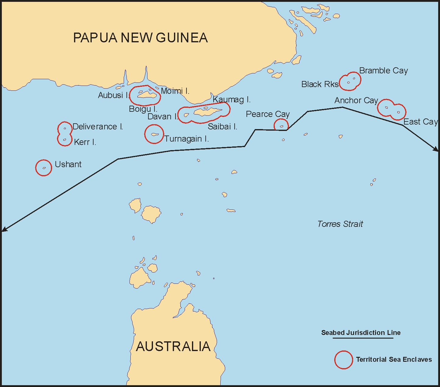
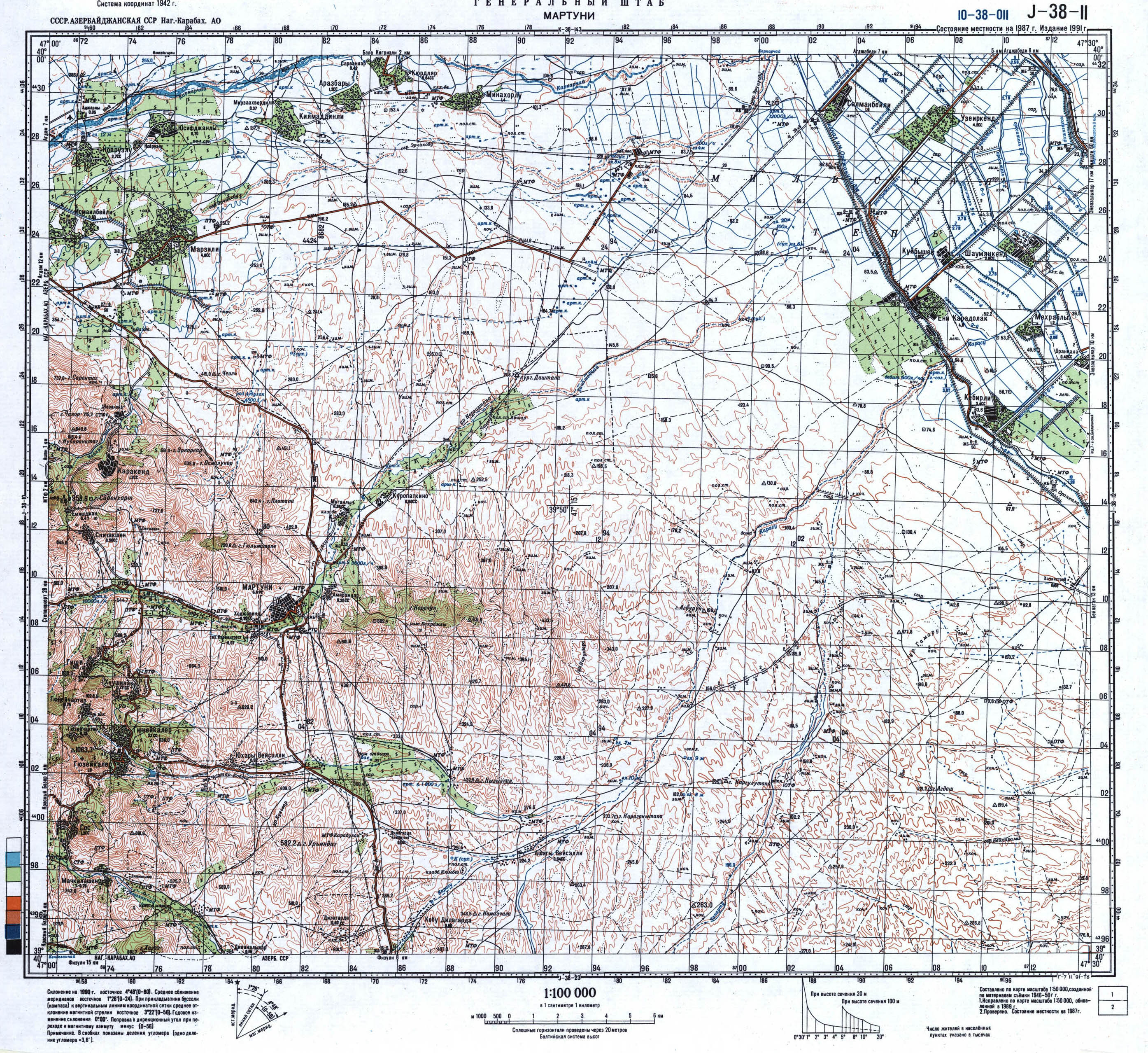
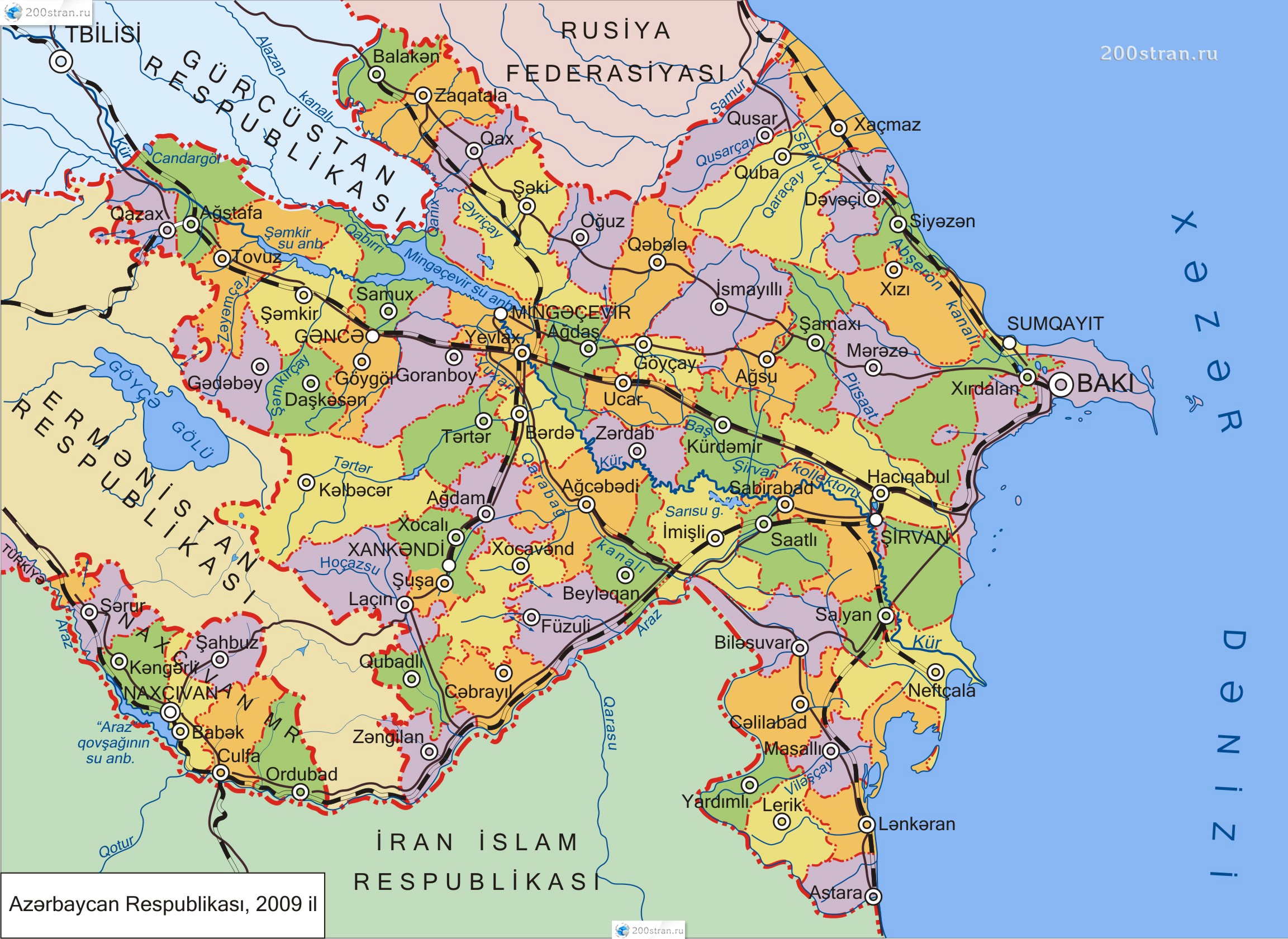
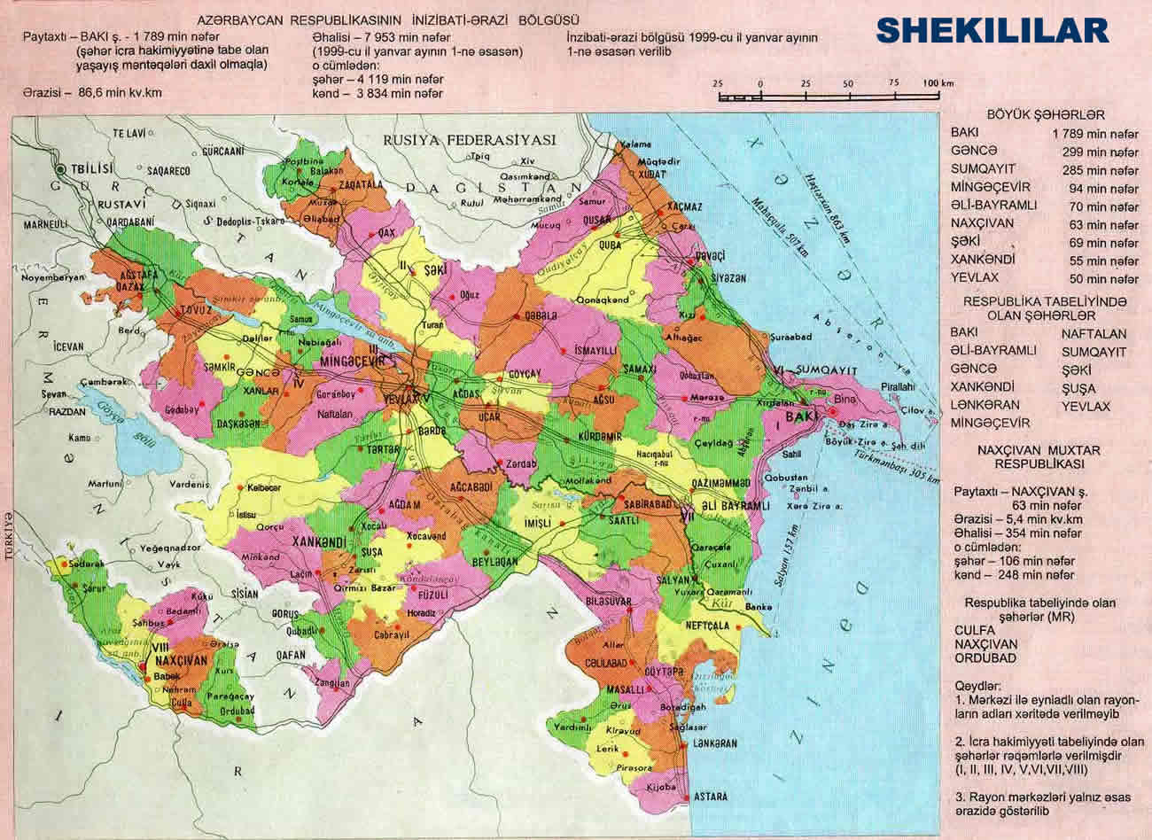
References
- Whyte, Brendan R. (2002). WAITING FOR THE ESQUIMO: An historical and documentary study of the Cooch Behar enclaves of India and Bangladesh (revised 2004). Melbourne: University of Melbourne (doctoral dissertation). ISBN 978-0-7340-2208-0.
- University of Melbourne ePrints repository has an abstract and a complete reprint (PDF: 13.59 MB).
- Chapter 1 (pages 1–24) is a general survey of international enclaves, with a table Enclaves of the world since 1996 on page 5.
- Nies, Susanne (2004). Sand in the works. Enclaves challenging metropolitan states. Paris. pp. 1–219.
- Jan S. Krogh's Geosite
- Smith, Barry (1997) "The Cognitive Geometry of War", in P. Koller and K. Puhl (eds.), Current Issues in Political Philosophy: Justice in Society and World Order, Vienna: Hölder-Pichler-Tempsky, 394–403.
- Evgeny Vinokurov, A Theory of Enclaves, Munich Personal RePEc Archive, 2007
- Puducherry Map