List of Canada–United States border crossings
This article includes lists of border crossings, ordered from west to east (north to south for Alaska crossings), along the International Boundary between Canada and the United States. Each port of entry (POE) in the tables below links to an article about that crossing.
There are five sections in this article that each provide a list of a particular POE type:
- Land ports of entry (limited to places where CBSA and/or CBP are regularly staffed and provide border inspection services);
- Closed land ports of entry;
- Unstaffed road crossings;
- Rail crossings; and
- point-to-point Ferry crossings.
_from_U.S._(Blaine%2C_WA).jpg)
Land ports of entry
Port of entry hours of service for road crossings, except where noted, are open year-round during the day.
| The yellow background indicates a border crossing where travel is permitted in only one direction. |
| The green background indicates a border crossing that is located at a bridge or a tunnel. |
| Canada Port of Entry Name | Canada Road/Highway [Community] | Province/
Territory |
U.S. Port of Entry Name | U.S. Road/Highway [Community] | State | Notes | Structure or Notable Feature | Coordinates |
|---|---|---|---|---|---|---|---|---|
| Little Gold Creek | Hwy 9 | Yukon | Poker Creek | Top of the World Highway | Alaska | May–Sept (9:00–21:00 PT / 8:00–20:00 AKT), depending on weather & road conditions. Canada: closed on holidays. | Northernmost Canada-U.S. border crossing | 64°5′8.02″N 141°0′3.92″W |
| Beaver Creek | Hwy 1 | Alcan | AK-2 (Alaska Highway) | Year-round (24-hour service). Canada: closed on holidays. | Furthest Canadian inspection station from the actual border (29 km) | 62°36′54.78″N 141°0′4.87″W | ||
| Pleasant Camp | Hwy 3 | British Columbia | Dalton Cache | AK-7 (Haines Highway) | Year-round (8:00–0:00 PT / 7:00–23:00 AKT). | 59°27′1.67″N 136°21′42.42″W | ||
| Fraser | Hwy 2 | Skagway | AK-98 (Klondike Highway) | Canada: north of border; April–Oct (24-hour service) / Nov–Mar (8:00–0:00 PT).
U.S.: year-round (24-hour service) |
Furthest U.S. inspection station among all U.S. land borders from actual border (8 mi south). Busiest border crossing of Alaska | 59°37′45.69″N 135°9′50.15″W | ||
| Stewart | Hwy 37A
(Glacier Highway) |
(closed - was Hyder) | International Street | Canada: year-round (8:00–0:00 PT / 7:00–23:00 AKT / tele-video reporting after hours.) U.S.: open but unstaffed, roads connect only to Canada | Persons may legally enter the US without reporting to inspection, as there is no U.S. inspection station. (The Hyder station permanently closed c. 1970s.) | 55°54′43.28″N 130°1′2.86″W | ||
| Boundary Bay | 56th Street
[Delta] |
Point Roberts | Tyee Drive | Washington | Year-round (24-hour service) | An obelisk marking the westernmost point of the border along the 49th parallel north is found one mile west at Monument Park. | 49°0′7.17″N 123°4′5.66″W | |
| Douglas | Hwy 99 [Surrey]
(Fraser Delta Thruway) |
Blaine - Peace Arch | I‑5 | Year-round (24-hour service).
No commercial vehicles. |
Peace Arch International Park | 49°0′7.45″N 122°45′23.49″W | ||
| Pacific Highway | Hwy 15 [Surrey]
(Pacific Highway) |
Blaine - Pacific Highway | SR 543 | Year-round (24-hour service). Commercial vehicles must use this crossing between Surrey and Blaine. | 49°0′7.74″N 122°44′7.58″W | |||
| Aldergrove | Hwy 13 | Lynden | SR 539 | Year-round (8:00–0:00 PT). | 49°0′8.14″N 122°29′6.37″W | |||
| Abbotsford-Huntingdon | Hwy 11
(Abbotsford-Mission Highway) |
Sumas | SR 9 | Year-round (24-hour service) | 49°0′8.65″N 122°15′55.25″W | |||
| Chopaka | Hwy 3 [Cawston]
(Crowsnest Highway) |
Nighthawk | Similkameen Road | Year-round (9:00–17:00 PT). | 49°0′0.76″N 119°40′15.74″W | |||
| Osoyoos | Hwy 97 | Oroville | US 97 | Year-round (24-hour service) | 49°0′0.36″N 119°27′45.72″W | |||
| Midway | Hwy 3
(Crowsnest Highway) |
Ferry | Customs Road [Curlew] | Year-round (9:00–17:00 PT). | 49°0′0.36″N 118°45′39.96″W | |||
| Carson | Hwy 41 [Grand Forks]
(Danville Highway) |
Danville | SR 21 | Year-round (8:00–0:00 PT). | 49°0′0.36″N 118°30′11.85″W | |||
| Cascade | Hwy 395 [Christina Lake] | Laurier | US 395 | 49°0′0.36″N 118°13′26.12″W | ||||
| Paterson | Hwy 22 [Rossland]
(Paterson-Trail Highway) |
Frontier | SR 25 [Northport] | Year-round (24-hour service) | 49°0′1.80″N 117°49′54.12″W | |||
| Waneta | Hwy 22A [Montrose]
(Waneta Highway) |
Boundary | Waneta Road [Northport] | Year-round (9:00–17:00 PT). | 49°0′2.52″N 117°37′30.36″W | |||
| Nelway | Hwy 6
(Nelson-Nelway Highway) |
Metaline Falls | SR 31 | Year-round (8:00–0:00 PT). | 49°0′0.00″N 117°17′58.92″W | |||
| Rykerts | Hwy 21 [Creston]
(Creston-Rykerts Highway) |
Porthill | SH-1 | Idaho | Year-round (8:00–0:00 MST / 7:00–23:00 PST, mostly)
(7:00–23:00 MST/PST, 2nd Sun, Mar–1st Sat, Nov) |
48°59′59.64″N 116°29′58.56″W | ||
| Kingsgate | Hwy 95 | Eastport | US-95 | Year-round (24-hour service).
Canada: closed on holidays. |
49°0′1.80″N 116°10′53.40″W | |||
| Roosville | Hwy 93 [Grasmere] | Roosville | US 93 [Eureka] | Montana | Year-round (24-hour service) | 48°59′58.56″N 115°3′21.24″W | ||
| Chief Mountain | Hwy 6 [Waterton Park] | Alberta | Chief Mountain | MT 17 | Daytime service seasonal: 9:00–18:00, May 15–31 / Day after U.S. Labor Day–Sept 30;
7:00–22:00, Labor Day–June 1; Closed, Oct. 1–May 14. |
Highest altitude (1,615 m or 5,299 ft) crossing on the US-Canada border; Waterton-Glacier International Peace Park | 48°59′58.92″N 113°39′38.88″W | |
| Carway | Hwy 2 [Cardston] | Piegan | US 89 [Babb] | Year-round (7:00–23:00). | 48°59′53.16″N 113°22′44.40″W | |||
| Del Bonita | Hwy 62 | Del Bonita | S-213 [Cut Bank] | Year-round (8:00–21:00, June 1 – Sept 15; 9:00–18:00, Sept. 16 – May 31) | 48°59′54.96″N 112°47′17.95″W | |||
| Coutts | Hwy 4 | Sweetgrass | I‑15 | Year-round (24-hour service) | 48°59′54.24″N 111°57′37.44″W | |||
| Aden | Hwy 880 | Whitlash | S-409 | Year-round (9:00–17:00). | 48°59′50.28″N 111°15′31.27″W | |||
| Wild Horse | Hwy 41 | Wild Horse | S-232 [Havre] | Year-round (8:00–21:00, May 15–Sept 30; 8:00–17:00, Oct 1–May 14). | 48°59′57.48″N 110°12′55.08″W | |||
| Willow Creek | Hwy 21 [Consul] | Saskatchewan | Willow Creek | S-233 | Year-round
9:00–17:00 CST/MDT, 2nd Sunday March – 1st Saturday Nov; 10:00–18:00 CST / 9:00–17:00 MST, rest of year |
49°0′0.00″N 109°43′53.76″W | ||
| Climax | Hwy 37 | Turner | S-241 | Year-round (8:00–21:00 CST/MDT, June 1 – Sept 15; 9:00–18:00 MT, Sept. 16 – May 31) | 48°59′58.20″N 108°23′21.12″W | |||
| Monchy | Hwy 4 [Climax] | Morgan | US 191 [Loring] | 48°59′59.28″N 107°49′54.84″W | ||||
| West Poplar River | Hwy 2 [Rockglen] | Opheim | MT 24 | 48°59′58.2″N 106°22′40.44″W | ||||
| Coronach | Hwy 36 | Scobey | MT 13 | Was the world's first fully automated port of entry (est. 1996–1998) | 48°59′58.20″N 105°24′28.08″W | |||
| Regway | Hwy 6 | Raymond | MT 16 | Year-round (24-hour service) | 48°59′57.12″N 104°34′28.46″W | |||
| Oungre | Hwy 35 | Fortuna | US 85 | North Dakota | Year-round (8:00–21:00 CST / 9:00 –22:00 CDT, 2nd Sunday March–1st Saturday Nov; 9:00–22:00, rest of year). | 48°59′58.56″N 103°48′34.18″W | ||
| Torquay | Hwy 350 | Ambrose | ND 42 | Year-round (8:00–16:00 CST / 9:00–17:00 CDT, 2nd Sunday March–1st Saturday Nov; 9:00–17:00, rest of year). | 48°59′57.48″N 103°29′12.48″W | |||
| Estevan Highway | Hwy 47 | Noonan | ND 40 | Year-round (8:00–21:00 CST / 9:00 –22:00 CDT, 2nd Sunday March–1st Saturday Nov; 9:00–22:00, rest of year). | 48°59′57.48″N 103°0′17.20″W | |||
| North Portal | Hwy 39 | Portal | US 52 | Year-round (24-hour service) | 48°59′56.04″N 102°33′10.08″W | |||
| Northgate | Hwy 9 | Northgate | ND 8 [Flaxton] | Year-round (8:00–21:00 CST / 9:00 –22:00 CDT, 2nd Sunday March–1st Saturday Nov; 9:00–22:00, rest of year). | 48°59′56.04″N 102°16′30.36″W | |||
| Carievale | Hwy 8 | Sherwood | ND 28 | 48°59′57.48″N 101°37′40.51″W | ||||
| Lyleton | PR 256 Pierson | Manitoba | Antler | ND 256 | Year-round (9:00–22:00). | 48°59′58.56″N 101°17′45.96″W | ||
| Coulter | PTH 83 [Melita] | Westhope | US 83 | Year-round (8:00–21:00). | 48°59′58.56″N 101°1′4.80″W | |||
| Goodlands | PTH 21 [Deloraine] | Carbury | ND 14 [Souris] | Year-round (9:00–22:00). | 48°59′57.84″N 100°33′20.11″W | |||
| Boissevain | PTH 10 | Dunseith | US 281 | Year-round (24-hour service) | International Peace Garden | 48°59′57.48″N 100°3′8.28″W | ||
| Lena | PTH 18 [Killarney] | Saint John | ND 30 | Year-round (8:00–21:00). | 48°59′57.84″N 99°39′32.15″W | |||
| Cartwright | PTH 5 | Hansboro | ND 4 | 48°59′58.92″N 99°20′48.84″W | ||||
| Crystal City | PTH 34 | Sarles | ND 20 | Year-round (9:00–22:00). | 49°0′0″N 98°56′15.79″W | |||
| Snowflake | PR 242 | Hannah | 91st Ave. NE | 49°0′0.72″N 98°41′39.48″W | ||||
| Windygates | PTH 31 [Darlingford] | Maida | ND 1 [Langdon] | 49°0′1.08″N 98°21′53.64″W | ||||
| Winkler | PTH 32 | Walhalla | ND 32 | 49°0′1.80″N 97°54′30.96″W | ||||
| Gretna | PTH 30 | Neche | ND 18 | 49°0′1.80″N 97°33′25.20″W | ||||
| Emerson | PTH 75
(Lord Selkirk Highway) |
Pembina | I-29 | Year-round (24-hour service) | Formerly known as "West Lynne"; the Canadian side was renamed in 2003 when Emerson East closed. | 49°0′1.80″N 97°14′15.72″W | ||
| Tolstoi | PTH 59 | Lancaster | US 59 | Minnesota | Year-round
Victoria Day & Labor Day: 8:00–20:00; Canada: 8:00–22:00; US: 8:00–18:00.[1] |
49°0′0.72″N 96°48′5.40″W | ||
| Piney | PTH 89 | Pinecreek | MN 89 | Year-round
Canada: 9:00–22:00; US: 9:00–17:00. |
48°59′59.64″N 95°58′41.52″W | |||
| South Junction | PR 310 | Roseau | MN 310 | Year-round
Canada: 8:00–22:00; US: 8:00–20:00[1] |
48°59′58.56″N 95°45′59.40″W | |||
| Sprague | PTH 12 | Warroad | MN 313 | Year-round (24-hour service) | Easternmost crossing along the 49th parallel north | 48°59′56.40″N 95°22′34.32″W | ||
| Rainy River | Hwy 11 | Ontario | Baudette | MN 72 | Minnesota | Year-round (24-hour service) | Baudette – Rainy River International Bridge | 48°43′8.94″N 94°35′25.25″W |
| Fort Frances | Hwy 71 | International Falls | US 53 / US 71 | Fort Frances–International Falls International Bridge | 48°36′26.69″N 93°24′6.42″W | |||
| Pigeon River | Hwy 61 [Neebing] | Grand Portage | MN 61 | Pigeon River Bridge | 48°0′5.1″N 89°35′6.61″W | |||
| Sault Ste. Marie | Huron Street | Sault Ste. Marie | I-75 | Michigan | Sault Ste. Marie International Bridge | 46°30′30.24″N 84°21′38.58″W | ||
| Sarnia | Hwy 402 | Port Huron | I-69 / I-94 | Blue Water Bridge | 42°59′55.3″N 82°25′24.44″W | |||
| Windsor-Detroit Tunnel | Goyeau Street | Detroit-Windsor Tunnel | Jefferson Avenue | Detroit–Windsor Tunnel | 42°19′25.96″N 83°2′25.04″W | |||
| Windsor - Ambassador Bridge | Hwy 3 [Windsor] | Detroit - Ambassador Bridge | I-75 / I-96 | Ambassador Bridge
Southernmost road crossing and busiest commercial crossing |
42°18′42.47″N 83°4′26.39″W | |||
| Fort Erie | QEW | Buffalo | I-190 / Baird Drive | New York | Peace Bridge
Busiest passenger vehicle crossing[2] |
42°54′25.06″N 78°54′21.45″W | ||
| Niagara Falls - Rainbow Bridge | Hwy 420 / Falls Avenue | Niagara Falls - Rainbow Bridge | NY 384 / NY 104 / US 62 | Year-round (24-hour service)
No commercial trucks. |
Rainbow Bridge | 43°5′24.62″N 79°4′3.69″W | ||
| Niagara Falls - Whirlpool Rapids Bridge | River Road | Niagara Falls - Whirlpool Rapids Bridge | Whirlpool Street | Year-round (7:00–23:00);
NEXUS use only. |
Whirlpool Rapids Bridge | 43°6′33.27″N 79°3′30″W | ||
| Queenston | Hwy 405 [Niagara-on-the-Lake] | Lewiston | I-190 / NY 104 | Year-round (24-hour service) | Lewiston–Queenston Bridge | 43°9′10.77″N 79°2′40.12″W | ||
| Lansdowne | Hwy 137 [Hill Island] | Alexandria Bay | I-81 | Thousand Islands Bridge | 44°20′50.18″N 75°59′0.34″W | |||
| Prescott | Hwy 16 [Johnstown] | Ogdensburg | NY 812 | Ogdensburg–Prescott International Bridge | 44°43′59.33″N 75°27′27.88″W | |||
| Cornwall | Akwesasne International Road
[Cornwall] |
Massena | NY 37 [Rooseveltown] | Year-round (24-hour service)
Canada: ("interim") at the north end of the new (low) north channel bridge. Travellers from the U.S. to Cornwall Island first cross the island to the Canadian POE. |
Seaway International Bridge, Three Nations Crossing | 44°59′26.37″N 74°44′22.26″W | ||
| Dundee | Route 132 | Quebec | Fort Covington | Water Street | New York | Year-round (24-hour service) | 44°59′52.92″N 74°30′27.94″W | |
| Trout River | Route 138 [Athelstan] | Trout River | NY 30 [Constable] | 44°59′31.38″N 74°18′29.43″W | ||||
| Herdman | Route 202 [Hinchinbrooke] | Chateaugay | NY 374 (River Street) | 44°59′37.13″N 74°5′8.67″W | ||||
| (closed – was Franklin Centre) | Route 209 | Quebec | Churubusco | NY 189 | New York | Canada: closed.
US: 8:00–16:00; |
Entry into Canada is not permitted at this location. |
44°59′56.41″N 73°56′20.57″W |
| Covey Hill | Route 203 [Havelock] | Quebec | Cannon Corners | Cannon Corners Road [Mooers Forks] | New York | Year-round (8:00–16:00) Canada: 8:00–00:00, May–Oct | 45°0′11.32″N 73°45′22.90″W | |
| Hemmingford | Route 219 | Mooers | NY 22 (Hemmingford Road) | Year-round (24-hour service) | 45°0′16.07″N 73°36′10.88″W | |||
| St-Bernard-de-Lacolle | A-15 | Champlain | I-87 | 45°0′31.83″N 73°27′8.26″W | ||||
| Lacolle: Route 221 |
Route 221 | Overton Corners | NY 276 [Champlain] | 45°0′35.7″N 73°24′0.63″W | ||||
| Lacolle: Route 223 |
Route 223 | Rouses Point | US 11 | 45°0′37.33″N 73°22′15.21″W | ||||
| Noyan | Route 225 | Alburg | VT 225 [Alburgh] | Vermont | 45°0′41.69″N 73°17′47.54″W | |||
| Clarenceville | Chemin Beech Sud | Alburg Springs | Alburg Springs Road [Alburgh] | Year-round (8:00–00:00). | 45°0′46.92″N 73°12′44.27″W | |||
| St–Armand/ Phillipsburg | Route 133 | Highgate Springs | I‑89 | Year-round (24-hour service) | 45°0′55.55″N 73°5′5.17″W | |||
| Morses Line | Route 235 [St-Armand] | Morses Line | VT 235 | Year-round
Canada: 8:00–16:00, Has Remote Traveller Processing 16:00–8:00, only open to citizens and permanent residents of Canada and the U.S.[3] US: 8:00–00:00 |
45°0′51.45″N 72°58′42.59″W | |||
| Frelighsburg | Route 237 | West Berkshire | VT 108 [Berkshire] | Year-round (24-hour service) | 45°0′58.67″N 72°49′31.13″W | |||
| East Pinnacle | Chemin de Richford | Pinnacle Road | Pinnacle Road [Richford] | Year-round (8:00–00:00). | 45°0′56.03″N 72°42′00.15″W | |||
| Abercorn | Route 139 | Richford | VT 139 | Year-round (24-hour service) | 45°0′54.00″N 72°39′45.51″W | |||
| Glen Sutton | Chemin de la Vallée-Missisquoi | Quebec | East Richford | VT 105A | Vermont | Year-round (8:00–16:00) | Missisquoi River Bridge | 45°0′42.79″N 72°35′19.13″W |
| Highwater | Route 243 | Quebec | North Troy | VT 243 | Vermont | Year-round (24-hour service) | 45°0′26.12″N 72°24′57.25″W | |
| Stanstead - Beebe | Route 247 | Beebe Plain | Beebe Road [Derby] | Canada: formerly named Beebe. | 45°0′20.93″N 72°08′31.16″W | |||
| Stanstead - 143 | Route 143 | Derby Line - Rte 5 | US 5 | 45°0′20.64″N 72°05′57.56″W | ||||
| Stanstead - 55 | A-55 | Derby Line | I‑91 | Year-round (24-hour service) | Canada: formerly named Rock Island. | 45°0′21.11″N 72°05′17.46″W | ||
| Stanhope | Route 147 | Norton | VT 147 | 45°0′38.46″N 71°47′35.88″W | ||||
| Hereford Road | Route 141 | Canaan | VT 141 | 45°0′45.47″N 71°33′36.80″W | ||||
| East Hereford | Route 253 | Beecher Falls | VT 253 | 45°0′48.21″N 71°30′19.11″W | ||||
| Chartierville | Route 257 | Pittsburg | US 3 | New Hampshire | Year-round (8:00–00:00) | 45°15′09.9″N 71°12′17.7″W | ||
| Woburn | Route 161 | Coburn Gore | SR 27 | Maine | Year-round (24-hour service) | 45°22′43.01″N 70°48′28.96″W | ||
| Armstrong | Route 173 | Jackman | US 201 / SR 6 | 45°48′20.26″N 70°23′48.24″W | ||||
| St-Zacharie | Route de la Frontière | St. Zacharie | Golden Road (private-North Maine Woods) | Canada: open only for Pilot Project for Travellers in Remote Areas-Quebec (PPTRA-Q)[4] permit holders, during U.S. hours.
US: Year-round (6:00–20:00, Mon–Thurs / 6:00–16:00 Fri). |
46°05′34.29″N 70°17′25.68″W | |||
| Ste-Aurélie | Route 277 | Quebec | Ste. Aurelie | St. Aurelie Road (private-North Maine Woods) | Maine | Year-round
Canada: 9:00–17:00 Mon–Fri, with additional hours for PPTRA-Q permits; US: 6:00–21:00, Mon–Thurs / 6:00–16:00 Fri |
46°12′27.02″N 70°16′34.31″W | |
| St-Just-de-Bretenières | Rue des Moulins | Quebec | St. Juste | St. Juste Road / Stetson Road (private-North Maine Woods) | Maine | Year-round
Canada: 9:00–17:00 Mon–Fri, with additional hours for PPTRA-Q permits; US: 6:00–21:00, Mon–Thurs / 6:00–16:00 Fri |
46°32′44.60″N 70°01′44.66″W | |
| St-Pamphile | Route Elgin Sud | St. Pamphile | Blanchette / Maibec Road (private-North Maine Woods) | Year-round
Canada: 9:00–17:00 Mon–Fri, with additional hours for PPTRA-Q permits; US: 6:00–21:00, Mon & Thurs / 6:00–16:00 Tues, Wed & Fri / 8:00–16:00 Sat |
46°56′33.06″N 69°45′01.39″W | |||
| Pohenegamook | Rue de la Frontière | Estcourt | Frontier Road (public) / Estcourt Road (private-North Maine Woods) | Year Round
Canada: 9:00–17:00 Mon–Fri, with additional hours for PPTRA-Q permits; US: 9:00–17:00 Mon-Fri. |
US: at road to Maine interior, 0.83 km or 0.52 mi southwest of Canadian POE, | 47°27′22.46″N 69°13′41.38″W | ||
| Clair | Route 205 | New Brunswick | Fort Kent | US 1 | Maine | Year-round (24-hour service) | Clair – Fort Kent Bridge | 47°14′57.3″N 68°36′13.6″W |
| Edmundston | Route 120 | Madawaska | Bridge Street | Edmundston–Madawaska Bridge | 47°21′36.5″N 68°19′43.3″W | |||
| St. Leonard | Bridge Street/Rue du Pont | Van Buren | St. Leonard – Van Buren Bridge | 47°09′34.92″N 67°55′51.24″W | ||||
| Grand Falls | Route 218 | New Brunswick | Hamlin | Boundaryline Road | Maine | 7:00–23:00 ET / 8:00–00:00 AT | 47°03′37.95″N 67°47′24.57″W | |
| Gillespie Portage | Route 375 | Limestone | SR 229 | 6:00–22:00 ET / 7:00– 23:00 AT | 46°55′28.45″N 67°47′24.57″W | |||
| Four Falls | Brown Road | New Brunswick | (closed – was East Road) | Russell Road | Maine | US: closed.
Canada: 9:00–23:30 AT, 3rd Monday, April – 2nd Sunday, Oct. |
Entry into the United States is not permitted at this location. | 46°49′24.21″N 67°47′22.65″W |
| Andover | Route 190 | New Brunswick | Fort Fairfield | SR 167 | Maine | Year-round (24-hour service) | 46°45′55.18″N 67°47′21.84″W | |
| River de Chute | Smugglers Road | Easton | Ladner Road | 8:00–16:00 ET / 9:00–17:00 AT | 46°36′01.14″N 67°47′17.79″W | |||
| Centreville | Route 110 | Bridgewater | Boundary Line Road | 5:00–21:00 ET / 6:00–22:00 AT | 46°27′01.28″N 67°47′05.18″W | |||
| Bloomfield | Line Road | Monticello | Fletcher Road | Monday–Saturday (8:00–16:00 ET / 9:00–17:00 AT) | 46°19′03.33″N 67°46′58.14″W | |||
| Woodstock Road | Route 95 | Houlton | I‑95 | Year-round (24-hour service) | 46°08′06.74″N 67°46′52.76″W | |||
| Fosterville | Route 122 | New Brunswick | Orient | Boundary Road | Maine | 7:00–23:00 ET / 8:00–00:00 AT, June–Sept; 7:00–17:00 ET / 8:00–18:00 AT, Oct–May | Boundary Bridge | 45°49′00.30″N 67°46′51.21″W |
| Forest City | Forest City Road | Forest City | Forest City Road | 8:00–16:00 ET / 9:00–17:00 AT
US (winter): closed on Sundays |
Forest City Bridge | 45°39′46.87″N 67°43′42.01″W | ||
| St. Croix | Route 4 | Vanceboro | SR 6 | Year-round (24-hour service) | Saint Croix – Vanceboro Bridge | 45°34′07.58″N 67°25′42.86″W | ||
| St. Stephen (3rd Bridge) | St. Stephen Drive | Calais - International Ave | International Avenue | Year-round (24-hour service); Commercial vehicles must use this crossing between St. Stephen & Calais. | International Avenue Bridge | 45°09′39.76″N 67°18′09.79″W | ||
| Milltown | Milltown Blvd | Calais - Milltown Bridge | North Street Extension | 6:00–22:00 ET / 7:00-23:00 AT | Milltown International Bridge | 45°10′11.88″N 67°17′48.39″W | ||
| St. Stephen (Ferry Point Bridge) | Milltown Blvd / Route 170 | Calais - Ferry Point | Main Street | Year-round (24-hour service); No commercial vehicles. | Ferry Point International Bridge | 45°11′30.0″N 67°17′0.2″W | ||
| Campobello | Route 774 | Lubec | SR 189 | Year-round (24-hour service);
Canada (holidays): closed |
Franklin Delano Roosevelt Bridge | 44°51′33.8″N 66°58′48.8″W |
Closed land ports of entry
This list includes only those crossings known to have had customs or immigration services at the border, but are now inactive. They are listed in order from west to east. Roads that are unattended, but otherwise still functioning are listed under the Unstaffed Road Crossings section.
Many former points of entry along the Custom and Border Protections Swanton Sector were barricaded/closed in the 1970s in securing the 1976 Montreal Summer Olympics.[5][6] These included counties in upstate New York (Clinton, Essex, Franklin, St. Lawrence, and Herkimer), and New Hampshire (Coos, Grafton, and Caroll), as well as many small uncontrolled crossings in western Vermont, including Henry Rd, Alburgh, less than 35 miles (56 km) away from Montreal.[6]
| Canada Port of Entry | Canada Road/ Highway | Province/ Territory | United States Port of Entry | United States Road/ Highway | State | Notes | Photo | Coordinates |
|---|---|---|---|---|---|---|---|---|
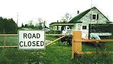
| Boundary Bay | 67 Street | British Columbia | Point Roberts | Meadow Lane | Washington | A former border crossing, permanently closed in 1975 when the Tyee Road border crossing was expanded.[7] The former Canada border station remains and has been refurbished, located on the eastern side of the peninsula. |  |
49°0′7.20″N 123°2′16.80″W |
| Chopaka West | Chopaka Road | Nighthawk West | Chopaka Road | Canada periodically provided border services at this crossing on Chopaka Road on the foothills west of the Similkameen River until the US barricaded the road in 1964. The Government of Canada still owns the property at the border. A branch of the Great Northern Railway once crossed the border at this location, but was abandoned in the late 1930s, around the time when the US stopped providing border inspections at the location.[8] | 49°0′0″N 119°43′33.4″W | |||
| Bridesville | Old Molson Road | Molson | Old Railroad Road | The town of Molson died a slow death as its mining and farming industries dried up in the 1920s, and the Canadian National Railway abandoned its line at the crossing in 1936.[9] Molson's designation as a port of entry was ultimately revoked in 1941.[10] What once was Molson's Customs and Immigration building still stands as part of the Molson Museums, displaying elements of the ghost town. | 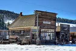 |
49°0′0.72″N 119°10′45.84″W | ||
| Myncaster | Myncaster Road | Chesaw | Bolster Road | Though the Canadian side supported both road and rail traffic, the traffic along Bolster Road was light while the railroad ceased operations in 1937. Canada would close its POE later that year, while the US ended its customs services around 1955. The crossing opened again for one day on June 9, 1990.[11] | 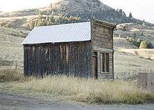 |
49°0′0.00″N 119°1′18.12″W | ||
| Newgate | Dorr Road | Gateway | Montana | This crossing was located on the eastern banks of the Kootenay River about 5 miles west of the Roosville border crossing. Customs operations began around 1902 to inspect both vessel traffic on the river and rail traffic on the adjacent Great Northern Railway branch. The US closed its Customs office in 1933 when rail service ended, with officers being relocated to the busier Roosville crossing. The railroad tracks were removed in 1936, and Canada closed its customs office in 1939. The U.S. Post Office closed in 1950 and, what was left of the town was inundated by water in 1975 with the completion of the Libby Dam, which created Lake Koocanusa.[12] | 49°0′3.96″N 114°28′42.24″W | |||
| Flathead | Flathead Rd | Trailcreek | North Fork Rd | This crossing, adjacent to the Flathead River, was established by Canada in 1914. In the 1970s, both the US and Canada constructed new border facilities to better accommodate regular recreational traffic. The crossing closed in 1996 due to flooding of the road just north of the border,[13] and the road is now gated. Both the US and Canada station buildings remain. |  |
49°0′3.96″N 114°28′42.24″W | ||
| Whiskey Gap | Emigrant Gap Road | Alberta | Emigrant Gap | Emigrant Gap Road | The Canadian port was originally called Fareham. It opened in 1932, but closed in 1939 when the highway through Del Bonita opened. It was once a favorite place to smuggle alcohol from the US into Alberta during its period of prohibition from 1916–1923, then from Canada during the US prohibition, which ended in 1933.[14] | 48°59′54.60″N 113°5′46.68″W | ||
| Pinhorn | Township Road 12 | Laird | Laird Road | Canadian port of entry opened in 1913, and closed in 1929. Customs staff moved the office to Aden, Alberta without authorization, but Canada Customs decided that was a better location anyway.[15] | 48°59′52.44″N 110°59′25.08″W | |||
| Big Beaver | Hwy 34 | Saskatchewan | Whitetail | MT 511 | The Big Beaver-Whitetail crossing was established in 1951, where traffic was never extensive. In 2009, the US would plan to use Recovery Act funds to upgrade its Whitetail border station. However, at the same time, Canada would to be planning to close its Big Beaver station. CNN ran a story on how wasteful it would be to spend millions at this crossing. The reporter sat in the middle of the empty roadway during the report.[16] Canada permanently closed their crossing on April 1, 2011, making it a southbound-only crossing. The U.S. POE closed on January 26, 2013.[17] Canada demolished the Big Beaver border station soon after closure. The U.S. border station remains, though the roadway has been barricaded. |  |
48°59′57.4″N 105°09′44.4″W | |
| Beaubier | Saskatchewan Highway 707 | Saskatchewan | Westby | North Westby Road | The port of Westby, Montana was established in 1919, and was revoked by Executive Order 9382 on September 23, 1943. Shortly before being designated a POE, the town of Westby moved a short distance from North Dakota into Montana to be closer to a new rail spur, and to be in a state that permitted the sale of alcohol.[18] | 48°59′59.9″N 104°04′41.4″W | ||
| Northgate | Hwy 9 | Saskatchewan | Northgate | ND 8 | North Dakota | This border crossing was established in 1913 to serve both highway and rail traffic. The US and Canadian Ports of Entry were abandoned when the highway was rebuilt about a half mile west of town in 1962. The former US border station was demolished in 2015, and the border community is a virtual ghost town.[19] The building that once served as the Canadian border station remains. | 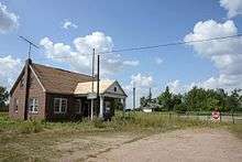 |
48°59′55.68″N 102°15′58.32″W |
| West Lynne (Emerson West) | 5th Street | Manitoba | Pembina | US 81 | This crossing on the Meridian Highway, whose other end was at the Mexico–United States border in Laredo, Texas, was moderately trafficked through the 1950s, but it was closed in 1964 when Interstate 29 and Manitoba Highway 29 were built immediately to the west. The Canadian and US border stations were demolished, but the concrete slabs on which they stood remain.[20] All road traffic must now use the modern Pembina–Emerson Border Crossing. |  |
49°0′1.44″N 97°14′6.36″W | |
| Emerson East | PTH 75 | Manitoba | Noyes | US 75 | Minnesota | Throughout the early 20th century, this was among the busiest U.S.-Canada border crossings. It was the point at which the Jefferson Highway intersected the international boundary and for a few years was adorned with an elaborate archway. Traffic waned with the 1964 opening of Interstate 29 two miles to the west. The crossing was closed by Canada in 2003 (where traffic was permitted southbound only) and then by the U.S. in 2006. All road traffic must now use the Pembina–Emerson Border Crossing. | .jpg) |
49°0′0.00″N 97°12′26.28″W |
| Pigeon River | Old Border Rd (formerly Ontario Highway 61) | Ontario | Pigeon River | County Route 89 (formerly MN 1 and US 61) | Formerly called Sextus City. The Outlaw Bridge as it was known, was built in 1917. It was closed in 1961 when a new bridge and border station were built in Grand Portage, Minnesota about 6 miles to the east. The old bridge, store, hotel and both border stations have all been demolished. |  |
48°0′37.44″N 89°42′29.88″W | |
| Niagara Falls | River Road | Niagara Falls | Niagara Street | New York | The Honeymoon Bridge collapsed on January 27, 1938 after an ice jam undermined the structure. A new bridge named the Rainbow Bridge was built a short distance to the north, and new border inspection facilities were built on both sides. | 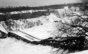 |
43°5′20.4″N 79°4′8.4″W | |
| Queenston | Niagara Regional Road 81 | Lewiston | Robert Moses State Parkway | The Queenston-Lewiston suspension bridge was replaced by the transverse-named Lewiston–Queenston Bridge in 1962, which was built about 0.7 miles (1.1 km) to the south. The bridge had a single line trolley track of the Niagara Gorge Railroad in the center of 3 lanes. The US inspection plaza has been transformed into the Earl W. Brydges Artpark State Park. |  |
43°09′43″N 79°2′47.6″W | ||
| Cornwall | Highway 138 | Massena | NY 37 | The Canadian port of entry on Cornwall Island was closed June 1, 2009, due to a disagreement between the Mohawk Nation of Akwesasne and the Canada Border Services Agency regarding the arming of border services officers. A temporary port of entry was opened July 13, 2009, at the north end of the Seaway International Bridge north (high) span; it was used until the current "interim" port of entry was opened January 24, 2014. The old border station on Cornwall Island was demolished in July 2015. |  |
44°59′26.37″N 74°44′22.26″W | ||
| Jamieson's Line | Chemin Jamieson | Quebec | Jamieson Line | County Road 29 | The Canadian port of entry was permanently closed on April 1, 2011. For three years, this was a one-way crossing, with travelers able to enter the U.S. but not Canada at this location. Finally, the U.S. port of entry closed August 21, 2014. |  |
44°59′30.26″N 74°10′28.78″W | |
| Roxham Road | Rang Roxham | Roxham Road | Roxham Road | The Canadian port of entry operated until the late 1950s and the building is now a private residence. The US never had a border station at this location. This crossing has been barricaded since the 1970s. In recent years, thousands of migrants have made unauthorized entry into Canada on foot at this location so they can request asylum.[21] RCMP has established temporary facilities at this crossing to aid in processing the surge in asylum seekers.[22] | 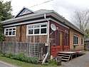 |
45°0′25.56″N 73°31′1.92″W | ||
| Blackpool | Chemin Ridge | Champlain | US 9 | The border crossing on US Route 9 closed in 1967 when Interstate 87 was completed immediately to the west. The last border station at this crossing was built in 1950 and was demolished soon after it closed in 1967. |  |
45°0′32.76″N 73°26′30.84″W | ||
| Saint-Bernard-de-Lacolle - 217 | Route 217 | Meridian Road | Meridian Road | The port of entry on Meridian Road closed around 1950. The Canada border station was demolished in the mid 1950s. The USDA has since used the old US border station as an office,[23] and the US Government at one time offered it for sale.[24] |  |
45°0′32.76″N 73°26′30.48″W | ||
| Highwater | Chemin Lafond | North Troy | Space Research Corporation Road | Vermont | In the 1960s and 1970s, Space Research Corporation founder Gerald Bull built his company on property his family owned on both sides of the border. As the company began building military weapons, the US established a border inspection station outside the company's south gate to inspect southbound traffic. This station also enabled US workers to legally return home after work without having to go through the North Troy border crossing, and it was not for use by the general public. Canada did not have a border station on the company's north gate. The SRC facility (and the Customs station) closed in 1980 when Bull was convicted of violating an arms embargo against South Africa.[25] Bull was assassinated in 1990. | 45°0′30.60″N 72°26′58.20″W | ||
| Mansonville | Chemin du Pont-Couvert | North Troy | Douglas Road | Also known as "Province Hill", Canada Customs closed this office around 1972. The building is now purple and privately owned, but in the 1980s it was rented as a vacation home.[26] Prior to its construction in the 1960s, Canada Customs operated out of a line house across the street. This building was separated, moved about a half mile North and used as cottages.[27] The US did not have a border station at this crossing; persons entering were expected to travel to the North Troy border station for inspection. |  |
45°0′22.68″N 72°22′28.92″W | ||
| Leadville | Chemin des Parulines | Newport | Leadville Road | Canada Customs had a station from the mid-1930s to 1939, then reopened in 1948. It was replaced with a new border station in the mid-1950s, which permanently closed on March 31, 1969.[28] The Canada border station was converted into a private home that has been updated substantially. There was no US border station at this location; persons entering the US here were expected to travel to the US Customs office at 70 Main Street, Newport, VT to report for inspection. That office closed in 1972, and the road was barricaded. Today the former US Customs office is home to Northeast Kingdom Community Action. | 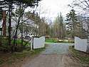 |
45°0′15.12″N 72°16′28.56″W | ||
| Leadville | Chemin de Leadville | Newport | Lake Road | Although this was a busy road with many lakeside homes, neither the US nor Canada had a border station here. Persons entering the US here were expected to travel to the US Customs office at 70 Main Street, Newport, VT to report for inspection. That office closed in 1972, and the road was barricaded at the border at that time. |  |
45°0′15.84″N 72°15′30.60″W | ||
| Lineboro | Chemin de Nord Derby | North Derby | North Derby Road | Canada provided Customs service at this road and rail crossing 1932-1937 and 1949–1953. The U.S. never had Customs services here. Persons entering the US at this location were expected to travel to the US Customs office at 70 Main Street, Newport, VT to report for inspection. That office closed in 1972, and the road was barricaded at the border at that time. Today the Canada border station is a private home.[29] |  |
45°0′21.10″N 72°10′19.20″W | ||
| Stanhope | Rue Principale | Norton | Nelson Road | Historically, signs directed travelers to report directly to the staffed Stanhope-Norton border station. It has been barricaded since 2015. This crossing is the site of an international general store and post office, which closed around 2002. |  |
45°0′38.16″N 71°47′55.32″W | ||
| Daaquam | Rang Sainte-Marie | Daaquam | American Realty Road | Maine | Crossing which mostly served the logging industry closed in 2004 when regular customs service was moved to St. Juste. The road is now barricaded. | 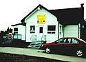 |
46°35′53.16″N 70°1′4.80″W | |
| Grand Falls | Caswell Road | New Brunswick | Caswell | (unnamed road) | The US operated a border inspection station between 1936 and 1953. The General Services Administration purchased approximately a half acre of land in 1931, and constructed a red brick border station. The property was sold by the US government on October 13, 1954,[30] and although the sale included the brick building, it has since been demolished. The parcel, and the road leading to the border from Route 1A are now private property. It is not known if Canada had a border station on Caswell Road. | 47°02′29.7″N 67°47′24.2″W | ||
| Four Falls | Brown Road | East Road | Russell Road | Canada still provides Customs services seasonally, but US-bound traffic is prohibited, and has been since the US border station closed in the 1960s. However until 2008, US-bound traffic was permitted to use the road to the Aroostook Valley Country Club, which is in both countries. Several Canadian properties can only be accessed via the US part of the road, which pre-dates the establishment of the border; several residents have experienced harassment from U.S. Border Patrol officers since 9/11.[31][32] | 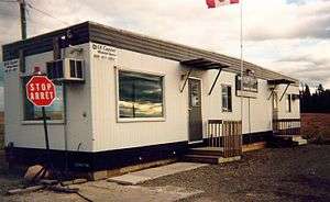 |
46°49′24.21″N 67°47′22.65″W | ||
| Tinker | Tinker Road | Fort Fairfield | Aroostook Falls Road | The US operated a border station at this crossing from 1941 to 1953. It was located about 500 feet west of the Canada–US border, with a private home standing between it and the border. The General Services Administration purchased the property for the border station on May 20, 1940, and placed a portable building on the property. GSA removed the building and sold the property on October 21, 1955.[33] In 1970, The Canadian Magazine declared this crossing "The best place to sneak across the border,"[34] The road was barricaded around 1976. The Aroostook River flood of 1994 killed 2 Canadian Customs officers whose vehicle was swept into a ditch by rising flood waters at this crossing.[35] | 46°47′36.24″N 67°47′22.56″W | |||
| Hillandale | Reid Road | Monson Hill | Dorsey Road | This crossing closed in the 1940s. Aside from some light fixtures, no signs of the border crossing remains. | 46°42′7.20″N 67°47′20.04″W | |||
| Beaconsfield | Nicholson Road | Easton | Curtis Road | Canada stopped providing Customs services in the late 1950s and erected a sign directing travelers to the nearest open crossing. The US moved its border services to the Rivière de Chute crossing from a more central location on Ladner Road. The crossing was barricaded in the 1980s. | 46°39′9.36″N 67°47′18.96″W | |||
| Listerville | Mars Hill Road | Mars Hill | Knoxford Line Road | Border inspection services were established in 1939, and closed in 1976. The US crossing was also known as Knoxford Line and was housed in a temporary trailer. The General Services Administration deemed the US border station property to be excess on November 3, 1977, and it was subsequently sold.[36] The Canada border station has been renovated and today it serves as a private home. | 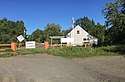 |
46°34′9.12″N 67°47′15.00″W | ||
| Upper Royalton | Brown Road | Blaine | Brown Road | This crossing was generally known as "Brown Road" on both sides of the border. The US border station was housed in a temporary trailer. It existed for only a few years, from 1941 to 1952. The US sold the 1 acre border station site on May 22, 1953.[37] |  |
46°30′13.6″N 67°47′09.6″W | ||
| Jackson Falls | Foxcroft Road | Littleton | Foxcroft Road | This crossing, known as "Starkey Corners" opened in 1936, and was permanently closed on May 19, 1962. The General Services Administration purchased the US border station property on May 20, 1932, and sold it (building included) on January 26, 1966.[38] The US border station is now a private home. The Canadian station was demolished in the late 1960s. | 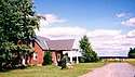 |
46°13′3.00″N 67°46′54.12″W | ||
| Woodstock | Old Houlton Road | Houlton | US 2 | Prior to the 1950s, the Canadian road to this crossing traversed a steep hill at the border, which caused problems for winter travelers. Around 1952, Canada excavated much of the hill and built a new inspection plaza on relatively level ground. This border crossing was closed in 1985 when Interstate 95 was completed immediately to the north.[39] The Canada border station, which was sometimes called Richmond Road, was demolished. The US border station remains in disrepair. |  |
46°8′0.00″N 67°46′52.32″W | ||
| Union Corner | Green Road | East Hodgdon | Boundary Line Road | This border crossing, known as "Union Corner", was permanently closed on May 19, 1962. The General Services Administration sold the US border station on August 16, 1965,[40] and it has since been used as a private home. The Canadian station was torn down in the late 1960s. | 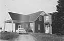 |
46°3′14.40″N 67°46′51.60″W | ||
| Monument | Amity Road | North Amity | Monument Road | The US purchased 12,580 square feet of land on the south side of Monument Road on May 25, 1932 and spent $5,625 to erect a red brick border station, which saw little traffic. This crossing was about 2000 feet north of Monument #1, which marks the beginning of the land border between the US and Canada. On February 19, 1949, the US sold the property and the border station. The building has since been demolished. | 45°56′56.1″N 67°46′52.5″W | |||
| Upper Mills | Hall Road | Baring | Front Street | This crossing closed in 1948 when the bridge was deemed unsafe. It was dismantled soon thereafter. The US did not have a Customs station at this crossing. | 45°8′12.48″N 67°19′5.88″W | |||
| St. Stephen | Route 170 | Calais | Todd Street | This crossing, also known as "Union Bridge", closed in 1961 when the bridge was deemed unsafe. It was dismantled in April, 1963, and two men drowned in the process.[41] The US border station property was sold on May 14, 1962, and still stands as a private residence. The former Canadian border station on Milltown Boulevard in St. Stephen likewise is serving as a private home. | 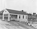 |
45°11′00.2″N 67°17′29.6″W |
Unstaffed road crossings

This is a list of roads that cross the U.S.-Canada border that do not have border inspection services, but where travelers are legally allowed to cross the border in one or both directions. In prior years, there were dozens of such roads where one could legally cross the border and then proceed to an open Customs office to report for inspection, but most have since been barricaded. Requirements for reporting to CBSA or CBP for inspection are noted.
| Canada City/Town | Canada Road Name | Province/ Territory | United States City/Town | United States Road Name | State | Notes | Coordinates |
|---|---|---|---|---|---|---|---|
| Stewart | Road to Salmon Glacier [Premier] | British Columbia | Hyder | NF-88, Tongass National Forest | Alaska | Unstaffed and open. Canadian road ends at former Granduc Mine; U.S. road connects only to Canada. | 56°2′46.32″N 130°2′12.48″W |
| Skagit Valley Provincial Park | Silver Skagit Road | North Cascades National Park | Silver Skagit Road | Washington | Unstaffed and open. Canadian road with access to Hozomeen Campground on Ross Lake ends about 2 miles inside the US . Persons found on the U.S. side by the U.S. Border Patrol should be prepared to provide passport identification. | 49°0′0.72″N 121°3′46.80″W | |
| Northwest Angle Provincial Forest | PR 525 | Manitoba | Angle Inlet | Winter Road | Minnesota | The only east-west crossing between Western Canada and the contiguous US, the border crossing is staffed remotely by both countries. Travelers are directed to video telephones 12.5 km (7.8 mi) from the border in Angle Inlet to contact the Canadian or U.S. border agencies to make their declarations. | 49°17′17.59″N 95°9′12.21″W |
| Kanatakon (St. Regis), Akwesasne 15 Réserve | Andrew Johnson Rd & Saint Regis St | Quebec | Akwesasne, St. Regis Mohawk Reservation | Johnson & St. Regis Roads | New York | Unstaffed crossings to/from Québec accessible by road only through New York. No requirement to report. | 44°59′58.02″N 74°39′0.14″W |
| Tsi Snaihne (Snye), Akwesasne 15 Réserve | River, Phillips, Snye, McDonald & Chapman Roads | Akwesasne, St. Regis Mohawk Reservation | River, Phillips, Snye, McDonald & Chapman Roads | Unstaffed crossings to/from Québec accessible by road only through New York state. No requirement to report. | 44°59′57.70″N 74°36′51.30″W | ||
| Dundee | Chemin de la Pointe Hopkins | Fort Covington | Hopkins Point Road | Unstaffed crossing to/from Québec accessible by road only through New York. Signs direct travelers to report to nearby staffed border post. | 44°59′53.16″N 74°30′32.94″W |
Rail crossings
| The green background indicates a crossing that is located at a bridge or a tunnel. |
| The blue background indicates a crossing where passenger rail service is available. |
| The red background indicates a closed railroad crossing. |
| Canada Nearest Community | Province/ Territory | Canada Rail | U.S. Nearest Community | State | U.S. Rail | Notes | Structure or Notable Feature | Coordinates |
|---|---|---|---|---|---|---|---|---|
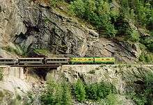
| Fraser | British Columbia | WPY | Skagway | Alaska | WPY | 3 ft (914 mm) narrow gauge route, isolated line not connected to any others in North America. Former northern terminus Whitehorse, now ends at Carcross. | 59°37′27.99″N 135°8′20.58″W | |
| White Rock | BNSF | Blaine | Washington | BNSF | Used by Amtrak Cascades passenger trains. Border inspection services are provided at Pacific Central Station in Vancouver, British Columbia. | 49°0′7.56″N 122°45′27.00″W | ||
| Huntingdon | British Columbia | CP, SRY | Sumas | Washington | BNSF | 49°0′8.64″N 122°16′0.84″W | ||
| Grand Forks | British Columbia | KFR | Danville | Washington | KFR | Abandoned by the KFR south of the border. | 49°0′0.36″N 118°29′33.36″W | |
| Billings | British Columbia | KFR | Laurier | Washington | KFR | Canada section isolated from Canadian rail network following CP's 1991 abandonment of their Boundary Sub, accessible only through the U.S. | 49°0′0.36″N 118°13′28.56″W | |
| Waneta | Northport | Canada section isolated from Canadian rail network following abandonment of Burlington Northern's Nelson Sub in 1989, only accessible through the U.S. | 49°0′2.52″N 117°37′36.84″W | |||||
| Kingsgate | CP | Eastport | Idaho | UP | 49°0′1.80″N 116°10′55.92″W | |||
| Coutts | Alberta | Sweetgrass | Montana | BNSF | 48°59′54.24″N 111°57′32.40″W | |||
| North Portal | Saskatchewan | Portal | North Dakota | CP (SOO) | 48°59′56.04″N 102°32′56.40″W | |||
| Northgate | CN | Northgate | BNSF | CN abandoned north of the border in 2001. Since 2016, approximately one mile of track is active in Canada to serve a multimodal export terminal operated by Ceres Global Ag. | 48°59′55.68″N 102°15′51.48″W | |||
| Gretna | Manitoba | CP | Neche | North Dakota | BN | The line was abandoned by both railways during the early 1990s. The tracks have been removed on both sides. | 49°0′1.80″N 97°33′38.16″W | |
| West Lynne (Emerson) | CN | Pembina | The tracks were removed after BN abandoned their line from Joliette to the border in 1980; CN and BN successor BNSF still interchange at the nearby Emerson-Noyes crossing. | 49°0′1.44″N 97°14′6.36″W | ||||
| Emerson | Manitoba | CN (west) / CP (east) | Noyes | Minnesota | BNSF (west) /
CP (east) |
Since closure of the adjacent road border crossing, this major rail crossing has been managed by the nearby Emerson (Canada) and Pembina (U.S.) ports of entry. | 49°0′1.44″N 97°12′13.32″W | |
| Sprague | CN | Warroad | CN | The U.S. stretch between Warroad & Baudette connects only through Canada. It was isolated from the U.S. rail network when Minnesota Northern Railroad abandoned the Warroad subdivision in 2009. | 48°59′56.40″N 95°22′32.16″W | |||
| Rainy River | Ontario | CN | Baudette | Minnesota | CN | The U.S. stretch between Warroad & Baudette connects only through Canada. | 48°43′10.56″N 94°35′29.04″W | |
| Fort Frances | MDW | International Falls | MDW | Once connecting to CN's nearby mainline, the Fort Frances stretch is now isolated from the Canadian rail network. Trains must cross this bridge to the U.S. to get back into Canada. | Fort Frances – International Falls International Bridge | 48°36′26.69″N 93°24′6.42″W | ||
| CN | Ranier | CN | Ranier International Rail Bridge | 48°36′53.64″N 93°24′6.42″W | ||||
| Sault Ste. Marie | CN (ACR) | Sault Ste. Marie | Michigan | CN (WC) | Sault Ste. Marie International Railroad Bridge | 46°30′30.60″N 84°21′41.76″W | ||
| Sarnia | CN | Port Huron | CN | Paul M. Tellier Tunnel | 42°57′34.20″N 82°25′21.36″W | |||
| Windsor | CP | Detroit | CP | Michigan Central Railway Tunnel | 42°19′9.12″N 83°3′30.24″W | |||
| Fort Erie | CN | Buffalo | New York | CN | International Railway Bridge | 42°55′46.20″N 78°54′28.80″W | ||
| Niagara Falls | Ontario | CP | Niagara Falls | New York | CP | Closed to rail traffic in 2000. Presently mothballed. | Michigan Central Railway Bridge | 43°6′30.60″N 79°3′29.52″W |
| Niagara Falls | Ontario | CN | Niagara Falls | New York | CSX | Used by Amtrak/Via Maple Leaf passenger trains. Cars may use the bridge if all passengers have a Nexus Card. | Whirlpool Rapids Bridge | 43°6′33.27″N 79°3′30.00″W |
| Sainte-Agnès-de-Dundee | Quebec | CSX | Fort Covington | New York | CSX | 44°59′51.36″N 74°29′8.88″W | ||
| Elgin | Quebec | NYC | Trout River | New York | NYC | Abandoned, but ROW intact. | 44°59′31.92″N 74°14′32.28″W | |
| Cantic | Quebec | CP (west track) & CN (east track) | Rouses Point | New York | CP (DH) | Used by Amtrak Adirondack passenger trains, using CN track in Canada. Cantic port of entry next to Lacolle 223. | 45°0′36.72″N 73°22′18.12″W | |
| Clarenceville | Quebec | CN | Alburg Springs | Vermont | CN | 45°0′45.00″N 73°14′28.32″W | ||
| Abercorn | CMQ | Richford | CMQ | U.S. section isolated from the U.S. rail network following 1990 abandonment of Central Vermont Railway's Richford Branch. Trains in the U.S. must pass through Canada. Part of the Farnham-Richford-North Troy line. | 45°0′54.36″N 72°39′49.32″W | |||
| Glen Sutton | East Richford | Canadian section has always been isolated from the Canadian rail network. Trains must pass through the U.S. to connect with the rest of Canada. Part of the Farnham-Richford-North Troy line. | 45°0′41.76″N 72°35′9.24″W | |||||
| Highwater | North Troy | Trains in Canada must pass back through the U.S. from this isolated section. Part of the Farnham-Richford-North Troy line. | 45°0′25.56″N 72°24′43.92″W | |||||
| Lineboro | Quebec | QCR | North Derby | Vermont | QCR | Tracks were removed in the 1990s. Now Piste cyclable de Stanstead (Canada) and Newport Bikepath (U.S.). Signs urge cyclists not to cross here. | 45°0′20.88″N 72°10′17.40″W | |
| Stanhope | Quebec | SLR | Norton | Vermont | SLQ | 45°0′38.16″N 71°47′42.36″W | ||
| Trudel (Lac-Mégantic) | CMQ | Beattie
(Jackman) |
Maine | CMQ | 45°32′48.12″N 70°41′21.48″W | |||
| St. Leonard | New Brunswick | MNRY | Van Buren | Maine | MNRY | Unnamed rail bridge | 47°10′29.64″N 67°56′32.28″W | |
| Tinker | New Brunswick | CP | Fort Fairfield | Maine | CP | Tracks removed. | 46°47′36.60″N 67°47′22.56″W | |
| Green Road | CAR | Houlton | CAR | Abandoned June 1989. | 46°5′42.72″N 67°46′52.32″W | |||
| St. Croix | New Brunswick | NBSR | Vanceboro | Maine | EMRY | Only Canada-U.S. border crossing to be attacked by a foreign force. See Vanceboro international bridge bombing. | Saint Croix-Vanceboro Railway Bridge | 45°33′50.40″N 67°25′39.00″W |
| Mohannes | Woodland | NBSR | The American stretch is isolated from the rest of the U.S. rail network, and trains must cross this bridge to a small portion through Canada to the U.S. at Baring. Part of NBSR's St. Stephen-Calais-Woodland branch; leased from Woodland Rail. | Sprague Falls Railroad Bridge | 45°10′0.84″N 67°24′15.48″W | |||
| Upper Mills | Baring Plantation | The Canadian stretch between Mohannes and Upper Mills is isolated from the Canadian rail network, and trains must cross this bridge into the U.S. to connect to the rest of Canada. Sold to Woodland Rail by Pan-Am Railways after a short period out of service. Part of the St. Stephen-Calais-Woodland branch; leased from Woodland Rail. | Baring Railroad Bridge | 45°8′3.84″N 67°24′15.48″W | ||||
| St. Stephen (Milltown) | Calais | The American stretch between Baring and Calais is isolated from the U.S. rail network, and trains in the U.S. must switch direction and cross this bridge into Canada to connect with the rest of the U.S. rail network. The line was disconnected from the U.S. network when Guilford Rail (Pan-Am Railways) abandoned the connecting line to Bangor in 1989; those rails were intact until torn up in the late 2000s. Part of the St. Stephen-Calais-Woodland branch; leased from Woodland Rail on the U.S. side. | Salmon Falls Railroad Bridge | 45°10′29.28″N 67°17′29.40″W |
Ferry Crossings
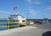
This list is of point-to-point international ferry services, including those for road vehicles, passengers and rail. Other marine ports of entry are not included.
| Canada Ferry Terminal | Province/ Territory | Waterway | U.S. Ferry Terminal | State | Ferry Company / Vessel | Notes |
|---|---|---|---|---|---|---|
| Prince Rupert | British Columbia | Inside Passage / Dixon Entrance | Whittier | Alaska | CN
[Aquatrain], |
Rail cars only.[42] |
| Ketchikan / Juneau | Alaska Marine Highway | Alaska Marine Highway also operates vehicle ferries between Ketchikan, Alaska and Bellingham, Washington, and Alaska Rail Marine operates train ferries between Whittier, Alaska and Seattle, Washington through the Inside Passage of British Columbia without docking at Canadian ports. | ||||
| Victoria | Strait of Juan de Fuca | Port Angeles | Washington | Blackball Transport
[M/V Coho] |
||
| Seattle | Clipper Navigation | Passengers only.[43] | ||||
| Sidney | San Juan Islands | Anacortes | Washington State Ferries | |||
| Waterton Park | Alberta | Waterton Lake | Goat Haunt Ranger Station | Montana | Waterton Shoreline Cruise | Scheduled passenger trips originating in Canada from the end of May to mid-September stop at the U.S. station, which is accessed in Glacier National Park only by hiking trails. |
| Sombra | Ontario | St. Clair River | Marine City | Michigan | Bluewater Ferry | Service currently suspended. |
| Walpole Island | Algonac | Walpole-Algonac Ferry | ||||
| Windsor | Detroit River | Detroit | Detroit-Windsor Truck Ferry | |||
| Pelee | Lake Erie | Sandusky | Ohio | Ontario Ferries[44] | Seasonal: April to mid-September. | |
| Wolfe Island | St. Lawrence River | Cape Vincent | New York | Cape Vincent-Wolfe Island Ferry | Seasonal: May 1 to October 15. | |
| Deer Island | New Brunswick | Passamaquoddy Bay
(Head Harbour Passage) |
Eastport | Maine | Cummings Cove to Eastport Ferry | Seasonal: mid-June to mid-September. Ferry did not run in 2018. |
| Yarmouth | Nova Scotia | Gulf of Maine | Portland | Bay Ferries | Seasonal: late-May to mid-October. |
See also
References
- "CBP finalizes hours for Lancaster and Roseau Ports of Entry". U.S. Border Customs and Protection. December 12, 2017.
- "Buffalo and Fort Erie Public Bridge Authority". peacebridge.com.
- (accessed 2016-12-30)
- http://www.cbsa-asfc.gc.ca/travel-voyage/pptraq-ppvreq-eng.html
- CLUI. "Chapter 3: The 45th Parallel | United Divide: A Linear Portrait Of The Usa/Canada Border". The Center for Land Use Interpretation. Retrieved March 27, 2020.
- Kifner, John (July 27, 1976). "Olympic Fears Stir Border Patrol Shift". New York Times Archives (News clipping). The New York Times. Retrieved March 27, 2020.
- Saba, Anne (October 1999), "Point Roberts, WA - Then and Now", US Customs Today.
- Ann Briley (April 12, 2011). "Chopaka: The early days". BC Local News. Black Press Media. Archived from the original on December 30, 2014. Retrieved December 30, 2014.
- Jones, David G. (1981). "Molson is Becoming Smaller: A Canadian-American Community After the First War." BC Studies 49(spring). p.54.
- 6 FR 705, Federal Register, February 1, 1941.
- Camp, Al (June 20, 1990). "Border Crossing Diplomacy Opens Way for Canadians." The Omak-Okanogan County Chronicle.
- S, Gary (May 17, 2017). "Gateway, Montana". Flickr (Photograph). Retrieved October 8, 2018.
- Michael Jamison of the Missoulian (April 11, 2002). "Bust near Glacier nets 120 pounds of pot". Missoulian.com. Retrieved March 2, 2011.
- name="Legg, Herbert (1962). Customs Services in Western Canada, 1867-1925; a History, The Creston Review Ltd., Creston, BC
- Legg, Herbert (1962). Customs Services in Western Canada, 1867-1925: a History. Creston, BC: The Creston Review. p. 206.
- Griffin, Drew; Johnston, Kathleen. "Feds plan to spend millions on remote Montana border posts". CNN. Retrieved December 16, 2018.
- CBP (January 25, 2013). "CBP Announces Closure of Port of Whitetail, Montana". U.S. Customs and Border Patrol. Washington: U.S. Department of Homeland Security. Archived from the original on June 26, 2013. Retrieved April 4, 2013.
- Wick, Douglas A. "Westby (Divide County)". North Dakota Place Names. Retrieved August 19, 2018.
- Larson, Troy (May 19, 2010). "Northgate, ND." GhostsofNorthDakota. Sonic Tremor Media. Archived from the original on September 8, 2011. Retrieved on April 12, 2014.
- Larson, Troy (April 15, 2015). "History Appreciation In Pembina". GhostsofNorthDakota. Sonic Tremor Media. Retrieved January 19, 2016.
- Ross, Selena (April 17, 2019). "In a twist, Canada asks U.S. for help cracking down at its southern border". The Washington Post. Retrieved July 5, 2019.
- "Why Illegal border-crossers to Canada target Roxham Road". CBC News: The National. CBC/Radio-Canada. September 26, 2017.
- Maisel, Albert Q. (November 17, 1953). "Aliens Are Swarming Over Our Unguarded Northern Border." Look Magazine, New York. p. 75.
- "Former Agricultural Inspection Border Station". LoopNet (Property listing). Retrieved March 2, 2011.
- Fried, Joseph P. (March 25, 1990). "Gerald Bull, 62, Shot in Belgium; Scientist Who Violated Arms Law". The New York Times. Retrieved June 12, 2016.
- O'Neill, Thomas (1984). Lakes, Peaks and Prairies - Discovering the United States-Canada Border, with photography by M. Yamashita. National Geographic Society. p. 53. ISBN 0-87044-478-6.
- Bailey, Merton (1982). Border Crossings of Potton Township. p.A5.
- "Mansonville Chamber of Commerce Annual Meeting reviews activities". Granby Leader-Mail (News clipping). June 4, 1969. p. 11. Retrieved April 15, 2020 – via Google News Newspapers.
- Farfan, Matthew (2009). The Vermont-Quebec Border - Life on the Line. Charleston, SC: Arcadia Publishing. p. 82.
- General Services Administration, Record Group 121 (October 13, 1954). US Border Station - former - Mars Hill, ME. Waltham, MA. National Archives Identifier: 1271926.
- CBC New Brunswick (April 1, 2003). "Orange alert on the Pedersen farm". CBC News. CBC/Radio-Canada.
- CBC New Brunswick (June 27, 2008). "Golfers' drive out of bounds, say U.S. officials". CBC News. CBC/Radio-Canada.
- General Services Administration, Record Group 269 (October 21, 1955). Aroostook Falls Road Border Station - Fort Fairfield, ME. Waltham, MA: National Archives Identifier: 659904.
- "All About the Border". The Canadian Magazine: 16. September 5, 1970.
- Anderson, David (April 18, 1994). House of Commons. [transcript]. Ottawa.
- General Services Administration, Record Group 269 (November 3, 1977). US Border Station - former - Mars Hill, ME. Waltham, MA: National Archives Identifier: 4723630.
- General Services Administration, Record Group 121 (May 22, 1941). Brown Road Border Station, Blaine, ME. Waltham, MA: National Archives Identifier: 1271888.
- General Services Administration, Record Group 291 (January 26, 1966). Border Station - Littleton, ME - [Project #] T-Maine-524. Waltham, MA: National Archives Identifier: 1143714.
- Hill, Tamra (October 26, 1985). "Border Station Dedicated". Bangor Daily News. Retrieved December 18, 2015.
- General Services Administration, Record Group 269 (August 16, 1965). Border Station (former) - Hodgdon, ME. Waltham, MA: National Archives Identifier: 660339.
- "2 Men Drown, 3 Rescued in St. Croix River Tragedy". Calais Advertiser. April 11, 1963.
- "Your Shipping Solution to Alaska". CN. Archived from the original on July 14, 2014. Retrieved March 21, 2018.
- "Seattle-Victoria Ferry". Clipper Vacations. Retrieved March 21, 2018.
- "Welcome to the MV Jiimaan". Ontarioferries.com. Archived from the original on December 19, 2010. Retrieved March 2, 2011.
External links
- Canada Border Services Agency - Highway-Land Border Offices
- U.S. Customs and Border Protection - Locate a Port of Entry