Decimomannu
Decimomannu (Sardinian: Deximumannu or Déximu Mannu [ˌdeʒimuˈmannu]) is a comune in the Metropolitan City of Cagliari, Sardinia, Italy. It is located about 17 km (11 mi) northwest of central Cagliari and had a population of about 8,115 As of 2014.[2]
Decimomannu | |
|---|---|
| Comune di Decimomannu | |
 Church of Santa Greca | |
 Coat of arms | |
Location of Decimomannu 
| |
 Decimomannu Location of Decimomannu in Sardinia 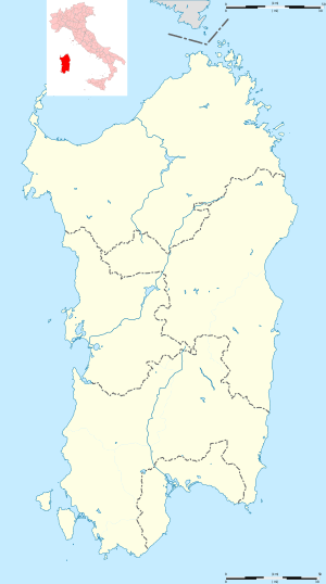 Decimomannu Decimomannu (Sardinia) | |
| Coordinates: 39°19′N 8°58′E | |
| Country | Italy |
| Region | Sardinia |
| Metropolitan city | Cagliari (CA) |
| Government | |
| • Mayor | Anna Paola Marongiu |
| Area | |
| • Total | 28.1 km2 (10.8 sq mi) |
| Elevation | 12 m (39 ft) |
| Population (30 September 2014)[2] | |
| • Total | 8,115 |
| • Density | 290/km2 (750/sq mi) |
| Demonym(s) | Decimesi |
| Time zone | UTC+1 (CET) |
| • Summer (DST) | UTC+2 (CEST) |
| Postal code | 09033 |
| Dialing code | 070 |
Geography
Decimomannu borders the municipalities of Assemini, Decimoputzu, San Sperate, Siliqua, Uta, Villasor, and Villaspeciosa. It is served by a railway station connecting it to Iglesias, Golfo Aranci, and Cagliari.
Climate
The climate is hot-summer Mediterranean (Köppen: Csa), similar to the rest of the south-central coast of Italy.[3]
| Climate data for Decimomannu (Decimomannu Air Base), elevation: 28 m or 92 ft, 1961-1990 normals | |||||||||||||
|---|---|---|---|---|---|---|---|---|---|---|---|---|---|
| Month | Jan | Feb | Mar | Apr | May | Jun | Jul | Aug | Sep | Oct | Nov | Dec | Year |
| Average high °C (°F) | 14.0 (57.2) |
14.6 (58.3) |
16.3 (61.3) |
19.2 (66.6) |
23.7 (74.7) |
28.1 (82.6) |
31.6 (88.9) |
31.4 (88.5) |
28.1 (82.6) |
23.4 (74.1) |
18.3 (64.9) |
15.0 (59.0) |
22.0 (71.6) |
| Average low °C (°F) | 4.5 (40.1) |
5.0 (41.0) |
5.9 (42.6) |
7.5 (45.5) |
10.8 (51.4) |
14.7 (58.5) |
17.6 (63.7) |
18.3 (64.9) |
16.1 (61.0) |
12.7 (54.9) |
8.5 (47.3) |
5.8 (42.4) |
10.6 (51.1) |
| Average precipitation mm (inches) | 47.7 (1.88) |
65.7 (2.59) |
51.8 (2.04) |
46.8 (1.84) |
24.2 (0.95) |
11.3 (0.44) |
3.2 (0.13) |
14.2 (0.56) |
37.3 (1.47) |
54.4 (2.14) |
65.7 (2.59) |
61.2 (2.41) |
483.5 (19.04) |
| Average precipitation days (≥ 1.0 mm) | 8.2 | 8.8 | 7.9 | 6.6 | 3.8 | 1.7 | 0.8 | 1.4 | 4.3 | 6.4 | 8.6 | 9.3 | 67.8 |
| Average relative humidity (%) | 78 | 75 | 72 | 70 | 68 | 64 | 62 | 64 | 69 | 73 | 78 | 80 | 71 |
| Source: NOAA[4] | |||||||||||||
History
Decimomannu's origins date back at least to Roman times, as attested by its Latin name, meaning "the biggest town located ten miles from Cagliari". Its earlier history was revealed when a necropolis from Phoenician-Punic times was found in 1879–80. It was the location of the battle of Decimomannu during the revolt of Hampsicora.
After belonging to the Byzantine Empire, in the Middle Ages it became part of the Giudicato of Cagliari. Several giudici (from Latin iudice, literally "judge") established their residences in Decimomannu. After the fall of the Giudicato of Cagliari, Decimomannu belonged to the Della Gherardesca family from Pisa. The Battle of Lucocisterna, fought between the Pisane and the Aragonese, took place here in 1324, and after it the town belonged to the latter (with the exception of a short period under the Giudicato of Arborea in 1353-1355). Decimomannu was part of the Kingdom of Sardinia in the Spanish Empire until 1708, when, together with the whole Sardinia, came under Piedmontese rule in 1720.
Main sights
- Church of Sant'Antonio Abate (16th century), in Gothic-Catalan style
- Church of Santa Greca, built in 1777 above a pre-existing one dating perhaps from around 1500.
- Roman Bridge, crossing the Rio Mannu river
References
- "Superficie di Comuni Province e Regioni italiane al 9 ottobre 2011". Istat. Retrieved 16 March 2019.
- All demographics and other statistics: Italian statistical institute Istat.
- "Deximumannu/Decimomannu climate: Average Temperature, weather by month, Deximumannu/Decimomannu weather averages - Climate-Data.org". en.climate-data.org. Retrieved 2019-07-17.
- "Decimomannu (16546) - WMO Weather Station". NOAA. Retrieved July 17, 2019.
| Wikimedia Commons has media related to Decimomannu. |
| Authority control |
|
|---|